Posts Tagged ‘photographs’

Hull Colour – 4

Tuesday, July 14th, 2020
Humber Bridge, Hull 80hull065
Humber Bridge, Hull ca.1980

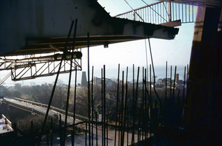
I’m not sure from exactly where I took this view of the Humber Bridge under construction, but I was fortunate enough to go on a tour of the construction organised for a group of science teachers, and it could have been made during that visit, though I don’t remember taking any colour pictures then. The bridge took around 9 years to build and was completed and opened in 1981.

The mill visible on Hessle foreshore was built around 1810 to grind the chalk that was being quarried here into whiting, finely powdered chalk used as a filler in paint and, together with linseed oil to make putty, in whitewash, gesso and ceramic glazes etc. The windmill went out of use about a hundred years ago, losing its cap and sails and the quarry closed in 1970. The area is now a country park.

Humber Bridge, Hull 80shull062
Humber Bridge, Hull ca.1980

After the cables were spun the box-girder sections of bridge decking were added, beginning in November 1979 and this picture must have been made shortly after this. Wikipedia states “the Humber Bridge was the longest single-span suspension bridge in the world for 17 years.”

When our family was travelling to Hull by train in the 1980s we would look out for the Humber Bridge in the distance to know we were getting close to our destination. I always offered a small cash prize for the first of our party to spot it through the train window, but think I never had to pay it out as I always saw it before the others.

River Humber, Hull 80hull110
River Humber, Hull 1980

The Humber has always seemed more mud in motion than a river, always a dirty brown colour, and it is only the small waves that differentiate between the river and the shore in this view. The mud and sandbanks in the estuary are always moving, and for many years ships travelling up the river to Hull or Goole needed the services of the Trinity House pilots, who started offering their services in 1512 and in 1581 were granted a charter authorising them to examine and licence pilots and take charge of ships. Various Acts of Parliament followed to endorse and regulate their activities, but the 1984 Pilotage Act transferred responsibility to the ports. In 2002 Associated British Ports terminated the authorisations of all Humber Pilots and employed their own pilots directly.

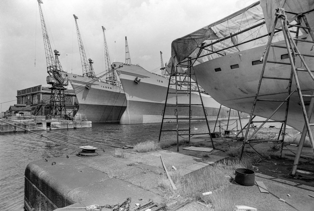
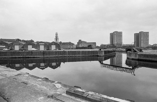
You can now walk along an esplanade along what had been the river frontage of Victoria Dock and various ship-building and other related businesses but only as far as what was the Alexandra Dock and is now ‘Green Port Hull’, a a wind energy manufacturing plant and riverside quay. I think this picture was probably taken just a little further downriver than the path now takes you.

Humber Dock Side, Hull 80hull113
Humber Dock Side, Hull 1980

There were some blue sheds on the dock side of Humber Dock that were demolished when the dock was dredged and converted into Hull Marina, and these had painted steel columns and wooden sides. The marine air had over the years produced this incredible rusting, lifting up the thick painted layers.

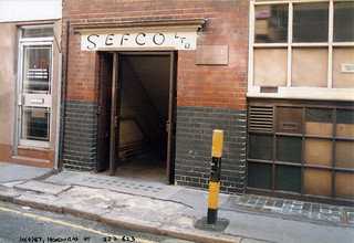
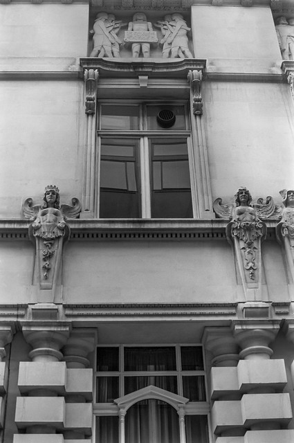
The buildings at the right of the picture are still there, though considerably altered on Humber Place at its junction with Wellington St, and are now Francis House, the offices of an accountancy firm, though the Wellington St building at extreme right has been demolished.

Railway Dock, Hull 80hull114
Railway Dock, Hull 1980

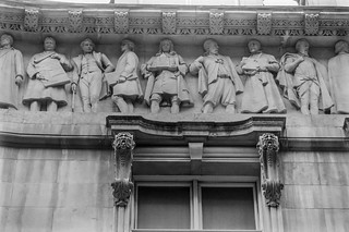
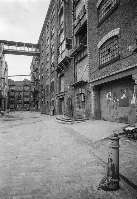
Although Hull lost some of its most impressive warehouses to a road scheme which split the Old Town from the city centre to take the heavy traffic for the King George Dock to the east of the city, some of those beside Railway Dock were retained, with the three gables shown here still visible, though the mass at the extreme right has been demolished.

King Billy, Market Place, Hull 80hull115a
Railway warning, Hull 1980

King Billy, King William III or William of Orange, successfully invaded Britain in 1688 in what is sometimes called the ‘Glorious Revolution’. James II was unpopular, largely because he was a Catholic and was seen to be changing Britain to a Catholic country, suspending anti-Catholic measures by decree when Parliament refused to do so and prosecuting Anglican bishops for seditious libel. His actions prompted anti-Catholic riots and many leading political figures of the day invited William to come and take over the country. But there were also leading Catholic members of the aristocracy who defended James and the ‘divine right of kings’ to overule all others, including Parliament. One of them was the governor of Hull, Lord Langdale, who took the military to occupy the city of Hull, fearing that William of Orange might try and land there. But instead of coming across the North Sea, William’s fleet went down the Channel and landed at Brixham on Novermber 5th, marching from there to London. The army deserted James and he fled to France on December 11th.

Hull had remained under Catholic control until December 3rd, when Protestant officers, hearing of a plot to imprison them, got together and arrested Langdale and his Catholic supporters. The day was celebrated in Hull for many years as ‘Town Taking Day’ when many wore orange sashes and celebrated with a procession, church service and fireworks in the Market Square – and around the statue of King Billy after it had been erected there in 1734.

Market Place is very much a backwater in the Old Town now, on the edge of the busy A63 and with one side occupied by some of the city’s most tedious buildings, as well as the rear end of Holy Trinity. Since the listed public toilets under King Billy closed there are few reasons to go there.

Railway warning, Hull 80hull116
Re-used Railway warning notice, Hull. 1980

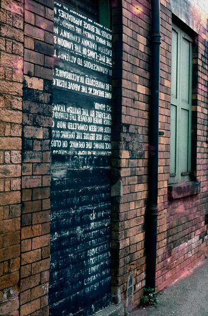
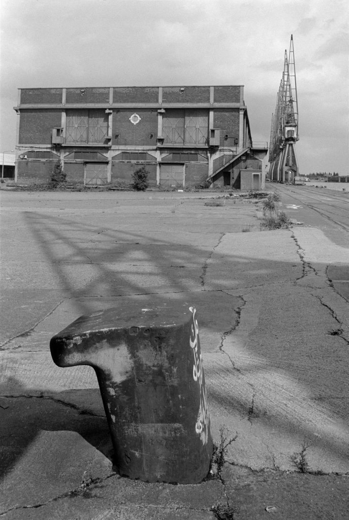
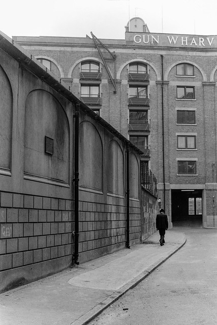
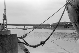
A dockside building with a doorway closed with boards from a notice that was once beside one of the swing bridges, probably that taking Wellington St across the Humber Dock lock, warning people it is an offence to pass the warning lights onto the bridge or be on it while it is moving.

A public footpath crosses the swing bridge into Albert Dock, and some time in the early 1980s while I was out walking with my family I notice that my wife and younger son in a push-chair were no longer following me. I turned around an looked for them, eventually spotting them on the bridge which was turning around to admit a ship to the dock. They had walked past the warning lights before they had been activated and the bridge operator, do doubt thinking only of the lorries which went across, had failed to spot a young woman already on the bridge with a baby buggy. She got a free ride and profuse apologies rather than a fine.

One of Hull’s minor tourist attractions, perhaps inspired by notices such as these, is now a footbridge across the River Hull on which people are allowed to ride. Unfortunately ship movements up the Hull are now extremely rare and the bridge almost never operates in anger, but there are scheduled tests most if not all weekends on which I’ve taken a couple of rides.


All photographs on this and my other sites, unless otherwise stated, are taken by and copyright of Peter Marshall, and are available for reproduction or can be bought as prints.


From the Royals

Monday, July 13th, 2020

I find to my surprise that it is very nearly seven years since I self-published my book ‘The Deserted Royals‘ and wrote a little about it here. Some of you who follow me on Facebook may have seen the rather wider range of pictures from that project made back in 1984 that I’m currently posting daily as my ‘story’ there, though I find Facebook particularly adept in hiding those posts I’d like to see and instead feeding me cats and celebs.

The ‘Royals’ in question are of course the Royal Docks, and most of my work was on the Royal Albert and King George V Docks in North Woolwich, by then part of the London Borough of Newham. I’d tried to photograph them from publicly accessible locations (with the usual mild bit of trespassing) but had found this very limiting, and wrote to the Port of London Authority who still owned these two docks, requesting permission to photograph them from the inside. Rather to my surprise they replied and granted me the access I’d requested. A similar letter to the owners of the Royal Victoria Dock went unanswered.

As well as the daily release on Facebook I will shortly be adding these pictures, along with others I took of London in 1984 to my Flickr album London 1984. At the moment it has pictures I took earlier in the year, including some from the West India Docks. I decided at the start of this year to put pictures on Flickr at a relatively high resolution and high quality and to trust any commercial users to respect my copyright and contact me to pay for usage. Although it’s almost certainly over-idealistic, I don’t think I’m likely to lose any significant income. I’ve used these larger images in this post and if you right click and open them in a new tab you can see them larger than in the post.

Here are a few of the pictures I’ve recently posted on Facebook, along with the usually short texts which accompany them, beginning below with an introductory picture and ending with today’s picture, about which I wrote a little more than usual.


South Quay, King George V Dock, Newham 1984
84-7c-21.
I had obtained permission from the PLA to photograph inside the dock area they owned – the King George V and Royal Albert Docks two docks on two days, and made my first visit in July. The security men in the gate house were clearly surprised that anyone should want to come and take pictures, but not very interested in what I did. Once inside there was no security presence and I could wander freely on the south quay of the King George V dock and on the central peninsula between the two docks, though their was no access to the north side of Albert Dock.
I was not supposed to enter any of the buildings, which could be unsafe, but I did take a number of pictures through windows and doorways, and later did cautiously enter some of the smaller buildings that seemed safe. On my first visit I exposed around ten rolls of black and white film – 360 exposures as well as some colour transparencies over around six or seven hours of work.
Iason and Ion are the two ships which could be seen in the distance in some pictures posted earlier, at the west end of the north quay of the King George V dock. To the left is the dry or graving dock at the west end of the dock, full of water.

King George V Dock, Newham 1984
84-7e-63.
A bollard and a more substantial shed on the land between the two docks, now the runway for London City Airport, looking roughly east. The row of cranes is along the north side of the King George V Dock.

Office curtain, King George V Dock, Royal Albert Dock, Newham 1984
84-7l-53.
This was one of the few pictures, possibly the only picture, where I used flash to capture the curtain blowing in the wind and to balance the light inside the office with that outside. It was quite a pretty curtain, a landscape with trees and something of a Japanese feel, but it was the wall-paper that attracted me more with its groups of small fishing boats in front of a shore with what was probably meant to be a fortress but looked to me more like a cement works like those further down the Thames.
Obviously the scene outside the window with its cranes was vital to the picture, and balancing the light levels inside and outside was no simple matter. Nowadays modern cameras do this kind of thing automatically but back then it involved calculations using distance and the flash guide number, careful exposure measurements through the window and a great deal of luck. It was made more difficult by the slow flash sync speed of all SLR cameras of the time, limited by their focal plane shutters, in this case to 1/60th of a second. I think it was the first time I’d tried to do anything like this, though I had read about it in photographic magazines and I only took a single frame, so it was definitely a case of beginner’s luck

All photographs on this and my other sites, unless otherwise stated, are taken by and copyright of Peter Marshall, and are available for reproduction or can be bought as prints.


Further North in TQ32

Saturday, July 4th, 2020
Swimming Pool, Golden Lane Estate, City, 1992 TQ3282-017
Swimming Pool, Golden Lane Estate, City, 1992

I don’t know why TQ32 didn’t take me very much into north London during the years 1986-92 as certainly in later years I spent more time in Canonbury, Stoke Newington and Enfield etc, but this particular 1km wide strip perhaps just avoids the areas of them that interested me most.

Dummies,  Old St, 1988, Islington TQ3282-005
Dummies, Old St, 1988, Islington

It’s just an accident of geography that while Green Lanes begins just on its west edge, as it goes north it moves just a little to the west, taking it out of the area. Another accident that much of what I photographed in Tottenham lies just a short way to its east. Of course the pictures I took of these areas still exist and are either already on line in other albums or will I hope soon be there as I get around to uploading other strips of the project.

Tin, Zinc, Iron & Copper Workers, Dufferin Ave, Old St, 1986  TQ3282-003
Tin, Zinc, Iron & Copper Workers, Dufferin Ave, Old St, 1986

TQ3282 begins on the edge of the city where both Islington and Hackney and meet it around Old St in Finsbury, Shoreditch and Hoxton. I don’t think there are now any Tin, Zinc, Iron & Copper Workers in Dufferin Ave, which seems largely now to be home to various financial organisations and I think this building close to Bunhill Fields may have been replaced by something more modern, or at least refronted.

SEFCO Ltd, Honduras St, Old St  1986 TQ3282-004
SEFCO Ltd, Honduras St, Old St 1986, Islington

Honduras Street is one of several short streets between Old St and Baltic St, just west of Golden Lane, and at one time was where Olympus Cameras had their service centre, which is probably why I walked down it and took this picture of SEFCO Ltd which will probably have been taken on an Olympus OM camera.

There was a company called SEFCO Ltd offering to supply specially shaped rubber pieces from an address in Rosebery Avenue in a small ad in the magazine Electrical Engineering in September 1955 who may possibly be the same company moved to a different but nearby address, but otherwise I can find no other information on the internet.

In later years I visited Honduras Street to go to exhibitions and events when it became the home of Foto8 magazine and the Host gallery from 2002 to 2012.

Mural, Caribbean House, Bridport Place, Hoxton, 1986 TQ3283-001
Mural, Caribbean House, Bridport Place, Hoxton, 1986, Hackney

Among the other pictures that I made in TQ32 were a few from Hoxton and Stoke Newington and the start of Green Lanes, including a fine travel agent’s window and several of a photographer’s shop.

Photographer, shop window, Newington Green, Green Lanes, 1988 TQ3285-008
Photographer’s window, Newington Green, Green Lanes, 1988

And further north there are some of interest you can find for yourself, including one with some particular resonance at the moment which I probably photographed at the time in part for its street name, Black Boy Lane.

You will find the pictures on Pages 3 and 4 of TQ32 London Cross-section.

High in the City

Friday, July 3rd, 2020
The Podium, Alphage Highwalk, City, 1992TQ3281-064
The Podium pub, St Alphage Highwalk, City, 1992

When architects and planners looked at how the city should be rebuilt after the considerable bomb damage in the war, they dreamt of a city where people and traffic would be separated, with pedestrians circulating at an upper level on what were called ‘highwalks’, and these were incorporated into the parts of the city which were being rebuilt.

Britannic Tower, Moor St, Moorgate, City, 1992 TQ3281-099
Highwalk entrance, Britannic Tower, Moor St, Moorgate, City, 1992

The largest of these areas was of course the Barbican, which was linked to the more central areas of the city by highwalks along and across London Wall, but there were also smaller sections of highwalks around Upper Thames St and around the Nat West Tower, Bishopsgate and Wormwood St.

Barbican, City, 1992TQ3281-094
Escalator, Highwalk, London Wall, Wood St

The planners were young, fit and idealistic and perhaps failed to appreciate the ways people actually moved around the city using buses, tube and taxis and their reluctance to climb stairs unnecessarily to get to buildings most of which still had their entrances at street level. There were escalators, but too few and these were expensive and needed maintenance. The planners perhaps also failed to see how much many older buildings from the Victorian and Edwardian eras would as the years progressed be seen as making a positive contribution to our cityscape – and often but not always be protected from demolition (or at least their facades protected) by listing.

Bassishaw Highwalk, City, 1987 TQ3281-043
Bassishaw Highwalk, City, 1987

Most of the city continues to exist at street level, and much of the highwalks outside of the Barbican that was built has now been altered or demolished – with the IRA beginning the process in some areas. They also were responsible for the first real controls on road traffic through the city, with the police ‘ring of steel’ introduced in the early 1990s as a response to bombings at the Baltic Exchange and Bishopsgate.

St Alphage Highwalk,, London Wall, City, 1992 TQ3281-103

More recently there have been some minor road and junction closures and the ‘Bank on Safety’ scheme has limited traffic at Bank junction to buses and cyclists between 7am and 7pm Monday to Friday; further controls seem inevitable with some city streets being pedestrianised and others being made ‘no through roads’.

St Alphage Highwalk,, London Wall, City, 1992TQ3281-105
St Alphage Highwalk,, London Wall, City, 1992

Long overdue is an overhaul of the private hire systems and in particular of ‘black cabs’ which are responsible for much of the congestion in the city. They will be changing to electric vehicles, but we need to see a move to a smartphone app based system with an end to the current discrimination against mini-cabs over the congestion charge and an end to wasteful ‘cruising for hire’.

You can see more pictures from the City of London taken in 1986-92, including some more from the highwalks, in page 3 of my album TQ32 London Cross-Section. These are scans made from cheap trade processed en-prints at the time I took the pictures which were sometimes rather poor quality.

Lucky 13 – 1986

Friday, June 26th, 2020

I can’t quite work out why my album 1986 London Photographs spreads out its 1370 photographs over 14 pages, as there seem to be roughly 100 pictures on each of the pages I’ve bothered to count, but to my surprise Page 13 isn’t the last. But despite the superstitions about the number 13 it does appear to have a number of pictures I came across by luck as I walked around the streets, mainly in Islington and the City.

Barnsbury Terrace, Islington 86-10o-56_2400
6 and 7 Barnsbury Terrace

This pair of villas were built around 1840 are are locally listed. If you go there now you may find my picture surprising, as the pair are now more or less symmetrical, except for the additional second floor window above the recessed door of the right hand house. But it has gained the pilasters around the main windows on the ground and first floor and that on the second floor now has the three arches mirroring its neighbour.

I assumed when I took this picture that the rather stark appearance of the right hand house was probably due to a repair after bomb damage. There have been some rather more minor changes to the left hand house also.

Stone Frieze, Musgrove Watson, Battishill Street Gardens, Islington86-10p-33_2400
Stone Frieze, Musgrove Watson, Battishill Street Gardens, Islington

I made several pictures of this remarkable stone frieze which was installed here in the new Battishill Street Gardens which were opened by Sir John Betjamin in 1975. The gardens were a pleasant quiet place to eat my sandwiches when I was photographing in the area.

The frieze had been made by Musgrove Watson (1804-1847), best known for his brass reliefs around the base of Nelson’s column for the Hall of Commerce in Threadneedle St set up in 1830 by biscuit-maker and amateur architect Edward Moxhay as a rival to other places acting as exchanges for commercial information and the display of samples including the Royal Exchange, of Lloyd’s, the Baltic, Garraway’s, the Jerusalem, and the North and South American Coffee-houses.

Never as successful as Moxhay and other investors had hoped, the Hall of Commerce was demolished in 1922, but the bas-relief frieze from its frontage was saved at UCL, and presented by Sir Albert Richardson to Islington Council for their new garden in 1974.

Fleet St, Ludgate Hill, St Paul's Cathedral, City 86-11e-54
Fleet St, Ludgate Hill and St Paul’s Cathedral

It was only after the railway bridge across Ludgate Hill of the line leading north from Blackfriars was demolished that I realised that I had never set out to photograph what had been one of the archetypal London views of St Paul’s Cathedral.

The line between Ludgate Hill Station and Holborn Viaduct station which the bridge carried opened in 1866. Ludgate Hill station was closed in 1929 but only demolished around the time the line closed to rail traffic in 1969. The bridge remained in place until 1990 when a new line for Thameslink services was tunnelled underground below the old route.

I searched and found a few pictures, including this one, that showed the bridge from Fleet Street a short distance west of Ludgate Circus.

Hatton Place, Saffron Hill, Clerkenwell, Camden 86-11g-32
Hatton Place, Saffron Hill, Clerkenwell, Camden

Sir Christopher Hatton was  Lord Chancellor of England for Elizabeth I and his London Home was in this areagiving his name to Hatton Garden. Hatton Place is at the side of the Hat & Tun, which probably got its name from a ‘rebus’ for Sir Christopher, and Hatton Place was formerly Hat in Tun (or Hat and Tun) Yard. Back in 1871 it was described as one of the foulest smelling streets in London – and there was plenty of competition. The pub was renamed as Deux Beers Cafe Bar in 2000, but has since reverted to its former name.

I can find no explanation for the elephant head at No 13, which I presume was in some way related to the business then occupying these premises. The ground floor is now a jewellry shop and workshop but the floors above have been converted into flats and there is now a large window in place of the elephant.

Mural, Farringdon Lane, Clerkenwell, Camden 86-11g-54
Mural, Farringdon Lane, Clerkenwell, Camden

Farringdon Lane used to be called Ray Street, and the bridge over the railway here from where I took this picture is still called Ray St Bridge. There is now no trace of the mural on the wall. I think it depicted scenes from the history and industry of the area, including the Clerk’s Well and printing. I tried several times to photograph it in colour but somehow never managed to get the colours right, and prefer this black and white version.

Holborn Viaduct, City 86-11i-11
Holborn Viaduct, looking down Farringdon St

Another photograph of the decorative statuary on Holborn Viaduct, looking down Farringdon St and the Fleet valley towards the River Thames.

Page 13, 1986 London Photographs.


All photographs on this and my other sites, unless otherwise stated, are taken by and copyright of Peter Marshall, and are available for reproduction or can be bought as prints.


Matlock Walk

Saturday, June 20th, 2020

Last October seems now so long ago. Linda and I had gone to Matlock to look after two of our grandchildren for a couple of days in what turned out to be a small family emergency.

I took a few photographs on the walk back from taking the girls to school, and then went out later in the day for some exercise. Matlock is a pretty hilly kind of place, so I got plenty of it.

Matlock Bank is an area on a hill that rises up from the riverside at the centre of Matlock, with Bank Road rising pretty steeply up the hillside. It doesn’t have any banks on it, though there are some shops, the post office and police station close to the bottom, several churches higher up as well as offices for the local council and, close to the top those for Derbyshire County Council in what used to be Smedley’s Hydro.

It was this hydro, and other similar smaller establishments that made Matlock the town it is, and the spa became an important tourist centre in the nineteenth century. I knew, having done my research earlier in The Crown.

In 1893 a cable-hauled tramway opened on Bank Road, “Tuppence up, Penny Down” for the ride up around 300ft of hill on the world’s steepest tramway on public roads, a gradient of 18% – 1 in 5½. Unfortunately it was closed in 1927, with the council who ran it replacing it with a motor bus service.

There are still buses. Occasionally, though I didn’t see one while out for my walk. But I was glad I hadn’t brought my bike. I just don’t have the gears forgetting up 1 in 5½ – or the brakes for going down.

More pictures on My London Diary in Matlock Town Walk.

Shepperton Ride

Wednesday, June 17th, 2020
River Thames, Church Square, Shepperton

June 4th I took it easy again on my ten-mile ride, forcing myself to stop and take pictures here and there. Of course the stopping and starting does actually add to the amount of energy expended and I find it hard to actually waste the effort I’ve made by braking, so the places I stop are sometimes more determined by where I need to slow down for other reasons.

Laleham

I’d changed my route slightly to go along a little of the River Thames towpath through Laleham village. I don’t like cycling along this bit of the towpath much, partly because its often quite busy with walkers, but mainly because the loose chippings on the actual path are a nuisance. Years ago, as a teacher hurrying along here on my way to an early morning in-service training meeting at the Runnymede Centre in Chertsey a stone flew up and into my chain, snapping the fairly chunky aluminium arm of my Campagnolo rear derailleur. I couldn’t ride the bike but rushed home pushing it, and picked up my wife’s bike to ride to the session. Fortunately I’d left home early to enjoy the bike ride, and ended up only a few minutes late. But I had to buy a new derailleur, opting for a rather cheaper model that seemed to work just as well.

This time I took the path in a leisurely fashion, keeping as far as possible to a narrow hardened mud area to one side of the chippings to arrive at the parking area where I stopped to take a photograph before proceeding.

One of many unfilled gravel pits in Spelthorne
Chertsey Lock and Chertsey Bridge

The narrow path soon becomes a metalled road, which would provide a pleasant ride beside the river to Chertsey Lock and Chertsey Bridge, though marred by the traffic humps and the occasional rather dangerous pothole.

The house where Zane died

Just before the bridge is the house where during the 2014 floods a tragic release from landfill of deadly hydrogen cyanide killed a seven-year-old and paralysed his father. Zane Gbangbola’s parents have continued the campaign to get the truth about the incident since.

Chertsey Lock

At the bridge I turned left towards Shepperton, along a busier road with a road surface curiously resistant to bicycle tires.

House, Dockett Eddy Lane
Pharoah’s Island can only be accessed by boat
Shepperton Ferry – not currently operating.

It was a pleasure to turn off down Docket Eddy Lane which leads back down to the river, and past the houses on the riverside and on Pharoah’s Island to Shepperton Lock and the ferry.

I turned off the route into Church Square and went down to the garden by the riverside, to find a pair of fancy ducks with a small group of chicks. I switched to my longer lens so as not to disturb them while taking pictures.

Back on my bike I rode up Shepperton High St, turning left at the top to go over the M3. It’s always just a little of a struggle up this bridge, perhaps because its usually against the wind and very open, but there is a long downhill stretch after it, with little need to pedal until just before the next traffic lights. I kept on and was soon cycling through Laleham on the road and up towards Staines, over some more resistant road surface and some really poor cracks and holes at the roundabout by the pub I still think of as the Lucan Arms, though it has changed its name several times since Lord Lucan went missing. Nowadays he could easily disappear through a Surrey pothole.


All photographs on this and my other sites, unless otherwise stated, are taken by and copyright of Peter Marshall, and are available for reproduction or can be bought as prints.


London 1986 Page 10

Friday, June 12th, 2020
Institute of Chartered Accountants, Great Swan Alley, City 86-8ab-32-Edit_2400

Page 10 of London 1986 begins in the city of London, and strongly features a remarkable set of figures around the Institute of Chartered Accountants building from 1890-93 in Great Swan Alley, off Moorgate a little to the north of the Bank of England. Above its first floor windows is a long frieze of figures representing various trades and figures, some dating from the 1890s and others added in the 1930s and 1960s when the building was extended. Among them you can see Wren holding a model of St Pauls Cathedral.

Institute of Chartered Accountants, Great Swan Alley, City 86-8ab-34-Edit_2400

But apparently of more interest to me were what Pevsner describes as the “small very female termini caryatids” whose figures seemed very much at odds with my ideas both of the Victorians and of accountants and on whom I expended far to much film.

Petticoat Lane, City, Tower Hamlets86-9a-23_2400

I managed to drag myself away from the sirens of the ICA and out of the City into Petticoat Lane and the area around this, finding as well as a market a large group of Christians armed with muscial instruments.

Guildhall, Exhibition hall, Magistrates' court, Offices, Richard Gilbert Scott, 65 Basinghall Street, City 86-9b-14_2400

Later I returned to the City for more pictures, including some of one of my favourite modern buildings in the city, the Exhibition hall, Magistrates’ court and Offices by Richard Gilbert Scott at 65 Basinghall Street with its wonderful concrete roofs.

Highwalk, Wood St, City 86-9d-41_2400

The city’s Highwalks also attracted my attention, part of a post-war vision of separating pedestrians from traffic by visionary architects who perhaps failed to appreciate the tremendous residue of street-level development that anchored people to the ground. It worked for areas that had been largely obliterated by bombing, particularly the Barbican, but could never become sufficiently comprehensive elsewhere across the city to make sense. It did however provide photographers with some useful elevated viewpoints.

City Mill Lock, Bow Back Rivers, Stratford, Newham  86-9f-26_2400

At the end of the page are a few pictures from Bromley-by-Bow and Stratford back rivers, including some of the near derelict lock linking the City Mill River and St Thomas’s Creek with the tidal Waterworks River. I think this lock dated from the 1930s when the City Mill River was enlarged and other work done as a part of a flood relief plan for the area (and also to give work to the unemployed.) Because the Waterworks River was then tidal, the water level in it could be either above or below that in the City Mill river and there are two pairs of gates at this end of the lock. These were replaced by modern gates a few years ago, but a new lock was built at Three Mills as a part of the Olympic redevelopment, which probably makes the double gate redundant.

Page 10 of London 1986

Southwark & City – 1986 page 9

Monday, June 8th, 2020
Tower Bridge, River Thames, pier, Hays Wharf, Southwark 86-8z-21-Edit_2400


Page 9 of my album London 1986, black and white pictures taken of the city that year, begins briefly on familiar ground in Southwark, close to the OXO tower, before going on to Clerkenwell and Finsbury. Because of my rather odd filing system the two areas interweave before I return to Southwark and Bermondsey.

Laystall Street, Clerkenwell, Camden 86-8x-32-Edit_2400
A plaque above a hairdresser’s shop commemorates Guiseppe Mazzini, founder of Young Italy, a secret society formed to promote Italian unification. He lived in London at various times between 1840 and his death in 1872 to escape arrest on the continent.
Tower Bridge, River Thames, Hays Wharf, Southwark 86-8z-22-Edit_2400

I crossed Tower Bridge briefly and returned south of the river. The riverfront between Tower Bridge and Southwark Crown Court , opened in 1983, has changed completely since I took these pictures, though many of the pictures away from the river have altered relatively little – the George Inn was last rebuilt in after a fire in 1677.

Hays Wharf, Pickle Herring St, Southwark 86-8z-41-Edit_2400
Pickle Herring St, Southwark  86-8z-55-Edit_2400

Later I went to the City, wandering the area around Bank and towards the Tower with page 9 ending with a second picture of Pepys on Seething Lane.

Lombard St, City  86-8aa-21-Edit_2400

The City is also an area where many older buildings have been preserved, despite some notable losses, though most date from the nineteenth or early twentieth centuries, and most that I photographed are still recognisable. But the environment has been altered and many are now somewhat overwhelmed by gigantic towers.


All photographs on this and my other sites, unless otherwise stated, are taken by and copyright of Peter Marshall, and are available for reproduction or can be bought as prints.


More from Page 5

Wednesday, May 27th, 2020

The previous post Page 5 of my London 1986 pictures looked at some from Hoxton and Islington and there were many more in the album that in my post, including a number form Shoreditch. Later in July I returned to Wapping, Shadwell, Limehouse and the West India Docks with a few other images from Greenwich, Finsbury and the City.

New Crane Wharf, Wapping, Tower Hamlets 86-7i-23_2400
New Crane Wharf, Wapping
Gun Wharves, Wapping,  Tower Hamlets 86-7i-32
Gun Wharves, Wapping
Rotherhithe from Wapping, Tower Hamlets v 86-7i-35_2400
Rotherhithe from Wapping
Limehouse Dock entrance, Limehouse, Tower Hamlets 86-7j-46_2400
Limehouse Dock entrance
Limehouse Dock, Limehouse Cut, Limehouse, Tower Hamlets 86-7j-51_2400
Limehouse Dock
West India Dock, Isle of Dogs, Tower Hamlets  86-7k-65_2400
West India Docks

These are just a few of my favourite pictures from the 100 on page 5 of my Flickr album of pictures I made in London in 1986. Clicking on any image will take you to a larger version on Flickr.


All photographs on this and my other sites, unless otherwise stated, are taken by and copyright of Peter Marshall, and are available for reproduction or can be bought as prints.