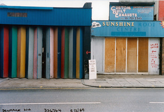
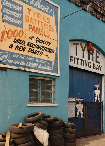
Posts Tagged ‘colour’

Hull Colour – 4

Tuesday, July 14th, 2020
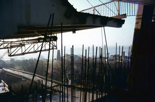
Humber Bridge, Hull 80hull065
Humber Bridge, Hull ca.1980

I’m not sure from exactly where I took this view of the Humber Bridge under construction, but I was fortunate enough to go on a tour of the construction organised for a group of science teachers, and it could have been made during that visit, though I don’t remember taking any colour pictures then. The bridge took around 9 years to build and was completed and opened in 1981.

The mill visible on Hessle foreshore was built around 1810 to grind the chalk that was being quarried here into whiting, finely powdered chalk used as a filler in paint and, together with linseed oil to make putty, in whitewash, gesso and ceramic glazes etc. The windmill went out of use about a hundred years ago, losing its cap and sails and the quarry closed in 1970. The area is now a country park.

Humber Bridge, Hull 80shull062
Humber Bridge, Hull ca.1980

After the cables were spun the box-girder sections of bridge decking were added, beginning in November 1979 and this picture must have been made shortly after this. Wikipedia states “the Humber Bridge was the longest single-span suspension bridge in the world for 17 years.”

When our family was travelling to Hull by train in the 1980s we would look out for the Humber Bridge in the distance to know we were getting close to our destination. I always offered a small cash prize for the first of our party to spot it through the train window, but think I never had to pay it out as I always saw it before the others.

River Humber, Hull 80hull110
River Humber, Hull 1980

The Humber has always seemed more mud in motion than a river, always a dirty brown colour, and it is only the small waves that differentiate between the river and the shore in this view. The mud and sandbanks in the estuary are always moving, and for many years ships travelling up the river to Hull or Goole needed the services of the Trinity House pilots, who started offering their services in 1512 and in 1581 were granted a charter authorising them to examine and licence pilots and take charge of ships. Various Acts of Parliament followed to endorse and regulate their activities, but the 1984 Pilotage Act transferred responsibility to the ports. In 2002 Associated British Ports terminated the authorisations of all Humber Pilots and employed their own pilots directly.

You can now walk along an esplanade along what had been the river frontage of Victoria Dock and various ship-building and other related businesses but only as far as what was the Alexandra Dock and is now ‘Green Port Hull’, a a wind energy manufacturing plant and riverside quay. I think this picture was probably taken just a little further downriver than the path now takes you.

Humber Dock Side, Hull 80hull113
Humber Dock Side, Hull 1980

There were some blue sheds on the dock side of Humber Dock that were demolished when the dock was dredged and converted into Hull Marina, and these had painted steel columns and wooden sides. The marine air had over the years produced this incredible rusting, lifting up the thick painted layers.

The buildings at the right of the picture are still there, though considerably altered on Humber Place at its junction with Wellington St, and are now Francis House, the offices of an accountancy firm, though the Wellington St building at extreme right has been demolished.

Railway Dock, Hull 80hull114
Railway Dock, Hull 1980

Although Hull lost some of its most impressive warehouses to a road scheme which split the Old Town from the city centre to take the heavy traffic for the King George Dock to the east of the city, some of those beside Railway Dock were retained, with the three gables shown here still visible, though the mass at the extreme right has been demolished.

King Billy, Market Place, Hull 80hull115a
Railway warning, Hull 1980

King Billy, King William III or William of Orange, successfully invaded Britain in 1688 in what is sometimes called the ‘Glorious Revolution’. James II was unpopular, largely because he was a Catholic and was seen to be changing Britain to a Catholic country, suspending anti-Catholic measures by decree when Parliament refused to do so and prosecuting Anglican bishops for seditious libel. His actions prompted anti-Catholic riots and many leading political figures of the day invited William to come and take over the country. But there were also leading Catholic members of the aristocracy who defended James and the ‘divine right of kings’ to overule all others, including Parliament. One of them was the governor of Hull, Lord Langdale, who took the military to occupy the city of Hull, fearing that William of Orange might try and land there. But instead of coming across the North Sea, William’s fleet went down the Channel and landed at Brixham on Novermber 5th, marching from there to London. The army deserted James and he fled to France on December 11th.

Hull had remained under Catholic control until December 3rd, when Protestant officers, hearing of a plot to imprison them, got together and arrested Langdale and his Catholic supporters. The day was celebrated in Hull for many years as ‘Town Taking Day’ when many wore orange sashes and celebrated with a procession, church service and fireworks in the Market Square – and around the statue of King Billy after it had been erected there in 1734.

Market Place is very much a backwater in the Old Town now, on the edge of the busy A63 and with one side occupied by some of the city’s most tedious buildings, as well as the rear end of Holy Trinity. Since the listed public toilets under King Billy closed there are few reasons to go there.

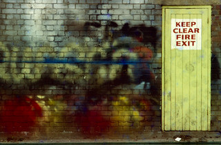
Railway warning, Hull 80hull116
Re-used Railway warning notice, Hull. 1980

A dockside building with a doorway closed with boards from a notice that was once beside one of the swing bridges, probably that taking Wellington St across the Humber Dock lock, warning people it is an offence to pass the warning lights onto the bridge or be on it while it is moving.

A public footpath crosses the swing bridge into Albert Dock, and some time in the early 1980s while I was out walking with my family I notice that my wife and younger son in a push-chair were no longer following me. I turned around an looked for them, eventually spotting them on the bridge which was turning around to admit a ship to the dock. They had walked past the warning lights before they had been activated and the bridge operator, do doubt thinking only of the lorries which went across, had failed to spot a young woman already on the bridge with a baby buggy. She got a free ride and profuse apologies rather than a fine.

One of Hull’s minor tourist attractions, perhaps inspired by notices such as these, is now a footbridge across the River Hull on which people are allowed to ride. Unfortunately ship movements up the Hull are now extremely rare and the bridge almost never operates in anger, but there are scheduled tests most if not all weekends on which I’ve taken a couple of rides.


All photographs on this and my other sites, unless otherwise stated, are taken by and copyright of Peter Marshall, and are available for reproduction or can be bought as prints.

Hull Colour – 3

Sunday, July 12th, 2020
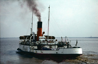
Humber Ferry, Hull 72hull057
PS Lincoln Castle – Humber Ferry, 1972

Before the Humber Bridge was opened in 1981, ferries transported passengers and cars across the Humber from the pier in Hull to New Holland in Lincolnshire, where a train service took passengers on to Grimsby and other stations. For drivers it avoided the journey to Boothferry Bridge near Goole, 28 miles away up river – and a similar journey back on the opposite bank. By the mid-70s an alternative route for many journeys had been provided by the M62 viaduct a mile or so east of the Boothferry Bridge – which largely removed the necessity for the Humber Bridge.

The Lincoln Castle was a great improvement on the other paddle steamers when she came into service in 1941, and was much loved by the time she was replaced by a more economical diesel-powered ferry in 1978. For a short time she was grounded on the beach at Hessle as a restaurant – where I went for afternoon tea – and later in the same role in Grimsby. By 2009 her condition had deteriorated and after attempts to preserve the ship failed was scrapped in 2010.

I travelled across on the ferry a couple of times, took a few pictures in New Holland and took the ferry back. It was a good family outing, particularly for our two young boys as the ship had been constructed to give passengers a good view of the engine room and steam engine.

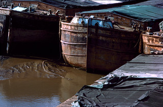
Old Harbour, Hull  77hull045
Old Harbour, Hull 1977

You can still walk beside the River Hull in the Old Town, and it remains an interesting walk, but back in the 1970s there was still some commercial activity, and at the right times of the tide vessels would pass up or down past these largely redundant barges, moored here three deep.

This was the original harbour of Hull, before the docks were built, though there were many wharves upstream both in Hull and further north to Beverley and beyond, and the river remains navigable. Although traffic had dropped markedly there were still a number of industrial sites still using the river in the 1970s and into the present century.

Old Town, Hull 77hull047
Old Town, Hull 1977

Wooden crates were being burnt in a bin down an alley and producing an almost comic book head of flame, a beacon in the shadow of the alley. Flames are always something of a challenge for photography, generally resulting in burned out highlights that have nothing to do with their temperature but simply their intensity. I was surprised that transparency film with its very limited exposure range handled this so well, more I think a matter of luck than expertise.

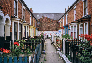
Terrace, Hull 81-Hull-003
Terrace, Hull 1981

Widely publicised as a “fairytale wedding” and the “wedding of the century”, the marriage Prince Charles and Lady Diana Spencer on Wednesday 29 July 1981 clearly caught the imagination of many in Hull, and I photographed some of the decorations painted on derelict buildings and here on a typical Hull “terrace’, though I cannot remember its location.

Many of Hull’s roads have these short pedestrian terraces at right angles to the main street to pack more houses into a small area. Not all have such neatly maintained fences and gardens, but almost all are too narrow for them to have been converted to take cars.

The black cat halfway down the street didn’t bring the unhappy couple much luck.

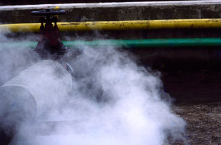
Wincolmlee, Hull 80hull087
Wincolmlee, Hull 1980

Wincolmlee runs roughly parallel to the River Hull, on the road side of the wharves along its west bank, from the north of the Old Town up to Air St, a little over a mile. Lime St, runs in the same way on the east side of the river a little less than half the distance.

Much of Hull’s industry involved agricultural oils and there were storage tanks on both sides of the river. I think these colour-coded pipes probably linked some of them, but what attracted me as well as their colours were the clouds of steam.

Scott warehouse, Hull 80hull088
Scott warehouse, Hull 1980

Hull’s unlisted riverside properties have largely been demolished with some notable losses. But John A Scott’s warehouse in Alfred Gelder St was converted to flats around 1980, the work going on while I took this picture involving making windows in what had been a largely or entirely blank wall.

It isn’t in itself a very exciting building, but it’s river frontage now fits better with the listed building immediately downstream than a new build.

Quite a few buildings in the industrial area around Wincolmlee which in areas of higher property values – such as London – would have been converted to luxury flats have simply been demolished or are still largely derelict. But the area has perhaps been given a boost by the ‘Bankside Gallery’ of graffiti which sprang up following the intervention by Banksy.

Mud, Hull 80hull090
Mud, Hull 1980

I’m unsure as the the actual location or date of this picture – one of the great majority of my slides which lack any captioning. But it is certainly one of Hull’s docks, almost certainly Humber Dock, Railway Dock or Humber Dock Basin. The reflections in the wet mud give some clues, but not enough for me to be sure.

These docks close to the centre of the city had been unused for some years and were all heavily silted with Humber mud. Considerable dredging was required to make Humber Dock usable as Hull Marina, which opened in 1983.

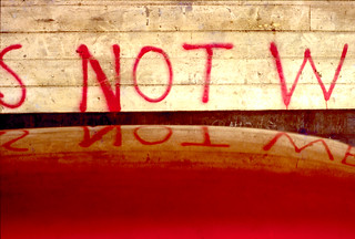
S Not W, Hull 80hull091
S Not W, Hull 1980

I deliberately cropped the message which I think was written on the wooden side of a dockside shed to give the rather enigmatic message ‘S NOT W’. Unfortunately I can no longer remember the entire text, though the letter after W is clearly E, and not as I hoped A for an anti-war slogan.

The saturated red which attracted me, at least in part because it matched the colour of the painted letters, was the roof of a car.

British Extracting Co Ltd, Hull 80hull089
British Extracting Co Ltd, Hull 1980

This former British Extracting Company silo on the side of the River Hull was built in 1919 and one of a number of similar buildings in Hull and elsewhere designed by Gelder & Kitchen of Hull. It has regularly been visited and photographed in recent years by urban explorers.

Sir Alfred Gelder (1855-1941) was born in North Cave and became a Hull councillor in 1895, serving five terms in a row as Mayor from 1898-1903 and overseeing the extensive redevelopment of the city after which he was knighted. He was Liberal MP for Brigg from 1910-1918. A Methodist, he founded his architectural practice in Hull in 1878 and designed a wide range of buildings including several Methodist chapels in the city and elsewhere as well as many flour and oilseed crushing mills, including the first roller mill for fellow Methodist Joseph Rank and other buildings for Ranks’s son, J Arthur Rank.

Llewellyn Kitchen, (1869-1948) from Manchester joined Gelder as chief assistant in 1892 after having worked for a number of architects elsewhere and soon became the junior partner in the practice, although he appears to have been the more interesting architect of the pair. Kitchen was also a leading freemason in the area.

Gelder and Kitchen LLP is still in business, the second oldest firm of architects in the UK today.


Hull Colour 2

Friday, July 10th, 2020

A look at a few more of my colour pictures from Hull in the 1970s.

Paint, Hull 70shull077
Paint, Hull 1970s

I made a number of exposures of this wall, which I think was possibly at one of the dry docks on Dock Office Row, though my memory may be at fault. I often walked up High St from Clarence St next to Drypool Bridge and then on to Wincolmlee, sometimes continuing on up to Bankside or Air St, where I could walk west and across towards my parents-in-law’s house just off Chanterlands Ave north.

I was attracted by the colour but also by the mix of the accidental and deliberate in the markings on the wall. Like quite of few of the other images, time has added its mark to this picture, with some patches of blue which I haven’t entirely managed to retouch where mould has attacked the dyes.

Hull 70shull083
Hull 1970s – a distant view of Saltend

I can’t recall at all taking this picture, and another also taken from a similarly rural viewpoint with the chemical works in the distance. From the view I think it is taken from somewhere on the west edge of Hedon, perhaps on a walk from Hull to Paull.

But when or wherever it was made, its an image I like for its contrast, both visually and between the agricultural and industrial.

Weighton Lock, Broomfleet, 72-80-Hull-005
Weighton Lock, Broomfleet, 1970s

In contrast I remember our family walk which took us to Weighton Lock well. If you have travelled my rail from Selby or Doncaster to Hull, your train will have sped through Broomfleet, and you may just have seen a station there.

The man in the ticket office at Hull Paragon station seemed surprised when we asked for tickets to Broomfleet, but trains do stop there. Now you have a choice of the 07:19 or the 16:21 – but then there were rather more though I think we did have to tell the guard we wanted to stop there – and to hold our our hands for the returning train.

The lock is where the Market Weighton Canal joins the River Humber. Opened in 1782, the canal was both a navigable waterway and a drainage ditch. The upper section was closed around 1900 and the lower few miles to the lock abandoned in 1971. The Market Weighton Civic Trust managed to save the lock by getting it listed as an ancient monument, and it was repaired and reopened although there is no right to navigation around six of its original nine and a half miles remain navigable.

A few other pictures in the album are also from trips we made from Hull, including to Flamborough.

Guildhall Rd, Hull 72-80-Hull-008
Guildhall Rd, Hull, 1970s

Until ‘The Dock’ was opened in 1778, ships coming to Hull moored the the ‘Old Harbour’ in the River Hull, where staithes still run from the High St to the river. The dock was the largest dock in the UK when it was built, and soon became known as the ‘Old Dock’, but was renamed Queen’s Dock in honour of the visit to Hull by Queen Victoria and Prince Albert in 1854.

By the 1920s it was redundant, with docks on the Humber – Victoria Dock, Albert Dock, Alexandra Dock, Riverside Quay and King George Dock – forming the port of Hull, and it finally closed in 1930. The city bought it and filled it in to create Queen’s Gardens. Filling it took four years – one year longer than its construction and provided some employment during a period of recession.

I’m not sure exactly where these former warehouses on the south side of Queens Dock (Queens Gardens) in Guildhall Road were, but from the street sign I think they were just to the west of Quay St and have since been demolished.

River Hull, Hull 72-80-Hull-011
River Hull, Hull from North Bridge

I added the following text to a black and white image on my Hull photos web site taken from just a foot or two to the left of this image:

Peeling paint on a wall advertises the coal and sand wharf belonging to ‘Henry’, which I think may be Henry Mead & Co at 15 Lime Street, which was wound up in 1973. On the west bank of the Hull are a long line of wharves and buildings on Wincolmlee, with the towering silos of R&W Paul (now Maizecor) in the distance. A single vessel is visible moored at one of the Lime St wharves.
 
Floods from the Hull, mainly because of a tides coming up from the Humber, were fairly frequent before the tidal barrier was built, because the corporation failed to get wharf owners to maintain adequate flood defences. A number of derelict properties made their job more difficult. More recent floods have been because of excessive rainfall in the Hull valley.

Apart from the Maizecor silo, none of the buildings visible in this slide are still standing.

Hull colour

Thursday, July 9th, 2020
Humber Dock Basin, Hull 70shull052
Silted up dock. 1970s

I’m aware that its a while – over a year since I’ve written anything here about Hull, so here is the first of a short series of posts about a city where I’ve spent quite a lot of time photographing.

King Billy, Hull 70shull048
King Billy, 1970s

I’ve never actually lived in Hull, but for around 35 years I visited the city regularly visiting my wife’s family home, where we stayed for at least a week every year, more in the earlier years. After that house was sold we had a good friend who was always pleased for us to stay with him in his large mansion, but since his death around ten years ago my visits have been less frequent.

Window, Hull 70shull069
Old Town reflection, 1970s

During those visits to Hull I spent a lot of time on the streets taking photographs, sometimes out with other family members, but often on my own.

Docks notice, Hull 70shull070
Docks Notice, 1970s

Mostly I was photographing in black and white, working on a project that in the early 1980s became an exhibition (and much later a book) ‘Still Occupied – A View of Hull’. As well over a hundred black and white images, the show at the Ferens Gallery also included around 40 colour pictures, giving a more abstract view and concentrating on the docks and the River Hull and the riverside industries.

Poulterers, Hull 70s-hull073
D Marks & Sons. Possibly on Humber St, 1970s

At that time I worked in colour using 35mm transparency film and quite a few of the slides have either been discarded or deteriorated beyond recovery, while others have been lost. But a couple of months ago I found around 250 of the more interesting pictures and re-photographed them using a Nikon D810 fitted with a Nikon PB-6 bellows, Nikon 60mm f2.8 macro lens and PS-6 slide duplicating attachment.

Window, Hull 70shull075
Dockside Shed, 1970s

The pictures here come from the first fifteen in the album, and the top one, which I think is probably of Railway Dock, shows the silted up state of the disused docks at that time. Those familiar with Hull will recognise ‘King Billy’ below this, reflected in the window of the pub where he is reputed to drink when the clock strikes thirteen. It’s a little harder to recognise the buildings reflected in the window below, particularly because the double image makes it seem more slender – or to read the rather minimal remains of the dockside notice that follows.

I can’t remember exactly where D Marks and Sons had their poulterers business, perhaps has the caption suggests on Humber St, but it could have been somewhere off the Hessle Rd. The distinctive blue shed was one of several around Humber Dock Basin.

Dockside shed, Hull 70shull046

All photographs on this and my other sites, unless otherwise stated, are taken by and copyright of Peter Marshall, and are available for reproduction or can be bought as prints.


Further North in TQ32

Saturday, July 4th, 2020
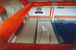
Swimming Pool, Golden Lane Estate, City, 1992 TQ3282-017
Swimming Pool, Golden Lane Estate, City, 1992

I don’t know why TQ32 didn’t take me very much into north London during the years 1986-92 as certainly in later years I spent more time in Canonbury, Stoke Newington and Enfield etc, but this particular 1km wide strip perhaps just avoids the areas of them that interested me most.

Dummies,  Old St, 1988, Islington TQ3282-005
Dummies, Old St, 1988, Islington

It’s just an accident of geography that while Green Lanes begins just on its west edge, as it goes north it moves just a little to the west, taking it out of the area. Another accident that much of what I photographed in Tottenham lies just a short way to its east. Of course the pictures I took of these areas still exist and are either already on line in other albums or will I hope soon be there as I get around to uploading other strips of the project.

Tin, Zinc, Iron & Copper Workers, Dufferin Ave, Old St, 1986  TQ3282-003
Tin, Zinc, Iron & Copper Workers, Dufferin Ave, Old St, 1986

TQ3282 begins on the edge of the city where both Islington and Hackney and meet it around Old St in Finsbury, Shoreditch and Hoxton. I don’t think there are now any Tin, Zinc, Iron & Copper Workers in Dufferin Ave, which seems largely now to be home to various financial organisations and I think this building close to Bunhill Fields may have been replaced by something more modern, or at least refronted.

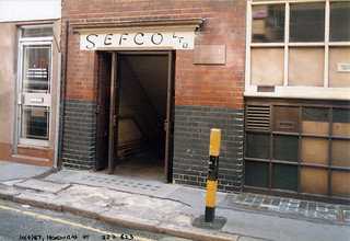
SEFCO Ltd, Honduras St, Old St  1986 TQ3282-004
SEFCO Ltd, Honduras St, Old St 1986, Islington

Honduras Street is one of several short streets between Old St and Baltic St, just west of Golden Lane, and at one time was where Olympus Cameras had their service centre, which is probably why I walked down it and took this picture of SEFCO Ltd which will probably have been taken on an Olympus OM camera.

There was a company called SEFCO Ltd offering to supply specially shaped rubber pieces from an address in Rosebery Avenue in a small ad in the magazine Electrical Engineering in September 1955 who may possibly be the same company moved to a different but nearby address, but otherwise I can find no other information on the internet.

In later years I visited Honduras Street to go to exhibitions and events when it became the home of Foto8 magazine and the Host gallery from 2002 to 2012.

Mural, Caribbean House, Bridport Place, Hoxton, 1986 TQ3283-001
Mural, Caribbean House, Bridport Place, Hoxton, 1986, Hackney

Among the other pictures that I made in TQ32 were a few from Hoxton and Stoke Newington and the start of Green Lanes, including a fine travel agent’s window and several of a photographer’s shop.

Photographer, shop window, Newington Green, Green Lanes, 1988 TQ3285-008
Photographer’s window, Newington Green, Green Lanes, 1988

And further north there are some of interest you can find for yourself, including one with some particular resonance at the moment which I probably photographed at the time in part for its street name, Black Boy Lane.

You will find the pictures on Pages 3 and 4 of TQ32 London Cross-section.

High in the City

Friday, July 3rd, 2020
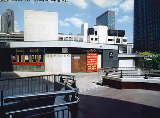
The Podium, Alphage Highwalk, City, 1992TQ3281-064
The Podium pub, St Alphage Highwalk, City, 1992

When architects and planners looked at how the city should be rebuilt after the considerable bomb damage in the war, they dreamt of a city where people and traffic would be separated, with pedestrians circulating at an upper level on what were called ‘highwalks’, and these were incorporated into the parts of the city which were being rebuilt.

Britannic Tower, Moor St, Moorgate, City, 1992 TQ3281-099
Highwalk entrance, Britannic Tower, Moor St, Moorgate, City, 1992

The largest of these areas was of course the Barbican, which was linked to the more central areas of the city by highwalks along and across London Wall, but there were also smaller sections of highwalks around Upper Thames St and around the Nat West Tower, Bishopsgate and Wormwood St.

Barbican, City, 1992TQ3281-094
Escalator, Highwalk, London Wall, Wood St

The planners were young, fit and idealistic and perhaps failed to appreciate the ways people actually moved around the city using buses, tube and taxis and their reluctance to climb stairs unnecessarily to get to buildings most of which still had their entrances at street level. There were escalators, but too few and these were expensive and needed maintenance. The planners perhaps also failed to see how much many older buildings from the Victorian and Edwardian eras would as the years progressed be seen as making a positive contribution to our cityscape – and often but not always be protected from demolition (or at least their facades protected) by listing.

Bassishaw Highwalk, City, 1987 TQ3281-043
Bassishaw Highwalk, City, 1987

Most of the city continues to exist at street level, and much of the highwalks outside of the Barbican that was built has now been altered or demolished – with the IRA beginning the process in some areas. They also were responsible for the first real controls on road traffic through the city, with the police ‘ring of steel’ introduced in the early 1990s as a response to bombings at the Baltic Exchange and Bishopsgate.

St Alphage Highwalk,, London Wall, City, 1992 TQ3281-103

More recently there have been some minor road and junction closures and the ‘Bank on Safety’ scheme has limited traffic at Bank junction to buses and cyclists between 7am and 7pm Monday to Friday; further controls seem inevitable with some city streets being pedestrianised and others being made ‘no through roads’.

St Alphage Highwalk,, London Wall, City, 1992TQ3281-105
St Alphage Highwalk,, London Wall, City, 1992

Long overdue is an overhaul of the private hire systems and in particular of ‘black cabs’ which are responsible for much of the congestion in the city. They will be changing to electric vehicles, but we need to see a move to a smartphone app based system with an end to the current discrimination against mini-cabs over the congestion charge and an end to wasteful ‘cruising for hire’.

You can see more pictures from the City of London taken in 1986-92, including some more from the highwalks, in page 3 of my album TQ32 London Cross-Section. These are scans made from cheap trade processed en-prints at the time I took the pictures which were sometimes rather poor quality.

City colour

Tuesday, June 30th, 2020

The 1km wide strip of TQ32 in our National Grid includes a section of the City of London, from a little to the west of St Paul’s Cathedral to a few yards east of the Monument, with the Thames at its south and the Barbican and Moorgate at its north, a little over a square kilometre of “the square mile”, perhaps two fifths of the city. So its not surprising that I took quite a few pictures in the City during the period I was putting colour prints into the albums that make up my ‘London Cross-section’, from roughly 1986-92. Though as you will see if you look at the album TQ32 – London Cross-section, they are mainly from just a few small areas that I found of most interest. Here is just a small initial selection of them with some comments.

Pig, Office, Lower Thames St, City, 1991 TQ3280-031
Pig, Office, Lower Thames St, City, 1991

Walking around the City now you often find yourself going past the windows of large offices filled with people staring into screens, but back in the late 1980s and early 90s this was more of a novelty. Also something of a novelty was this pink inflatable pig on a windowsill. The real watershed for the City came in 1986, with the ‘Big Bang’, on a Monday in October that year when the City of London was deregulated, with face-to-face share dealing replaced by electronic trading. I don’t know what business this office was dealing with but the idea of pigs seemed appropriate to the getting of snouts in the trough as so many in the City found themselves in clover.

Doorway, Little Britain, City, 1986 TQ3281-001
Doorway, Little Britain, City, 1986

Lawrence & Co. (Estd. 1897) Ltd. were once blouse manufacturers at 7 Little Britain, a street (and area) at the edge of Smithfield, but the peeling paint and corrugated iron on this doorway seemed to me to symbolise something about the state of the nation, the larger Britain, and their was the City of London Recorder and myself also a recorder.

You can still walk along Little Britain and indentify a few of the doorways I photographed, though what is left are simply facades, and the atmosphere is largely but not entirely lost.

Heroes Memorial, Postmans Park, City, 1986 TQ3281-116
Heroes Memorial, Postmans Park, City, 1986

In 1887 prominent painter and sculptor George Frederic Watts (1817-1904) proposed the erection of a memorial to commemorate the heroic self-sacrifice of ordinary people who had died saving the lives of others as a part of the commemorations of the Golden Jubilee of Queen Victoria, but it was not taken up.

Some years later in 1898, the vicar of St Botolph’s Aldersgate suggested to Watts that the memorial could be built in Postman’s Park, the former churchyard adjoining the church and a wooden loggia was built to shelter a wall with space for 120 ceramic memorial tiles to be made by William De Morgan, though only 4 were in place when this was opened in 1900.

De Morgan gave up ceramics in 1906 after making only 24 tiles, and Watt’s widow, Mary Watts was unhappy with new tiles made by Royal Doulton, and rather lost interest. Only 53 tiles had been added by 1931 when work ceased. When I photographed it the display was in fairly poor condition, but has since been repaired and in 2009 the first new tablet was added.

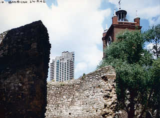
Roman Wall, Barbican, City, 1992TQ3281-068
Roman Wall, Barbican, City, 1992

I walked through the Barbican quite often and occasionally took photographs as I was involved in a group called ‘London Documentary Photographers’ which had been founded by Mike Seaborne, then curator of photographs at the Museum of London and which regularly met there, as well as organising several photography shows at the Barbican Library.

I like this picture because it encompasses so much of the history of the city of London, with a section of its Roman Wall, the tower of St Giles-without-Cripplegate, one of the few medieval churches to survive the 1666 Great Fire (though the tower dates from 1682 and the church was reconstructed after being gutted by bombing in the Blitz of 1940) as well as the taller tower from the Barbican Estate, built between 1965 and 1976 on an area devastated in the war.

Shakespeare, Garden, Aldermanbury, Love Lane, City, 1986TQ3281-019
Shakespeare, Garden, Aldermanbury, Love Lane, City,

Shakespeare, on this plinth in St Mary Aldermanbury Garden, Love Lane is another reminder of the city’s history – as is the garden. The church here was destroyed in the Great Fire and rebuilt shortly after to the plans of Sir Christopher Wren. It was gutted again during the Blitz in 1940, leaving only the walls standing. In 1966 these were shipped to Fulton, Missour and restored as a memorial to Winston Churchill’s ‘Iron Curtain’ speech in that town in 1946.

The area was laid out as a public garden after it was acquired by the City of London in 1970 and is often quite full at lunchtime with city workers eating their sandwiches.

Shakespeare’s bust, by Charles Allen (1862 – 1956), is part of a memorial from 1896 to John Heminge and Henry Condell, fellow actors of Shakespeare who after his death in 1616 collected his works and published them at their own expense in 1623, thus making them available to later generations. Without them his work would have lost.

TQ32 – London Cross-section.


All photographs on this and my other sites, unless otherwise stated, are taken by and copyright of Peter Marshall, and are available for reproduction or can be bought as prints.


More from Southwark

Monday, June 29th, 2020

I recently added these pictures (and many others) to my Flickr album TQ32 – London Cross-section.

Church, Councillor St, Camberwell,1989 TQ3277-014
Church, Councillor St, Camberwell,1989

Enter In To His Gates With Thanksgiving‘, the sentiment over a church door in Camberwell had two missing letters. It perhaps wasn’t surprising that the door was firmly closed and the gate locked, as I took this picture on a Friday, May 5th 1989. Nothing much special happened that day, but the previous day had been the 10th anniversary of Margaret Thatcher becoming prime minister, whose policies had a great effect on my photography, causing much of the dereliction and empty factories I was recording.

I was still a full-time teacher, but at a sixth-form and community college which then offered a wide range of evening as well as daytime courses. As a union rep I’d won a local agreement on timetabling which limited the number of sessions within which staff could be required to work, as well as national agreements to the number of contact hours. For me that meant my teaching finished at noon, and if I rushed to the station I could be in London taking pictures around an hour later.

Cafe, Southwark Bridge Rd,The Borough, 1991 TQ3279-012
Cafe, Southwark Bridge Rd,The Borough, 1991

I photographed this cafe on several occasions from 1986 to 1992, and though it never looked very open, I think it must still have been in business in the earlier years. In 1991, the street number 108 is painted large, and this was 108 Great Guildford Street, in a little tangle of streets on the edge of Southwark Bridge Road. It was once the Fox and Hounds public house, re-built in 1884 – and according to ‘Pubwiki’, its address over the years has over the years before its current one variously been ‘Little Bandy Leg Walk’, 118 Southwark Bridge Rd and 19 Little Guildford Street.

The building is still there, but the ground floor frontage is much changed. As well as these colour details I find photographed the entire building from across the street in 1992 (and possibly in earlier years.) I think few of the buildings which can be seen reflected in its windows have gone.

Bankside, 1986, Southwark TQ3280-017
The Jones-Wilcox Patent Wire-Bound Hose Co Ltd 47-48 Bankside, 1986

Walter Henry Wilcox established his company in 1876-8 selling engineering supplies and lubricating oils and moved from Uppper Thames St across the river to 36 Southwark St in 1880, and first advertised his wire-bound hose, the first of its type in 1888. The wholly-owned subsidiary, the Jones-Willcox Patent Wire Bound Hose Co, was set up in 1897 and was in business on Bankside until 1976 when it moved to Peacock Street. Their Bankside works was demolished around 1986 for the building of the replica Globe Theatre.

Grace’s Guide has condiserable information about the company, including reproductions of many advertisements and a long quotation about the widespread use “thoughout the Empire” of these hoses for petrol and other oils “constructed in an extensive Factory … from specially prepared canvas”. Their hoses contained no rubber which petrol and oils rapidly destroy. https://www.gracesguide.co.uk/1930_Industrial_Britain:_W._H._Willcox_and_Co

Mural, Porlock St, The Borough, 1992 TQ3279-021
Mural, Porlock St, The Borough, 1992

“… and he ascended into heaven” says the text at the bottom of this mural, the words I think coming from the head to their left. It may well have been a representation of the priest of St Hugh’s Church, part of a settlement founded in 1885 by former pupils of Charterhouse School to bring education and enlightenment to the deprived communities of Bermondsey and built in 1896. Probably the other figures represented local residents. The mural was I think on the tall wall of the building, part of the settlement premises that then stood on the corner of Porlock St and Crosby Row.

This later became known as the ‘Rainbow Building’ from a later mural on it, a rather primitive representation of a mis-coloured rainbow on a bed of grass with two trees and in the blue sky above a large yellow sun and a larger crude representation of the earth, presumably based on a child’s painting.

Church and ‘Rainbow Building’ were demolished in 2011 and replaced by flats with a new St Hugh’s Church in the basement which opened in 2013.

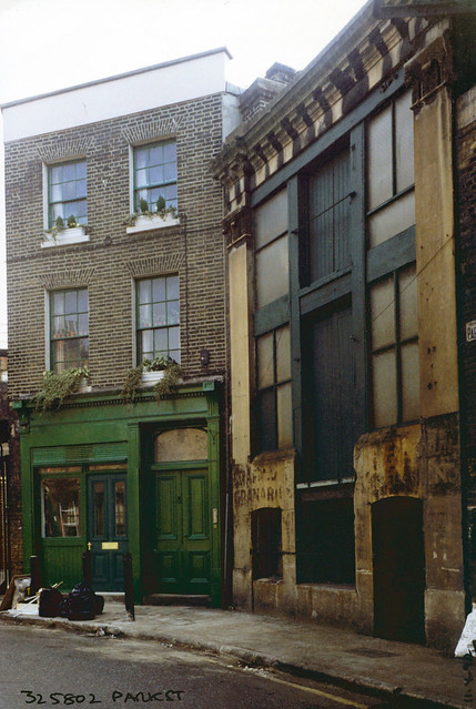
Park St, Southwark, 1992 TQ3280-042
Granary, Park St, 1992

This corner of Park St next to the railway bridge is still entirely recognisable. This image shows some of the problems of reproducing from a poor quality enprint and at some point I will try to find the negative to make a clearer image. But its defects give it a particular patina.

Painted signs, faded, label 15 Park St as a Granary, and it was apparently in use around 1900 for agricultural produce from Kent farms. There is more largely illegible signage around the right hand door. Some time after I made this picture the carefully faded text ‘PEROT EXPORTATEUR’ was painted over the doorway – presumably for some film – and Banksy and other graffitists later added contributions, including the text ‘BANKSY WOULD BE NOBODY WITHOUT BLEU LE RAT’ to the right-hand side.

Among the films which this building has appeared is as the gang hideout in Guy Ritchie’s 1998 crime comedy film ‘Lock Stock And Two Smoking Barrels’. The street also puts in an appearance in quite a few other films, including Howards End, 102 Dalmations, Keep the Aspidistra Flying, Entrapment


All photographs on this and my other sites, unless otherwise stated, are taken by and copyright of Peter Marshall, and are available for reproduction or can be bought as prints.


South of the River

Sunday, June 28th, 2020
Cafe, Norwood Rd, Herne Hill, 1991 TQ3274-001
Café, Norwood Rd, Herne Hill, 1991

I think I only took my first pictures on colour negative film in 1985. When I began in photography at the start of the 1970s it was quite clear that colour neg was just for amateur snaps and social photography, but real photographers – if they stooped to colour – did it on transparency film.

Cafe, Loughborough Junction, 1989, TQ3275-001
Café, Loughborough Junction, 1989

Most publications – books, magazines, newspapers etc – . still used only – or mainly – black and white, and when colour was used it was almost invariably from colour transparency. Images taken on colour neg were only used at a last resort, and usually then duped onto transparency for repro, or occasionally printed onto black and white paper to be used. You could get special panchromatic black and white paper which gave some chance of normal tonality, but it was a pain to use as normal darkroom safelights fogged it, and often normal black and white paper was used despite the often very poor tonality it gave.

Shops, Flaxman Rd, Loughborough Junction, 1987 TQ3276-002
Shops, Flaxman Rd, Loughborough Junction, 1987

Though colour transparency was great for repro, making prints from it had its limitations – as did using transparency film. I found myself too often having images with empty black shadow areas or unusably blown highlights as it the film had a limited exposure range. You could get great punchy saturated colour prints, fine for advertising (which was never my scene) but it was difficult to achieve subtlety. Fed up with telling printers what I wanted and being told it wasn’t possible I began making my own prints, working at times with complicated unsharp masking for Cibachromes. My German project I deliberately printed on outdated Agfa direct reversal paper.

Shops, Denmark Hill, Camberwell, 1989 TQ3276-004
Shops, Denmark Hill, Camberwell, 1989

In the 1980s, Fuji shook up colour negative (and, to a lesser extent transparency film), producing new film and print materials that gave greater fidelity, longer print life and greater flexibility in the darkroom. Seeing the prints that other photographers were making (and the fact I wasn’t actually selling my slides professionally) was a conversion experience. Since then I don’t think I’ve ever taken pictures on slide film.

Hairdresser, Coldharbour Lane, Camberwell, 1989, TQ3276-007
Gee P. Johnson, The People’s Salon, Coldharbour Lane, Camberwell, 1989,

At the same time I was beginning a major black and white project to photograph the fabric of London, and saw my colour work as separate to that, but dependent on it. I don’t think I ever went out to visit a place or area to take colour pictures, but simply did so when opportunities arose as I visited various areas.

I didn’t have a particular interest in cafes or hairdressers, but saw these and other shops and offices as example of small businesses with relatively low start-up costs which reflected both the aesthetic of their owners and of the people of the area which they served. Gee P Johnson’s unisex ‘The People’s Salon’ for me expressed that sense well.

TQ3276-013
Daneville Rd, Camberwell, 1989, Southwark,

Filing selected trade prints in albums according to their grid references was a way to explore the differences between different areas across London – and I chose to do so in these 1km wide south-north strips. It was also a kind of cataloguing system for my work, though not always as well documented on the prints it should have been.

Garage, Camberwell Station Rd, Camberwell, 1989 TQ3276-017
Garage, Camberwell Station Rd, Camberwell,

These examples come from the first thirty or so images in my Flickr album TQ32 London Cross-section, which contains a little over 300 pictures. I’ll perhaps look again at some more shortly.


All photographs on this and my other sites, unless otherwise stated, are taken by and copyright of Peter Marshall, and are available for reproduction or can be bought as prints.

TQ31 – North London

Friday, June 19th, 2020

There are many pictures on the fourth and last page of my album TQ31 London Cross-Section I’d like to show you and say a little about, though in most cases they need little text, but it can sometimes add interest. But my time is limited and I’ll leave you to discover most of them for yourselves.

Andreas, Hairdresser, Hornsey Rd, Lower Holloway, 1989 TQ3185-005

I think Andreas’s Barber Shop on the Hornsey Road had probably ceased trading by the time I took this picture, as there is no light bulb in the socket just to the left of the centre of the window. There is a notice in the door that gives its opening times, but where it says ‘Closed’ I think this may have been permanent.
As I was still working full-time, many of my pictures were made at the weekend, often like this one on Sunday mornings, when most shops would have been closed. The building is still there, but not the shop or its shopfront; the whole row of shops present when I was taking pictures has now been converted to residential use.

Hoo Hing Ltd,  Drayton Park, Highbury, 1989 TQ3185-008

Rather to my surprise, this industrial/commercial building is still there on Drayton Park, and, at least until recently, the name ‘HOO HING LTD’ was still present above the doorway. The company still exists and is an importer of oriental food and catering products, but the site was reported as due to be cleared in 2006 for housing. However in 2019 it was still there; like many redevelopments it may have been halted by the financial crash.

Sisters Gowns, Seven Sisters Rd, Finsbury Park, 1989 TQ3186-015

Sisters Gowns was at the rear of a property at 216 Seven Sisters Road in Finsbury Park and this door was on Coleridge Rd. The property was demolished in 2008 (the sign had gone earlier), but the site was still empty in 2019.

Shop window, Fonthill Rd, Finsbury Park, 1989 TQ3186-021

Fonthill Rd in Finsbury Park, apparently known to locals as ‘The Font’ is possibly London’s best ‘fashion village’. On weekdays the trade is (or at least was) largely for the trade, but on Saturdays it becomes a busy retail fashion area, often packed with women on the lookout for a bargain. Fortunately most of the shops were closed when I went to take pictures on a Sunday morning.

Hairdresser,  Turnpike Lane, 1989 TQ3189-015

A unisex hairdressers at Turnpike Lane excited me in my hunt for heads, with a couple of fine examples as well as some photographs. I think I took rather more pictures than the three you can see here. A recessed doorway meant I could work from several angles.

Reflection, shop window, West Green Rd, West Green, 1989, Haringey TQ3189-010

Close to Turnpike Lane, down West Green Road, I came across another interesting shop window for a tailor’s shop, offering best styles made to measure at local prices. Working with a single lens reflex camera with its through the lens view meant that I could clearly see how the reflection and direct view combined, and could make small movements and sometimes deliberate shading to control the effect.

TQ31 London Cross-Section includes almost 400 pictures made in a small sliver of London, just a kilometre wide, which reflect the different areas it passes through from Norwood in the south to Wood Green in the north. The pictures come from just one of around a dozen such albums containing colour pictures I took when working around London between 1986 and 1992.


All photographs on this and my other sites, unless otherwise stated, are taken by and copyright of Peter Marshall, and are available for reproduction or can be bought as prints.