Stratford 2005

Footbridge at Stratford to Carpenters Estate

Back in 2005 many were still hoping that London would not win their bid to hold the Olympics, particularly those who lived in the area who could see how their lives would be disrupted by this huge event (though in the end it was far worse than they had imagined.)

One of many businesses on Carpenters Road

They also saw how it would impact on the longer term development of the area. Many planners warned how it would distort the proper planning of the area and its future; although investment in the area was welcome, much or most of it would be put into white elephants which would have little long-term utility.

Waterworks River and Old River Lea at Carpenters Lock

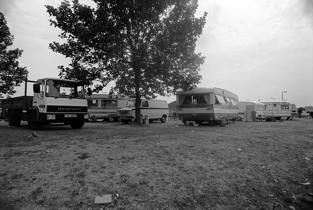
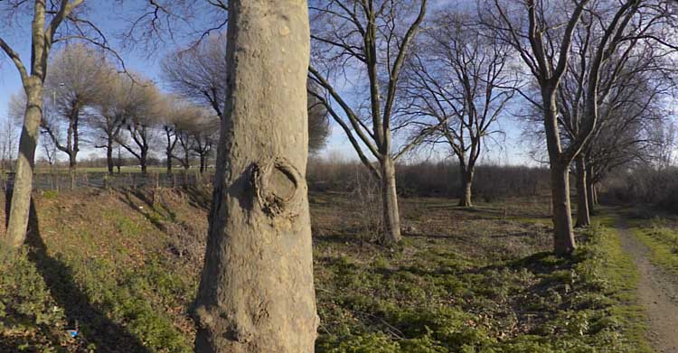
On Sunday 23 January 2005 I took my bike with me to Stratford and cycled to the meeting point at Temple Mills for a tour of the Olympic area with No to London 2012, a coalition of east london community groups and social justice campaigners.

Bully Point Nature Reserve

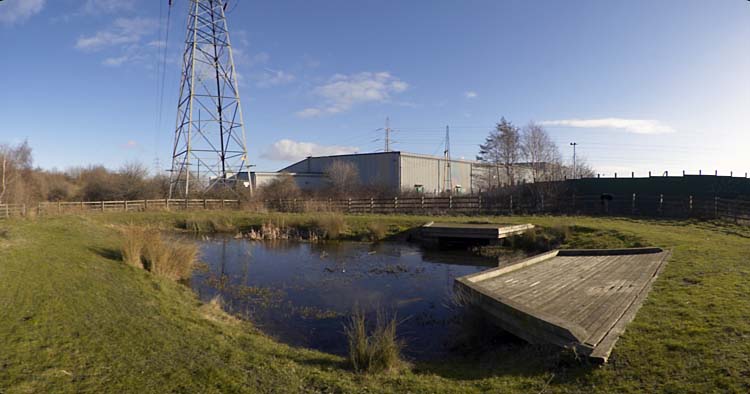
Around 20 of us then took a walk around the area, getting some informative comments at a number of locations. As I remarked in my write-up of the event in My London Diary:

It was an opportunity that IOC delegates are not likely to have, with their view of these particular areas expected to be with a pair of binoculars from a distant tower block.

My London Diary: January 2005

I was already familiar with the area, having photographed around it since the 1980s, but still learnt a lot from some of those who spoke – and had just a little to add.

BMX track at Eastway Cycle Circuit is marked out

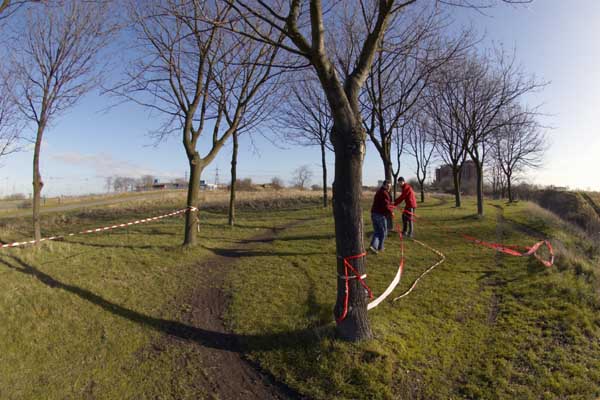
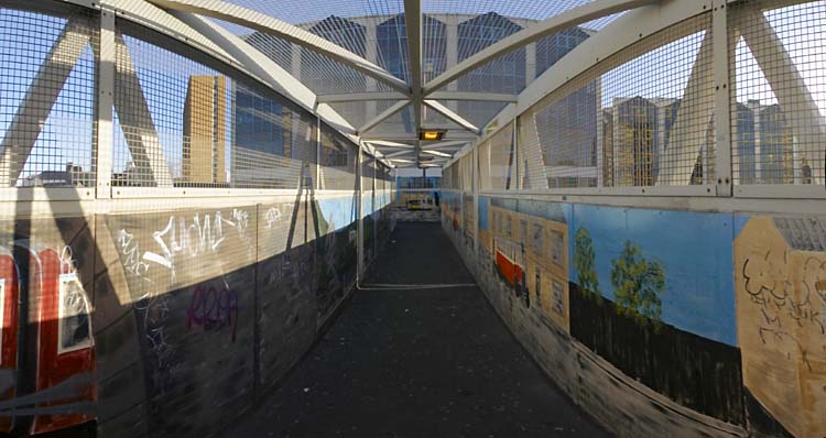
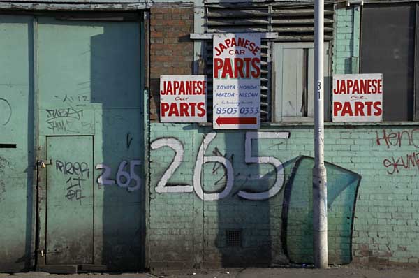
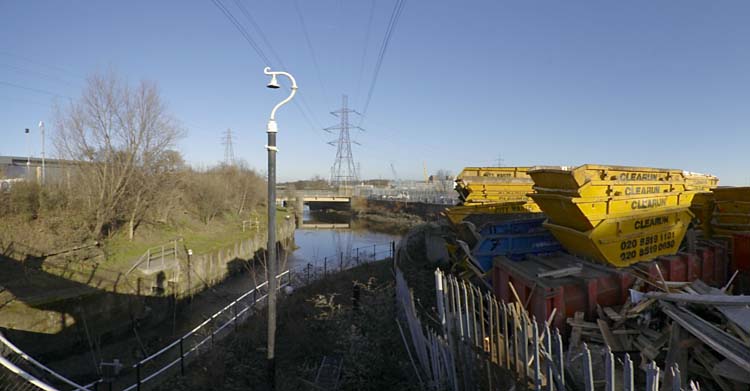
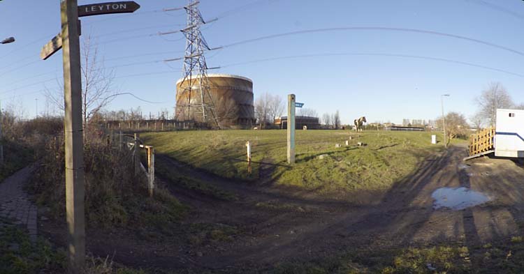
On our route around and also on my way to the meeting point I took the opportunity to take a few pictures, and after I’d sat down after the tour to eat my sandwiches by the Lea Navigation, to cycle to another area which was to be affected by the Olympics, Marsh Lane in Leyton, before making my way back to Stratford.

Wick Field, Hackney Wick

We were lucky with the weather, mild for January and with some sunshine, and I’d enjoyed the fairly short rides as well as the guided tour. I’d made several hundred pictures, including a number of panoramic images and felt I’d had a good day.

Leyton Marsh

Of course, London lost – and was condemned to host the Olympics. It was an event that caught the imagination of many of the public for the few weeks it was on, but has left a toxic legacy that will last decades.

You can see more of these pictures on My London Diary, where I’ve also written more about it.


All photographs on this and my other sites, unless otherwise stated, are taken by and copyright of Peter Marshall, and are available for reproduction or can be bought as prints.


Around High St Stratford

St Thomas's Creek, Cook's Road, Stratford, Newham, 1983 35q-34_2400
St Thomas’s Creek, Cook’s Road, Stratford, Newham, 1983

There is and long seems to have been some confusion about the naming of this part of the canal system that links the main line of the Lea Navigation at Bow Bridge to the City Mill River and City Mill Lock. On some maps (including Google’s) it is simply referred to as ‘Bow Back Rivers’ but I find it less confusing to give it the more local name, St Thomas’s Creek, sometimes written as St Thomas Creek. The creek got its name from St. Thomas’s Mill, sometimes called ‘Pudding Mill’, I think because of its shape, which also gave its name to the small stream the Pudding Mill River and was actually on that stream on Pudding Mill Lane. For those interested there is a good map of the area before the flood relief works of 1931-5 on British History Online.

Yardley's Box Factory, Stratford High St, Stratford, Newham, 198336m-63-positive_2400
Warton House, former Yardley’s Box Factory, High St, Stratford, 1983

The earliest connection of the Yardley name to soap-making was in the first half of the 17th century, when a Yardley was given the concession to produce soap for the whole of London, but the company dated its founding as ‘Clever Brothers’ to 1770. This company making soaps and perfumes was taken over by William Yardley in 1823 and passed on to his son Charles when he died the following year. The company moved from Bloomsbury to a large factory on Carpenters Road Stratford in 1904 and bought land on Stratford High St in 1918. In 1913 they had trade-marked a picture by Francis Wheatley from his 1793 series, the ‘Cries of London’ to use in their advertising, replacing the primroses in his picture by lavender, and when they built a new art deco box factory in 1938 this was installed at a large scale on the building. Yardleys moved to Basildon in 1966, needing large premises, but in 1967 were taken over by British American Tobacco who sold the business to Beecham in 1985, who again sold it on after they merged to be SmithKlein Beecham. The company went into receivership in 1998. Parts of the box factory – including this section on the High St next to the Northern Outfall Sewer and the Waterworks River are still there, all that is left of Yardley’s in Stratford.

Stratford High St area, Stratford, Newham, 1983 36m-14_2400
Stratford High St area, 1982

I cannot remember exactly where I took this or the next picture, though from other exposures on the same films both are clearly somewhere not far from Stratford High St. I think the canal seen at right here is probably St Thomas’s Creek.

Timber yard, Stratford, Newham, 1982 32v-22_2400
Timber yard, Stratford High St area, 1982

Timber was the main product carried on the Lea Navigation in the later years of its use, and I think this timber yard was probably close to the main stream of the navigation. My attempts to find it again in later years were unsuccesful.

Cafe, Stratford market, Stratford, Newham, 1983 36p-35_2400
Cafe, Stratford market, Stratford, Newham, 1983

The notices on the door offer not just ‘Jellied Eels’ but ‘Best Jellied Eels’, along with ‘Loch Fine Kippers’. My contact sheet puts its location as Stratford Market in Burford Road, just off High St to the south.

Barge, Lea Navigation, Bow Bridge, Bow Flyover, Tower Hamlets, Newham, 1981 29t-26p_2400
Barges, Bow Bridge, October 1981

These last two pictures were some of the first I took in the area after I heard on a radio interview that commercial traffic on the Lea Navigation was to come to an end in a few weeks time.

I think it was the same day that I picked up my camera bag and got on the train to come to look for and photograph any remaining activity. It was a slow journey to Bromley-by-Bow from where I spent an hour or so walking along beside the navigation between Bow Locks and Bow Bridge, where I found three barges loaded with cut timber, photographing all three from the bridge and going down onto the wharf for another picture.

Barge, Lea Navigation, Bow Bridge, Tower Hamlets, Newham, 1981 29t-25_2400
Barges, Bow Bridge, October 1981

I find it hard now to understand why I took so few pictures – only around 30 exposures on the entire visit, and just these two where I found evidence of any remaining commercial traffic.

More pictures from the area on page 3 of my Flickr album River Lea – Lea Navigation 1981-1992.


All photographs on this and my other sites, unless otherwise stated, are taken by and copyright of Peter Marshall, and are available for reproduction or can be bought as prints.


City Mill Lock & Blaker Rd

City Mill Lock, Blaker Rd,  Stratford Marsh, Stratford, Newham, 1990 90-9f-32 (2)_2400
City Mill Lock, Blaker Rd, Stratford Marsh, Stratford, Newham, 1990

City Mill Lock connected the tidal Waterworks River with the Bow Back Rivers which are a part of the Lea Navigation and thus at a constant level. There is another lock connecting the two systems further north where Carpenters Lock connects the Old River Lea to the start of the Waterworks River close to Carpenters Road. Both locks were built in the 1930s when considerable work was carried out, mainly to reduce flooding but also with the intent of increasing commercial traffic on the Back Rivers, particularly the City Mill River. But I think this never happened and by the 1960s these streams were seldom if ever used.

City Mill Lock, Blaker Rd,  Stratford Marsh, Stratford, Newham, 1983 36m-35_2400
City Mill Lock, Blaker Rd, Stratford Marsh, Stratford, Newham, 1983

The River Lea was at least theoretically navigable at the right stage of the tide some way further north – and of course much further by kayaks, though there are legal restrictions on parts of its many streams.

Since the Olympics, the tidal flow on the river has been regulated by a new lock on the Prescott Channel at Three Mills which I photographed in 2010. The original intention of British Waterways that the river above this point should be non-tidal but its level still varies, perhaps simply with the river flow.

City Mill Lock, St Thomas's Creek, Stratford Marsh, Newham, 1983 36m-22a-positive-2_2400
City Mill Lock, St Thomas’s Creek, Stratford Marsh, Newham, 1983

The lock gates had clearly seen rather better times and the lock was unusable. These gates were replaced as a part of the makeover of the area for the Olympics.

City Mill River, Stratford Marsh, Stratford, Newham, 1983 35v-15_2400
City Mill River, Stratford Marsh, Stratford, Newham, 1983

Just to the west of the lock, behind the lock keepers house, St Thomas’s Creek turns towards the north and becomes the City Mill River. A few boats were moored here, next to Blaker Rd.

City Mill River, Blaker Rd,  Stratford Marsh, Stratford, Newham, 1983 35v-13_2400
City Mill River, Blaker Rd, Stratford Marsh, Stratford, Newham, 1983

Continuing north beside the City Mill River along Blaker Road led to a footpath which went under the Northern Outfall Sewer in a tunnel. It was possible to access the Greenway walkway on the sewer from here.

City Mill River, Blaker Rd,  Stratford Marsh, Stratford, Newham, 198335v-26_2400
City Mill River, Blaker Rd, Stratford Marsh, Stratford, Newham, 1983

From where you could look down on the path and the railings beside the river.

City Mill River, Stratford Marsh, Stratford, Newham, 1983 35v-25_2400
City Mill River, Stratford Marsh, Stratford, Newham, 1983

This is the view looking back down the City Mill River towards City Mill Lock, now rather different.

City Mill River, Railway, Stratford Marsh, Newham, 1983 36m-43

The footpath led on past the Northern Outfall Sewer to a rather strangely angled basin taking the river under the main railway lines. From here you could continue walking beside the river and eventually reach the north end of Marshgate Lane and Carpenters Road.

The last time I tried to repeat this walk, in 2019, it was not possible, with work still taking place in the area and fences stopping me. As well as work still taking place after the 2012 Olympics, parts were blocked by work on Crossrail.

More pictures on Flickr.


All photographs on this and my other sites, unless otherwise stated, are taken by and copyright of Peter Marshall, and are available for reproduction or can be bought as prints.


Around Warton Road

Robbialac, Warton Rd, Stratford, Newham, 1983 35p-15_2400
Jenson and Nicholson, Robbialac Works, Warton Road, Stratford, London E15.

Jensen and Nicholson were the makers of Robbialac paints and had premises here on Warton Road, offices on the Goswell Rd and a further works in Stratford on Carpenters Rd. The business was started in 1821 at the Barbican by William Kingham and John Jenson became a partner in 1840, taking over the business in 1848. He was joined in 1856 by Wilfred Nicholson.

Following a fire which destroyed the company’s factory, Nicholson decided to move to Stratford Marshes and a few years later Nicholson took over the company, which continued to trade under the name Jenson and Nicholson Ltd. As well as Robbialac enamel paints for cars and home decoration, the company also made Copal varnishes and distributed Cuprinol wood preservatives. In 1960 they merged with Berger Paints forming Berger, Jenson and Nicholson who after various takeovers became a part of Crown Paints and were then acquired by the Dutch company Akzo Nobel. (Information from Grace’s Guide https://www.gracesguide.co.uk/Jenson_and_Nicholson.)

The name Robbialac came from the 15th century Italian ceramicist Luca Della Robbia, famed for his brightly coloured enamels and the word lacquer. The major Portuguese paint manufacturer Tinta Robbialac, founded in 1928, also uses it as a brand name.

Bridgewater Rd, Stratford, Newham, 1983 35q-12_2400
Bridgewater Rd, Stratford, Newham, 1983

The concrete bridge here is an early use of ferro-concrete I think had a plaque on it stating it had been built using the Hennebique system and certainly deserves preservation. I photographed it on various occasions and it survived the Olympics and was still present when I last visited the area, but I’m unsure if it will be retained in the future.

Waterworks River, Bridgewater Rd, Stratford, 1983 36m-62-positive_2400
Waterworks River, Bridgewater Rd, Stratford, 1983

The view looking south from the Bridgewater Road bridge along the Waterworks River to the Warton House on Stratford High St, and blocks of flats on the opposite side of the street off Abbey Lane, Albert Bigg Point and Aubrey Moore Point. The footpath on the bank at right was extremely overgrown and the gates to it were locked. At right is one of the many pylons that were taken down for the Olympics.

Carpenters Rd, Stratford, Newham, 1983 35p-51_2400
Carpenters Estate, Stratford, Newham, 1983

I am not sure of the exact location of this doorway with its interesting use of concrete. There were (and are) 3 point blocks on the Carpenters Estate and I think the one in the background here may be Dennison Point and this building may have been on the site now occupied by the Building Crafts College in Kennard Road which moved to a new building here in 2001.

Waterworks River, Railway Bridge, Stratford, Newham, 1983 35q-32_2400
Waterworks River, Railway Bridge, Stratford, Newham, 1983

I think this is from the footpath beside the Waterworks River looking north towards the bridge carrying the Eastern Region main line from Liverpool St across to Stratford. Possibly I had climbed down from Bridgewater Road as I think this path was closed at the time. The factory at right was on Warton Rd.

Waterworks River, Blaker Rd, Stratford, 1983 36m-52_2400
Waterworks River, view towards Blaker Rd from the Greenway, Stratford, 1983

The Waterworks River turns to the left in the distance to go under Stratford High St, with a channel going on under Blaker Rd to City Mill lock. The concrete pillar is part of the bridge carrying the Northern Outfall Sewer across the river and I wondered if the profuse fig tree growing here might be benefiting from some warmth from the sewage or possibly even be nourished by some leakage.

Kerry's, Greenway, Northern Outfall Sewer, Stratford, Newham, 1983 35v-23_2400
Kerry’s, Stratford 1983.

Kerry’s were a company that made and distributed a wide range of products, both those they made themselves and others branded with their name. In 1961 according to Grace’s Guide they were “Wholesale distributors to the motor, radio, electrical and cycle trades, also machine tool makers, specialising in centre lathes, boring mills, power saws, drills and special purpose machines” and even produced a light weight moped, the Capitano. Manufacturing moved to Basildon in the 1960s and the business was bought up and sold at the end of the decade.

Although Kerry’s address was Warton Road, I think the factory was actually rather closer to the Northern Outfall Sewer and reached over the bridge on Bridgewater Road.

More pictures on Flickr.


All photographs on this and my other sites, unless otherwise stated, are taken by and copyright of Peter Marshall, and are available for reproduction or can be bought as prints.


Deep in the Olympic Area

Footbridge, Carpenters Lock, Old River Lea, Stratford Marsh, Newham, 1983 35p-33_2400
Footbridge, Carpenters Lock, Old River Lea, Stratford Marsh, Newham, 1983

I titled my self-published book put together in 2010 on the Lee Valley ‘Before the Olympics‘ because many of the pictures in it were taken in an area that was then being largely destroyed for a few weeks of sporting activities in 2012.

Footbridge, Carpenters Lock, Old River Lea, Stratford Marsh, Newham, 1992 92-8e51_2400
Footbridge, Carpenters Lock, Old River Lea, Stratford Marsh, Newham, 1992

It was an area that over the previous 25 or so years had held a particular fascination for me as a post-industrial wilderness close to the centre of London, one of the world’s greatest cities. Within a few yards of busy major roads I could find myself struggling to walk along overgrown paths – and sometimes having to climb over or around fences to do so. For months a pair of secatuers were needed in my camera bag to cut through the brambles that barred my progress (though when I wrote earlier about this I slightly exagerrated them as a ‘machete’.)

Old River Lee, Waterworks River, Stratford Marsh, Newham, 1983 33x-24_2400
Old River Lee, Waterworks River, Stratford Marsh, Newham, 1983

At times I spent hours wandering the area without meeting or seeing another living soul, or only across rivers, perhaps working in one of the many small businesses still at work, often in ramshackle buildings with smoke or steam emerging though ventilators or cracks. Or I would emerge from under a bridge or around a corner to see large industrial structures such as oil storage tanks.

Old River Lea, Stratford Marsh, Newham, 1983 35p-34_2400
Old River Lea, Stratford Marsh, Newham, 1983

It was of course an area that was bound to change, but not in the way it has. And the old was in some respects dystopian. Many of the remaining businesses were the kind that we like to hide away on the fringes, perhaps necessary but best kept out of sight. The River Lea was during the worst years of the development of industry the outer boundary of London, inside which there was a long history of restrictions to curb the activities of the most noxious and polluting industries; across that boundary almost anything went and factories were set up to enjoy that licence to pollute.

Old River Lee, Waterworks River, Stratford Marsh, Newham, 1983 33x-36_2400
Old River Lee, Waterworks River, Stratford Marsh, Newham, 1983

Those years of largely unfettered industrial activity had left their toxic legacy in the soil, though some plants seemed to thrive on it. There were schemes to tidy up the area in the 1990s, with some streams and paths being cleared and the route beside the Waterworks River being decorated with art from junior schools in the area, but nature soon took it back , and a few years later I was again struggling through shoulder-high weeds.

Waterworks River, Marshgate Lane, Stratford Marsh, Newham, 1992 92-8e44_2400
Waterworks River, from Marshgate Lane, 1992

The Olympics were terra-forming, with tons of soil from the area being sterilised, tons being dumped elsewhere in landfill, and virgin soil brought in, in part from building work on the Channel Tunnel Rail Link. A new landscape emerged, retaining the watery outlines of the old, along with the Greenway and the major rail routes but with different land, and none of what was previously present on the rest of its surface, though with new white elephants fast being constructed.

Waterworks River, Marshgate Lane, Stratford Marsh, Newham, 1983 35p-43_2400
Waterworks River from Marshgate Lane, Stratford Marsh, Newham, 1983
Waterworks River, Marshgate Lane, Stratford Marsh, Newham, 1992 92-8e32_2400
Waterworks River, 1992
Footbridge, Stratford Marsh, Newham, 1983 35p-32_2400
Stratford Marsh, 1983
Marshgate Lane, Stratford Marsh, Newham, 1983 35p-36_2400
Marshgate Lane, 1983

All photographs on this and my other sites, unless otherwise stated, are taken by and copyright of Peter Marshall, and are available for reproduction or can be bought as prints.


Clapton – Lea Valley 1982

2020 is a year I don’t think I want to look back on, so I’ll eschew that traditional filler and instead look back rather further to continue my series on walks in the Lea valley in the 1980s.

Works, Upper Clapton or South Tottenham, Hackney or Haringey,1982 32c-42_2400

This time of year it has been a tradition for at least some of my family to get together to go on sometimes fairly lengthy walks, usually somewhere in the country. It’s something that has rather tailed off over the years, with both my sons now having young children, and also as my own legs getting old and tired, making anything over six or seven miles something of an ordeal.

Flats, Anchor & Hope, High Hill Ferry, Clapton, Hackney, 1982 32c-41_2400

This year things have become even more difficult, with us all under Tier 4 restrictions on travel etc and in different parts of the country, so our meetings have only been virtual. And although Linda and I have managed some short walks – around 5 miles on Boxing Day – these have all started and finished at our home. But at least I can take a digital walk in the Lea Valley.

Playing Field, Leyton, Waltham Forest, 1982 32c-44_2400

These pictures were not all taken on the same walk, which is one I did several times when working on my Lea Valley project and have repeated parts of rather more times since, sometimes riding on my Brompton folder. Parts of it have changed dramatically over the years, and wherever in these pictures you see a timber yard, factory or power station there is probably now several blocks of flats.

Clapton, Hackney, 1982 32u-64_2400

So many changes make it difficult for me to pinpoint the exact locations of some of these pictures, though others have very recognisable landmarks – such as the railway viaduct in the background above, now with a blue plaque celebrating the work of Alliott Verdon Roe, the first man to build and fly an entirely British aeroplane, built here in one of its arches, back in 1909.

Latham TImber, Clapton, Hackney, 1982 32c-31p (2)_2400

But Latham Timber is long gone, along with its neighbouring yard and the fences on which ‘The Gruesome’ staked their territorial claim and on which P & R pledged their ‘Forever True’ love in white paint on 16-8-82. Where are they now I wonder as I look at these pictures? Though so far as I’m aware I never saw any of them back in 1982 either.

33a-54_2400

The Gruesome Clapton, Hackney, 1982 33a-65_2400

The Gruesome Clapton, Hackney, 1982 33a-63_2400

Latham TImber, Clapton, Hackney, 1982 32c-56_2400

Middlesex Wharf, Clapton, Hackney, 1982 33a-52_2400

More pictures at River Lea – Lea Navigation 1981-1992. My next post in this series will look a little downstream.


All photographs on this and my other sites, unless otherwise stated, are taken by and copyright of Peter Marshall, and are available for reproduction or can be bought as prints.


Towards Hackney Wick 1982

I continue my virtual walk downriver towards Hackney Wick.

Clapton Park Estate, Clapton Park,  Hackney, 1982 32k-64_2400

Past the Clapton Park Estate: Norbury Court, Bakewell Court, Ambergate Court and Sudbury Court at 172 Daubeney Road, each 20 stories with 114 flats, approved by Hackney Council in 1968. Three were demolished by explosions in 1993-5 but Sudbury Court was sold to a private developer who gave it a relatively minor make-over and renamed it Landmark Heights.

Clapton Park Estate, Clapton Park, Hackney, 1982 32k-53p_2400

Somewhere I passed a canal-side factory –

Hackney Wick, Tower Hamlets, 1983 36n-46_2400

as well as the wide expanse of Hackney Marshes, with what must surely be more football pitches and anyone needs

Hackney Marsh, Hackney Wick, Hackney, 1982 32z-62_2400

as well as some wilder areas where the hogweed grows

Hackney Marsh, Hackney Wick, Hackney, 1982 32u-13_2400

and was ambushed by a group of children

Hackney Wick, Hackney, 1982 32k-51_2400

who demanded I take their pictures.

Hackney Wick, Hackney, 1982 32k-42_2400

Clost to Eastway I came across a travellers site

Travellers site,  Eastway, Stratford, Newham, 1983  36o-12_2400

close to the River Lea, here looking a very serious river away from the navigation.

River Lea, Eastway, Stratford, Newham, 1983  36o-13 (2)_2400

My walk continued but in a less linear fashion wandering around Hackney Wick – in the next episode. You can see all the pictures and more in my album River Lea – Lea Navigation 1981-1992.


All photographs on this and my other sites, unless otherwise stated, are taken by and copyright of Peter Marshall, and are available for reproduction or can be bought as prints.


Lea Valley 1993 – Around Tottenham Hale

Stonebridge Lock, Northumberland Park, 1983 37c-22_2400

Continuing my pictures from walks along the River Lea and Lea Navigation in 1983 which are in my Flickr album River Lea – Lea Navigation 1981-1992.

Tottenham Hale station on the Victoria Line was a convenient starting point for walks both north and south along the Lea navigatiion, which is crossed by Ferry Lane around 200 metres from the station.

Stonebridge Lock is around 3/4 miles north up the path from Ferry Lane, where steps lead down to the towpath immediately after you cross Pymmes Brook. The view above is looking south back towards Tottenham Hale.

Lea Navigation, Tottenham, 1983 34l-51_2400

Thames Water Sludge Mains Bridge No 3 crosses the Navigation closer to Ferry Lane, and as well as a crudely painted landscape also carried racist graffiti from the National Party, a splinter group of the National Front which was active from 1976-83.

Ferry Lane, Tottenham, 1983 34l-64_2400

A lone tree behind a gate somewhere on Ferry Lane (or its eastern continuation, Forest Road.)

Flood Channel, Leyton, Waltham Forest, 1982 32d-46_2400

The Lee Flood Relief Channel at Forest Rd. There are now tall recently built blocks of flats replacing the inustrial units and garage in this picture.

Ferry Lane Wharf, Tottenham Hale, Hackney, 1982 32d-56_2400

This extensive range of warehouses fronting the navigation immediately south of Ferry Lane has now been demolished and replaced by housing.

Ferry Lane Wharf, Tottenham Hale, Hackney, 1982 32d-55_2400

There is a channel here from the River Lee Diversion which takes excess water from the river and navigation north of Enfield, though usually most of the flow in this rejoins the navigation around half a mile further south.

Ferry Lane Wharf, Tottenham Hale, Hackney, 1982 32d-53_2400

The pattern of waterways it the Lea Valley is difficult to understand and as well as the diversion there are also various flood channels, as well of course as tributaries such as the Pymmes Brook and Dagenham Brook. In the old days there were various man-made channels to feed water mills, while more recently, particularly in the twentieth century various projects to control flooding in the area.

Flickr album River Lea – Lea Navigation 1981-1992.


All photographs on this and my other sites, unless otherwise stated, are taken by and copyright of Peter Marshall, and are available for reproduction or can be bought as prints.


Pymmes & Tottenham Marsh 1983

Pymmes Brook,  Edmonton, 1983 37c-55_2400

The Pymmes Brook is a stream in north London which runs from Barnet and joins the River Lea at Tottenham. It got its name from William Pymme who was given land in Edmonton by Edward II in the fourteenth century.

Pymmes Brook,  Edmonton, 1983 37c-56_2400

Although it begins from underground springs at Monken Hadley Common in the London Borough of Barnet, these supply relatively little of the water which reaches the River Lea, particularly when the river is in flood, augmented by water runoff from streets and sewage overflows along with the more normal industrial effluent. Because it used often to flood in its lower course, much is now in deep concrete channels, and in some places is culverted.

Pymmes Brook,  Edmonton, 1983 37c-65_2400

I’m no longer sure exactly where I took most of these pictures of the Pymmes Brook, but I think they were just a little after it flowed under the North Circular. I think some may actually be of the Salmons Brook which runs down from Enfield and joins it in Upper Edmonton. This gets its name not from the fish – which were probably once found in it before the area became urban and industrial – but from the 13th century landowner John Salemon.

Pymmes Brook,  Edmonton, 1983 37c-23_2400

The river runs more or less parallel to the Lea Navigation just a few yards away across Tottenham Marshes and only finally flows into the Lea close to Ferry Lane in Tottenham Hale.

Chalk Bridge, Tottenham, 1983 34l-13_2400

My pictures of the Lea continue south from Chalk Bridge and past Tottenham Marshes.

Lea Navigation, Tottenham Marshes, 1983 34l-31_2400

On the east side are the large Banbury and Lockwood reservoirs, part of a series up the Lea Valley providing water for much of east London.

Banbury Reservoir, from Lea Navigation, 1983 34l-24_2400

This is one of the most picturesque sections of the River Lea, certainly in its lower reaches. I could almost imagine Izaak Walton walking along here in conversation (as Piscator) with his friends Venator and Auceps on May Day holding the discussion of the relative merits of fishing, hunting and fowling as recorded in his ‘The Compleat Angler‘.

Lea Navigation, Tottenham Marshes, 1983 37c-33_2400

More pictures from the Lea in my Flick album River Lea – Lea Navigation 1981-1992


All photographs on this and my other sites, unless otherwise stated, are taken by and copyright of Peter Marshall, and are available for reproduction or can be bought as prints.


Ponders End & Edmonton

Lea Navigation, Brimsdown, Ponders End, 1983 34m-22_2400

I’m not sure why the name Ponders End so appeals to me. It has a rather down to earth quality (or perhaps down to water) which is apparently reflected in its etymology, stretching back over 600 years to the Ponder family, with a John Ponder being recorded as far back as 1373. He or his family apparently got their name because they kept or lived by a fishpond or mill pond on the River Lea. Ponders End was their end of Edmonton.

Lea Navigation, Ponders End, 1983 34m-23_2400

The River Lea was important for the movement of people and goods from the earliest times and was improved for navigation at various times in the middle ages; later the first modern gated lock on a river was built at Waltham Abbey in 1577 and the basis of the current Lea Navigation – including the Limehouse Cut – were laid in the 1770s, though there were further improvements well into the 20th century. You can read more on Wikipedia. In recent convention the spelling Lea is used for the river and natural features, and Lee for those man-made features such as the navigation but I tend to use Lea for both.

Lea Navigation, Ponders End, 1983 34m-24_2400

Because of its good transport links to London, industry began to arrive here in the 19th century, with wharves along the canal. Later with the growth of motorised transport development became centred along the Great Cambridge Road, the A10, a short distance to the west, particularly after its improvement in the 1930s. When I took these pictures back in 1983 the area was full of factories, but many were derelict, their demise accelerated by Thatcher’s national flight from manufacturing – something which was at the centre of my recording of out post-industrial landscape

Lea Navigation, Brimsdown, Ponders End, 1983 34m-32_2400

The area had turned its back on the canal where all commercial traffic had ceased a couple of years earlier, but many of the structures were still present. Now almost all have been replaced by warehousing and some residential development. In later years I photographed around the little that remained, including Wright’s Flour Mill, parts of which date from the 18th century.

Lea Navigation, Brimsdown, Ponders End, 1983 34m-36_2400

Back in 1983, there was no GPS and it was hard to determine the exact location of the pictures I took as I walked beside the navigation, and I made few records that would help. In a few pictures it is possible to see features which still exist, particularly the tall blocks of council flats close to Ponders End station.

Thorn Lighting, Edmonton, 1983 37e-34_2400

The last two pictures are of one of Edmonton’s best known and largest industries, Thorn Lighting. Julius Thorn opened his Atlas Lamp Works Ltd in Edmonton in 1932, and later at the start of the war a second factory in Tottenham. The company is now part of the Austrian company Zumtobel. I think that these two pictures are part of their Angel Road site. The main production moved from here to Merthyr Tydfil soon after the Second Wolrd War, but speciality lamps were produced here until around the late 1960s.

Thorn Lighting, Edmonton, 1983 37e-35_2400

More pictures in River Lea – Lea Navigation 1981-1992 on Flickr. Click on any of the pictures above to go to a larger version in that album, where you can also comment on the pictures.


All photographs on this and my other sites, unless otherwise stated, are taken by and copyright of Peter Marshall, and are available for reproduction or can be bought as prints.