Liverpool Road, Highbury Corner & Caledonian Rd – 1989

Liverpool Road, Highbury Corner & Caledonian Rd continues my walk in Islington on Sunday 15th October 1989 which began with the post Memorials, Eros and More. The previous post was Shops, a Poly, Electricity, Church & Library.

Samuel Lewis buildings, Samuel Lewis Housing Trust, Liverpool Rd, Islington, 1989 89-10h-63

Samuel Lewis was born in Birmingham in 1837, started work at 13 selling steel pens, then opened a jewellers shop before becoming the most fashionable money-lender of his day. When he died in 1901 he left £2.6 million to his wife, with over £1 million going to charity on her death.

£670,000 of this – equivalent to around £30 million today – went to a charitable trust to provide housing for the poor, and these flats are on the first of eight large estates they built.

This estate was built in 1909-10 for the Samuel Lewis Trust, architects Charles Sampson Joseph, (1872-1948), Charles James Smithem and Ernest Martin Joseph (1877-1960) who worked as Joseph & Smithem until 1916. The two Joseph brothers were sons of Nathan Solomon Joseph (1834-1909) who as well as building many synagogues was the leading designer of social housing as architect for the Guiness Trust and the Four per Cent Industrial Dwellings Company and worked also for the LCC and other London councils and he may also have contributed to the designs for these buildings.

Hampton Court, Upper St, Islington, 1989 89-10h-41

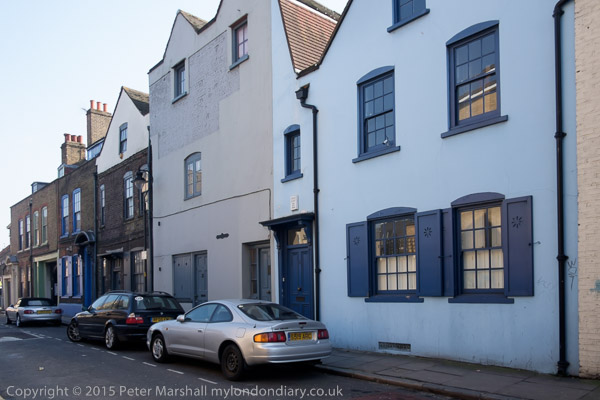
I was amused by the contrast between this street and its namesake palace on the River Thames. This Hampton Court is a short street leading west from Upper Street at Highbury Corner, leading to Swan Yard, which is at the end of the street in my picture.

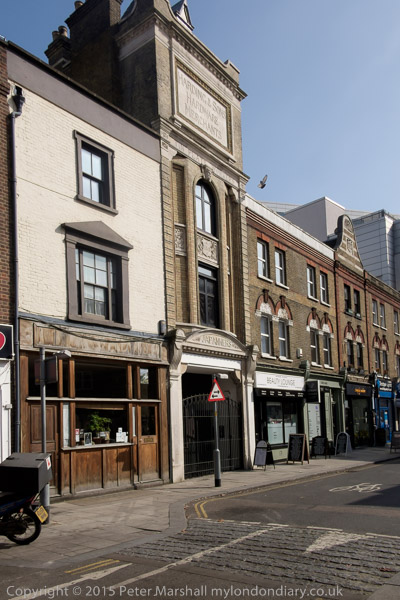
On the left wall is a sign for J Barrett & Sons, but I can’t make out what their business was at 250 Upper St, now a Starbucks. The posters on the wall at right are for a Socialist Party Public Meeting and I think we have four pictures of Maggie Thatcher; I can’t quite read the text but I’m sure it wasn’t complimentary.

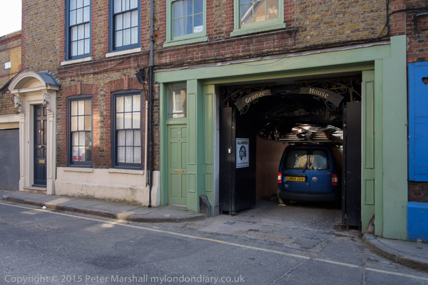
The tall building on the right at the end of the street is now a printers and I think probably was when I made this picture. Those to the right of it have been replaced and I think those on the left considerably refurbished. Those in Swan Yard at the end of the street are still there but have lost their white paint.

Swan Yard, Islington, 1989 89-10h-43

I think Highbury Studios, at 15 Swan Yard and most other workshops on the street have been converted to residential or office use and there is now a new building at the southern end of the street, recently converted into coworking office space with a communal roof terrace overlooking Laycock Green, an urban green open space.

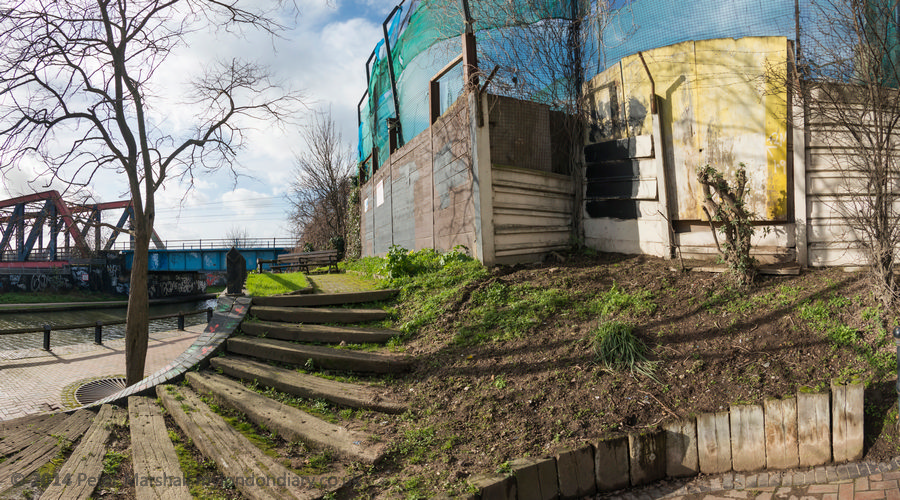
Swan Yard and the southern side of Hampton Court are included in the Upper Street (North) conservation area.

Mallett, Porter & Dowd, North London Engineering Works, 465, Caledonian Rd, Lower Holloway, Islington, 1989 89-10h-33

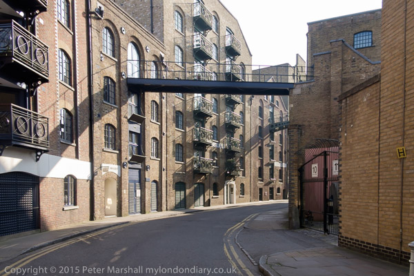
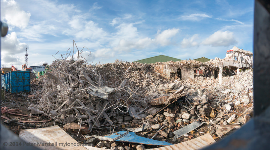
This warehouse and works was built in 1874. Its conversion to student housing for University College London was awarded the Carbuncle Cup for the ugliest building of 2013 from Building Design magazine. The red brick building was demolished with its frontage retained a short distance in front of a a new multicoloured building. The judges commented “The original frontage has been retained in a cynical gesture towards preservation. But its failings go deeper,” and said “This is a building that the jury struggled to see as remotely fit for human occupation.” The rooms lack adequate daylight, give little privacy and those behind the facade have no view outside. Islington council had refused planning permission for the treatment of this locally listed building but were overruled.

Hubbards for Cupboards, 453, Caledonian Rd, Lower Holloway, Islington, 1989 89-10h-35

Those musical among you can sing “We’re Hub-bords Cup-boards, We’re Hub-bords Cup-boards, We’re go-ing to fight, fight, fight – to get your of-fice right” to the tune shown on this shop, Hubbards for Cupboards Tables & Chairs, at Hubbards Corner on Caledonian Rd. 453 Caledonian Rd on the north corner with Market Road is now a large block of flats with a natural food shop at ground level.

Caledonian Road Methodist Church, Caledonian Rd, Market Rd, Lower Holloway, Islington, 1989 89-10h-36

Built in an Italianate style in 1870 as a Primitive Methodist Chapel, architects T & W Stone, it became Caledonian Road Methodist church in 1932 and is still in use. It was restored in 1953 and the exterior cleaned in 1980. Grade II listed.

Market Rd, Lower Holloway, Islington, 1989 89-10h-24

This building, at 18 Market Road opposite the bus stop at Market Road Gardens and the adventure playground was demolished between 2008 and 2012. Peter Darley in The Journal of the Islington Archaeology & History Society says it was a tripe factory when Czech refugge Otto Fischel bought it in the 1950s and made it Otaco Ltd, plastic injection moulders. His wife, artist Käthe Strenitz was fascinated with industrial London and produced many fine pictures.

You can read more in Jane’s London about J. L. Henson tripe dealer whose name was originally on the panel where E.Zee is in my picture. But the elephants and E. Zee remain unaccounted for, but were perhaps linked in some way with the playground opposite. Though I have a nagging feeling that somewhere in the past I have written more about them.

A private limited company EZEE Ltd, Company number 02564140, was incorporated in 1990, had its registered office for a year in 1992-3 at 14-18 Market Rd. Its business was given as Artistic & literary creation etc. It last filed annual returns in 1991 and was finally dissolved in 2015.

My walk continued and there will be another post shortly.


FlickrFacebookMy London DiaryHull PhotosLea ValleyParis
London’s Industrial HeritageLondon Photos

All photographs on this page are copyright © Peter Marshall.
Contact me to buy prints or licence to reproduce.


Blackpool & Minwear Wood

Blackpool & Minwear Wood: More holiday snaps. We could have walked to Blackpool from where we were staying in Narberth. Not of course the Blackpool in Lancashire but the very much smaller Blackpool in Pembrokeshire.

Blackpool & Minwear Wood

It would have been a pleasant walk along country roads and through Carnaston Woods, perhaps 5 or 6 kilometres, but we wanted to go a little beyond Blackpool to Minwear Woods for a walk there, and together with the walk back would have been too much for some of us.

Blackpool & Minwear Wood

Blackpool isn’t a very large place. It has a bridge, Blackpool Bridge, a large house, Blackpool and Blackpool Mill. One road to nowhere very much, woods around and several footpaths including the Knights Way.

The bridge takes the Knights Way over the Eastern River Cleddau, close to the limit of the tide coming up the river from Milford Haven and at the highest navigable point of the river.

Blackpool & Minwear Wood

It has an inscription stating it was built around 1830 by Baroness de Rutzen; she was the daughter and heiress to Nathaniel Phillips, the owner of the Slebech estate and of Blackpool Mill. I think it may have been rebuilt then rather than entirely new though it may have replaced a ford a short way upstream.

Blackpool & Minwear Wood

Mary Dorothea Phillips (1797-1860) had met Charles Frederick (1795-1874), Baron de Rutzen in Rome in 1821 and they were married in 1822 in England. Later they became Lords of the Manors of Slebech, Minwear, Newton, Narberth and Robeston Wathen, and of the Manors or Reeveship of Lampeter Velfrey and Llanddewi Velfrey.

Usually described as German, de Rutzen was born in what is now Latvia and the family had extensive estates in Lithuania and you can read a great deal more about him on Geni.com, including his description of his first meeting with the charming daughter of Mrs Phillips, who was a notable pianist. After the marriage the couple lived in Brighton and London for some years, moving to Slebech Hall after Baroness de Rutzen became joint owner of the estates there as well as in Jamaica in 1830. It was a happy marriage and they had seven children.

There is no sign of a pool on either old maps of Blackpool or the current OS maps, but I think the name may come from a creek of the Cleddau immediately upstream of the bridge. The were some dramatic views of this overgrown area from the track leading to the bridge, but a footpath there was closed as too dangerous to enter.

Blackpool mill was built in 1813 on the site of a wharf and a former ironworks and is a remarkable Grade II* listed building, recently beautifully restored as a “Heritage Dining” restaurant, Black Pool Mill, by the nearby holiday park. We didn’t go inside as we had brought sandwiches which we ate at a picnic table in the woods but the restoration has retained the machinery of the mill virtually intact. Originally powered by a large waterwheel using water from a mill race coming from around a mile up-river, the waterwheel was replaced by more efficient turbine in 1903. The mill race is a feature in front of the mill which is set back from the road.

Minwear Woods are a short distance to the west on the slopes above the river and we walked around the clearly marked trail. Trees obscure any view of the river except at a recently constructed viewpoint just off the trail. A short distance to the west the view from an earlier viewpoint is now completely blocked by trees.

There are a few more pictures from this walk in the album Blackpool & Minwear Wood.


FlickrFacebookMy London DiaryHull PhotosLea ValleyParis
London’s Industrial HeritageLondon Photos

All photographs on this page are copyright © Peter Marshall.
Contact me to buy prints or licence to reproduce.


Thames Path: Oxford-Eynsham – 2011

Thames Path: Oxford-Eynsham: Saturday 27 August 2011

Thames Path: Oxford-Eynsham

Here with just a few minor changes is the post I wrote in 2011, still available with many more pictures on My London Diary, though I’ve added some useful links here.

Thames Path: Oxford-Eynsham

The question most people reading this may well be asking is ‘Where the **** is Eynsham?’ and fortunately the answer is ‘Not very far from Oxford‘ and one of its main attractions is the good bus service taking you back there.

Thames Path: Oxford-Eynsham

However had you been reading this web site a thousand or so years ago (tricky because I don’t think those Anglosaxons were too hot on internet protocols and although the avian-based RFC1149 would have been technically feasible it was only published in 1990, more or less as Tim Berners-Lee was inventing the web) the question you might have been asking was ‘Where the **** is Oxford‘, a rather less significant place until it got the idea of a having a university.

Thames Path: Oxford-Eynsham
Alice in Wonderland began here, as Dodgson and another Rev friend rowed up the river with three young girls

As we found when we got there, Eynsham had a huge abbey, though the only real sign we saw remaining of it were its fish ponds. But that was at the end of our walk, shortly before I mutinied and made for the Red Lion.

They brought Alice and her sisters to Godstow Abbey for a picnic. Earlier it was best known as the final residence

Our family walk started at the station and we made our way to the Thames, where our Thames Path book (the official guide, now in a new edition, but others are available) seemed to show the path on the wrong side of the river.

of the ‘The Fair Rosamund’ Henry II’s famous mistress, buried here around 1177.

Years ago, before we had a Thames path, I remember getting quite excited about the draft proposal for it, and even making a few suggestions. Of course there was a tow path next to the river except where some less scrupulous riparian owners had stolen and enclosed parts of it, but it did have an unfortunate habit of jumping from one side to the other at remote places where until around the 1930s there had been a ferry.

Most earlier visitors seem to have carved their initials on the Abbey, but I couldn’t see C.L.D loves A.L anywhere.

Now I’m not so sure that such ‘long-distance paths‘ are such a good idea. They encourage people to approach walking in a very competitive and one-dimensional way, ‘bagging‘ stages of the route in what are more route marches than enjoyable.

My kind of walk tends to go a quite a slow pace overall, stopping to look at and photograph things that take my interest, diverting from the path to look at what seem interesting features on the map, not worrying about getting any particular distance. But of course outside the city there are certain practicalities about finding a bus stop or station from where you can get home. My companions are usually rather more heading for the goal, and you will see the backs of two figures in the middle distance in some of my pictures, though not me running after them to catch up.

Some dead trees provided a useful seat on which to eat our sandwiches, and it was now warm in the sun

But at least this was a fairly short walk, and we did have time to look around Eynsham, a large village with around five pubs and a post office, as well as a heritage trail around the extensive former abbey grounds which we did around half of. The others were also keen to look for traces of the former railway, an extremely thirst-making and largely fruitless task, serving largely as a reminder of how short-sighted we were in abandoning way-leaves on what might by now have seemed a very suitable route for lightweight community transport.

The final picture was taken from the top of the bus on my way home as it went over Swinford Bridge, with a view along the Thames to Eynsham Lock. The bridge is a local traffic bottleneck, with long queues at the rush hour holding up traffic for around 20 minutes or more as motorists have to stop to pay the toll. Although the toll for cars is only 5p – cash only – that nets around £175,000 a year and, under the Act of Parliament granted in 1767 the income from it is free of income tax – which had not then been invented.

A long campaign (at least since 1905) by users continues to get the toll abolished, most recently with a petition to their local MP, a Mr David Cameron, who you think might be able to do something about it. But the owner of the bridge, who bought it in 2009 for £1.08 million remains anonymous, and could well be a considerable donor to Conservative party funds.

Thames Path: Oxford-Eynsham


FlickrFacebookMy London DiaryHull PhotosLea ValleyParis
London’s Industrial HeritageLondon Photos

All photographs on this page are copyright © Peter Marshall.
Contact me to buy prints or licence to reproduce.


Crouch Hill & Stroud Green – 1989

Crouch Hill & Stroud Green: My walk on Sunday 24th Sepember 1989 continued after I took a train from Blackhorse Road to Crouch Hill. Then the Gospel Oak to Barking line – apparently called by some the Goblin line was one of the least reliable in the country – perhaps it should have been called the Gremlin line. But for once a train came – and on a Sunday too!

The line is now part of the London Overground with a much improved service and in February this year was renamed the Suffragette line. It now also runs beyond Barking to Barking Riverside, though as yet there seems little reason to ever go there.

Marion Gray, Antiques, 33 Crouch Hill, Finsbury Park, Islington, 1989 89-9e-21

Almost immediately out of the station was the fine house, on the end of a rather less grand terrace on the west side of Crouch Hill. The station was opened in 1867/8 as a part of the Tottenham and Hampstead Junction Railway and this accelerated development in the area.

This house was sold in 2017 having long been converted into a ground floor nursery with three flats above. Last year it was covered in scaffolding, presumably for a major refurbishment.

Crouch Hill, Finsbury Park, Islington, 1989 89-9e-22

These shops are on the east side of Crouch Hill, immediately north of Japan Crescent and south of the railway. They still look much the same although the shops have changed and become considerably less useful.

I was attracted by the decorated brickwork, obscured on the leftmost building by some unfortunate cladding, and the curved brick partitions between the houses about the shop fronts.

At extreme right is the pub sign for Marler’s bar, opened in 1983 in a former post office. It’s a pub which has gone through a whole pile of names apprently including Hopsmiths, Noble, Big Fat Sofa, Flag, Racecourse, Tap and Spile and Brave Sir Robin. Andrew Marler was a partner of Tim Martin of Wethersppons, but the history of their collaboration appears to be dulled by alcohol and variously recorded.

Crouch Hill & Stroud Green

Fytos Fashion at 34, Crouch Hill, Finsbury Park, Islington, 1989 89-9e-23 was one of the 20 images that was a part of my web site and book ‘1989’, ISBN: 978-1-909363-01-4, and above is the page from that.

Alley, Crouch Hill, Finsbury Park, Islington, 1989 89-9e-24

I can tell you little more about EKASA ENTERPRISE WHOLESALE DISTRIBUTOR other than the list printed here – CONFECTIONERY TOBACCO STATIONERY DRINKS GREETING CARDS MEDICINE E.T.C.

They shared the alley, reached through a carriage entrance between shops at 17 Crouch Hill, with Albert E Chapman Ltd, whose sign including also Stretchwall U K Ltd was there until at least 2011.

Bowler Products Ltd, 14-16, Crouch Hill, Finsbury Park, Islington, 1989 89-9e-25

I hoped that Bowler products Ltd made either cricket balls or hats but they were Importers and Wholesale Distributors of a whole range of goods listed on their shop front but neither of these.

Old Style Delivery, Friern Manor Dairy Farm, Stroud Green Rd, Finsbury Park, Islington,   1989 89-9e-12
Old Style Delivery, Friern Manor Dairy Farm, Stroud Green Rd, Finsbury Park, Islington, 1989 89-9e-12

According to the Hornsey Historical Society this Grade II listed building “with its seven sgraffito panels, was built specially for the Friern Manor Dairy Farm Company on the site at the rear of Hanley Road, where the company rented cowsheds and stables.” There had been a dairy here “from the middle of the 19th century, first by Davis & Co. and then by George Taylor” but this building dates from around 1889-95. The company began earlier and an inscription states ESTABLISHED AD. 1836 The artist of the seven panels and architect are unknown, though the bricks came from Tommy Lawrence of Bracknell.

The buildings were let in the 1920s to United Dairies who used them until 1968. After this they eventually in 1997 they were carefully restored to become The Old Diary pub. This closed in 2020 but was reopened in 2022.

Present Day Delivery, Friern Manor Dairy Farm, Stroud Green Rd, Finsbury Park, Islington, 1989 89-9e-26
Present Day Delivery, Friern Manor Dairy Farm, Stroud Green Rd, Finsbury Park, Islington, 1989

I photographed all seven panels, and you can find some more pictures of them on Flickr, but here I’ll just share the two, one showing ‘Old Style Delivery‘ by two milkmaids with a yoke across their shoulders carrying pails, and this one, ‘Present Day Delivery‘ with the milkman driving a horse and cart carrying large churns.

Even as far back as I can remember in the immediate post-war years our milk was delivered using an electric milk float, at first I think a trailer with the milkman walking in front with a handle to control the power and steering and later with him sitting in a cab. But I do remember a visit to the outskirts of a small town in Germany back in the 1970s where the milk cart was horse-drawn and the milkman measured out the milk using litre or half-litre jugs into the containers brought out by the hausfraus.

We still now in our suburban area get our milk delivered in bottles by a milk operative in the middle of the night driving a now silent electric vehicle.

More on this walk shortly.


FlickrFacebookMy London DiaryHull PhotosLea ValleyParis
London’s Industrial HeritageLondon Photos

All photographs on this page are copyright © Peter Marshall.
Contact me to buy prints or licence to reproduce.


Thames Path: Buscot to Cricklade – 2013

Thames Path: Buscot to Cricklade: Together with my wife and elder son I had on Saturdays spread over several years walked much of the Thames path. We’d walked it chunks of around 8-12 miles a day between places which could be reached by public transport but had come to a halt at Shifford, near Hinton Waldrist, 9 miles to the southwest of Oxford from which, at least back around 2012 it was still possible to take a bus. Thanks to cuts I think the bus service is now too infrequent to be of use.

Thames Path: Buscot to Cricklade - 2013
The room next to ours at Buscot had a four poster bed

But further upstream there was little or no public transport – and what little there was didn’t go in useful directions for us. So my son had booked us into a couple of hotels to bridge the gap, giving three longish days of walking. We travelled fairly light with just essentials in rucksacks – and of course for me a small camera bag, but it was still fairly taxing – and something I couldn’t repeat now, 11 years later.

Thames Path: Buscot to Cricklade - 2013

You can read my account of the three days, complete with rather a lot of pictures on My London Dairy at Thames Path: Shifford to Buscot, Buscot to Cricklade and Cricklade to the Source.

Thames Path: Buscot to Cricklade - 2013
Old Father Thames

I’d kept my photography equipment minimal too, taking just one camera, a Fuji X-Pro1 and I think two lenses. One was the Fujifilm XF18-55mmF2.8-4 R LM OIS, a mouthful almost larger than the lens itself, Fuji’s 18-55mm kit lens. It’s a fairly small and light lens but a remarkably good one. Fuji has since brought out zooms with wider focal length ranges, wider apertures (and higher prices) and I have some, but within its limitations I think this remains my favourite.

Thames Path: Buscot to Cricklade - 2013
Halfpenny Bridge – the toll house at right – Lechlade

I don’t think I then owned a wider Fuji lens than the zoom with the 18mm being equivalent to 27mm on a full-frame camera, rather a moderated wide-angle for me, but for those scenes where I felt a need for a wider view I also took my Nikon DX 10.5mm fisheye with a Fuji adaptor. Compact and lightweight, this worked well but was a little fiddly to use. I’ve never found using lenses with adaptors quite as satisfactory as those in the actually camera fitting. I don’t think any of the pictures I put online for this section of the walk were made with this, though some for both other days are.

The entrance to the Thames and Severn Canal across the Thames

The Buscot to Cricklade section of the walk was a little shorter than the first day when we probably walked a total of sixteen or seventeen miles, but includes some of the best and some of the worst parts of the route. There are some delightful sections of riverside walking and Lechlade is certainly a town worth visiting, as we did, although a diversion from the Thames Path itself.

The next mile or so is arguably the most interesting section of the Thames Path, at least in its upper reaches, with the start of the Thames and Severn Canal. It’s also here that the Thames towpath begins – or for us ends.

And a short distance further on is the remarkable St John the Baptist Church at Inglesham, saved and restored by William Morris and his his pre-Raphaelite friends founded the Society for the Protection of Ancient Buildings (SPAB) or ‘Anti-Scrape’ to oppose the gothicisation of buildings such as these.

But then comes a long trek over a mile beside a busy A361 followed by a longer one along along paths and lanes with hardly a sniff of a the river until you reach Castle Eaton, a village which seemed closed (and its pub certainly was.)

From there the path does follow the river all the way into Cricklade, though as I noted “going every direction except a straight line to there“. Finally we arrived at the White Hart, supposedly the poshest and oldest principal coaching inn at Cricklade since the time of Elizabeth 1 but bought by Arkells Brewery in 1973. Our rooms in a more modern part of the building were comfortable enough but rather less impressive than those on the previous night at Buscot.

Thames Path: Cricklade to the Source
Thames Path: Buscot to Cricklade
Thames Path: Shifford to Buscot


FlickrFacebookMy London DiaryHull PhotosLea ValleyParis
London’s Industrial HeritageLondon Photos

All photographs on this page are copyright © Peter Marshall.
Contact me to buy prints or licence to reproduce.


Bermondsey Equinox 2015

Bermondsey Equinox: Spring, or rather Astronomical Spring, officially starts today, 20th March, though meteorologists see things differently and start it on March 1st and the weather has its own ideas. Botanists too make up their own minds by looking at plants.

Bermondsey Equinox

Today is the Spring Equinox, which I always assumed meant equal lengths of day and night, but checking the tables I find that today we get 24 minutes more day than night.

Bermondsey Equinox

The actual definition of the Equinox is apparently the moment when the Sun is directly above the equator and the Earth’s rotational axis passes through from being tilted towards the southern hemisphere to the north. So it really is just a moment, this year at 3.06 am UTC 20th March. Most years it falls on 20th March, but in 2007 it was on the 21st in the UK, and this year will be on the 19th across the USA.

Bermondsey Equinox

But watch out for Druids, particularly should you be near Tower Hill, where in some previous years I’ve photographed their celebrations which begin at noon, I think Greenwich Mean Time.

Bermondsey Equinox

It’s an interesting event to watch, and doubtless important for those taking part, and also good to photograph at least once or twice, but when you’ve done it a few times difficult to find anything new to say.

So I won’t be there today. And I won’t write about it here, as last year I posted Druid Order – Spring Equinox at Tower Hill and you can still read all about it there as well on the various other posts here and on My London Diary.

Back in 2015 I didn’t go to Tower Hill but was instead on the opposite side of the River Thames in Bermondsey, out for a walk around one of my favourite areas of London with a few photographer friends.

As I wrote then, it was “really just an excuse to meet up, go to a couple of pubs and then end up with a meal” and though it was a fine afternoon I don’t think any of us took many pictures. I’d photographed the area fairly extensively in previous years and had even written a leaflet with a walk for part of it.

The leaflet came about back in the dark ages of computing, when Desk Top Publishing had more or less just been invented and I was teaching an evening class in the use of Aldus Pagemaker, bought up by Adobe in 1994 who then killed it and brought out Indesign, more powerful but far more difficult to use. West Bermondsey – The leather area was an industrial archaeology walk which I made use of to illustrate some of my lessons.

Over the next few years I printed hundreds of copies on my Epson Dot-Matrix printer – which accounts for the crude illustrations – and sold them at 20p a time – hardly a money spinner but it covered my costs. They were bought and given out by local historian Stephen Humphrey (1952-2017), chief archivist at Southwark’s Local Studies Library for 30 years on his local history walks and sold at the Bermondsey festival. I met Stephen who wrote a number of publications on the history of the area a few times – and had visited him in the Library when researching the leaflet, which also relied on information from a walk led by Tim Smith for the Greater London Industrial Archaeology Society where it is one of a very long list of interesting walks in London.

The area has changed considerably since I wrote it, but most of what is mentioned remains despite considerable gentrification. You can find several hundreds of my older images of Bermondsey in colour and black and white on Flickr – including those used in illustrating the leaflet in much better reproduction.

There are a few more images from my 2015 walk on My London Diary at Bermondsey Walk.


FlickrFacebookMy London DiaryHull PhotosLea ValleyParis
London’s Industrial HeritageLondon Photos

All photographs on this page are copyright © Peter Marshall.
Contact me to buy prints or licence to reproduce.


Council flats, Piles of Bricks, A House Hospital and Brasserie

My walk on Friday 4th August 1989 began at a bus stop on Battersea Bridge Road more or less opposite where I had caught a bus at the end of my previous walk

Shuttleworth Rd,  Battersea, Wandsworth, 1989 89-7o-14
Shuttleworth Rd, Battersea, Wandsworth, 1989 89-7o-14

McCarthy Court is set just a few yards back from the road and I think this picture of it was possibly taken in Bridge Lane. Its two long blocks, one 4-storey and the other 2-storey were built for Wandsworth Council in 1978 with an inner garden between them and they contain 42 one bedroom flats and 36 two bedroom flats. The estate, now with a mix of council tenants, leaseholders and private tenants since 2005 has been managed by the McCarthy Court Co-operative whose board consists of estate residents with one council nominee. I assume McCarthy was the name of some local councillor or officer but perhaps someone in the area can tell me.

It had been planned, as the Survey of London recounted in 2013 as a part of a much larger development by the then Conservative government, but permission for much of this was denied by the Ministry of Housing and Wandsworth was told the houses over much of the site were sound and could be renovated. Writing about these pictures now I often wish that this survey had been available when I was photographing the area, as there were few published sources then.

Bridge Lane,  Battersea, Wandsworth, 1989 89-7o-15
Bridge Lane, Battersea, Wandsworth, 1989 89-7o-15

The first Battersea Bridge was a toll bridge which replaced a ferry across the River Thames to Chelsea and was opened to pedestrians in 1771 and to horses and carts the following year. Designer Henry Holland had been forced to cut costs and the bridge was narrow and dangerous both to users and river traffic, but with some reinforcement it lasted until 1885, the last wooden bridge over the Thames. This bridge was painted by almost every significant British painter of the age including Turner and Whistler.

Presumably Bridge Lane used to lead to the bridge, though it now stops short, and may in earlier times have led the the ferry. These houses on Bridge Lane are presumably Victorian and may have been among those saved from demolition by the Minstry of Housing in 1968, though I think these are what is now number 1 and 2 on the north side of the road, despite the number 9 in my picture and 15 on one of the doors.

Bridge Lane,  Battersea, Wandsworth, 1989 89-7o-16
Bridge Lane, Battersea, Wandsworth, 1989 89-7o-16

An interesting use of piles of bricks on top of both rectangular and cylindrical columns on the gate and steps to this house. I don’t think these have survived.

Back in the 1960s the Tate Gallery had paid Carl Andre a little over £2,000 for a pile of bricks, causing huge controversy over what many considered a waste of money. These seemed to me rather more interesting.

Fence, Orbel St, Battersea, Wandsworth, 1989 89-8a-64

Bridge Lane ends at Surrey Lane and I turned west down it and then down Orbel Street. The estate here was built in the 1870s and 80s, and the northern side of Orbel Street is lined by semi-detached two storey houses with only vestigial front gardens.

You can stil see the short section of fencing between the two doorways of 70 and 72 on the street, unusually ornate for these houses, but the gate and the section fronting the pavement has gone. With the leaves from the shrub behind I felt I could almost be in the Palm House at Kew.

The House Hospital, 64 Battersea High St, Battersea, Wandsworth, 1989 89-8a-52
The House Hospital, 64, Battersea High St, Battersea, Wandsworth, 1989 89-8a-52

Not a medical establishment, The House Hospital at 64 Battersea High Street was for me symbol of the rapid and considerable gentrification of the area taking place as the industries were moving out. It offered replacement doors, at a price unspecified, fire places, baths, basins, taps etc. The site at 64-66 had built in 1975 for the factory of Allen and Ernest Lambert, who called themselves the Allen Brothers and made cigars. It later became a pipe factory for Imperial Tobacco until around 1930. According to the Survey of Londonin the late 1950s they were occupied by the Ductube Company Ltd, makers of inflatable tubing for laying ducts in concrete.”

The building at right and the factory site behind has since been redeveloped as ‘Restoration Square‘. Number 64 and therather dull block at left, Powrie House, remain.

Bennett's Brasserie, London House, Battersea Square, Battersea, Wandsworth, 1989 89-8a-55
Bennett’s Brasserie, London House, Battersea Square, Battersea, Wandsworth, 1989 89-8a-55

James Bennett was a linen draper, who named his business premises very visibly ‘London House’. Originally in a Georgian building on the right of this picture he added to this in a matching fashion across the middle and left of my picture in 1866. I think the ground-floor addition of Bennett’s Brasserie is rather later. The builidng is locally listed. I think ‘London’ was perhaps a suggestion that he sold fine fabrics, not the coarser ‘Manchester’ cloth, as Battersea was clearly back then not in London.

Gordon Ramsey took over the Brasserie in 2014 as a restaurant, but this closed in 2022.

Battersea Square had more or less disappeared off the maps by the 1970s, but the name was restored and considerable work carried out on the area after it was designated as a Conservation Area – the work was more or less complete when I made these pictures in 1989.

More from Battersea in a later post about this walk.


FlickrFacebookMy London DiaryHull PhotosLea ValleyParis
London’s Industrial HeritageLondon Photos

All photographs on this page are copyright © Peter Marshall.
Contact me to buy prints or licence to reproduce.


Latchmere Passage, Milton Hall, Dentists & a Triangle

Latchmere Passage, Milton Hall, Dentists & a Triangle concludes my walk in Clapham on Saturday July 29th 1989 which began with Some Madness and Houses in Clapham and continued on Monday 31st. The previous part was Shaftesbury Park & Latchmere Road.

Latchmere Passage, Latchmere Rd, Battersea, Wandsworth, 1989 89-7o-32

The passage was probably built around 1859-63 when the West London Extension Railway was built, disrupting a local route that links what is now Cabul Road with Sheepcote Lane on the eastern side of Latchmere Road.

The railway was an important route crossing the Thames and the three lines that cross Latchmere Passage, each on its own viaduct and bridge, link it to the lines into Waterloo, to the north platforms of Clapham Junction serving lines out of Waterloo and those on the south side for the lines out of Victoria. The latter two bridges are now used by Overground and Thameslink trains.

Milton Congregational Hall, 21, Cabul Rd, Battersea, Wandsworth, 1989 89-7o-34

Cabul Road is part of the estate here and to the west of Falcon Road developed as the Falcon Park estate by Alfred Heaver in 1879 – 1881, with street names taken from the battles of the Second Afghan War (1878–80) and the 1879 Zulu War. Almost all of the area was covered with small two-storey terraced houses, with the exception of this 1885 Milton Congregational Hall, designed by Searle & Hayes in a restrained Queen Anne style.

Congregationalists had worshipped at Milton Hall, Battersea since 1873, presumably in some earlier building and after its congregation combined with Battersea Congregational Church in the 1930s had various uses including as a film studio. It was recently redeveloped, retaining the facade, as residential properties.

A large part of the area was damaged by wartime bombing and after the war converted to open and rather featureless green spaces, Shillington Gardens and Falcon Park.

Dentists, 77 Falcon Rd, Battersea, Wandsworth, 1989 89-7o-22

This is one of three semi-deatched pairs of houses on Falcon Road which date from around 1850 when the area began to be developed by William Willmer Pocock, an architect and prominent Methodist and Thomas Daniel Carter who owned much of the land. Carter had sold some of the land to Pocock as containing brick earth, and Pocock set up the Falcon Brick Works here. But the bricks were not too good and the area soon began to be built over.

Next door to the dentists was Grove End House, also built around 1850 and now rather altered as the Battersea Mosque.

Knowsley Rd, Battersea, Wandsworth, 1989 89-7o-24

I realised then that I had missed out the Poyntz Road triangle, a small triangle of roads between the railway lines to the east of Latchmere Road, and I retraced my steps to Latchmere Road, then crossed over into Knowsley Road.

The picture shows the end of the road just beyond its junction with Shellwood Road. The houses here were built in the 1870s and seem little changed now. The archway led through to a yard with buildings around it, I think workshops, though there is now a more recent block of flats. The Overground from Clapham Junction to Wandsworth Road runs on an embankment to the right of the houses here.

Door, Battersea Bridge Rd,  Battersea, Wandsworth, 1989 89-7o-11
Door, Battersea Bridge Rd, Battersea, Wandsworth, 1989 89-7o-11

I took a couple of pictures on Latchmere Road, not on-line, and continued north up Battersea Bridge Road, where I made this picture of a doorway with a rather flimsy-looking railing and what appears to be a fairly subtantial tree. The house and doorway are still there and in rather better condition but there is no sign of the the tree and its hard to see where it could have been growing.

By now I was looking for a bus stop to take me back to Clapham Junction, just a few yards further up the street. This was the end of my walk in July 1989 though I returned to Battersea a few days later.

Harlesden, Willesden, Mary Seacole & a Wassail

Harlesden, Willesden, Mary Seacole & a Wassail: Sunday 2nd February 2014, ten years ago today was a pleasant winter day, not too cold and with some sunshine and light clouds, perfect for panoramas, so I went early to have a walk around the area before going on to photograph the wassail in Willesden Green.


Harlesden, Willesden & Mary Seacole

Harlesden, Willesden, Mary Seacole & a Wassail

It was long ago on one of the dirtiest trains imaginable, windows think with dust so I could hardly see outside that I first came to Willesden Junction Station from Richmond on the North London Line which ran to the City and Broad Street Station. Upgraded to run to North Woolwich in the 80s with new rolling stock the line became a key way for me to travel to photograph around north London. Nowadays the line is part of London’s Overground, since 2016 run by Arriva Rail London, a part of Deutsche Bahn and rather cleaner, with trains running to Stratford.

Harlesden, Willesden, Mary Seacole & a Wassail

Willesden Junction, which links with the Bakerloo line and another Overground service from Euston to Watford Junction is not in Willesden but in Harlesden and has platforms at two levels, and also has mainline trains rushing past without stopping. Apparently, according to Wikipedia, in earlier years it was was nicknamed “Bewildering Junction” or “The Wilderness” because it contained such a maze of entrances, passages and platforms and it is still rather like that.

Harlesden, Willesden, Mary Seacole & a Wassail

If you can find it, a footpath leads over the mainline tracks next to the line from Richmond and Clapham Junction through an industrial wasteland and eventually to Hythe Road. Google Maps even dignifies it with a name, Salter Street Alleyway. Turning left at into Hythe Road takes you to Scrubs Lane, but going right can take you to the Grand Union Canal, with a bridge leading across to the tow path. I did both.

Harlesden, Willesden, Mary Seacole & a Wassail

The blue sky with clouds was perfect weather for panoramas, and I took a number going back and forth a little in the area, across the Scrubs Lane bridge and back. At the corner of this bridge is a memorial garden to Mary Seacole (1805-81) who nursed many British soldiers in the Crimean War as well as working in her native Jamaica and Panama and Cuba, funding her medical work from the proceeds of her general store and boarding house in Jamaica. The garden, on the canal bank next to Mitre bridge, on Scrubs Lane, not far from where she was buried in St Mary’s Catholic cemetery, Kensal Green, was begun in 2003, shortly before the 2005 bi-centenary celebration of her birth.

The garden, now rather overshadowed by a new development, was a pleasant place to sit in the sun and eat my sandwiches before making my way to Willesden Green for the Wassail. Pictures from the walk start here on My London Diary and include more panoramas as well as other pictures.


Willesden Wassail – Willesden Green

This was the fifth Urban Wassail in Willesden High Street organised by Rachel Rose Reid to celebrate local shopkeepers who give Willesden Green its character and help to create a vibrant community.

The wassail is described as a “small free festival run by and for people from Willesden Green” and also celebrates the work of all who live there and create the neighbourhood and brought together artists and volunteers from the area including James Mcdonald, Berakah Multi Faith Choir, Poetcurious, Errol Mcglashan and several others, with more performing later after the wassail.

The group met at Willesden Green Station, though unfortunately this was closed for engineering works on the day. Here there was a performance from ParkLife singers, a local community choir run as a not-for-profit co-operatvie and led by Charlotte Eaton, before Rachel Rose Reid introduced us to the first shopkeeper who told us a little abor her shop, Daisychain Florist, with all of the 70 or so people present repeating her words in Occupy ‘mike-check’ style.

Then everyone sang a Wassail Song, borrowed from the Carhampton Wassail, with the shop name in place of its “Old Apple Tree”. You can read this on My London Diary.

The same pattern was repeated at a number of shops along the High Stret including Hamada supermarket, Khan Halal Butchers, Pound.com, Corner Barber Shop, Red Pig, Fornetti, Mezzoroma and Buy Wise.

There were other stops on the route for poetry and songs, including one in the yard at the front of Sainsbury’s, one of relatively few chains in the area.

Here we were also told about the campaign to save the Queensbury Pub on Walm Lane from demolition, with a petition of over 4,000 signatures to Brent Council against the demolition of this ‘Asset of Community Value’ and its replacement by a 10 storey block of flats. The pub had been open since 1895 but was bought by developer Fairview New Homes (North London) Ltd in 2012. Brent turned down the development, but the developer, now called Redbourne (Queensbury) Ltd put forward new plans in 2018. Again these were refused by the council but the developer’s appeal succeeded. The pub vlosed in 2022-3 and was demolished in October 2023 to build 48 flats. The development is supposed to include a new pub.

The Wassail ended with a number of poetry performances opposite the Willesden Green Library building site, after which we moved to the neighbouring cherry tree for a final wassail after which everyone let off the party poppers and decorated the tree with ribbons. It was slightly less noisy version of the traditional banging pans and firing guns in order to wake up the apple trees.

The wassailers then moved to the Bar Gallery in Queens Parade on the corner of Walm Lane, where refreshments were available and there were to be more performances. I went along but then realised it was time for me to start my journey home and left.

More pictures on My London Diary at Willesden Wassail.


FlickrFacebookMy London DiaryHull PhotosLea ValleyParis
London’s Industrial HeritageLondon Photos

All photographs on this page are copyright © Peter Marshall.
Contact me to buy prints or licence to reproduce.


A Chateau, Wix’s Lane & Shaftesbury

Continuing my walk in Clapham on Saturday July 29th 1989 which began with Some Madness and Houses in Clapham.

Clapham Common Northside, Cedars Rd, Clapham, Lambeth, 1989 89-7n-24

This truly grand scale building facing Clapham Common is at the western edge of the London Borough of Lambeth and the road in the foreground is Cedars Road. A terrace of five mansions at 48-52 Clapham Common North side, it was built by J T Knowles in 1860 with the two ends as pavilions with roofs like those of French Renaissance chateaux. It was Grade II listed in 1969 as Knowles Terrace.

Earlier the road had been lined with villas built for rich City merchants in the mid-eighteenth century.

Clapham Common Northside, Wix's Lane, Clapham, Lambeth, 1989 89-7n-25
Clapham Common North Side, Wix’s Lane, Clapham, Lambeth, 1989 89-7n-25

Wix’s Lane is the boundary between Lambeth and Wandsworth, although the street sign is from the Borough of Battersea which was became a part of Wandsworth in 1965 and my map shows the boundary as running along this wall.

Charles Wix was a builder and he built a villa for himself on Clapham Common North Side on the west corner of Wix’s Lane around 1780, living there until his death in 1820. Not long after this was rebuilt as Cedars Cottage but it and its neighbours were later replaced by a rather bland red-brick terrace.

The view here gives a better view of the rather heavy ornamental work on the 1860s Knowles Terrace.

School, Wix's Lane, Battersea, Wandsworth, 1989 89-7n-26
School, Wix’s Lane, Battersea, Wandsworth, 1989 89-7n-26

The London School Board built Wix’s Lane School, which opened on 27th April 1903. It later became Wix County Primary School. It is now still in use as Belleville Wix Academy and also houses a Lycée Francais.

Wix’s Lane had been a field path from Clapham Common to Lavender Hill but when villas were built along this section of Clapham Common North Side they were given back entrances from it for stabling their horses and carriages. The school was the first building on its west side, taking a large section of the gardens of one of these houses, Byram House.

School, Wix's Lane, Battersea, Wandsworth, 1989  89-7n-11
School, Wix’s Lane, Battersea, Wandsworth, 1989 89-7n-1

The Belleville Wix Academy history page includes a quote from a 1937 school inspector ‘”in the early years it was not uncommon to see twenty or thirty children being led to and from Wix’s Lane School by maidservants“. However, it goes on to say: “now the larger houses are divided into flats, and these, as well as the smaller houses in the neighbourhood, are occupied mainly by clerical workers in the City, by local tradesman and shop keepers, and by artisans and labourers of the better type“. “Poverty exists“, it states, “although it is mainly courageously hidden“‘ .

Flats, Cedars Rd, Clapham, Lambeth, 1989 89-7n-12

I walked back to Cedars Road and walked up it past some rather more modern flats on my way to Wandsworth Road. Much of both sides of this tree-lined road are now covered by similar modern flats, and few of the trees are cedars. A few older houses remain but although I photographed a couple of them I’ve not put these pictures on-line.

House, Glycena Rd, Grayshott Rd,  Battersea, Wandsworth, 1989 89-7o-65
House, Glycena Rd, Grayshott Rd, Battersea, Wandsworth, 1989 89-7o-65

I turned west on Wandsworth Road and then went up Acanthus Road, on my way to Brassey Square.. Acanthus Road becomes Grayshott Road, and this house is on the corner of that and Glycena Road.

This and a similar house opposite act as a gateway to the Shaftesbury Park Estate built between 1872 and 1877 by the Artizans’, Labourers’, & General Dwellings Company, about which I’ve written in previous posts. These houses and their short terraces are one of only two listed parts of the estate. It was just a little further up the road at what are now Nos 65-7 that Lord Shaftesbury formally began the estate with a memorial stone in 1872. It is still in place but I didn’t photograph it.

Sabine Rd, Brassey Square, Shaftesbury Estate, Battersea, Wandsworth, 1989 89-7o-51
Sabine Rd, Brassey Square, Shaftesbury Park Estate, Battersea, Wandsworth, 1989 89-7o-51

I turned east down Sabine Road, another of the first streets to be built after that stone was laid with its message ‘Healthy homes, first condition of social progress’ in 1872. Supposedly the main figure in the 1951 Ealing comedy The Lavender Hill Mob lived in a seedy boarding house here, though none of the film was shot in the area. In just a few yards I was in Brassey Square, intended to be the centre of the estate which is now the Shaftesbury Park Estate Conservation Area.

Brassey Square which took its name from contractor Thomas Brassey and his three sons who all became MPs and had shares and it was meant to have a garden at its centre, but this was built over in 1879. This building with its frontage on Sabine Road has doors numbered 78 and 1 presumably for that road and Brassey Square respectively. The building is locally listed and is presumed to have been a part of the never-completed plan to build a library, central hall and co-operative shops fronting Brassey Square.

My account of the walk will continue in a later post.


FlickrFacebookMy London DiaryHull PhotosLea ValleyParis
London’s Industrial HeritageLondon Photos

All photographs on this page are copyright © Peter Marshall.
Contact me to buy prints or licence to reproduce.