Posts Tagged ‘Hull’

Hull Colour – 8

Sunday, July 19th, 2020
Barges in River Hull, Stoneferry, Hull 81-04-Hull-051_2400

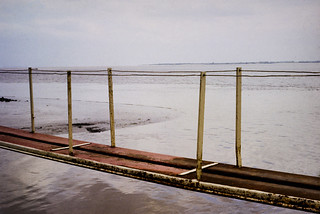
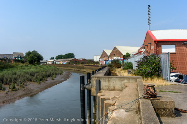
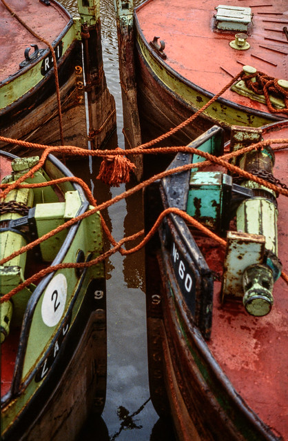
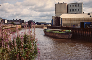
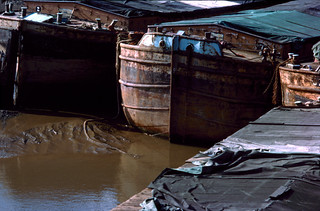
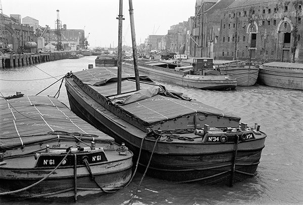
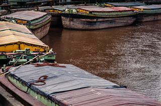
More barges on the River Hull, moored around the bend just north of the Isis Oil Mills. Here’s that same bend in 2018:

All of the barges are in the green and yellow colour scheme of Hull’s Gillyott and Scott, formed in 1964 by amalgamation of the five companies of William Gilyott, John A. Scott, T.F. Wood, Furleys and John Deheer.

Some of the barges had the names of birds – such as No 129 Ring Plover at the centre of the group above. Others had to make do with just a simple number or a letter and number such as R50 here. Perhaps it depended on which company they had come from.

Warehouse, River Hull, 83-01-Hull-061_2400
Warehouse, River Hull, 1983

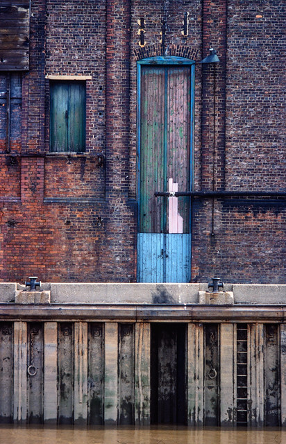
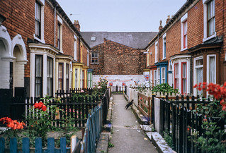
This warehouse on the bank of the River Hull had its frontage on High St, immediately upstream from Drypool Bridge. The narrow passage of Blaides Staithe separates it from Blaydes House, the rear of which can be seen at the right of the picture.

Not long after I photographed it, the warehouse was demolished, its site remaining undeveloped when I last visited it 35 years later, though then said to be ‘Under Offer’. In London it would almost certainly have been preserved, probably listed and converted into luxury flats, but Hull’s low property prices signed its death warrant.

Kenfig, dredger, River Hull, Hull 83-01-Hull-062_2400
Kenfig, dredger, River Hull, 1983

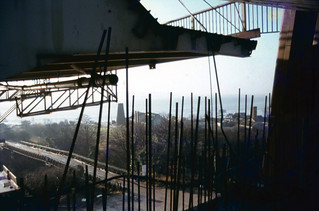
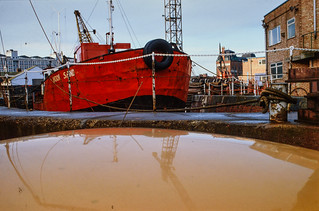
I took quite a few photographs of the Kenfig, which seemed to be moored and quietly rusting in the River Hull for several years, though I think it had previously been responsible for some of the dredging of Humber Dock for the new marina.

I wrote the following when I was commenting daily on a picture of Hull during the 2017 year as City of Culture:

The Kenfig, a grab hopper dredger built in 1954 by Henry Scarr Ltd of Hessle for the British Transport Docks Board at Port Talbot. It was one of the dredgers used to clear the passage into Humber Dock for the Marina, and in 1983 was bought by Jones & Bailey Contractors Ltd of Hull who renamed her Hedon Sand in 1984. Around 5 years later she was scrapped at New Holland.

Kenfig was moored just a little upstream of Drypool Bridge on the River Hull for most of the 1980s, seldom if ever moving.

Hook Sand, Dry Dock, Hull 83-01-Hull-067_2400

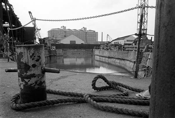
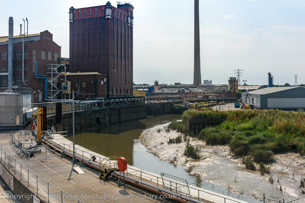
There are still several dry docks on the lower part of the River Hull, though I think none currently in use, with one scheduled in 2023 to be the centre of a new maritime museum, where it will house Hull’s last sidewinder trawler the Arctic Corsair.

This one is on the opposite side of the river, north of Drypool Bridge and my picture is taken from its road entrance on Great Union St.

The Old Harbour, River Hull, evening. 83-01-Hull-077_2400
The Old Harbour, River Hull, evening. 1983

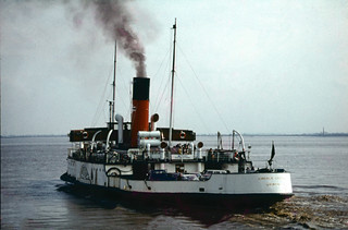
My apologies for the poor technical quality of this image, which reflects the difference between colour films and the quality we now get from digital images. I think this was probably taken on an ISO400 colour film, while with my current digital camera I would happily work at ISO6400 and get considerably superior results. Photographers will understand this is a difference of five stops. I couldn’t use a very slow shutter speed as the small tanker was moving up river at some speed with the tide.

The view here is looking towards the mouth of the River Hull. The sand and gravel works have now gone and there is a rather ugly hotel on that side of the river. Further down, past the Myton Bridge, built in 1979 and the tidal barrier, the land at Sammy’s Point is now occupied by The Deep.

More pictures at Hull Colour 1972-85 on Flickr.


All photographs on this and my other sites, unless otherwise stated, are taken by and copyright of Peter Marshall, and are available for reproduction or can be bought as prints.


Hull Colour – 7

Saturday, July 18th, 2020
Lighthouse, Paull 81-04-Hull-043_2400

I think that Paull was one of the places we may have walked to during one of our stays in Hull, taking a bus to somewhere outside the city to a suitable starting point. There were a couple of time I hired a car, but I think only to go for holiday weeks elsewhere in Yorkshire. The last time I hired one I managed to drive it off the road into a ploughed field at some speed somewhere near Meaux (which despite the name is on the outskirts of Hull) and decided the time had come for me to give up driving.

Strangely given that back in 1965 when I first visited Hull was a city full of bicycles it was over 35 years before I ever cycled around the city. And when I did in 2003, I visited Paull for a second time, though actually riding there from Hornsea.

Paull is a riverside village on the north bank of the Humber a few miles south-east of Hull, just beyond Hedon Haven. Neither Paull nor Hedon grew as ports because sandbanks in the Humber made them unsuitable for larger ships, while a deepwater channel led towards the mouth of the River Hull.

Navigation in and out of Hull was tricky, and in 1836 Trinity House built the lighthouse at Paull for ships leaving Hull to steer towards, before picking up other lights on the south side of the estuary. Unfortunately the channel soon moved and by around 1870 this lighthouse was obsolete and was replaced by two ‘leading lights’ a little further downstream at Thorngumbald Clough.

This extensive Grade II listed property was offered for sale in 2013 for £169,950 though it is unclear if it was sold and a rather lower bid was considered. For those of us used to London prices it seems excessively cheap.

Mouth of River Hull, RIver Humber 81-04-Hull-044_2400

This picture amused me after photographing the Humber Bridge and I think I captioned it at the time as “Not the Humber Bridge” . The view is actually of both the River Hull, coming in from the left and the Humber across the top of the image, and the spit of mud and sand is Sammy’s Point, where Hull’s major tourist attraction, ‘The Deep’ now stands, a little back from the point here.

This was a short gangway leading out to a iron-sheathed concrete dolphin at the mouth of the River Hull from the end of Nelson St. The dolphin, designed as a temporary mooring in deep water for vessels waiting for the tide to go up the River Hull (and perhaps to protect the bank from vessels off course) is still there, but the promenade has been rebuilt to stretch to the dolphin, and a footpath now leads north from it beside the Hull.

Alley in Old Town, Hull 81-04-Hull-050_2400
Alley in Old Town, Hull 1981

I can’t remember precisely where this was, but the view through it is to the wholesale fruit and vegetable traders, probably on Humber St, though possibly on Wellington St. I think this may have been an alley leading from Blanket Row, but the area has changed too much for me to now be sure.

Clearly I was attracted by both the atmosphere of the alley leading to the street and by the colour, particularly the three areas of blue against the muted yellows. Blue mixed with yellow in my paintbox to make greens and green is the only other colour in this image.

Barge R57 moored at wharf north of Ferry Lane, Hull 81-04-Hull-052_2400
Barge R57 moored at wharf north of Ferry Lane, Hull 1981

The last time I was in Hull I sat eating a lunchtime snack beside the River Hull here, though the scene had changed a little.

There was actually a barge moored a little downstream, though looking rather derelict, but I was surprised to find that there were still a couple of buildings from the earlier image remaining.

East Hull Ladder Works, Hull 81hull81003_2400
East Hull Ladder Works, Hull 1981

I don’t know the name of the dog or the name of the street where the East Hull Ladder Works then stood, but am fairly sure that it and the houses along the street either fell down or were demolished not long after I made the picture.

Probably this was a side-street off of Holderness Rd, well-placed for timber which came into Hull’s Victoria Dock. The rapid growth of Hull during the 19th century with its tremendous boom in house building will have created considerable demand for ladders.

Holderness Rd, 1977 – East Hull

And there were certainly plenty of them for sale on the Holderness Road as this picture from my web site ‘Still Occupied – A View of Hull‘ shows.

Sissons Paints, mosaic, Clough Rd, Bankside, Hull 81-04-Hull-058_2400
Sissons Paints, mosaic, Clough Rd, Bankside, Hull 81

Sisson’s Paints were another famous brand from Hull, and their advertising often used their 1910 trademark of two painters carrying cans of paint and a plank. Sisson’s won a court case against a far-eastern company that copied it, replacing the plank with a ladder, but now Sissons Paints Malaysia, one of several foreign companies that continue its name, uses it with a ladder. In the early years adverts using it had the plank carrying the text ‘Hall’s. Distemper’, a product responsible for many gloomy hallways across the world, which over the years I’ve cleaned laboriously from several walls.

Sisson’s extensive works were beside the River Hull at Bankside and had this mosaic installed in 1953 (their 150th anniversary) when they were rebuilt after wartime bombing. The company was bought by Reckitt and Colman in 1964, sold on to the Donald Macpherson Group in 1968 and taken over by  Finland’s largest paint manufacturer Tikkurila Oy in 1984, though production in Hull had I think ceased before this and the plant looked derelict when I took this picture. It was demolished in the early 1990s and the mosaic lost. All that remains is the gates.

Part of the large area occupied by the factory is now more colourful than ever as a part of the Bankside Gallery which sprung up following Banksy’s addition ‘Draw The Raised Bridge’ on Scott Street bridge in January 2018.

Bankside Gallery, 2018

Hull Colour 1972-85 on Flickr.


All photographs on this and my other sites, unless otherwise stated, are taken by and copyright of Peter Marshall, and are available for reproduction or can be bought as prints.


Hull Colour – 6

Friday, July 17th, 2020
Barges on River Hull and Croda works, Hull 81-04-Hull-030_2400
Barges on River Hull and Croda works, Hull 1981

A busy scene on the River Hull, probably taken in 1981, though the dates on these images come from the album they are filed in and are sometimes not the exact year, and this could possibly have been made earlier.

The slide mount crops the image slightly and I’m sure that the actual transparency will have included the top of the water tank on the Croda silo at the Isis Oil Mills, but it would have greatly slowed down the photographing of this and the other slides to have removed the slides from their mounts – and would have made handling them much more tricky. And the macro lens and bellows combination I was using with the older Nikon slide holder was fine for mounted slides but could not give proper coverage of the full 24x36mm.

Perhaps because of the problem of slide mounts, many SLR cameras, though marketing on the benefits of actually viewing through the taking lens rather than the separate optics of the rangefinder Leica or twin-lens Rolleiflex had viewfinders that cropped the images and were actually less accurate in their framing than the Leica. Though even the Leica white line frames never quite exactly represented the area that would appear on film (though some lenses came very close) making something of a nonsense the insistence of many photographers of printing the edges of the negative to give a black frame because this represented how they had seen the picture when they pressed the button. It was always more an aesthetic decision.

The silo was still there last time I walked along Bankside, but the location from where I took this picture was behind a locked gate and the buildings to the right of the silo had gone and there was only one vessel, Cargill’s edible oil tanker Swinderby, moored along this reach of the river.

Works, River Hull 81-04-Hull-032_2400
Works, River Hull 1981

I can’t remember now where I took this picture of a wharf across the RIver Hull, somewhere in Hull. But I do remember being attracted by what appears to have been built as an incredibly tall doorway, though it does now appear to have been blocked by a pipe that emerges through it at a little under half its height.

Was it, I mused, made for giraffes?

542 Hessle Rd and phone box, Hull 81-04-Hull-034_2400
542 Hessle Rd and phone box, Hull 1981

Hull Corporation was one of 55 local authorities to bid for a licence to provide telephone services in their local area in 1902 and opened its first telephone exchange in a former public baths two years later. While other local authorities who had been granted licences soon abandoned or failed, Hull continued its service after the Postmaster General had gained a monopoly elsewhere across the country.

And when in 1936 the Post Office launched a new red phone box designed by Sir Giles Gilbert Scott to commemorate the Silver Jubilee of King George V and decided that all phone boxes across the country should be red, Hull decided while adopting the new design to keep their traditional colour of cream and green, eventually moving to all cream. Hull City Telephone Department continued to innovate – and introduced a message from Santa in 1952. The council hived off the service into a fully owned separate company, Kingston Communications (HULL) PLC in 1987, which was floated on the Stock Exchange in 1999. In 2007 Hull Council sold its remaining stake in the business which changed its name to KCOM Group PLC.

The scene on Hessle Rd is still recognisable, but the shop has changed and no longer has the colour scheme and awning that attracted my attention, and although there is still a phone box I think it may have moved a few feet.

Lincoln Castle, Hessle Forshore, Hessle 81-04-Hull-039_2400
Lincoln Castle, Hessle Forshore, Hessle 1981

The paddle steamer Lincoln Castle was now beached on the Humber foreshore at Hessle, close to the Humber Bridge, and was now a restaurant where we went for afternoon tea. I made it into a rather strange landscape of distant jagged hills in this picture.

Humber Bridge, from Barton on Humber82hull135_2400
Humber Bridge, from Barton on Humber 1982

And of course we went across the Humber Bridge which took us to Barton-on-Humber. Where we walked around a bit and found there wasn’t a great deal there. I took a few photographs, mainly of the Humber Bridge, and I rather like this almost monochrome view.

More pictures on Flickr in Hull Colour 1972-85.


All photographs on this and my other sites, unless otherwise stated, are taken by and copyright of Peter Marshall, and are available for reproduction or can be bought as prints.


Hull Colour – 5

Thursday, July 16th, 2020
Wilmington Bridge, Hull 80hull102
Wilmington Bridge, Hull 19802

I’ve photographed this listed railway swing bridge across the River Hull many times, but I like this particular detail image not just because it gets away from a more standard view and for its colour, but because of the way it puts the bridge into its now largely gone industrial context.

The bridge was built to carry the lines from Hull east to the two North Sea seaside towns of Hornsea and Withernsea. Coming out from Hull Paragon the line turned north to a level crossing at the end of Spring Bank, close to the junction of Princes Avenue. Next to this was Botanic Station, where my wife in her youth would catch a train to Hornsea for the family’s annual week at the seaside. The line then swung east to Stepney Station, close to Stepney Lane on Beverley Road and then on to this bridge across the RIver Hull. The lines to Withernsea and Hornsea diverged on the other side of the river.

Sadly, Dr Beeching, an firm evangelist for the car and the motor trade, put an end to all that and both lines closed to passenger services in October 1964, a few months before my first trip to Hull. Goods services continued to use the bridge and track as far as Hedon until 1968, and all too often I found myself sitting on the top of a bus waiting for the crossing gates to open. In front of me during the evening rush hour then would be hundreds of men on bicycles on their way home.

Nowadays the bridge seldom swings for traffic along the river, though it remains in working order and will do so when necessary. And although there are no trains, the bridge is still in use for cyclists and pedestrians.

Sculcoates, Hull 80hull132
Sculcoates, Hull 1980

An evening glow lights up this view of Sculcoates, with the cabin of the Wilmington Bridge at its right-hand edge and the tall silo of the British Extracting Company Ltd at its left. I’ve not been able to find out why the water tank on its roof has a logo with a crown on top of a stylised letter R – please let me know if you know.

I think this view is from the embankment of another disused railway line which took the Hull, Barnsley and West Riding Junction Railway and Dock Company line to its Hull terminus at Cannon St. This had been intended simply as a goods station, but the company (later more simply known as the Hull and Barnsley railway) ran out of money to construct a passenger station closer to the city centre. The line which ran here on the west side of the Beverley and Barmston Drain was a short spur down from Beverley Road Junction on the line still in use for traffic to the eastern docks.

Barges in Old Harbour, Hull 81-04-Hull-020_2400
Barges in Old Harbour, Hull 1981

Another view of barges moored in the Old Harbour of the River Hull, secured to each other by some bright orange ropes. I’m sure that some of my more imaginative psychogeographic friends would see it as some kind of weird psychic circuitry.

Red Doors, Pattern Store, Hull 81-04-Hull-022_2400
Red Doors, Pattern Store, Hull 1981

I like the idea of a ‘pattern store’. If you ‘Google’ it you will mainly get sewing patterns, but I think this one will have been at some kind of engineering works. Patternmakers were particularly important in shipbuilding, railway works and foundries, and the patterns they made were usually wooden cut-out shapes which recorded the exact size and shape to which metal had to be cut or cast for a particular purpose. Pattern stores might also be used to hold plans and drawings.

McGrath Bros, Fish Curers, St Mark's Sq, St James Street, 1981 81-04-Hull-023_2400
McGrath Bros, Fish Curers, St Mark’s Sq, St James Street, 1981

Unlike the previous picture which I have no idea of where I took it, I can locate this painted gate fairly precisely to St Mark’s Square. Off St James’s St, which is off the Hessle Rd, this bears little resemblance to its Venetian namesake, but is rather more accurately a square, though only two sides carry its name.

McGraths, later ‘Shears (McGraths)’ was a member of the HULL Fish Merchants Protection Association, and although the Cod Wars had more or less killed Hull’s fishing industry, when I took this picture the auctions at the fish dock were still the largest fresh fish auctions in the country, handling over two thirds of our Icelandic fish imports as well as the smaller amounts landed by trawlers still operating from Hull and fish brought by lorry from other ports. Hull got a new state-of-the-art fish fishmarket in 2001, but in 2011 Icelandic fish agent Atlantic Fresh abandoned Hull’s Fishgate for Grimsby.

I love the pointing hand with its flourish directing the reader to the company’s Office.

Barge Torcha and River Hull, Bankside, Hull 81-04-Hull-028_2400
Barge Torcha and River Hull, Bankside, Hull 1981

I read the name of the barge incorrectly from a black and white version of this picture as it is TORCHA and not TORCH , but here is what I wrote about it.

A little downstream from the Hull Exhaust Centre, visible at left was another viewpoint, I think from a derelict wharf on the River Hull. This image, looking upstream, shows barge Torch, with number 22, owned by Hull’s Gillyott and Scott, a major tug and lighter owner formed in 1964 by amalgamation of the five companies of William Gilyott, John A. Scott, T.F. Wood, Furleys and John Deheer. Gilyott and Scott (Transport) Ltd also owned lorries. The barges are said to have been sold to Dave Hornshaw of Hornshaw Water Transport in Goole.
 
The buildings on the East bank are some of those on the Morley Street ultramarine works, then still part of Reckitt’s – with Hull’s tallest chimney a little out of the frame to the right. Most or all have now been demolished.

Torcha is Spanish for torch, and according to one dictionary in English is a mixture of mud with straw and cob used for roofing. It’s not a word I’ve heard used but the connection with mud would certainly be appropriate for a barge the the River Hull or Humber. Cob is a more usual term of the the mix of clay, sand and straw used in building, the daub in wattle and daub which often also contained cow dung.

More pictures at Hull Colour 1972-85.


All photographs on this and my other sites, unless otherwise stated, are taken by and copyright of Peter Marshall, and are available for reproduction or can be bought as prints.


Hull Colour – 4

Tuesday, July 14th, 2020
Humber Bridge, Hull 80hull065
Humber Bridge, Hull ca.1980

I’m not sure from exactly where I took this view of the Humber Bridge under construction, but I was fortunate enough to go on a tour of the construction organised for a group of science teachers, and it could have been made during that visit, though I don’t remember taking any colour pictures then. The bridge took around 9 years to build and was completed and opened in 1981.

The mill visible on Hessle foreshore was built around 1810 to grind the chalk that was being quarried here into whiting, finely powdered chalk used as a filler in paint and, together with linseed oil to make putty, in whitewash, gesso and ceramic glazes etc. The windmill went out of use about a hundred years ago, losing its cap and sails and the quarry closed in 1970. The area is now a country park.

Humber Bridge, Hull 80shull062
Humber Bridge, Hull ca.1980

After the cables were spun the box-girder sections of bridge decking were added, beginning in November 1979 and this picture must have been made shortly after this. Wikipedia states “the Humber Bridge was the longest single-span suspension bridge in the world for 17 years.”

When our family was travelling to Hull by train in the 1980s we would look out for the Humber Bridge in the distance to know we were getting close to our destination. I always offered a small cash prize for the first of our party to spot it through the train window, but think I never had to pay it out as I always saw it before the others.

River Humber, Hull 80hull110
River Humber, Hull 1980

The Humber has always seemed more mud in motion than a river, always a dirty brown colour, and it is only the small waves that differentiate between the river and the shore in this view. The mud and sandbanks in the estuary are always moving, and for many years ships travelling up the river to Hull or Goole needed the services of the Trinity House pilots, who started offering their services in 1512 and in 1581 were granted a charter authorising them to examine and licence pilots and take charge of ships. Various Acts of Parliament followed to endorse and regulate their activities, but the 1984 Pilotage Act transferred responsibility to the ports. In 2002 Associated British Ports terminated the authorisations of all Humber Pilots and employed their own pilots directly.

You can now walk along an esplanade along what had been the river frontage of Victoria Dock and various ship-building and other related businesses but only as far as what was the Alexandra Dock and is now ‘Green Port Hull’, a a wind energy manufacturing plant and riverside quay. I think this picture was probably taken just a little further downriver than the path now takes you.

Humber Dock Side, Hull 80hull113
Humber Dock Side, Hull 1980

There were some blue sheds on the dock side of Humber Dock that were demolished when the dock was dredged and converted into Hull Marina, and these had painted steel columns and wooden sides. The marine air had over the years produced this incredible rusting, lifting up the thick painted layers.

The buildings at the right of the picture are still there, though considerably altered on Humber Place at its junction with Wellington St, and are now Francis House, the offices of an accountancy firm, though the Wellington St building at extreme right has been demolished.

Railway Dock, Hull 80hull114
Railway Dock, Hull 1980

Although Hull lost some of its most impressive warehouses to a road scheme which split the Old Town from the city centre to take the heavy traffic for the King George Dock to the east of the city, some of those beside Railway Dock were retained, with the three gables shown here still visible, though the mass at the extreme right has been demolished.

King Billy, Market Place, Hull 80hull115a
Railway warning, Hull 1980

King Billy, King William III or William of Orange, successfully invaded Britain in 1688 in what is sometimes called the ‘Glorious Revolution’. James II was unpopular, largely because he was a Catholic and was seen to be changing Britain to a Catholic country, suspending anti-Catholic measures by decree when Parliament refused to do so and prosecuting Anglican bishops for seditious libel. His actions prompted anti-Catholic riots and many leading political figures of the day invited William to come and take over the country. But there were also leading Catholic members of the aristocracy who defended James and the ‘divine right of kings’ to overule all others, including Parliament. One of them was the governor of Hull, Lord Langdale, who took the military to occupy the city of Hull, fearing that William of Orange might try and land there. But instead of coming across the North Sea, William’s fleet went down the Channel and landed at Brixham on Novermber 5th, marching from there to London. The army deserted James and he fled to France on December 11th.

Hull had remained under Catholic control until December 3rd, when Protestant officers, hearing of a plot to imprison them, got together and arrested Langdale and his Catholic supporters. The day was celebrated in Hull for many years as ‘Town Taking Day’ when many wore orange sashes and celebrated with a procession, church service and fireworks in the Market Square – and around the statue of King Billy after it had been erected there in 1734.

Market Place is very much a backwater in the Old Town now, on the edge of the busy A63 and with one side occupied by some of the city’s most tedious buildings, as well as the rear end of Holy Trinity. Since the listed public toilets under King Billy closed there are few reasons to go there.

Railway warning, Hull 80hull116
Re-used Railway warning notice, Hull. 1980

A dockside building with a doorway closed with boards from a notice that was once beside one of the swing bridges, probably that taking Wellington St across the Humber Dock lock, warning people it is an offence to pass the warning lights onto the bridge or be on it while it is moving.

A public footpath crosses the swing bridge into Albert Dock, and some time in the early 1980s while I was out walking with my family I notice that my wife and younger son in a push-chair were no longer following me. I turned around an looked for them, eventually spotting them on the bridge which was turning around to admit a ship to the dock. They had walked past the warning lights before they had been activated and the bridge operator, do doubt thinking only of the lorries which went across, had failed to spot a young woman already on the bridge with a baby buggy. She got a free ride and profuse apologies rather than a fine.

One of Hull’s minor tourist attractions, perhaps inspired by notices such as these, is now a footbridge across the River Hull on which people are allowed to ride. Unfortunately ship movements up the Hull are now extremely rare and the bridge almost never operates in anger, but there are scheduled tests most if not all weekends on which I’ve taken a couple of rides.


All photographs on this and my other sites, unless otherwise stated, are taken by and copyright of Peter Marshall, and are available for reproduction or can be bought as prints.


Hull Colour – 3

Sunday, July 12th, 2020
Humber Ferry, Hull 72hull057
PS Lincoln Castle – Humber Ferry, 1972

Before the Humber Bridge was opened in 1981, ferries transported passengers and cars across the Humber from the pier in Hull to New Holland in Lincolnshire, where a train service took passengers on to Grimsby and other stations. For drivers it avoided the journey to Boothferry Bridge near Goole, 28 miles away up river – and a similar journey back on the opposite bank. By the mid-70s an alternative route for many journeys had been provided by the M62 viaduct a mile or so east of the Boothferry Bridge – which largely removed the necessity for the Humber Bridge.

The Lincoln Castle was a great improvement on the other paddle steamers when she came into service in 1941, and was much loved by the time she was replaced by a more economical diesel-powered ferry in 1978. For a short time she was grounded on the beach at Hessle as a restaurant – where I went for afternoon tea – and later in the same role in Grimsby. By 2009 her condition had deteriorated and after attempts to preserve the ship failed was scrapped in 2010.

I travelled across on the ferry a couple of times, took a few pictures in New Holland and took the ferry back. It was a good family outing, particularly for our two young boys as the ship had been constructed to give passengers a good view of the engine room and steam engine.

Old Harbour, Hull  77hull045
Old Harbour, Hull 1977

You can still walk beside the River Hull in the Old Town, and it remains an interesting walk, but back in the 1970s there was still some commercial activity, and at the right times of the tide vessels would pass up or down past these largely redundant barges, moored here three deep.

This was the original harbour of Hull, before the docks were built, though there were many wharves upstream both in Hull and further north to Beverley and beyond, and the river remains navigable. Although traffic had dropped markedly there were still a number of industrial sites still using the river in the 1970s and into the present century.

Old Town, Hull 77hull047
Old Town, Hull 1977

Wooden crates were being burnt in a bin down an alley and producing an almost comic book head of flame, a beacon in the shadow of the alley. Flames are always something of a challenge for photography, generally resulting in burned out highlights that have nothing to do with their temperature but simply their intensity. I was surprised that transparency film with its very limited exposure range handled this so well, more I think a matter of luck than expertise.

Terrace, Hull 81-Hull-003
Terrace, Hull 1981

Widely publicised as a “fairytale wedding” and the “wedding of the century”, the marriage Prince Charles and Lady Diana Spencer on Wednesday 29 July 1981 clearly caught the imagination of many in Hull, and I photographed some of the decorations painted on derelict buildings and here on a typical Hull “terrace’, though I cannot remember its location.

Many of Hull’s roads have these short pedestrian terraces at right angles to the main street to pack more houses into a small area. Not all have such neatly maintained fences and gardens, but almost all are too narrow for them to have been converted to take cars.

The black cat halfway down the street didn’t bring the unhappy couple much luck.

Wincolmlee, Hull 80hull087
Wincolmlee, Hull 1980

Wincolmlee runs roughly parallel to the River Hull, on the road side of the wharves along its west bank, from the north of the Old Town up to Air St, a little over a mile. Lime St, runs in the same way on the east side of the river a little less than half the distance.

Much of Hull’s industry involved agricultural oils and there were storage tanks on both sides of the river. I think these colour-coded pipes probably linked some of them, but what attracted me as well as their colours were the clouds of steam.

Scott warehouse, Hull 80hull088
Scott warehouse, Hull 1980

Hull’s unlisted riverside properties have largely been demolished with some notable losses. But John A Scott’s warehouse in Alfred Gelder St was converted to flats around 1980, the work going on while I took this picture involving making windows in what had been a largely or entirely blank wall.

It isn’t in itself a very exciting building, but it’s river frontage now fits better with the listed building immediately downstream than a new build.

Quite a few buildings in the industrial area around Wincolmlee which in areas of higher property values – such as London – would have been converted to luxury flats have simply been demolished or are still largely derelict. But the area has perhaps been given a boost by the ‘Bankside Gallery’ of graffiti which sprang up following the intervention by Banksy.

Mud, Hull 80hull090
Mud, Hull 1980

I’m unsure as the the actual location or date of this picture – one of the great majority of my slides which lack any captioning. But it is certainly one of Hull’s docks, almost certainly Humber Dock, Railway Dock or Humber Dock Basin. The reflections in the wet mud give some clues, but not enough for me to be sure.

These docks close to the centre of the city had been unused for some years and were all heavily silted with Humber mud. Considerable dredging was required to make Humber Dock usable as Hull Marina, which opened in 1983.

S Not W, Hull 80hull091
S Not W, Hull 1980

I deliberately cropped the message which I think was written on the wooden side of a dockside shed to give the rather enigmatic message ‘S NOT W’. Unfortunately I can no longer remember the entire text, though the letter after W is clearly E, and not as I hoped A for an anti-war slogan.

The saturated red which attracted me, at least in part because it matched the colour of the painted letters, was the roof of a car.

British Extracting Co Ltd, Hull 80hull089
British Extracting Co Ltd, Hull 1980

This former British Extracting Company silo on the side of the River Hull was built in 1919 and one of a number of similar buildings in Hull and elsewhere designed by Gelder & Kitchen of Hull. It has regularly been visited and photographed in recent years by urban explorers.

Sir Alfred Gelder (1855-1941) was born in North Cave and became a Hull councillor in 1895, serving five terms in a row as Mayor from 1898-1903 and overseeing the extensive redevelopment of the city after which he was knighted. He was Liberal MP for Brigg from 1910-1918. A Methodist, he founded his architectural practice in Hull in 1878 and designed a wide range of buildings including several Methodist chapels in the city and elsewhere as well as many flour and oilseed crushing mills, including the first roller mill for fellow Methodist Joseph Rank and other buildings for Ranks’s son, J Arthur Rank.

Llewellyn Kitchen, (1869-1948) from Manchester joined Gelder as chief assistant in 1892 after having worked for a number of architects elsewhere and soon became the junior partner in the practice, although he appears to have been the more interesting architect of the pair. Kitchen was also a leading freemason in the area.

Gelder and Kitchen LLP is still in business, the second oldest firm of architects in the UK today.


Hull Colour 2

Friday, July 10th, 2020

A look at a few more of my colour pictures from Hull in the 1970s.

Paint, Hull 70shull077
Paint, Hull 1970s

I made a number of exposures of this wall, which I think was possibly at one of the dry docks on Dock Office Row, though my memory may be at fault. I often walked up High St from Clarence St next to Drypool Bridge and then on to Wincolmlee, sometimes continuing on up to Bankside or Air St, where I could walk west and across towards my parents-in-law’s house just off Chanterlands Ave north.

I was attracted by the colour but also by the mix of the accidental and deliberate in the markings on the wall. Like quite of few of the other images, time has added its mark to this picture, with some patches of blue which I haven’t entirely managed to retouch where mould has attacked the dyes.

Hull 70shull083
Hull 1970s – a distant view of Saltend

I can’t recall at all taking this picture, and another also taken from a similarly rural viewpoint with the chemical works in the distance. From the view I think it is taken from somewhere on the west edge of Hedon, perhaps on a walk from Hull to Paull.

But when or wherever it was made, its an image I like for its contrast, both visually and between the agricultural and industrial.

Weighton Lock, Broomfleet, 72-80-Hull-005
Weighton Lock, Broomfleet, 1970s

In contrast I remember our family walk which took us to Weighton Lock well. If you have travelled my rail from Selby or Doncaster to Hull, your train will have sped through Broomfleet, and you may just have seen a station there.

The man in the ticket office at Hull Paragon station seemed surprised when we asked for tickets to Broomfleet, but trains do stop there. Now you have a choice of the 07:19 or the 16:21 – but then there were rather more though I think we did have to tell the guard we wanted to stop there – and to hold our our hands for the returning train.

The lock is where the Market Weighton Canal joins the River Humber. Opened in 1782, the canal was both a navigable waterway and a drainage ditch. The upper section was closed around 1900 and the lower few miles to the lock abandoned in 1971. The Market Weighton Civic Trust managed to save the lock by getting it listed as an ancient monument, and it was repaired and reopened although there is no right to navigation around six of its original nine and a half miles remain navigable.

A few other pictures in the album are also from trips we made from Hull, including to Flamborough.

Guildhall Rd, Hull 72-80-Hull-008
Guildhall Rd, Hull, 1970s

Until ‘The Dock’ was opened in 1778, ships coming to Hull moored the the ‘Old Harbour’ in the River Hull, where staithes still run from the High St to the river. The dock was the largest dock in the UK when it was built, and soon became known as the ‘Old Dock’, but was renamed Queen’s Dock in honour of the visit to Hull by Queen Victoria and Prince Albert in 1854.

By the 1920s it was redundant, with docks on the Humber – Victoria Dock, Albert Dock, Alexandra Dock, Riverside Quay and King George Dock – forming the port of Hull, and it finally closed in 1930. The city bought it and filled it in to create Queen’s Gardens. Filling it took four years – one year longer than its construction and provided some employment during a period of recession.

I’m not sure exactly where these former warehouses on the south side of Queens Dock (Queens Gardens) in Guildhall Road were, but from the street sign I think they were just to the west of Quay St and have since been demolished.

River Hull, Hull 72-80-Hull-011
River Hull, Hull from North Bridge

I added the following text to a black and white image on my Hull photos web site taken from just a foot or two to the left of this image:

Peeling paint on a wall advertises the coal and sand wharf belonging to ‘Henry’, which I think may be Henry Mead & Co at 15 Lime Street, which was wound up in 1973. On the west bank of the Hull are a long line of wharves and buildings on Wincolmlee, with the towering silos of R&W Paul (now Maizecor) in the distance. A single vessel is visible moored at one of the Lime St wharves.
 
Floods from the Hull, mainly because of a tides coming up from the Humber, were fairly frequent before the tidal barrier was built, because the corporation failed to get wharf owners to maintain adequate flood defences. A number of derelict properties made their job more difficult. More recent floods have been because of excessive rainfall in the Hull valley.

Apart from the Maizecor silo, none of the buildings visible in this slide are still standing.

Hull colour

Thursday, July 9th, 2020
Humber Dock Basin, Hull 70shull052
Silted up dock. 1970s

I’m aware that its a while – over a year since I’ve written anything here about Hull, so here is the first of a short series of posts about a city where I’ve spent quite a lot of time photographing.

King Billy, Hull 70shull048
King Billy, 1970s

I’ve never actually lived in Hull, but for around 35 years I visited the city regularly visiting my wife’s family home, where we stayed for at least a week every year, more in the earlier years. After that house was sold we had a good friend who was always pleased for us to stay with him in his large mansion, but since his death around ten years ago my visits have been less frequent.

Window, Hull 70shull069
Old Town reflection, 1970s

During those visits to Hull I spent a lot of time on the streets taking photographs, sometimes out with other family members, but often on my own.

Docks notice, Hull 70shull070
Docks Notice, 1970s

Mostly I was photographing in black and white, working on a project that in the early 1980s became an exhibition (and much later a book) ‘Still Occupied – A View of Hull’. As well over a hundred black and white images, the show at the Ferens Gallery also included around 40 colour pictures, giving a more abstract view and concentrating on the docks and the River Hull and the riverside industries.

Poulterers, Hull 70s-hull073
D Marks & Sons. Possibly on Humber St, 1970s

At that time I worked in colour using 35mm transparency film and quite a few of the slides have either been discarded or deteriorated beyond recovery, while others have been lost. But a couple of months ago I found around 250 of the more interesting pictures and re-photographed them using a Nikon D810 fitted with a Nikon PB-6 bellows, Nikon 60mm f2.8 macro lens and PS-6 slide duplicating attachment.

Window, Hull 70shull075
Dockside Shed, 1970s

The pictures here come from the first fifteen in the album, and the top one, which I think is probably of Railway Dock, shows the silted up state of the disused docks at that time. Those familiar with Hull will recognise ‘King Billy’ below this, reflected in the window of the pub where he is reputed to drink when the clock strikes thirteen. It’s a little harder to recognise the buildings reflected in the window below, particularly because the double image makes it seem more slender – or to read the rather minimal remains of the dockside notice that follows.

I can’t remember exactly where D Marks and Sons had their poulterers business, perhaps has the caption suggests on Humber St, but it could have been somewhere off the Hessle Rd. The distinctive blue shed was one of several around Humber Dock Basin.

Dockside shed, Hull 70shull046

All photographs on this and my other sites, unless otherwise stated, are taken by and copyright of Peter Marshall, and are available for reproduction or can be bought as prints.


A River Full of Stories

Tuesday, October 15th, 2019

I’m pleased to have some of my pictures included in ‘A River Full of Stories‘ , a large hardback of around 200 pages recently published by Rich & Lou Duffy Howard in Hull. It’s an unusual title in several ways, and comes from their online project of the same name, a follow-up to their Open Bridges (which I wrote about here) which was a part of Hull’s 2017 year as UK City of Culture.

The book launch took place a little over a week ago, though I’m sorry I was unable to attend as I was at a weekend meeting elsewhere.

I have a small portfolio with 6 pages of my work, all reproduced well and to a good size on the roughly 10×11″ pages, as well as three other large reproductions in the main body of the book.

The book is packed with interesting photography, both historical and contemporary of Hull and its river, and the presentation is one only made possible by considerable sponsorship attracted to the project acheived by Rich and Lou Duffy-Howard who curated and edited it both online and in print.

You can of course read about it in the Hull Daily Mail (though I don’t get a mention) and there is an exhibition about both projects in the centre of Hull at the Hull Maritime Museum in Queen Victoria Square until the end of 2019.

The book is unusual in that it is not for sale, but contributors were given a free copy along with every library in Hull and the East Riding. However you can still buy the Café Royal Book  The River Hull 1977–85 which has most of the pictures in it – if on a rather smaller scale and less expensively reproduced. My other Café Royal Book on Hull, The Streets of Hull 1979–85 is also still available. And you can see many more pictures on my Hull web site in the links below.


There are no adverts on this site and it receives no sponsorship, and I like to keep it that way. But it does take a considerable amount of my time and thought, and if you enjoy reading it, please share on social media.
And small donations via Paypal – perhaps the cost of a beer – would be appreciated.

All photographs on this and my other sites, unless otherwise stated, are taken by and copyright of Peter Marshall, and are available for reproduction or can be bought as prints.