Back in Stockwell

Back in Stockwell: It was the 17th July 1989 before I was able to return to Stockwell and take up my wanderings around south London where I had left off on 4th June.

Stockwell War Memorial, South Lambeth Rd, Stockwell, Lambeth, 1989 89-7c-26

Coming out from Stockwell Underground I turned left and came to the war memorial, then on a rather scruffy triangle of grass and litter between the South Lambeth Road and the A3 Clapham Road. This has since been tidied up as Stockwell Memorial Gardens with a mural celebrating others who died in WW2 including war hero Violette Szabó, GC and a the Bronze Woman statue by Aleix Barbat, a tribute to all black Caribbean women.

The Stockwell War Memorial was erected in 1922 to the design of Frank Twydals Dear which attracted praise at the time for its excellent proportion, refined detail and simple lines.

The figure of Remembrance is by sculptor Benjamin Clemens and the clock with a face on all four sides of the tower was donated by the father of one of the 574 men named on the memorial who died on the Somme on 9th August 1916, aged 19, Frederick H S Caiger. He was the only son of Dr Caiger, superintendent of South Western Fever Hospital.

The mural is on the Security Archives in my picture, one of eight deep level shelters built for WW2. Stockwell was used to house US troops. The bunkers were 100ft underground and had 8000 bunks, canteen and hospital facilities.

Scallywag, Clapham Rd, Stockwell, Lambeth, 1989 89-7c-15

Scallywag was a pine furniture showroom which had started in an old church in Camberwell in 1970 and moved here in 1985 becoming the largest pine showroom in Europe. It is now based in a rural location in East Sussex as well as in the USA.

TDA House, Mecca Bookmakers, 211-213, Clapham Rd, Stockwell, Lambeth, 1989 89-7d-66

Opposite the war memorial on Clapham Road were these two architecturally very different buildings, TDA House and Mecca Bookmakers.

TDA House at 211 was built as the Stockwell Palladium cinema which opened in 1915 but was rebuilt as the Ritz Cinema in 1937. In 1954 it became Classic Cinema and in 1969 the Tatler Film Club showing uncensored blue movies, reverting to the Classic for a couple of years before closing in 1981. A snooker club for some years it then became TDA House for the Tigray Development Association supporting Ethiopian refugees and in 2017 became an Ethiopian restaurant.

Next door at 213 Mecca is now Ladbrokes.

Stockwell Lane, Stockwell, Lambeth, 1989 89-7d-53

I didn’t go up Clapham Road but turned into Stockwell Road, walking along her and making this picture just after I had turned into the narrow Stockwell Lane. It shows quite a mixture of buildings, with a recent house close to where I was standing, the back of a row of shops on Stockwell Road and a white building on the opposite side of the road which then had shops on its ground floor, but which is where Stockwell Green United Reform Church moved to after selling its premises on Stockwell Green.

The tower beyond is Birrell House, with an address on Stockwell Road but set well back from it, now managed by Hyde Housing, who took it over from Lambeth council after a vote by residents in 1999. The block, approved by the London County Council in 1964 was an addition to the Stockwell Gardens estate with 68 flats on 18 floors was named after Miss Elsie Birrell, London Undergroud’s first female porter who worked at Stockwell Station during the Second World War.

Garden, Stockwell, Lambeth, 1989  89-7d-56
Garden, Stockwell, Lambeth, 1989 89-7d-56

Stockwell in the past was noted for its gardens, particularly the botanical gardens of the Tradescant family and I could resist these fine specimens (certainly not Tradescantia) filling a fairly small front garden near Stockwell Park Crescent.

Houses, 2-4, Stockwell Park Crescent, Stockwell, Lambeth, 1989 89-7d-46
Villas, 2-4, Stockwell Park Crescent, Stockwell, Lambeth, 1989 89-7d-46

Stockwell Park Crescent was laid out in the late 1830s and many of the houses in it date from the 1840s. These were large houses for the middle classes many of whose heads will have worked in the city but wanted to live in the ‘country’ in places such as Stockwell. The small attic rooms will have been for the servants. These were villas rather than the terraces common in urban London and on a crescent which aimed for a more informal and romantic landscape.

Although basically plain, there are classical details on the frontage rather than actual columns, extending to the eaves which give a classical facade. The pair is Grade II listed.

More on my walk in a later post.


Epping Forest Centenary Walk

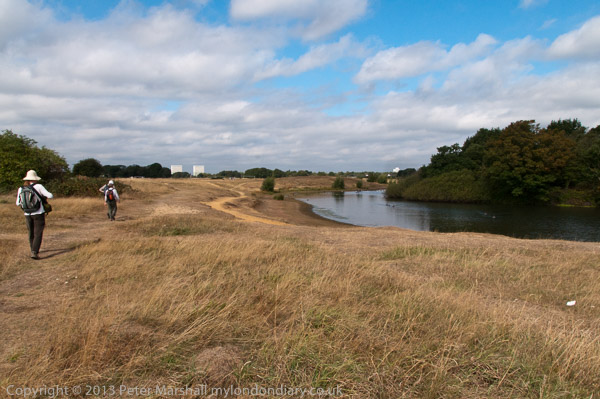
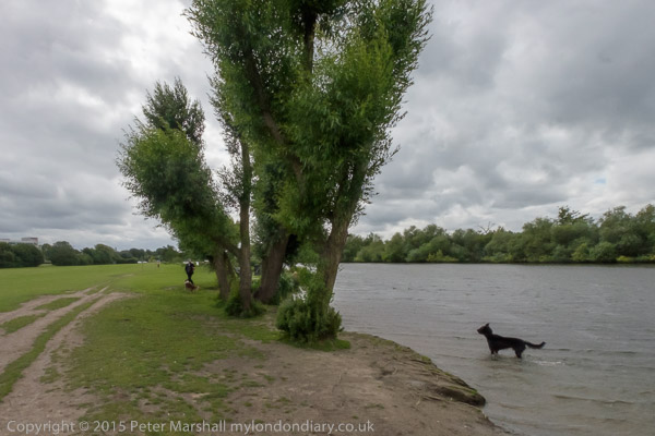
Epping Forest Centenary Walk 2009: London is in some ways a ‘green city’ with over 3,000 parks of varying sizes within the boroughs which make up Greater London. These range from pocket handkerchief areas to large commons and royal parks such as the roughly 2500 acre Richmond Park.

Epping Forest Centenary Walk
Wanstead Flats

London Mayor Sadiq Khan supported London being designated as the world’s first National Park City in 2019 and announced plans to increase the amount of ‘green space’ to 50%. This isn’t a huge target as according to the capital’s environmental records centreRoughly 47% of Greater London is ‘green’; 33% of London is natural habitats within open space according to surveyed habitat information and an additional 14% is estimated to be vegetated private, domestic garden land.”

Epping Forest Centenary Walk
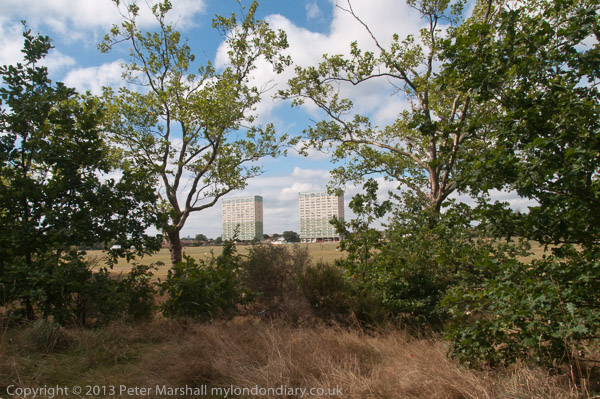
One of the Montague Road Estate flats had misssiles on its roof for the Olympics

In order of size, starting with the largest they categorise this as Other Urban Fringe, Parks And Gardens, Natural And Semi-natural Urban Greenspace, Green Corridors, Outdoor Sports Facilities, Unknown and amenities with other minor contributions. Some 22% is classified as Green Belt which gives some quite strong protection against development, though my borough is currently proposing to build on a little of it.

Epping Forest Centenary Walk
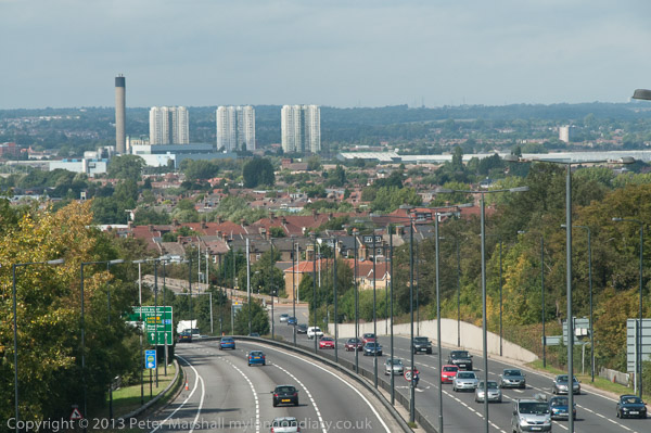
The walk goes on a bridge across the North Circular Road

The protection of green spaces in and around London has a long history, back to the Norman conquest when kings set up royal hunting grounds convenient to their palaces in Westminster and further afield. These were called forests, though most were mainly open land rather than full of trees; the name was a legal term meaning only the king had the right to hunt deer in them. One of the larger areas, established by Henry II in the 12th century was Epping Forest, part of an even larger Forest of Essex.

Epping Forest Centenary Walk
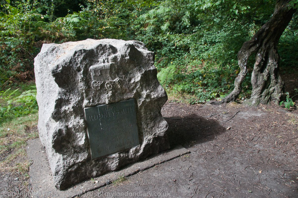
Memorial to a famous evanglalist Gypsy Rodney Smith born in a bender here

Enclosures began to threaten the future of the forest at the start of the 19th century when around a third of the remaining forest was allowed to be privatised for building development and farming by the lords of various manors in the forest. By 1870 around two thirds of the forest had been enclosed.

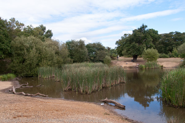
Warren Pond

By this time many people had become worried about the loss of the commons, particular after neighbouring Hainault Forest had been sold off by the Crown, the trees removed and the area turned into poor agricultural land. More and more people were coming out from London during their free times to enjoy the green spaces in the outskirts and preservation societies were set up.

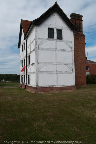
Queen Elizabeth’s Hunting Lodge

The City of London became involved after it bought land at Manor Park for the City of London Cemetery. Traditonally the city had organised Easter Monday stag hunts in the forest, but they now became commoners with the right to graze animals, and began legal actions agaimst lords of the manor who had enclosed forest land. Eventually Acts of Parliament allowed them to purchase the forest manors and an court in 1874 ruled that all enclosures made since 1851 were illegal.

Under the Epping Forest Act 1878 the forest ceased to be a royal forest and became managed by the City – as it still is. The Crown lost its right to venison and commoners lost some of their rights too, but the City Conservators were obliged to “at all times keep Epping Forest unenclosed and unbuilt on as an open space for the recreation and enjoyment of the people.”

The preservation of Epping Forest was the first major victory in Europe for the modern environmental movement. Four years later it was endorsed by Queen Victoria, who although it was no longer royal but in the hands of the City of London, nevertheless stated “It gives me the greatest satisfaction to dedicate this beautiful forest to the use and enjoyment of my people for all time“.

On the 100th anniversary of the Epping Forest Act in 1978, the Friends of Epping Forest began a annual series of anniversary walks from along a route they established from Manor Park Station to Epping. The Friends were originally formed to oppose the routing of London’s orbital M25 through the Forest, leading to it being put in a tunnel. But they have been less successful in opposing some other breaches of the 1878 Act, and in 1989-94 a large section of the south of the forest was lost to build the M11 link road, and during the London 2012 Olympics a temporary police station was allowed to be built on Wanstead Flats.

Epping Station at the end of our walk

I walked the Epping Forest Centenary Walk with some of my family and a friend on Bank Holiday Monday 31 August 2009, and you can download a leaflet including a map (though I’d advise also having the OS Explorer 174) of what has now been renamed the Epping Forest Big Walk. According to this it is 14.1 miles (22.7km) but we managed to walk rather further, possibly partly because we got a little lost at times. Of course you can do the walk in stages rather than all on the same day. If you want to walk with others you can join the free Big Walk this year on Sunday 17th September 2023 to be led by experienced guides!


Sunlight, Trinity, Town Hall & Granada

Sunlight, Trinity, Town Hall & Granada continues the account of my walk on Sunday 28th May 1989. The previous post was The Alexandra, Sanitary Ware & Ace and the walk began with Lavender Hill & Wandsworth Rd – 1989.

Sunlight Laundry, 125 Acre Lane, Brixton, Lambeth, 1989 89-5l-43
Sunlight Laundry, 125, Acre Lane, Brixton, Lambeth, 1989 89-5l-43

Built 1937, architect F E Simpkins Sunlight Laundry is a fine example of Art Deco ‘moderne’ style which unfortunately some architectural historians have turned up their noses at – perhaps why this building and some others are unlisted. Clearly this should be.

The Sunlight company was founded in 1900 and expanded with branches across London and after a merger in 1928 became a national business. Until the 1960s much of its work was for middle class domestic homes, but the wider ownership of washing machines shrunk the market and it concentrated on hotels, factories and other commercial clients. Later it also became a major contractor to hospitals.

Sunlight Laundry, 125 Acre Lane, Brixton, Lambeth, 1989 89-5l-46

There are another three pictures of this building online (click on one of these images to go to the album to see them), and I’ve also photographed it on other occasions when passing, though usually I’ve gone past on a 37 bus and not stopped.

Sunlight became part of the Danish Berendsen group and in 2013 changed its name to reflect this. It continues in business internationally and in the UK is the leading company in textile and laundry services to the hospitality and healthcare sectors. The company was acquired in 2017 by the French laundry services group Elis, whose name and logo now label its frontage.

Trinity Homes, Almshouses,  28, Acre Lane, Brixton, Lambeth, 1989 89-5l-33
Trinity Homes, Almshouses, 28, Acre Lane, Brixton, Lambeth, 1989 89-5l-33

Trinity Homes is a Christian Charity which provides accommodation to both single and married couples over the age of 57 who are members of a Christian denomination. As it states on its frontage it was erected in 1822-4 and was built and Endowed by Thomas Bailey. Additional homes were added in 1860. Initially it was The Trinity Asylum for Aged Persons. The building is Grade II listed.

Bailey was a cut-glass manufacture in the City of London and lived in Bethal House on Trent Road in Brixton Hill behind Corpus Christi Catholic church, built on land given by Bailey. His house, built in 1768, became part of the RC primary school built on the site in 1902 but has since been demolished.

Lambeth Assembly Hall, Buckner Rd, Acre Lane, Brixton, Lambeth, 1989 89-5l-34

The Assembly Hall is at the west end of the Town Hall complex and this striking sculpture relieves a huge plain brick wall area. This rather plain building is covered by the Grade II listing of Lambeth Town Hall and I think dates from 1935-8 when the Town Hall was raised and extended. The striking sculpture on what the listing text calls a particularly handsome rear elevation is ‘Youth rising from the Past‘, by Denis Dunlop (1892–1959).

Lambeth Town Hall, Acre Lane, Brixton 89-5l-35-Edit

Lambeth Town Hall seen from Acre Lane, though my more usual views of it have been either from Windrush Square or in close-up from the bus stop on the opposite side of the road during those long waits for a No 37 bus.

I’m not a great fan of the rather pompous clock tower of this Grade II listed town hall designed by Septimus Warwick and H Austen Hall and built in 1905-8. Edwardian Baroque always seems to me a period where architecture lost its way and was given excessive funding thanks to our plundering the wealth of the Empire.

Granada Brixton, Brighton Terrace, Bernay's Grove, Brixton, Lambeth, 1989 89-5l-36
Granada Brixton, Brighton Terrace, Bernay’s Grove, Brixton, Lambeth, 1989

Opened in 1898 as the Empress Theatre, designed by Wylson & Long, it was reconstructed in Art Deco style by Andrew Mather, reopening in 1931 as the New Empress Theatre. It showed films on Sundays when live performances were not allowed. It closed as a theatre in 1957 and after alterations opened a month later as a cinema. Granada Brixton became a Bingo Club in 1967 and when this closed was used as a furniture store. It was demolished in 1992 and the rather ugly Pavilion Mansions built on the site.

This walk continues along Brighton Terrace in a later post.


Postmen, The Majestic and More

Postmen, The Majestic continues my walk on Sunday 28th May 1989. The previous post was Citroen & More Clapham and the walk began with Lavender Hill & Wandsworth Rd – 1989.

Postmen's Office, Venn St, Clapham, Lambeth, 1989 89-5j-23
Postmens Office, Venn St, Clapham, Lambeth, 1989 89-5j-23

Postmen and Postwomen are still using the Postmen’s Office, a rather grand building from AD1902 where Venn Street takes a 90 degree turn to the east with Sedley Place going west. It seems now to be officially known as the Royal Mail Clapham Delivery Office.

I liked this picture partly because it gave some indication of the work which goes on inside the office, but came back for another picture when the rented truck had moved.

Postmen's Office, Venn St, Clapham, Lambeth, 1989 89-5k-36
Postmens Office, Venn St, Clapham, Lambeth, 1989 89-5k-36

When Lambeth Council set up their ‘Local List’ of historic buildings and artifacts which are not included in the statutory listing in 2010 it was one of the first to be listed, along with four others in the Clapham area, recognised by the council itself as being of architectural interest.

The Clapham Society two years later submitted there ow n list of over 70 properties in the area to recommend to the council of which only around ten were added, some excluded because they were inside already designated conservation areas. Clapham really does have a lot of interesting properties

Local listing provides little actual protection to properties but does mean the council will be aware of them in coming to planning decisions and take them into consideration in setting up local development plans. But unlike buildings in conservation areas or listed buildings they can be demolished without consent – which is seldom granted for listed buildings.

Former The Majestic, cinema, Clapham High St, Clapham, Lambeth, 1989 89-5k-41
Former Majestic, cinema, Clapham High St, Clapham, Lambeth, 1989 89-5k-41

The Majestic Cinema at 146 Clapham High St was designed by John Stanley Beard and opened in 1914.
The narrow front entrance – another shopfront between shops – leads to a large auditorium behind behind the shops. It seems that one of the names on the title deeds was Charles Chaplin. The cinema was taken over in 1928 and became part of Gaumont British Cinemas in 1929. Bomb damage closed it for a few months in 1940-1 and in 1950 it was re-named Gaumont Theatre, closing ten years later in 1960.

Majestic Cinema, Stonhouse St, Clapham, Lambeth, 1989 89-5j-24

The side of the cinema gives a better idea of its scale. After it closed as a cinema, the balcony was converted into a recording studio, Majestic Studios, continuing in use even after the main space became a bingo club in 1969, though probably not operating during the same hours. Among those who recorded there were Brian Eno. Adam Faith, David Bowie and the Sex Pistols.

In 1985 it became Cinatra’s nightclub and is now Infernos night club and disco. There are now new blocks on each side of the cinema building.

Langley Electrical, 156-8, Stonhouse St, Clapham, Lambeth, 1989 89-5j-25
Langley Electrical, 158, Stonhouse St, Clapham, Lambeth, 1989 89-5j-25

Langley Electrical, the first of this row of buildings on the opposite side of the street just past the cinema has been removed but the rest from 156 survives and has been tidied up and the ground floor shops mainly converted to residential use.

Houses, 34-40, Voltaire Rd, Clapham, Lambeth, 1989 89-5j-13

I walked along Clapham High Street, wandering a little down the side streets off the north side, and turning down Clapham Manor Road to Voltaire Road, where I amused myself a little with this image, hiding the foreground with the van and the ball on the top of a gate post. I think that gate has since been demolished but the houses are still there.

Shops, Clapham High St, Clapham, Lambeth, 1989 89-5k-61

This picture was taken across the road from the corner with Voltaire Road. There are still shops though looking rather less run down and housing different businesses and the houses behind are still there but no longer advertise the CASH SUPPLY STORES selling VEGETABLES CAULIFLOWERS and something illegible or THE MUSIC ROLL EXCHANGE offering Gramophone Records and claiming to have the LARGEST STOCK OF SECONDHAND MUSIC ROLLS IN ALL LONDON.

The railings have also gone, replaces around 2012 with some stands for locking bikes.

My walk on Sunday 28th May 1989 will continue in another post.


Citroen & More Clapham

Citroen & More Clapham continues my walk on Sunday 28th May 1989. The previous post was North St, Rectory Gardens & Rectory Grove and the walk began with Lavender Hill & Wandsworth Rd – 1989.

Car, Rectory Grove, Clapham, Lambeth, 1989 89-5j-52

Although cars in my pictures now often attract attention when I post the on Flickr, I seldom deliberately photographed them, but this is one exception. I think even I might have identified this as a Citroen, but it was only after I posted it that one of my regular commenters identified it as dating from 1938. So it was 51 years old when I took its picture, and apparently is still around and still taxed for road use.

The house it is parked in front of is 12 Rectory Grove, at the end of a short Grade II listed terrace at 12-18, which dates it only as “Early-mid C19”.

Rectory Grove, Rectory Gardens, Clapham, Lambeth, 1989 89-5j-56

I walked back south down Rectory Grove, again passing the entrance to Rectory Gardens which I wrote about in my previous post on this walk. As you can see there are shops on Rectory Grove, one still open in 1989 and I think selling pottery. These buildings were rather grander than those in Rectory Gardens, with three storeys. Between the two shops was I think the entrance to flats above. There was another shop beyond this corner building and may once have been a couple more, although these were I think residential in 1989.

Shops, Rose & Crown, Old Town, The Polygon, Clapham, Lambeth, 1989 89-5j-46

Continuing south I came to Old Town and The Polygon with this Grade II listed corner shop with its row of seven large oilmen’s jars above its mid-19th century shop fronts. The building itself is perhaps a little over a hundred years earlier.

Oilmen sold oil to the public, mainly for use in lighting before the introduction of gas and electric lighting, and often used ancient pots and their pictures in advertising. Large jars of this shape were used for the transport of oil by ship, often containing around 20 gallons, and when full these thick earthenware vessels must have weighed 70 kilograms or more. They were protected in transit with rope cases, but moving them must have been heavy work.

But I think these may well have been ‘single-use’ rather than being returned to source for refilling. Jars were often sawn in half as in Clapham as shop signs in the 19th century and were always then painted red, and often fixed like these above the shop windows. Many came from the Mediterranean filled with olive oil, though whale oil was more commonly used for lighting until the supply fell off and it was replaced by mineral oils.

The People's Church, Grafton Square, Clapham, Lambeth, 1989 89-5j-35
The People’s Church, Grafton Square, Clapham, Lambeth, 1989 89-5j-35

Designed by William Nevin as a Baptist Church in 1889, the building was renovated and opened as the People’s Church in 1959. Sold after the roof collapsed, it is now the Grafton Square Surgery and The Grafton apartment building, where a loft flat sold recently for around £2m.

Pyramid, Old Town, Clapham, Lambeth, 1989 89-5j-36

I’d photographed this decoration above the shop Pyramid only a few weeks earlier, but the lighting was right and I couldn’t resist making another picture – and I was also keen to get a better image of the crest. Here’s what I wrote about it earlier:

Walking down the street took me the Old Town, where the light was showing the device on the house at No 12 here with its proverb ‘CONTENTEMENT PASSE RICHESSE‘, the motto of the Atkins-Bowyer family. Richard Bowyer (d1820) had taken on the name when he inherited the Manor of Clapham from Sir Richard Atkins of Clapham. I’ve never quite worked out what the relief which is thought to have come from the old Manor House is meant to depict.

Pyramid, Old Town, Clapham, Lambeth, 1989 89-5j-21

Back in 1989 I didn’t own a decent long telephoto lens – the longest I owned were a 90mm for the Leica and a 105mm for the Olympus. I think this was probably taken with the 105mm and the device on the wall is certainly clearer, but no easier for me to interpret. At the top there appear to be three animals with a bird, perhaps an ostrich standing on top of what could be a crocodile or dragon or hound with perhaps a snake on the bird’s back, its head going down to the croc.

Below that with the motto spread over it is what could be cloth hanging from spars or perhaps flames or who knows what, and at the bottom a shield with stripes and what looks like two chickens with their wings up above and one below a row of stars. Perhaps others will know more and comment.

The old manor house was only finally demolished in 1837, though its octagonal tower had been taken down around 1810, perhaps because it was unsafe. It was probably this tower that led to the street laid out on the site, near St Paul’s Clapham being named Turret Grove.

Trinity Close, Flats, The Pavement, Clapham, Lambeth, 1989 89-5j-22

Continuing south along The Pavement took me to this large 1936 development of flats on five storeys with some little interesting At Deco features of which this gate post and porch are perhaps the best. I think that the post (and its partner on the other side of the entrance) may have been built to support an entrance light, but there was no sign of it. The building, which extends back some distance in a roughly H-shape replaced three existing buildings on The Pavement.

It was designed by J J de Segrais and three of its top floor flats on this side have balconies with views over Clapham Common. At the centre just below roof level is a small sculptural decoration which I didn’t try to photograph. Trinity Close is is joined at its north side to another large 1930s block of flats, Windsor Court (which for some reason I didn’t photograph.) It has the date A. D, 1935 on its ‘moderne’ frontage and shops along its ground floor. A tunnel through a wide entrance at the right of this block leads to the rear of both blocks.

More on this walk to follow.


North St, Rectory Gardens & Rectory Grove

North St, Rectory Gardens & Rectory Grove: Continuing with my walk on Sunday 28th May 1989. The first and previous post about this was Lavender Hill & Wandsworth Rd – 1989 which ended with a picture of the Hibbert Almshouses still on Wandsworth Road in Clapham.

M S Automobiles, 97-9 North St, Clapham, Lambeth, 1989 89-5i-24

From Wandsworth Road I turned down North Street and took this picture just a few yards down the street. This rather elegant group of three of houses at 97-1010 have been altered somewhat since my picture and the entrance to the rear yard of M S Automobiles Ltd now leads to North Street Mews workshops and studios, the the two properties on the street now residential.

The doorway for West One Carriers is now a bay window (and was probably originally built as one) and the flower pots and ventilators have disappeared. 99 now has a small plain painted brick wall joining to the post at the right of my picture.

Unfortunately I can’t make out the sign at the left of the door to 99, though it looks rather like a pigeon. Scooter geeks would doubtless be able to tell me more about that parked underneath.

Doorway, 28 North St, Rozel Rd, Clapham, Lambeth, 1989 89-5i-11

A small terrace two storey houses with shopfronts on North Street has its north end on Rozel Road, and just behind the shop front – here with a metal shutter at right – is this doorway which is now to 28a North Street which has been considerably extended to the rear.

There were some similar decorations above the doors of most of the houses on Rozel Road, and some with similar brickwork which I imagine were all built around the same time in the late nineteenth century, probably in the 1880s. I’m not sure what the mirrored objects in the relief are meant to represent, possibly a coornucopia or horn of plenty. But for many the bubblegum machine at right of the door will have been of more interest.

NECO, Electric Motors, North St, Clapham, Lambeth, 1989 89-5i-13

Normand Electrical Company were manufacturers and suppliers of ‘NECO’ electric motors and gearboxes here in Clapham from around 1938. The company was bought by P C Henderson in 1982, and later they sold it to FKI Electricals. The NECO brand is still used. The factory was demolished and replaced by gated housing, Floris Place, its entrance in Fitzwilliam Road.

Rectory Gardens, Rectory Grove, Clapham, Lambeth, 1989 89-5i-14

Rectory Gardens was built around 1870-80 as philanthropic housing for low paid workers. Many of the 28 houses were in very poor repair after war damage and had been squatted in the late 60s and 70s to form a unique community. In 1969 Lambeth Council planned to redevelop this area and acquired Rectory Gardens in 1970.

Rectory Gardens, Rectory Grove, Clapham, Lambeth, 1989 89-5i-16

The redevelopment was opposed by the Rectory Gardens Squatters’ Association (RAGS) and Clapham Action Rectory Grove (CARG) and at a public inquiry the council lost an appeal over the compulsory purchase of adjoining properties needed for the redevelopment. The council refused to formalise the occupation by residents who had formed a housing cooperative, but continued to try to evict the squatters who had turned the area into a flourishing artistic community.

Rectory Gardens, Rectory Grove, Clapham, Lambeth, 1989 89-5j-63

Eventually Lambeth Labour Council under Cabinet Member for Housing Matthew Bennett began evictions and put in ‘security guardians’ and in 2016-7 sold off the properties. The very active Clapham Society lobbied for the retention of these houses as a group run by a housing association but developer Lexadon is rebuilding them and marketing them as luxury properties, “a triangular mews-style development” as a private close in an expensive area.

You can read more about Rectory Gardens in posts on The Spectacle Blog.

49, Rectory Grove, Clapham, Lambeth, 1989 89-5j-65

49 Rectory Grove is Grade II listed as an early 19th century two storey house with attic and basement. When I made this picture there were new houses being built on both sides of it behind the tall corrugated iron fences topped with barbed wire.

The area behind the house had been the printing works of Clark & Fenn Ltd and was redevelped as the Charles Barry Estate, taking its name from Sir Charles Barry, the designer of the Houses of Parliament and Trafalgar Square who lived not far away at 29-32 Clapham Common North Side.

20-28,Rectory Grove, Clapham, Lambeth, 1989 89-5j-66
20-28, Rectory Grove, Clapham, Lambeth, 1989 89-5j-66

This fine terrace on Rectory Grove, ending at Turret Grove has the name above it Cromwell Cottages is unlisted, unlike many other properties along the street. Rectory Grove leads to the churchyard of St Paul’s Church which was the original parish church of Clapham around which the village from the 12th century, although the current church dates from 1815.

The tiny village began to grow when people fled London during the plague and the Great Fire and it became a fashionable place to live in the l8th century. By then the area further south and around the common was becoming the centre of the village which expanded greatly in the early nineteenth century.

More from Rectory Grove and Clapham in the next instalment of pictures from this walk shortly.


Loddon & Thames

Loddon & Thames: Eight years ago I published an account of a walk I made with Linda and Sam from Winnersh Triangle to Reading, not by the rather boring direct route of around 4.5 miles but along two of Berskhire’s rivers, the Loddon and the Thames. Here I republish te text in full, though the original is still on My London Diary, which also has many, many more pictures for those who are interested.


Loddon & Thames

Winnersh Triangle to Reading. Mon 27 Jul 2015

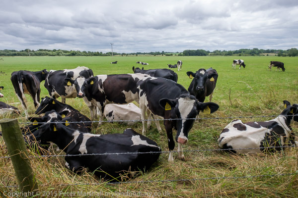
Cows next to a footpath by the River Thames

Winnersh Triangle sounds like a dangerous place to go, a new halt (hardly a station with a platform only a foot or two wide) on the Waterloo to Reading line that opened in 1986. It’s lightweight wood structure was designed not to put too great a load on the Loddon Viaduct on which it hangs, though there is a ticket office at ground level, closed when we arrived.

Loddon & Thames

Mostly Winnersh Triangle is home to company men and the companies they work for in what the web site describes as “an 85-acre, mature business environment” between the A329M motorway, the rail line and the River Loddon. The web site says it’s a place where “everyday things become exceptional and exceptional things happen every day“, but very little seemed to be happening on the day we went there. It didn’t look like a place where anything of interest ever happened, and its big selling point is that you can be at Heathrow in 30 minutes.

Loddon & Thames

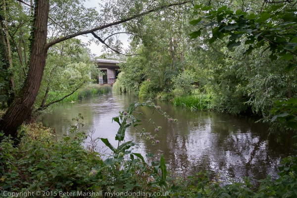
We took a quick look, didn’t like it and headed south under the railway to walk along the Reading Road to Loddon Bridge, joining a footpath that led north beside the River Loddon under the railway and motorway. You’ve probably never heard of the Loddon, but its a sizeable tributary of the Thames, that often gets too sizeable for its banks, flooding nastily. A man in council hi-viz who was checking the river gave us a 20 minute dissertation on this and related matters before we all escaped, though I’d wandered away taking pictures after the first five.

Loddon & Thames

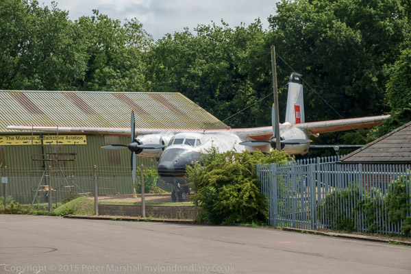
Fortunately the river was fairly low or we might have been paddling or swimming for the next mile or so, before the path veered away and climbed to a road and we found ourselves briefly in suburbia. Then we came across a large BEA twin prop plane, its presence soon explained by a sign ‘The Museum of Berkshire Aviation’. It was closed which saved us from having to decide if we wanted to be enthralled by “Berkshire’s dynamic contribution to aviation history.”

You can find out more on the museum web site, which includes a picture of a rather dinky little ‘Miles Pusher’, which was “built by F. G. Miles under protest and therefore never flew.” Miles went bust in 1947, and Handley Page took over the designs, accounting for the Handley Page Herald turboprop standing outside. Miles from 1942 had been designing an experimental supersonic jet aircraft to fly at 1000mph, but the Air Ministry in 1946 cancelled this, deciding only to build it as an unmanned rocket-powered scale model which achieved controlled flight at Mach 1.34 – 1020mph. The design of the Miles M52 informed the later English Electric Lightning which I saw at the Farnborough Air Show in the early 1950s and could out-perform anything from that era.

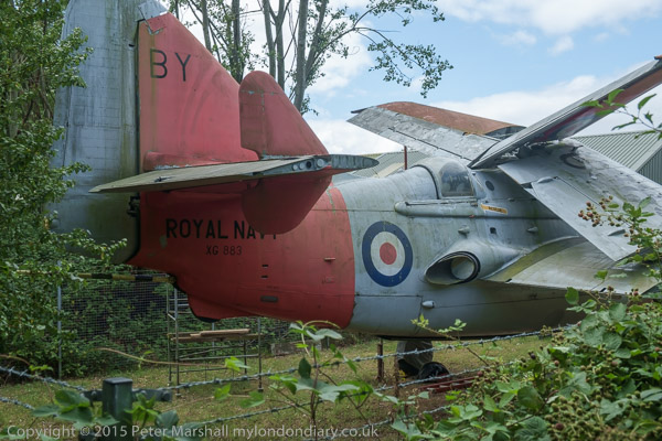
We didn’t hang around, though Sam looked up a few things on his mobile and we photographed the Fairey Gannet out the back before going along the footpath and down to the river to continue our path through rural Berkshire alongside the river to Whistley Mill Lane.

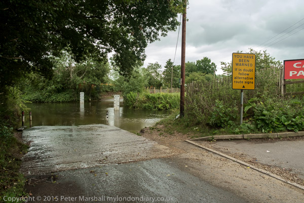
This leads to a ford over the Old River, still a stream of the River Loddon, and unless you are driving a Land Rover or something larger, its probably best to turn around and go back. The level markers were at 2 feet, but fortunately there is a footpath to a footbridge around 60 yards to the south which we crossed, taking us to the Lands End pub, which might have been a good place to lunch, but we had brought sandwiches.

The next mile or so took us through the Charvil, a suburban fringe of Twyford, and with some difficulty across the A4 to Milestone Ave, a narrow lane with some 1930s development on the east side for the first half mile or so. Just before a bridge over one of the minor arms of the Loddon, a footpath leads off to the River Thames. We’ve previously walked along the Thames path on the opposite bank, which we came on to a mile or two later as it crosses the bridge at Sonning.

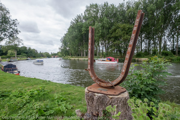
Sonning is home to Uri Geller

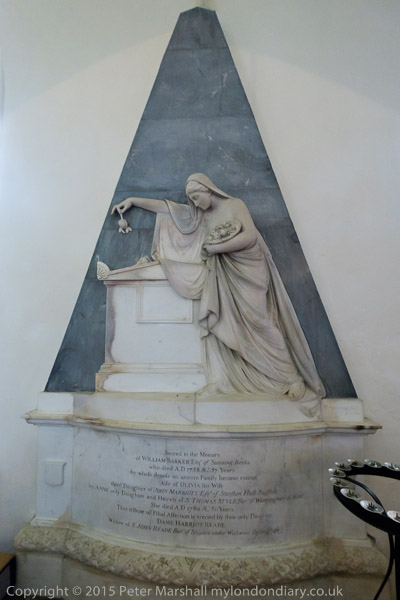
We took a look inside St Andrew’s Church there (and were given a copy of what must be one of the most lavishly produced church magazines in the country) and briefly explored the grounds before taking the path from the churchyard to rejoin the Thames path, walking along this into Reading for the train home.


Many more pictures from the walk on My London Diary.

Ghost Sign, Cooltan and a Cinema

The final episode in in the series of posts on my walk in south London on Sunday 6th May 1989. The walk began with Hanover, Belgrave, Chapel, Shops, Taxis. The previous post was Railton Road, Herne Hill.

Ghost Sign, S.Errington, Dulwich Road, Brixton, Lambeth, 1989 89-5f-41
Ghost Sign, S.Errington, Dulwich Road, Herne Hill, Lambeth, 1989 89-5f-41

I turned into Dulwich Road and walked up it towards Brixton, stopping to make very few pictures, perhaps keen to get to the end of the walk. Just before reaching Water Lane on the side of what was then Ellis Newsagents at 1a Dulwich Road I couldn’t resist the finely painted sign ‘
S Cooltan
ERRINGTON
DEALER IN
ANTIQUE
&
MODERN

FURNITURE

FURNITURE
BOUGHT
SOLD OR

in drop capitals, decorated with some fine curly bits. Clearly something at the bottom following the ‘OR’ had been painted over, but I couldn’t decide what it might have been. Perhaps ‘EXCHANGED’ or ‘HIRED’?

The property now looks to be residential, but on Google Maps it still appears as:
S Errington Dealer In Antique & Modern Furniture
Home Furniture Shop
Temporarily closed

and that sign is still there, rather more faded and with the lettering now looking very much plainer. Unfortunately although I will have had a camera body with colour film in my bag I did’t photograph this in colour. Some days I only thought in black and white.

CoolTan Suntan Lotion factory, Effra Rd, Brixton, Lambeth, 1989  89-5f-44
CoolTan, Suntan Lotion factory, Effra Rd, Brixton, Lambeth, 1989 89-5f-44

I walked along Brixton Water Lane, taking a couple of pictures (not digitised) on my way to Effra Road. The the names suggest I was following the route of the River Effra, underground since the early nineteenth century, but in fact I had been doing so all the way down from Herne Hill and was now walking away from it. Effra Road got its name from Effra Farm which was on the bank of the river.

CoolTan Suntan Lotion factory, Effra Rd, Brixton, Lambeth, 1989  89-5f-33
CoolTan Suntan Lotion factory, Effra Rd, Brixton, Lambeth, 1989 89-5f-33

The former Suntan lotion factory was squatted and in June 1991 became the CoolTan Arts Centre. They were evicted in February 1992, and the centre moved first to offices above Brixton Cycles before squatting the former Unemployment Benefit Offices in Coldharbour Lane. There it became a thriving art space, with a cafe, live music and offices for various campaign groups including Reclaim the Streets, Earth First! and the Green Party until 1995, when the building was taken over by The Voice newspaper – who boarded it up and left it empty and rotting. The Effra Road factory was demolished shortly after their eviction and remained as empty unused ground for over ten years.

CoolTan Suntan Lotion factory, Effra Rd, Brixton, Lambeth, 1989  89-5f-34
CoolTan Suntan Lotion factory, Effra Rd, Brixton, Lambeth, 1989 89-5f-34

But Cooltan Arts continued. From 1993-2016 Michelle Baharier was, as she writes in her statement on the South London Women Artists site, “Founder, Artistic Director and CEO of CoolTan Arts, London. In twenty-five years, I grew CoolTan Arts from an old suntan lotion factory squatted social centre in Brixton to a user-led disabled people’s arts and mental health charity. CoolTan Arts worked with over three thousand people face-to-face per year with its participatory art programme. The charity improved the lives of individuals with mental distress through creativity, self-advocacy, and volunteer opportunities within the arts. During my tenure at CoolTan I developed psycho-geography walks and other collaborative events with different communities.”

CoolTan Suntan Lotion factory, Effra Rd, Brixton, Lambeth, 1989  89-5f-35
CoolTan Suntan Lotion factory, Effra Rd, Brixton, Lambeth, 1989 89-5f-35

Clearly I was intrigued by this empty 1930s moderne factory and by its gates and their shadows. Unfortunately the gates were locked and although the fence was fairly low the location seemed a little public for me to climb over and explore the site further though it was more decorative than a real barrier. Eventually I managed to tear myself away and continue my walk, taking a few pictures not online as I walked past St Matthews Church and on to Brixton Hill.

Former Cinema, 101-3 Brixton Hill, Brixton, Lambeth, 1989 89-5f-24

The Tarpaulin & Ten Mfg Co, T&T was for many years in the former cinema, which was converted from shops and opened on 10th March 1911 as Brixton Hill Cinematograph Theatre, and was 13th of Montagu A. Pyke’s chain of Cinematograph Theatres. Pyke went out of business when he was jailed after his projectionist in his cinema died in a fire in 1914, and the cinema was taken over by others. It changed its name then and several other times over the years, operating under names including ‘New Royalty’, ‘New Royalty Kinema’ and finally the Clifton.

It showed its last film in 1957 and deteriorated badly before becoming the T&T shop. I think this kept going into this century and the building was up for sale in 2004 and became the Dalxiis Somalian restaurant. By 2008 the auditorium had been demolished and the front of the cinema had become the South Beach Bar, which lost its licence in 2012. In 2015-6 it was ‘Believers Home Chapel’ , in 2018 the S.G.H Events Hall and in 2019 the TAMI Gospel Centre of The Anointed Ministry International, though still with the South Beach Bar sign on that metal structure, empty in my picture at roof level that had once carried the The New Royalty Kinema and Camping Centre signs.

Post Office Building, Blenheim  Gardens, Brixton, Lambeth, 1989 89-5f-11
Post Office Building, Blenheim Gardens, Brixton, Lambeth, 1989 89-5f-11

I went down Blenheim Gardens, photographing this building, dating from 1891 and still in use by the Royal Mail as Brixton Delivery Office, and the windmill, before walking through the back streets between Brixton Hill and Tulse Hill on a roundabout way to Brixton Water Lane to catch a bus on my way home at the end of my long walk.


Railton Road, Herne Hill

The next episode in in the series of posts on my walk in south London on Sunday 7th May 1989. The walk began with Hanover, Belgrave, Chapel, Shops, Taxis. The previous post was Herne Hill, Dorchester and Carnegie.

Shops, Railton Rd, Herne Hill, Lambeth, 1989 89-5f-62

I wandered up Railton Road from the junction with Dulwich Road towards Herne Hill station. Herne Hill only appears to have got its name relatively recently, with the Herne Hill Society stating that the first documented reference dates from 1801. Earlier maps show it as King’s Hill or Dulwich Hill.

Neither of the two derivations they give seems particularly likely, with an Old English root hyrne (corner, angle) hyll seeming unlikely from the late appearance of the name and a roost of large numbers of heron on the nearby River Effra seems fanciful. Other possibilities put forward have been that it was named after a family called Herne who apparently lived here in the 17th century.

Perhaps the name really does come from Herne the Hunter, the mythical resident of Herne’s Oak in the Windsor Forest some twenty five miles or more to the west, transferred here by an early developer of the area who perhaps saw oak trees which reminded him of that place, perhaps also hearing the rattling of chains and ghostly moans in this area. Who knows?

Railton Road was apparently one of the roads developed in 1868, a few years after the coming of the railway, the station on this road opening in 1862. Until then the area had been one of large villas with leafy gardens for the wealthy, but soon became full of “smaller houses for clerks, artisans, craftsmen and their families, the workers taking advantage of cheap fares for commuting into London.

Shops, Railton Rd, Herne Hill, Lambeth, 1989 89-5f-63

The building at 222 Railton Road, here the Herne Hill Bingo and Social Club, was the Herne Hill Cinema, said to have opened in 1914, although there appears according to a postcard on Brixton Buzz to have been a cinema around here earlier than that. It’s narrow facade opened to a much wider auditorium behind which could seat 750.

Brixton Buzz quotes Cinema Treasures giving more information about its 1932 design by George Coles and closure as a cinema in 1959, but says it continued in use as a bingo club until 1986, then becoming shuttered and empty. Clearly it was locked and barred when I photographed it in 1989, and has a notice too small to read on its door, but doesn’t look in too poor condition. It is now a private bar, but apparently the auditorium area behind was demolished and housing built on the site.

Herne Hill Station, Railton Rd, Herne Hill, Lambeth, 1989 89-5f-66

Herne Hill Station was opened at the bottom of Herne Hill on Railton Road by the London, Chatham and Dover Railway in 1862. At first it was a terminus, with services only towards Victoria, but a year later the line was extended to Beckenham and by the end of the decade there were also services to “the City of London, King’s Cross, Kingston via Wimbledon, and Kent, including express trains to Dover Harbour for continental Europe.

The building with its polychrome brick Gothic tower seems excessive for what was a small suburban station, and was certainly intended to impress. The tower held the water tank needed by steam locomotives. The Wikipedia article quotes The Building News description of the station from 1863 as “spacious and convenient … and of the very best quality” and states “an unusual amount of decorative taste has been displayed“. It became an exempler of Victorian railway architecture.

Shops, Railton Rd, Herne Hill, Lambeth, 1989 89-5f-65

This view looks toward the corner with Rymer St, which now takes traffic from Railton Road to Dulwich Road as Railton Road a little further north is now a no-entry street for motorised traffic other than buses.

At left is 200 Railton Road and at right, next to an alley is an accomodation bureau and letting service at 289, now the home of Herne Hill Books. Apparently this stretch of road was until 1888 known as Lett Street. The alley was once a public footpath, and looks as if it was still in 1989.

This view still looks much the same now, with the two 19-storey blocks of Park View House and Herne Hill House in Hurst Street, each built in 1966 with 72 flats, towering over the neighbourhood. Park View House many be blessed with a view of Brockwell Park, but unfortunately you can see it and its neighbouring tower from the park.

Railton Rd, Rymer St, Herne Hill, Lambeth, 1989 89-5f-51

A closer view of 200 Railton Road. I have been unable to find out more about this building. Two of the three ground-floor shops appear to have been converted to to residential use by the time I made this picture.

Shops, Railton Rd, Herne Hill, Lambeth, 1989 89-5f-55

I walked back down south down Railton Road to the junction with Dulwich Rd, stopping to photograph this terrace of shops at 315-323 Railton Road. This is now a pedestrian area and the shops are rather different in nature.

I liked the sign at left on 315, ‘Only the best is good enough for me‘ though with the metal shutters up on a Sunday I could not be sure what it sold, though I think it was probably a greengrocers.

To be concluded in another post.


Herne Hill, Dorchester and Carnegie

Herne Hill, Dorchester and Carnegie: Another episode in in the series of posts on my walk in south London on Sunday 7th May 1989 (on earlier posts I put the date wrongly as 6th May). The walk began with Hanover, Belgrave, Chapel, Shops, Taxis. The previous post was Ruskin & Half Moon, Herne Hill.

Houses, Herne Hill, Herne Hill, Lambeth, 1989 89-5e-34

There are some fine late Victorian houses on Herne Hill and most seemed in a good state of repair, though this one was getting some major work done. The chimneys are impressive. If you click on the image you will go to my Flickr album where you will find a couple more pictures of houses on this section of the street – and there are also a few I haven’t put online.

Flats, Dorchester Court, Herne Hill, Herne Hill, Lambeth, 1989 89-5e-23

A little further up I came to this splendid group of 1930’s ‘moderne’ style flats. There are 96 flats in 8 blocks around a courtyard. Built in 1933-4 Dorchester Court is Grade II listed, the architects were Leslie H Kemp and Frederick E Tasker and the estate was developed by a local builder and developer, Mr Morrell. The name probably came from that of the Dorchester Hotel which had been opened in 1931 on Park Lane intended to be the perfect luxury hotel.

According to Historic EnglandThere are structural problems with the balconies and general external deterioration. A Listed Building Consent application for the extension and refurbishment of the blocks is pending determination” and the Evening Standard in 2022 ran an article with the impresively long headline “Inside neglected Art Deco block where residents face carbon monoxide leaks, mice, cockroaches and lead pipes” stating “Residents at the Herne Hill estate are stuck in a nightmare.”

Until recently Dorchester Court was owned and neglected by the property company Manaquel, a family company whose wealth is estimated at £200 million. The Standard says they have appealed against a 2021 improvement notice from Lambeth Council and that their “endgame appears to be a full-scale redevelopment.”

The Dorchester Court Tenants Union sate that “Dorchester Court is operated by Property Partners, who are owned by Beaumaris Ventures Limited (British Virgin Islands), a financial intermediary of the IFM Group Limited (Jersey), who are both listed in the Panama Papers. Dorchester Court generates around £1.5 million in rent per year with additional income from leaseholder service charges.

House, 10-12 Herne Hill, Herne Hill, Lambeth, 1989 89-5e-24

A grand pair of Italianate mid-19th century semi-detached houses, now flats, with a most unusual design. The house has now lost its white fence and rather hides behind a brick wall and a tall hedge.

Carnegie Library, Haredale Rd, Herne Hill Rd, Herne Hill, Lambeth, 1989 89-5e-11

I turned left into Herne Hill Road from Herne Hill, and walked along it to photograph the Haredale Road frontage of the Carnegie Library before going on to photograph the main entrance on Herne Hill Road. This Grade II listed library is one of those built with a grant from Scottish-American steel baron, Andrew Carnegie, using his vast profits from his ruthless exploitation of workers to establish over 2,800 libraries. He provided a grant of £12,500 to enable the Herne Hill Library, designed by architects Wakeford and Sons, to be built and opened in 1906.

Carnegie Library, Herne Hill Rd, Herne Hill, Lambeth, 1989 89-5e-12

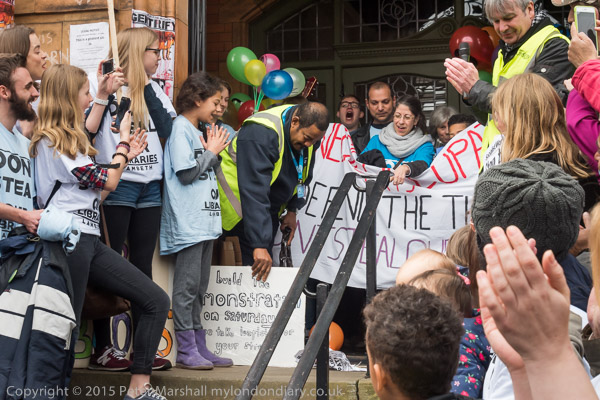
I was back at the library in 2016 at the end of a ten days of occupation by local residents against Lambeth council’s plans to turn it into a fee-charging gym run by Greenwich Leisure Ltd with an just un-staffed lounge with books. Their occupation had hit national headlines with huge support from around the country.

The gym plans went ahead, but with a little more library provision than originally planned and there is also now the Carnegie Library Hub based in the building, “a thriving sustainable centre of local activity attractive to the whole community for developing employment opportunities, learning, fitness and wellbeing, cultural and social activity” which protects and celebrates its history and legacy.

I didn’t take many more pictures as I walked back to Herne Hill and walked back down it. After a short walk along Half Moon Lane I turned around and went towards the station, where the next part of this walk will begin.