Jews, a Bishop and the Sally Army

Jews, a Bishop and the Sally Army: Continuing my walk in October 1988 around Clapton – the previous pos was Hats, Bags, Passports, Mansions, Biocrin & Hollywood.

Jewish Free School,  Lea Bridge Road, Clapton, Hackney, 1988 88-10b-41-Edit_2400
Jewish Free School, Lea Bridge Road, Clapton, Hackney, 1988 88-10b-41

The Jewish presence in Hackney dates back to the late 17th century and grew greatly in the late nineteenth and early twentieth century, and by the 1950s it was said to have the largest and densest Jewish population in the country. Many were supporters of the Labour party and local councillors and leaders, and among former Jewish Free School pupils is Labour life peer Maurice Glasman, Baron Glasman. Other well-known Jewish people who grew up in Clapton include Helen Shapiro, Harold Pinter, Lord Levy and Lord Sugar. Since the 1970s the area has been home to a fast growing ultra orthodox community.

The Clapton Jewish Day School was established next to the synagogue in Lea Bridge Road in 1956, though these splendid gates may be older. The school moved to Cazenove Road in 1973 as the voluntary aided Simon Marks Jewish Primary School and is the only remaining mixed Jewish school in inner London.

Clapton Federation Synagogue, Lea Bridge Road, Clapton, Hackney, 1988  88-10b-43-Edit_2400
Clapton Federation Synagogue, Lea Bridge Road, Clapton, Hackney, 1988 88-10b-43

Clapton Federation Synagogue or Sha’are Shomayim (Gates of Heaven) was founded in 1919 by Elias Ephraim Frumkin (1880-1958) whose family were well-known East End wine merchants Frumkin & Co. In 1932 the synagogue moved into this fine Art Deco new building by architect Marcus Kenneth Glass with a polychrome facade and mosaics at 47 Lea Bridge Rd. In 2005 the congregation moved out to hold its services in the Springfield Synagogue on Upper Clapton Road. Attempts to have the building listed unfortunately failed and it was demolished in 2006, replaced by a rather ugly large block of flats.

The Frumkin family had settled in Whitechapel around 1893, and opened a shop the following year selling Kosher wines on the corner of Commercial Road and Cannon Street Road. Elias, the son of the founder developed the Cherry Brandy for which the company became famous. The firm which supplied wine for many weddings and Bar Mitzvahs later opened branches in Edgware and the West End but finally closed in 1997.

Bishop Wood's Almshouses, Lower Clapton Rd, Lower Clapton, Hackney, 1988 88-10b-44-Edit_2400
Bishop Wood’s Almshouses, Lower Clapton Rd, Lower Clapton, Hackney, 1988 88-10b-44

This is said to be Hackney’s oldest building. These Grade II listed almshouses facing Clapton Pond were opened in 1665 by Dr Thomas Wood, who had been born in Hackney, to provide homes for 10 poor elderly widows over the age of 60 years. In 1671 Wood was made Bishop of Lichfield and Coventry, but he preferred to stay living at home in Hackney and was eventually suspended as Bishop in 1684.

A very small chapel, with just 10 seats for the widows was added in 1845, and the almhouses refurbished in 1888, then in 1930 converted by the trustees into five self-contained apartments with separate facilities. After being requisitioned in World War II they reopened in 1948, and were further refurbished in 1985. Around 2010 the trustees decided that they were too expensive to maintain and bring up to modern standards and moved the residents to refurbished almshouses nearby in 2013. The buildings were put up for sale.

Lower Clapton Rd, Lower Clapton, Hackney, 1988 88-10b-46-Edit_2400
Lower Clapton Rd, Lower Clapton, Hackney, 1988 88-10b-46

Pond House at 162 Lower Clapton Rd was clearly not in the best of condition when I photographed it in 1988, despite having been Grade II* listed back in 1951. It has this fine semicircular Doric porch and was built in a Greek Revivial style for City stockbroker Benjamin Walsh between 1802 and 1803. Walsh became an MP in 1808 to escape bankruptcy proceedings but had to sell the house in 1809. He was expelled from the Stock Exchange and convicted of felony after defrauding a fellow MP of £22,000 but was pardoned for dubious reasons.

In 1877 it changed from a family house to a Girl’s school which closed in 1904, and it then became a clothing factory. In 1939 it became a social club for volunteers in the Hackney Rifle Regiment, who made several alterations and repairs causing it to be placed on English Heritage’s At Risk register. The social club sold it for development in 2008.

After a two rejected planning applications it was finally redeveloped by One Housing Group with four homes in the main building and it looks in fine condition as pictures on the The Clapton Pond Neighbourhood Action Group web site show.

Former Salvation Army HQ, Congress Hall, Linscott Rd, Lower Clapton, Hackney, 198 88-10b-31-Edit_2400
Former Salvation Army HQ, Congress Hall, Linscott Rd, Lower Clapton, Hackney, 198 88-10b-31

You can still see the shell of the former London Orphan Asylum dating from around 1823 by William Southcote Inman. The orphanage moved to Watford in 1867. In 1882 it became the the Salvation Army’s Congress Hall with a meeting hall built in what had been an open courtyard that could seat 4,700. Until 1929 it also housed the Salvation Army’s training college with accomodation for 150 men and 150 women. Congress Hall closed in 1970 and the building was acquired by Hackney Council, who demolished most of the building in 1976 to build Clapton Girl’s School on the site, leaving only the west portico and its flanking colonnades standing.

Former Salvation Army HQ, Congress Hall, Linscott Rd, Lower Clapton, Hackney, 198 88-10b-34-Edit_2400
Former Salvation Army HQ, Congress Hall, Linscott Rd, Lower Clapton, Hackney, 198 88-10b-34

In 2003 permission was granted for a rear extension and use by The Learning Trust Hackney as the Portico City Learning Centre, with work costing £1.9m supported by a Heritage Lottery Grant which restored the deteriorating structure. You can read a recent detailed heritage statement on the Hackney Council web site.

Lower Clapton Rd, Lower Clapton, Hackney,  1988 88-10b-24-Edit_2400
Lower Clapton Rd, Lower Clapton, Hackney, 1988 88-10b-24

A showroom wall display of spraying equipment somewhere on the Lower Clapton Road, between Linscott Road and Clapton Passage. There seemed to me a certain surreal quality to the display of around seventeen near identical spray guns.

My walk will continue in a later post. You can click on any of the images to go to larger images in my album 1988 London Photos, from where you can browse the album. The images in this post, but not in album, are displayed in the order they were taken on my walk.


Hats, Bags, Passports, Mansions, Biocrin & Hollywood

Hats, Bags, Passports, Mansions, Biocrin & Hollywood: This post continues my 1988 walk South Stokey & Hornsey Detached posted a few days ago.

Marmel & Grossmith, Hat Co Ltd, Boleyn Road, Dalston, Hackney, 1988 88-10a-24
Marmel & Grossmith, Hat Co Ltd, 1 & 2 Boleyn Road, Dalston, Hackney, 1988 88-10a-24

Back Road Kingsland dated from 1839 and was renamed Boleyn Rd in 1877, one of a number of local streets given names associated with Henry VIII who was alleged to have used a hunting lodge on nearby Newington Green. Until 1877 the road like many others in London was divided into a number of blocks or terraces each given its own name by the developers and many streets were renamed around then to end this confusion.

I’m not sure when Marmel & Grossmith set up their hat factory here, but in 1940 they had a hat factory at 159 Commercial St, Whitechapel. I don’t know when hat production ended in Boleyn Road, though the fly-posting suggests the works was no longer in use. The 33 flat Dalston Hat apartments into which the factory was transformed bear little resemblance to it but have an entrance marked by a giant top hat.

Cambay Ltd, Alpha House, Tyssen St, Dalston, Hackney, 1988 88-10a-25

Alpha House was on Tyssen St which runs north from Dalston Lane, just to the south of where it bends 90 degrees to the east until 2014, although around 2010 the signs for Cambay Bags Luggage & Travel Goods were replaced by those for Cyclone Design Lab. The new flats have solicitors offices on the ground floor.

I was attracted by the confusion of notices and also by the pictures of a large bag, and on the van, a man perhaps cleaning a car.

Dalston Lane, Dalston, Hackney, 1988 88-10a-12-Edit_2400
Dalston Lane, Dalston, Hackney, 1988 88-10a-12

Back on Dalston Lane there was a photographer’s shop window, something I always stop and have a look in. . The most interesting part to me was a framed selection of 16 passport pictures (with a label stating PASSPORTS in case we were not sure), which I thought gave a good representation of the local community.

Navarino Mansions, Dalston Lane, Hackney, 1988 88-10a-15-Edit_2400
Navarino Mansions, Dalston Lane, Hackney, 1988 88-10a-15

Walking towards Hackney I went past Navarino Mansions built in 1885 by the Four Percent Industrial Dwellings Society as 300 flats for Jewish workers from the East End. The architect, Nathan S.Joseph, set new standards for social housing in creating a building that was in finest style of the era as well as providing for the time high standards of provision.

Still owned in 1986-92 by the same organisation, then called simply the Industrial Dwellings Society [IDS] they were treated to a major refurbishment in 1986 to bring them up to modern standards, including the provision of lifts and new gardens in the courtyards and providing more spacious family accommodation.

House, St Mark's, Church, Colvestone Crescent, Dalston, Hackney, 1988 88-10b-61-Edit_2400
House, St Mark’s, Church, Colvestone Crescent, Dalston, Hackney, 1988 88-10b-61

I think I continued my walk back towards Dalston, probably going along Ridley Road – I liked going to the market there, though seldom took photographs – and turning up St Mark’s Rise with the intention of photographing St Mark’s Church which is a prominent local landmark – sometimes called the ‘Cathedral of the East End’, it is one of the largest parish churches in London and used once to have over 2,000 attending its Sunday services.

The church is Grade II* listed, with a nave by Chester Cheston Junior built in 1864-6 and its distinctive tower by Edward Lushington Blackburne added in 1877-80. The area around was developed in the 1860s as housing for the wealthier middle class who worked in the City.

Vine's Biocrin Ltd, Clarence Rd, Lower Clapton, Hackney, 1988 88-10b-52-Edit_2400

Vine’s Biocrin Ltd, 111, Clarence Rd, Lower Clapton, Hackney, 1988 88-10b-52

You can still buy a range of Vine’s Biocrin hand sanitiser, oils and creams although I think the original company, incorporated in 1937 for the “Manufacture of soap and detergents – Manufacture and wholesale of toilet preparations ” was dissolved around 2000.

The products, apparently still largely made for hairdressers, are now made elsewhere as this small factory has been replaced by flats, although the building part shown at the left is still there, now Capital Die-Stamping and The Hill Church at “Holy Anointing Christian Centre Where All Yoke Are Broken By The Anointing.” I don’t know if Vine’s make an anointing oil.

Kenninghall Rd, Hackney Downs, Hackney, 1988 88-10b-54-Edit_2400
Kenninghall Rd, Hackney Downs, Hackney, 1988 88-10b-54

I think this is De Vere Court at 63 Kenninghall Road, but if so the details on the impressive porch have been lost presumably in the conversion to 14 flats. Their are other impressive porches on the street but the brickwork around the first floor windows is unusual.

Hollywood Studios, Upper Clapton Rd, Clapton, Hackney, 1988 88-10b-56-Edit_2400
Hollywood Studios, Upper Clapton Rd, Clapton, Hackney, 1988 88-10b-56

The Lea Bridge Tramway Depot at 38-40 Upper Clapton Road was built in the Victorian era for horse-drawn trams, opening in 1873, and remains, its future under much doubt, as one of the few remaining examples of a Victorian horse-drawn tram depot in London.

The existence of the trams, taking people to work in the City and the West End until 1907 drove the development of a thriving suburb in Clapton. Until recently many of the buildings were in use by a range of businesses who were forced to quit after planning permission was given for this locally listed building to be demolished and the site redeveloped in 2011. Statutory listing was refused in 2005, probably because of English Heritage’s snobbish lack of interest in our industrial past. Hollywood Studios was a rehearsal room and recording studio used by groups including Iron Maiden occupied a part of the buildings for a few years from 1983.

My walk around Clapton in 1988 will continue in a later post.

South Stokey & Hornsey Detached

Stoke Newington or ‘Stokey’ has a well-deserved reputation for non-conformity of all kinds. The area from the middle-ages attracted many religious dissenters, Quakers and other non-comformists. Among them have been Isaac Watts, Daniel Defoe, John Howard, Edgar Allan Poe and Joseph Conrad. More recent years have seen many squatters, artists and bohemians, as well as political radicals, including Angy Brigade and IRA bombers. You can see a long list on Wikipedia. Although its now become rather gentrified, at least in parts, there are still signs of its more anarchic past. Parts of the area I walked around in the south weren’t even in the area until 1900, but were ‘Hornsey Detached’ – and Hornsey is several miles to the northwest.

School, Smith & Sons, Wordsworth Rd, Hackney, 1988 88-10a-42-Edit_2400
School, Smith & Sons, Wordsworth Rd, Hackney, 1988 88-10a-42

St Matthais C of E Primary is still in use at the rear of Smith & Sons at 22-32 Matthias Rd, N16, Ironmongers & Builders Merchants. This writing has now gone, but the building was still there and in a similar use as one of the more Travis Perkins showrooms until around 2019.

New Coach & Horse, pub, Matthias Rd, Stoke Newington, Islington, 1988 88-10a-44-Edit_2400
New Coach & Horse, pub, 69, Matthias Rd, Stoke Newington, Islington, 1988 88-10a-44

The Coach and Horses was in business here at least since the 1850s and in one early record the street was called Coach and Horse Lane. I’m not sure when it got the New in its name, perhaps after it stopped being a Reid & Co pub and serving their ‘Entire’. The company was founded to take over a brewery in Clerkenwell in 1757 by Richard Meux and Mungo Murray and only picked up Andrew Reid as a partner in 1793, becoming Reid& Co in 1816. They stopped brewing in 1899 after becoming a part of Watney, Combe, Reid & Co. Ltd in the first big merger in the UK brewing industry, but Watney continued for years to use the brand name for some beers.

At a glance the pub appears open, but the two long brackets without pub signs are presumably a sign that it had closed. Shortly after it was converted into flats.

Milton Grove, Stoke Newington, Hackney, Islington, 1988 88-10a-32-Edit_2400
Milton Grove, Stoke Newington, Hackney, Islington, 1988 88-10a-32

I took a couple of pictures at Newington Green (not online) before being attracted up the narrow passage of Church Walk and through the footpath to Howard Road and then taking Milton Grove, home of five times world professional darts champion Steve Bristow who lived at 97.

I don’t know of any particular link with Milton and Stoke Newington but when these streets but when the National Freehold Land Society laid out the streets in the area in 1852 they created Milton Grove along with Shakespeare Walk and Spenser Grove. Much of the area was destroyed in the war and rebuilt as the Milton Gardens Estate. And behind me as I took this picture was an open space, once a bomb site but kept as Butterfield Green. Bombs came into Milton Groves story again some years later in 1975, when an IRA bomb factory was discovered in a top floor flat at no 99.

A little to the south is an alley, Town Hall Approach, but you will find no sign of a town hall should you walk down it. This was the site of the Italianate South Hornsey Town Hall built by E Fry in 1881 which became the town hall of the Metropolitan Borough of Stoke Newington when this was created in 1900. Stoke Newington was only half the required size for a London borough, but the authorities granted it borough status to avoid “intolerable and interminable feuds” had it been subsumed into Hackney – which it eventually became part of, apparently without a revolution in 1965. But the old town hall was too small and after 37 years the borough opened a new one designed by John Reginald Truelove on Church Street – now a listed building – but the ‘approach’ is still there.

I wondered why No 72 was built with this large window and imposing door – perhaps it was a former chapel long converted to residential use. A few doors down, just visible over the cab of this recovery vehicle is the only listed building in the street, No 66, described (in part) as “Mid C19 villa of 2 storeys and basement, 3 windows. Stock brick….” Certainly a pleasant enough house but nothing in the text seems to justify the listing or greatly differentiate it from others in the area.

Nevill Rd, Stoke Newington, Hackney, Islington, 1988 88-10a-33-Edit_2400
Nevill Rd, Stoke Newington, Hackney, Islington, 1988 88-10a-33

It was quite a long walk before I made my next exposure at 29 Neville Road, once home to G Howell Upholsterer, but in 1988 flyposted against the Poll Tax. Something about the doorway at right of this image screams “Pub!”, and this was then The Nevill or The Nevil Arms.

Once specialising in Smith, Garrett’s Special Mild Ale, it had a moment of fame in May 1915 when a bomb dropped in its back garden during London’s first Zeppelin raid. A large incendiary bomb, it failed to ignite and did no damage. It was thought at one time to have been the first bomb dropped on London, but that fell a short distance away in Alkham Road. The pub was on this site since the 1870s and latterly a Charrington’s pub. I think it closed shortly after I made this picture and was converted to residential use around 2000.

A photograph after the raid shows that No 21 on the other side of the shop was quite badly damaged, certainly its windows blown out, while the shop, then selling confectionary and advertising local Clarnico along with Rowntrees Chocolates and (I think) R Whites Ginger Beer appears undamaged with a woman looking out of the second floor window as the crowd gawping at the damage next door.

Stoke Newington Rd,  Hackney, 1988 88-10a-34-Edit_2400
Stoke Newington Rd, Hackney, 1988 88-10a-34

This and the picture below were from a window of the same shop, protected by a strong wire grill. And while I may have known more when I took them, they are now a mystery to me.

What is on sale here? Is it wigs? The strange prints are part of a collection and have reference numbers at the lower left, but what collection? The name appears to start BI or even BII and end IERTON but the wire prevents me seeing the letters between and I can find nothing which fits between to make sense to me.

Stoke Newington Rd,  Hackney, 1988 88-10a-35-Edit_2400
Stoke Newington Rd, Hackney, 1988 88-10a-35

The second picture simply adds more confusion. Are these wigs or examples of hair styles or some curious sculptural art? I was always attracted by representations of the human form or face and photographed the window of many hairdressers and some shops selling wigs, but these just don’t seem to fit the pattern.

Imperial Avenue, Stoke Newington Estate, Stoke Newington, Hackney, 1988 88-10a-21

The fine 1903 Stoke Newington Estate by the Four Per Cent Industrial Dwellings Company in Coronation Avenue and Imperial Avenue (and still run by the IDS) was the site of one of the greatest civilian tragedies of the London blitz, when on 13th October 1940 it received a direct hit from a high-explosive bomb, probably a parachute mine. The Coronation Avenue block of the estate collapsed into the large communal air-raid shelter in its basement; many were killed directly while others were unable to make their escape as the cellar flooded with water. At least 160 people are thought to have died.

Azizye Mosque, Stoke Newington High St, Stoke Newington, Hackney, 1988 88-10a-23

The Apollo Picture House opened in 1913, becoming the Ambassador Cinema in 1933 and in 1966 became a bingo hall but was reopened as the Astra Cinema in 1974. It was soon converted into a cinema club showing martial arts and softcore sex films until it closed in 1983. It was then converted into a Turkish mosque, with its interior features being gutted and its exterior covered in highly coloured mozaic. The cinema had already had a Moorish look with the two domes at each end of the facade.

To be continued in a later post.


Paragon, Fashion, Morning Lane & Nautilus 1988

Paragon, Fashion, Morning Lane & Nautilus 1988 is the third and final post on my walk in on a Sunday in late September 1988. The first post was South Hackney Walk 1988 and it continued with the equally unimaginative title More South Hackney 1988. So I could have called this ‘Yet More South Hackney’. But the end of the walk took me further north towards the centre of Hackney – and I felt readers deserved something more interesting for a change.

Paragon Rd, Hackney, 1988 88-9d-34-Edit_2400
79-83 Paragon Rd, Hackney, 1988 88-9d-34

At 69-83 Paragon Road are four linked pairs of early-mid C19 houses with a Greek key pattern above the ground floor windows. My picture shows the east end of the row. They are Grade II listed as 71-83. The Buildings of England London 4 North states they were built in 1809-13 and suggests as the land was owned by St Thomas’s Hospital the design, which they suggest was inspired by Blackheath’s Paragon, may have been by the hospital’s surveyor Samuel Robinson or its builder Robert Collins

Bestglare Ltd, Esme Ltd, Ram Place, Hackney, 1988 88-9d-21-Edit_2400
Bestglare Ltd, Esme Ltd, Ram Place, Hackney, 1988 88-9d-21

I’m not sure that these same industrial units are still in Ram Place or have been replaced. The block closed to Chatham Place became AquaScutum when the area on Morning Lane was funded as a fashion quarter following the 2011 riots. But a few years later most of the stores had closed down. Aquascutum was one of the last to go, selling off £750 macs in its final sale for £75 – still more than I’d want to pay.

Hackney has strong links with fashion – but not so much with the higher end as with street and sweatshop, and many doubted the project from the start.

Sawyer Sewing Machines, Morning Lane, Hackney, 1988 88-9d-26-Edit_2400
Sawyer Sewing Machines, Morning Lane, Hackney, 1988 88-9d-26

The sewing machine shop at 99 Morning Lane was still in business, though from what we can see mainly dealing in more industrial than domestic machines, though a sign in the window does state ‘DOMESTIC MACHINES SERVICED & REPAIRED’. But next door at 101 the High Class Shoe Repairs have closed and the windows above are bare of glass, looking blind.

By 2008 the Sewing Machine shop was selling car spares, but next door was even more derelict and for sale. It was being refurbished in 2011 and was part let as residential the following year. By 2012 the ground floor was coffee & tea and car spares had given way to Morning Bedzzzzz and then fashion took over with The Hackney Shop and brew for two. But fashion changed and moved from Hackney with 2021 seeing the corner shop be transformed into ‘Beauty by Saima’. Brew for two branched out to sell garden plants as well as being a café.

Mini Cab Office, Morning Lane, Hackney, 1988 88-9d-12-Edit_2400
Mini Cab Office, Morning Lane, Hackney, 1988 88-9d-12

The Mini Cab Office was on a short road leading north from Morning Lane, and along with another property I photographed, Doreen’s Pet Centre (not online) this land was bought by Tesco in 1997 and is now underneath their store and car park.

Security Centre, Mare St, Hackney, 1988 88-9d-14-Edit_2400
Security Centre, Mare St, Hackney, 1988 88-9d-14

H & S Security Centre at 232 Mare St claimed to be specialists in all forms of security and had some rather fancy wrought iron railings, though would weld in rather plainer forms of protection. They had left a rather wide open area for some misguided youth to chalk in the word Sex, though there was something desperate in that last letter as if the culprit had been caught in the act.

You can still see the railings on the steps leading up to the front door but there is no sign of any business operating from here, part of a Grade II listed early 19th century terrace.

Mare St, Hackney, 1988 88-10a-61-Edit_2400
Diver, Mare St, Hackney, 1988 88-10a-61

Inside a shop window on Mare St I found a diver, or a least a diving suit with a rather realistic hand and hanging up to the left a selection of Solent divers neoprene dry suits. This was Collins & Chambers Ltd at 197-199 Mare Street with a shop named Nautilus immediately south of Cyntra Place, demolished in 2012, listed as supplying Scientific Equipment, Divers Equipment Supplies, Diver Equipment. Mare St Star Night supermarket opened there around 2018 supplying all your pan-Asian grocery needs.

I turned around somewhere near here and walked back up towards Hackney Central Station and the end of my walk, pausing briefly to photograph the side of the Hackney Empire (not on line) on my way.


More South Hackney 1988

More South Hackney 1988

Bucknell House, Victoria Park Rd, Hackney, 1988 88-9c-13-Edit_2400
Bucknell House, Victoria Park Rd, Hackney, 1988 88-9c-13

After eating my lunch in Victoria Park where I finished my previous post on this walk I went back to Victoria Park Rd and photographed No 78, Bucknell House, which seemed to be the site of a great deal of building activity, though I suspect not by Barry Bucknell who had been the great DIY expert on TV in the 50s and 60s with “Do it Yourself” and then “Bucknell’s House”.

Back then TV was broadcast live, and the programmes often ended in disaster, much to the viewers amusement. The street was built after Victoria Park, bought by the Crown, opened in 1845, stimulating development in the area which had before been slow.

Warneford St, Hackney, 1988 88-9d-64-Edit_2400
Warneford St, Hackney, 1988 88-9d-64

Much of the land in the area belonged to St. Thomas’s hospital and the trustees of the Sir John Cass Foundation (hence the name Cassland Rd.) I think these houses in Warneforde Street probably date from around the 1880s.

Victoria Park Rd, Hackney, 1988 88-9d-52-Edit_2400
Victoria Park Rd, Hackney, 1988 88-9d-52

These are some of a row of six very similar detached houses on the north side of Victoria Park Road just to the west of Clermont Road, numbers 69-81, I think these are probably 73 to 69. No house numbers are visible in the picture as is often the case, with properties either not having a number or these being too small to be visible. There were seldom bins visible back in 1988 with large house numbers on them, though now we all have wheelie-bins these are often the easiest way to find house numbers.

The Triangle, Mare St, Hackney, 1988 88-9d-53-Edit_2400
The Triangle, Mare St, Hackney, 1988 88-9d-53

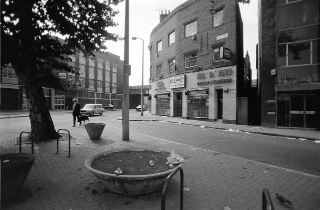
I’d walked past The Triangle where Mare St and Westgate Street meet earlier and had taken one picture (not online), but coming back later I made three more, another similar to this one and a third from a few yards further back including a large three-legged notice board telling me the is as the London borough of Hackney and a couple of modern telephone booths. But my main interest was in the building housing M.R.S.[Hackney]Ltd., T.V.s & Appliance Dealers and above them Baker Finance offering Personal Loans.

Just a few yards away I found more large graffiti, urging ‘Don’t mug me. MUG A YUPPIE!!!MUG A YUPPIE!!!’ but so far I’ve not scanned that frame.

Fashions, Mare St, Hackney, 1988 88-9d-43-Edit_2400
Fashions, Mare St, Hackney, 1988 88-9d-43

I walked further up Mare St, past the Cordwainer’s College, now part of the London College of Fashion but originally built in 1877 as Lady Hollis’s School for Girls, which moved to Hampton as Lady Eleanor Hollis in 1936 and it later turned down my sister for having working class parents (picture not online.) I then photographed this entrance, I think on the west side of Mare St, to Le Duman – Fashions of London – Ladies Fashions Factory Shop. It claimed to be ‘Now Open To The Public’ but that was only Monday-Friday, and it was Sunday.

Darnley Rd, Hackney, 1988 88-9d-46-Edit_2400
Darnley Rd, Hackney, 1988 88-9d-46

Further on up Mare St I photographed another block with an interesting corner on Darnley Rd and then this rather narrow alley leading to some industrial premises which I think was between two more interesting buildings on Darnley Road I failed to photograph!

Darnley Rd, Hackney, 1988 88-9d-31-Edit_2400
Darnley Rd, Hackney, 1988 88-9d-31

In Darnley Road I came across these houses which although they seemed to be in poor condition were still lived in. I wondered at their wide double doors. They are still there, though I think most have now been extensively refurbished into expensive flats. Darnley Road dates from 1853 and was one of the areas in which the well-to-do late Victorians lived.

Darnley House, Darnley Rd, Hackney, 1988 88-9d-33-Edit_2400
Darnley House, Darnley Rd, Hackney, 1988 88-9d-33

And also in Darnley Rd, No 57, the last house before the corner with Brenthouse Road was certainly very much in the middle of its complete refurbishment, and I was unsure if it was to be demolished. It looks very smart now, except that its gateposts do not quite match. That on the left has a low pyramidal cap with the word DARNLEY on its front edge, while at the right of the entrance is much flatter and wordless – and the brickwork below is not quite the same. The wall and posts are separately Grade II listed to house, and the listing of the posts mentions the inscribed word HOUSE – which isn’t there. My picture only shows a side of the left post. In 1927 this was the home of Dinshaw Phiroze, physician & surgeon, about whom I can tell you nothing more.

More pictures from this walk in South Hackney to follow in a later post, Paragon, Fashion, Morning Lane & Nautilus 1988.


South Hackney Walk 1988

South Hackney Walk 1988
It was not until Sunday 18th September 1988 that I had the time for another walk with my cameras around London, taking a train and tubes to Bethnal Green Station and walking north up Cambridge Heath Road to Mare St in Hackney.

Victoria Buildings, Mare St, Hackney, 1988 88-9c-53-Edit_2400
Victoria Buildings, Mare St, Hackney, 1988 88-9c-53

I stopped to take another photograph of the fine late Victorian commercial building with its row of shops at ground level and a bricked up doorway, particularly attracted by the multiple identities of No 7 as Aarons Van & Car Rental with Doris Car Service partly covering yet another. In the top left corner of the shop window it tells us ‘UNDER NEW MANAGEMENT’ while a rather drunken notice lower down states ‘YOU DRINK WE DRIVE’. Above Simply Seconds at No 9 were peeling posters and the upper floors appeared largely unoccupied.

Rich Scum out of Hackney!!, Westgate St, Hackney, 1988 88-9c-56-Edit_2400
Rich Scum out of Hackney!!, Westgate St, Hackney, 1988 88-9c-56

A little further up Mare St I wandered briefly down Westgate St, to record the graffiti on its railway bridge, which above the advert for LEATHER MERCHANTS gave the clear message ‘RICH SCUM OUT OF HACKNEY!!’. The bridge has been regularly repainted over the years, but I think later graffiti has been non-political.

King Edwards Rd, Hackney, 1988 88-9c-43-Edit_2400
King Edwards Rd, Hackney, 1988 88-9c-43

On King Edwards Road off to the west of Mare Street I came across a fine piece of architectural decoration with peeling paint and shrubs growing from it at No 6. The house next door, No 8 had a similar feature in better condition and a little more ornate which I also photographed but is not on-line.

Synagogue, Ainsworth Rd, Hackney, 1988 88-9c-31-Edit_2400
Synagogue, Ainsworth Rd, Hackney, 1988 88-9c-31

The South Hackney Federation Synagogue or Yavneh Synagogue at 25 Ainsworth Rd was founded in 1904 and was an Ashkenazi Orthodox synagogue incorporated into Clapton Federation Synagogue in the 1990s. It was demolished and replaced by a block of flats.

Church Crescent, Hackney, 1988 88-9c-21-Edit_2400
Southborough Road area, Hackney, 1988 88-9c-21

I often made use of framing a view through some kind of arch – in this case of trees – which had been emphasised by the writers for Amateur Photographer when as a grubby teenager I spent hours perusing it in my local library. And while it can be a useful device it is certainly a cliché and is often used ironically in my work. I’ve also here carefully joined together a 22 storey tower block and the rather grand porch of an older house.

I think the block could be Clare House in Hawthorne Avenue, on the other side of Victoria Park where I was standing on a street corner, somewhere not far from Church Crescent where I made a previous exposure and the next on the corner of Southborough and Lauriston Roads. But I cannot find its precise location

Derby Rd, Hackney, 1988 88-9c-24-Edit_2400
Derby Rd, Hackney, 1988 88-9c-24

These houses were on Derby Road, awaiting demolition as well as those in the image below. There is now a modern two-story housing development on this side of the street.

J Roler, Derby Rd, Hackney, 1988 88-9c-25-Edit_2400
J Roler, Derby Rd, Hackney, 1988 88-9c-25

J Roler was at the corner of Derby Rd though I think its address as No 6 may have been in Rutland Road. It appeared long closed when I made this picture. Perhaps someone reading this will remember visiting the shop and tell us all more in a comment to this post.

Shelter, Victoria Park, Hackney, 1988 88-9c-26-Edit_2400
Shelter, Victoria Park, Hackney, 1988 88-9c-26

A curiously organic shelter in Victoria Park with a generous coating of graffiti, none of any interest. In the background people are sitting beside the lake. I don’t think I walked far into the park and although I can’t identify and of the buildings in the background I think this is somewhere close to Victoria Park Road on the north side of the lake.

I suspect I sat here or somewhere close by drinking a cup of coffee and eating my sandwiches for lunch. Back in 1988 there were still relatively few places you could rely on getting a decent cup of coffee and my camera bag always included a space for a thermos. After a short rest I will have continued my walk – and there will be more pictures in a future post.


Old Ford, Hertford Union & Hackney

Old Ford, Hertford Union & Hackney

Gunmakers Lane, Hertford Union, canal, Old Ford, Tower Hamlets, 1988 88-8am-33-Edit_2400
Gunmakers Lane, Hertford Union, canal, Old Ford, Tower Hamlets, 1988 88-8am-33

The short street which goes across the canal on Three Colts Bridge probably got its name from the pub, the Gunmakers Arms, which stood opposite it 438 Old Ford Road on the west side of St Stephens Road – and perhaps there were once some guns made nearby. In April 1915 the pub was taken over by the East London Federation of Suffragettes, led by Sylvia Pankhurst, a more militant and working class breakaway from Women’s Social and Political Union who turned it into a day nursery and clinic.

The Connaught Works here on Old Ford Road was a furniture factory and is said to date from the 1920’s though it looks earlier and was extended to the east around 20 years later.

Gunmakers Lane, Hertford Union, canal, Old Ford, Tower Hamlets, 1988  88-8am-34-Edit_2400
Three Colt Bridge, Gunmakers Lane, Hertford Union, canal, Old Ford, Tower Hamlets, 1988 88-8am-34

This early 19th century cast iron bridge presumably dates from the building of the Hertford Union Canal which opened in 1830. It is Grade II* listed Scheduled Ancient Monument. A pub, the Old Three Colts, was close by at 450 Old Ford Rd from 1792 or earlier but was I think demolished a few years after WW2. St Stephens Road used to be called Three Colts Street, possibly because this pub was more or less at its end.

Victoria park Rd, Homerton, Hackney, 1988 88-8am-35-Edit_2400
Victoria park Rd, Homerton, Hackney, 1988 88-8am-35

The Three Colts Bridge leads to the Gunmakers Gate of Victoria Park, and I walked across the park to Victoria Park Road. This gothic fantasy of a building is now the Mossbourne Victoria Park Academy but was built in 1864-5 by Robert Lewis Roumieu as a French Protestant Hospital by a Huguenot charity, La Providence, who had decided to move out of earlier almshouses and hospital in Finsbury to a larger and more rural site here.

After WWII, La Providence moved to Rochester, selling the building to Roman Catholic nuns, the Faithful Companions of Jesus, and it reopened as the St Victoire Convent Girls’ Grammar School. When I made this picture it had become Cardinal Pole RC School and in 2014 was sold to be an academy school. The building is Grade II* listed.

Terrace Rd, Church Crescent, South Hackney, Hackney, 1988 88-8am-21-Edit_2400
Terrace Rd, Church Crescent, South Hackney, Hackney, 1988 88-8am-21

These Tudor-style group of cottages are thought to have been built in 1847-8 to designs by George Wales who was the architect of Monger’s almshouses further down Church Crescent. The other houses between the two sites are more classical in design but also thought to be by Wales.

They are Grade II listed and still there and look now rather neater, with the middle property of the Tudor three having had its brickwork cleaned and looking considerably brighter. It also appears to lack the variation in colour of the darker brickwork which I find more attractive, though perhaps it looks more like when it was newly built.

Terrace, Cassland Rd, Hackney, 1988 88-8am-25-Edit_2400
Hackney Terrace, Cassland Rd, Hackney, 1988 88-8am-25

This remarkable terrace at 20-54 Cassland Road overlooking Cassland Crescent is Grade II listed and was built from 1794 using funding from subscribers who made monthly payments over a period of four years, with the houses being allotted by ballot to a subscriber as each was built. All 18 were completed and occupied by 1801. This kind of co-operative funding of a development predates the earliest more conventional building societies.

James Taylor, gallery, Collent St, Hackney, 1988 88-8am-26-Edit_2400
James Taylor, gallery, Collent St, Hackney, 1988 88-8am-26

The James Taylor warehouse was built in 1893 in Collent Road, which was described by the James Taylor gallery as “Formerly a Victorian factory, china warehouse, squat and film location.” Around ten years ago it was transformed with the facade and front building on the site being retained, along with a long wall along the north almost to Cresset Road as a part of a complex redevelopment with up to 10 storeys containing 69 flats, office space and an underground car park.

I made a few more exposures around Well St and I think my walk probably ended on neaby Mare Street, where I photographed the Crown pub (not online) and then probably caught a train from Hackney Central.


Clicking on any of the pictures will take you to a larger version in my album 1988 London Photos, from where you can browse other images in the album.


Walking Around Kingsland Road

Walking Around Kingsland Road. This is the final part of my walk on 3rd Augest 1988. The previous post on this is More From the Balls Pond Road.

Tottenham Rd area , Kingsland, Hackney, 1988 88-8e-64-Edit_2400
Tottenham Rd area , Kingsland, Hackney, 1988 88-8e-64

My walk continued south of the Balls Pond Road. I think this workshop was in Bentley Road, a short street which connects both the Balls Pond Road and Kingsland Road to Tottenham Road in an area which was then dominated by light industry, most of which has now disappeared. This building had the large notice above its doorway with the message ‘WANTED – EXPERIENCED SKIRTS’ which rather amused me.

Public Washing Baths, Englefield Rd, Hackney, 1988 88-8e-53-Edit_2400
Public Washing Baths, Englefield Rd, Hackney, 1988 88-8e-53

The Public Washing Baths on Englefield Road were opened in 1932, long after the first public baths in London which opened in 1847. It remained in its original use until the 1960s, a vital facility as many individuals and families lived in rooms and houses without access to more than a washbasin or kitchen sink and without running hot water, and would come to take a bath (slipper bath) here, particularly on a Saturday or Sunday when they were off work. The baths were cheap and popular, with over 60,000 baths being taken there a year.

When I photographed them the sing outside read ‘ENGLEFIELD LAUNDRETTE’ and gave its opening hours but I think it was no longer in use. Shortly after this it became a centre for the Vietnamese Boat People in the borough, run by the An Viet Foundation until 2017 and in 2019 received a grant from the London Mayor to fund a new kitchen for its continuing use as a Chinese and Filipino community centre. I’m unsure of its current status.

Kingsland Rd, Kingsland, Hackney, 1988 88-8e-55-Edit_2400
Kingsland Rd, Kingsland, Hackney, 1988 88-8e-55

Kingsland Road was obviously a very piecemeal development with each plot here having a different buidling height, though they were all built to the same front line.

Metropolitan Hospital, Kingsland Rd, Kingsland, Hackney, 1988 88-8e-56-Edit_2400
Metropolitan Hospital, Kingsland Rd, Kingsland, Hackney, 1988 88-8e-56

The Metropolitan Hospital was built here in 1886, but had been founded by Joseph Fry, the son of the more famous Elizabeth, in Stepney 50 years earlier. It moved to several sites and was planning for a new building in Bsihopsgate Street when the site was needed for an extension to Liverpool St Station and the Station Hotel, and this site further north outside the City was found.

The hospital treated outpatients and had beds for 160. It had been set up as a free hospital but failed to attract sufficient funds and and removed the ‘free’ from its name. But the income from subscribers was still not enough to keep all of its beds in use. In 1948 it became a part of the NHS and was finally closed in 1977. Since I made this picture it has been refurbished for residential use and has lost the ‘HOSPITAL’ from its frontage and is now Metropolitan House.

London Dog Centre, Kingsland Rd, Middleton Rd, Dalston, Hackney, 1988 88-8e-41-Edit_2400
London Dog Centre, Kingsland Rd, Middleton Rd, Dalston, Hackney, 1988 88-8e-41

To the left of the London Dog Centre is a narrow and winding street, Glebe Road, which runs along to beside the railway line and then straight beside it to industrial and commercial premises built back to back with those on Kingsland Road, going all the way north to Richmond Road. One of these units presumably sold carpets.

The London Dog Centre claims to have good quality puppies usually avaialable and also carries a large sign for the next shop along, Waynes Removals who offered free estimates for D. H. S. S. & Cash, as well as selling cookers. It looks as if Wayne (or Mr Waynes?) has left a few random pieces of furniture on the pavement including some some of shelf unit in front of the LDC.

Kingsland Waste, Kingsland Rd, Kingsland, Dalston, Hackney, 1988 88-8e-44-Edit_2400
Kingsland Waste, Kingsland Rd, Kingsland, Dalston, Hackney, 1988 88-8e-44

Finally at the end of my walk I went up and down the Kingsland Waste, in front of the shops

Kingsland Waste, Kingsland Rd, Kingsland, Dalston, Hackney, 1988 88-8e-31-Edit_2400
Kingsland Waste, Kingsland Rd, Kingsland, Dalston, Hackney, 1988 88-8e-31

The Waste began in the middle of the nineteenth century when the land owner allowed people to trade alongside the road without charge and developed into a long and packed area of stalls selling secondhand goods, often of dubious utility, all the way from Middleton Road up to Forest Road, around a quarter of a mile to the north.

Kingsland Waste, Kingsland Rd, Kingsland, Dalston, Hackney, 1988 88-8e-32-Edit_2400
Kingsland Waste, Kingsland Rd, Kingsland, Dalston, Hackney, 1988 88-8e-32

Back in 1988 there were still many stalls on Saturdays, but over a rather shorter length, and some of the shops also spilt over onto the pavement. But on weekdays there were only a few traders. The market got smaller over the years, and Hackney council eventually refused to renew the licences for the remaining traders in 2015, saying it generated too much waste. But there was a local outcry and they were forced to reopen it a year or two later.

Kingsland Waste, Kingsland Rd, Kingsland, Dalston, Hackney, 1988 88-8e-22-Edit_2400
Kingsland Waste, Kingsland Rd, Kingsland, Dalston, Hackney, 1988 88-8e-22

My walk ended here on the Kingsland Road. I spent most of the rest of August in Paris – you can see the black and white pictures in Around Paris 1988 – and it was only 25 days later on 28th August that I was able to go for a walk in London again. More from that at a later date.


More From the Balls Pond Road

Balls Pond Road got its name from John Ball, the landlord of a pub next to the pond, in “about the middle of the 17th century … the Salutation House’ or ‘Boarded House’ ..famous for bull-baiting and other brutal sports and the pond for duck hunting.” The name Balls Pond Road was applied in 1865 to the whole length of the street which had been developed under various names.

Arundel Arms, Boleyn Rd, Stoke Newington, Hackney, 1988 88-8d-11-Edit_2400

One of the pubs featured in the Stoke Newington Lost Pubs Walk which states it was probably named after Henry Fitzalan, 12th Earl of Arundel, a page at the court of King Henry VIII; the king had a hunting lodge at Newington Green in the 1500s which explains a number of local street names including Boleyn Road. Its pub sign featured the 14th Earl, Thomas Howard, but the figure in my picture is unlikely to have been one of the Earls.

Open by 1881 it was a Trumans pub, rebuilt around 1930 and closed around 2006 and was demolished and replace by a block of flats above ground floor commercial premises.

Elbe Footwear, Balls Pond Rd, Kingsland, Hackney, 1988 88-8d-13-Edit_2400
Elbe Footwear, Balls Pond Rd, Kingsland, Hackney, 1988 88-8d-13

This part of the Balls Pond Road still presents a similar appearance by Elbe Footwear has no been replaced by Isabella Mews, with a wide gated ground floor entrance. I suspect Elbe may have had owners whose names begin with L and B rather than any connection to a German river.

Balls Pond Rd, Kingsland, Hackney, 1988 88-8d-16-Edit_2400
Balls Pond Rd, Kingsland, Hackney, 1988 88-8d-16

A nicely restrained early 19th century two storey terrace at 65-79 Balls Pond Road, Grade II listed in 1975.

Balls Pond Rd, Kingsland, Hackney, 1988 88-8e-01-Edit_2400
Balls Pond Rd, Kingsland, Hackney, 1988 88-8e-01

The view from across the street shows its simplicity but for me is a less interesting picture.

Alfred Halpern Ltd, Balls Pond Rd, Dalston, Islington, Hackney, 1988 88-8e-02-Edit_2400
Alfred Halpern Ltd, Balls Pond Rd, Dalston, Islington, Hackney, 1988 88-8e-02

This building, also on the south side of the street and so in Hackney looks as if it was about to fall down, but has been refurbished. Alfred Halpern Ltd at 49, Balls Pond Rd according to their fading sign were Vacuum Formers & Importers was the former Maberly Chapel or Earlham Hall, built around 1820 as an Independent Chapel, with a later school from 1844, together Grade II listed. The listing text states it has ‘MABERLY CHAPEL’ in the triangular area at the top of the frontage, but in my photograph only the letters MAB ar recognisable, with much of the plaster peeling. It has now been removed.

Balls Pond Rd, Dalston, Islington, 1988 88-8e-61-Edit_2400
Balls Pond Rd, Dalston, Islington, 1988 88-8e-61

There was an impressive row of fridge-freezers and cookers in front to the shop and neighbouring billboard on the Balls Pond Road, as well as a long, well-spaced row of prints in the picture. If they were really the size on the advert it would have been worth buying a can of Esso Superlube+.

The CALOR GAS shop (were those gas fridges?) had become a dry cleaners before 2008, but the billboard site was still then emptry, but was filled with ground floor shops and residential above shortly after.

Tottenham Rd, Kingsland, Hackney, 1988 88-8e-63-Edit_2400
Tottenham Rd, Kingsland, Hackney, 1988 88-8e-63

This LCC temporary housing was still lived in on Tottenham Road, a long street parallel to the Balls Pond Road joining Southgate Road to Kingsland Road. There has since been extensive redevelopment in the area and and these temporary buildings have long gone and I can no longer find the building in the background.

The previous post on this walk is Canonbury, Green Lanes and Balls Pond Road. My walk around the area will continue in a future post.

Canonbury, Green Lanes and Balls Pond Road

My next walk on Wednesday 3rd August 1988 began on a train going over the River Thames at Strand on the Green, the North London Line, taking me to Highbury & Islington from where I walked through Canonbury to Green Lanes, where I photographed an interesting pair of houses and found some rather poetic graffiti on my way to Newington Green and went on the the Balls Pond Road.

Grosvenor Ave, Canonbury, Islington, 1988 88-8c-14-Edit_2400
141 Grosvenor Ave, Canonbury, Islington, 1988 88-8c-14

In my dreams last night I was sitting in front of my computer and just turning it off after searching for the location of this house, which on my contact sheet is simply given as ‘?Highbury Grove’, and it flashed onto Google Streetview as the application closed. I was just coming round and wasn’t sure whether this was dream or memory, so as soon as I got back in front of the screen today I looked up where I thought it had been – and found no such street existed. However a few more minutes searching – and looking at the next image on the contact sheet helped – I recognised it as 141 Grosvenor Ave in Canonbury.

The house next door in the semi-detached also had those distinctive vertical brick panels in the colums of the porch and at the side of the windows, but they have been disguised I think by white masonary paint, and possibly others have suffered a similar fate.

But the dream got me thinking more about taking these pictures and about my photography generally as I lay half awake in bed. I think I had walked around half a mile before making my first picture on this walk, past many other houses and shops I might have stopped to photograph but had not done so and I reflected on this. I’ve always been a rather timid photographer and often find it difficult to start taking pictures until something jolts me out of this, and once I’ve got going my reluctance fades. Making a photograph exposes not just the film (or these days the sensor) but also the photographer.

Green Lanes, Highbury, Islington, Hackney, 1988 88-8d-65-Edit_2400
Green Lanes, Highbury, Islington, Hackney, 1988 88-8d-65

I can’t remember the exact route I took to Green Lanes, perhaps up Petherton Road, as the few pictures I made (not on-line) are typical of the area but not easy to locate, but I then walked south towards Newington Green, but a grid reference written on this frame of the contact sheet together with the street name Green Lanes suggests this shop window was near Aden Grove.

The curling notices suggest that Enright & Co Ltd m(established 1875) had left the building some time earlier, and although they say Houses Wanted, the upper left ‘Sorry Nothing’ was probably more appropriate. I rather liked the rather ghosty reflections in the glass, including my legs in the centre of the frame.

Roughly one in four of the pictures I made on this walk are on-line, and four of the ten from this particular film are these consecutive images from this section of Green Lanes.

Green Lanes, Highbury, , Islington, Hackney, 1988 1988 88-8d-66-Edit_2400
Green Lanes, Highbury, Islington, Hackney, 1988 1988 88-8d-66-Edit_2400

There are still several of these ‘Mid-Late 19c’ houses on Green Lanes, roughly oposite Aden Grove and they are locally listed at 57-63 for their ‘truncated Dutch gables’. The bars on the windows at right have gone but they still otherwise look much the same.

Graffiti, Green Lanes, Highbury, , Islington, Hackney, 1988 88-8d-51-Edit_2400
Graffiti, Green Lanes, Highbury, , Islington, Hackney, 1988 88-8d-51

Two writers appear to have taken advantage of this long stretch of white wall, probably empty industrial premises of some kind. Possible the “BIRD Turning in the sky air below the clouds’ there is no corner…” got in first complete with its extra apostrophe and the later writer (perhaps F. Ratttttl)tadded a line above and below, with some other additions including from an Arsenal fan.

Green Lanes here is on the border of the two London Boroughs of Hackney and Islington and I’ve included both boroughs in the captions even when I’m sure which side of the border I took the pictures on.

Graffiti, Green Lanes, Highbury, , Islington, Hackney, 1988 88-8d-52-Edit_2400
Graffiti, Green Lanes, Highbury, Islington, Hackney, 1988 88-8d-52

On the side of a boarded up shop, just off Green Lanes on the corner of Springdale Road was a more organised piece of writing, possibly advice to Fred to build a cradle for his baby. The reflecttion at left clearly shows the two buildings still on either side of Pegasus Close.

Annette Works, Halliford St, Ecclesbourne Rd, Islington, 1988 88-8d-31-Edit_2400
Annette Works, Halliford St, Ecclesbourne Rd, Islington, 1988 88-8d-31

For once a picture which includes precise information on its location, the Annette Works on the corner of Halliford St and Ecclesbourne Rd in Islington. The house at 61 Halliford Street was or had been home to Multi-Print Co, and this side of it has now been extensively rebuilt. I wondered briefly if there might be some connection to Annette Crescent, a listed crescent not far away on the Essex Road, but failed to find any further information. It seems unlikely as Annette Crescent was named for its developer, Thomas James Annett, only picking up the ‘e’ in later years.

Southgate Rd, Kingsland, Islington, Hackney, 1988 88-8d-36-Edit_2400
Southgate Rd, Kingsland, Islington, Hackney, 1988 88-8d-36

Southgate Road is another street on the Hackney/Islington border. There were no Vacancies at No 81, which is now together with No 83 ‘The Sydney Building’ a ‘warehouse conversion’ into flats with a rather prettier garden, roses replacing the buddleia.

Mildmay Rd, Canonbury, Islington, Hackney, 1988 88-8d-26-Edit_2400
Mildmay Rd, Canonbury, Islington, 1988 88-8d-26

This picture appears to show a woman looking out of a upper floor window but this is actually a painting on the wall. But there was a real woman coming along the street towards me. There is still a mural visible on the wall which can be seen rather better from Wolsey Road, but is largely obscured by an overgrown tree. I’m not sure if this upper part above and behind the main painted wall is still there.

The mural was painted in 1981 by Carolyne Beale for Mildmay Housing Action Area and is now in very poor condition, cracking badly. You can see a good colour picture of it all before the tree grew online, with a second picture of this lady at the window. I don’t think I photographed the mural properly, though I may have done.

More from the Balls Pond Road and Dalston in another post.


Click on any of the images in the post to see a larger version in my album 1988 London Photos, from where you can browse other images.