Maida Hill & Elgin, 1988

Prince of Wales Cinema, Bingo Hall, 331 Harrow Rd,  Westbourne Park, Westminster, 1988  88-3a-12-positive_2400
Prince of Wales Cinema, Bingo Hall, 331 Harrow Rd, Westbourne Green, Westminster, 1988

Although most Londoners will have heard of Maida Vale, few will have heard of Maida Hill, and those that have will probably – like me – be very unsure of where it changes to Westbourne Green or West Kilburn. Many of the old London district names have more or less disappeared, and estate agents take remarkable liberties with the boundaries of areas they feel are currently more upmarket.

Harrow Rd,  Westbourne Park, Westminster, 1988  88-3a-13-positive_2400
Harrow Rd, Westbourne Green, Westminster, 1988

Part of the reason for this is increased mobililty, particularly in those areas of London were many live in private rented accomodation, often with short-term leases or where for various reasons tenants often move very frequently. Most of the inner London boroughs were developed by before the First World War, and grew up first around the old named village centres – and later around the railway stations, underground stations and tram routes.

Shops, Harrow Rd, Maida Hill, Westminster, 1988 88-3a-43-positive_2400
Shops, Harrow Rd, Maida Hill, Westminster, 1988

People know Maida Vale mainly because it has an Underground Station – something Maida Hill lacks. And most – including myself – tend to forget that the area is Westbourne Green and call it after its station, Westbourne Park. The ease of travel – by rail, bus and bike, and later by car loosened the links of people to their native villages and of course many more came into the new houses in London from other parts of the country, and later the world.

Walterton Rd, Elgin Ave, Maida Hill, Westminster, 1988 88-3b-66-positive_2400
Walterton Rd, Elgin Ave, Maida Hill, Westminster, 1988

I grew up in the town on the edge of London where my father had been born in 1899. He’d worked elsewhere – including a couple of years when the army and air force took him to France and Germany, but had also commuted to various jobs in towns and areas around, including Kew, Guildford and Harrow thanks to buses or a motorbike. But back in the 1950s when I walked down the main road with him he would still be greeting almost everyone we met by name.

Walterton Rd, Elgin Ave, Maida Hill, Westminster, 1988 88-3a-16-positive_2400
Walterton Rd, Elgin Ave, Maida Hill, Westminster, 1988

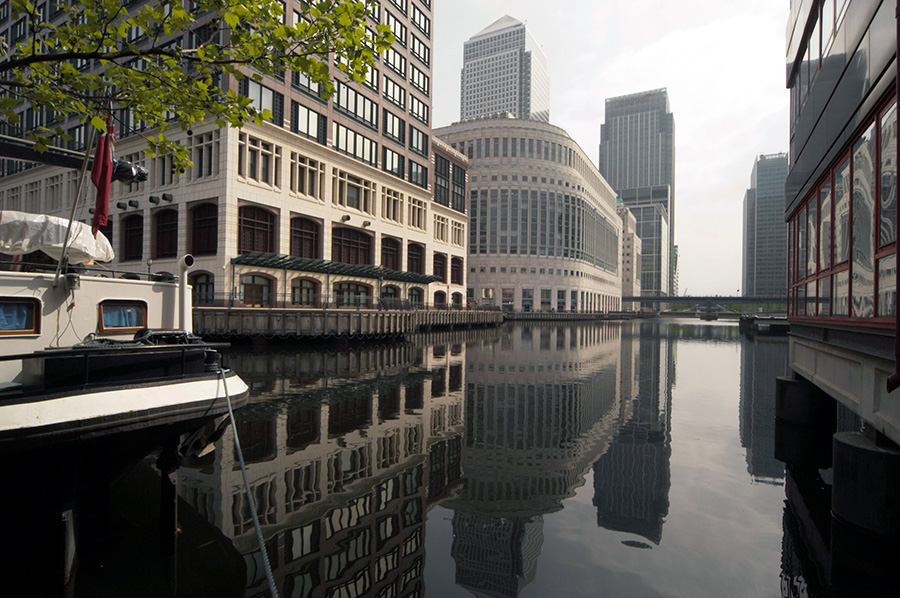
Captioning my photographs, even those where I know exactly where they were taken, I often have difficulty in deciding the name of the district in which they were taken. Sometimes I come back to one later and change my mind. Deciding which London Borough they are in is generally easier – the borough boundaries are marked by lines on maps, although sometimes, particularly where the boundary runs down the centre of a road I give both if I’m unsure what side of the road it is on. A minor confusion is that some London boroughs share a name with a district which is a part of them. I could write things like Camden, Camden, but it seems redundant to repeat it.

The Elgin Estate is possibly in Paddington, North Paddington or in Maida Hill, though the area is also sometimes simply referred to by the major road it is close to, the Harrow Road. When I put these pictures on-line I chose Maida Hill, simply because this was printed closer on the street map I was using.

Elgin Estate, Elgin Ave, Harrow Rd, Maida Hill, Westminster, 1988 88-3a-21-positive_2400
Elgin Estate, Elgin Ave, Harrow Rd, Maida Hill, Westminster, 1988

The triangle between Harrow Road, Elgin Avenue, and Chippenham Road contained some of the areas worst housing and the Greater London Council demolished these and built 300 maisonettes and flats in what was originally called the Walterton Road estate but later renamed the Elgin Estate. Started in 1966, the first tenants moved in in 1968.

It included two 22-storey tower blocks, Chantry Point and Hermes Point. A survey in 1983 found them and the rest of the estate in very poor condition and the GLC began a full-scale process of repairs. Unfortunately once work began it was brought to a halt when dangerous asbestos was found in the two tower blocks, which by then had been transferred to Westminster Council, though the GLC was still responsible for major works.

Elgin Estate, Elgin Ave, Harrow Rd, Maida Hill, Westminster, 1988 88-3a-11-positive_2400
Elgin Estate, Elgin Ave, Harrow Rd, Maida Hill, Westminster, 1988

Westminster stopped letting the blocks to new tenants though some lettings continued on short-term licences and other flats were squatted and the properties rapidly deteriorated. When the GLC was abolished in 1986 full responsibility passed to Westminster Council who secretly decided to sell the whole estate to private developers who intended to demolish the lot and rebuild at twice the density with one of the towers becoming a hotel.

Elgin Estate, Elgin Ave, Harrow Rd, Maida Hill, Westminster, 1988 88-3a-24-positive_2400
Elgin Estate, Elgin Ave, Harrow Rd, Maida Hill, Westminster, 1988

When the plans leaked, residents formed an action group demanding the council drop the plans and setting up their own proposals to save the homes. The council wanted to get rid of social tenants and replace them by wealthier home owners, to increase the Tory vote in the area, part of a process of exporting Westminster homeless families to boroughs on the edge of London and outside to places such as Staines. The Elgin estate – despite being known as having an asbestos health risk – was also used as a dumping ground for council tenants who were moved out of marginal wards. It was a policy that in 1997 was found by the High Court to be unlawful. The council appealed and won, but then lost in the House of Lords in 2001 when Lady Porter, leader of the council from 1983 to 1991 was ordered to pay a surcharge (including interest) of £43.3 million. She moved most of her money to Israel and to other family members and pleaded poverty, but eventually settled with a payment of £12.3 millioon.

Elgin Estate, Elgin Ave, Harrow Rd, Maida Hill, Westminster, 1988 88-3a-44-positive_2400
Elgin Estate, Elgin Ave, Harrow Rd, Maida Hill, Westminster, 1988

By 1988 when I made these pictures around a third of properties on the estate were empty with doors and windows blocked by steel sheets to keep out squatters who already occupied many of the flats in the two towers. But the 1988 Housing Act gave the remaining residents the chance to form a housing association, Walterton and Elgin Community Homes, which was then able to hold a ballot and acquire the homes from Westminster Council. In March 1989 WECH became the first ‘Tenants’ Choice’ landlord to be approved by the Housing Corporation, and despite various dirty tricks by the council, in 1991 was not only given the properties free of charge, but also awarded the maximum possible amount from the council of £77.5 million to cover the cost of repair (though this was only around a half of what was thought to be needed.

A vote by residents was 72% in favour of the transfer to WECH which was made in April 1992. Redevelopment of the area was carried out with extensive consultation with them, and involved an expensive demolition of the two towers in 1994, replaced by low rise housing.


All photographs on this and my other sites, unless otherwise stated, are taken by and copyright of Peter Marshall, and are available for reproduction or can be bought as prints.


Richmond and Clapham

Oak House, Old Palace Place, King St, Richmond, 1988 88-1a-53-positive_2400
Oak House, Old Palace Place, King St, Richmond, 1988

I went to Richmond fairly often fairly in my youth some 25 years or so before I took these pictures, sometimes on my bike, on the 37 bus from Hounslow Garage or by car with a friend from school who had a part-time job and could afford to run a Morris Minor. On the bike I would generally ride around Richmond Park, and I took my first cassette of black and white film mainly of the trees there, sending them away to be processed and getting back 36 crinkle-edged black and white enprints. D & P cost something like 17s11d (around 90p) and it was several years before I could afford to take another film. The prints were a dull grey, with no trace of either white or black, but even well-printed they would have been of no great interest.

Flooding, River Thames, Richmond, 1988 88-1a-62-positive_2400
Flooding, River Thames, Richmond, 1988

When we went together in my mate’s car, often with a third friend, it was to sit with a cup of coffee on the terrace of a coffee bar, watching the girls go by while our coffee cooled. I doubt we could ever afford more than a single cup, and certainly none of us had the nerve to talk to any of those passing girls. Richmond at the time was full of young foreign au-pairs, all rather older than us.

Flooding, River Thames, Richmond, 1988 88-1a-02-positive_2400
Flooding, River Thames, Richmond, 1988

I think most of my bus journeys were made on my own, visiting the Palm Court Hotel to listen to jazz in the bar there, standing making a pint of bitter (probably Red Barrel or Worthington E – I then knew no better) last and last as I couldn’t afford another. It was always a rather lonely evening, with little conversation – though occasionally some older man would attempt to pick me up but I wasn’t interested. But there was some truly great music from the likes of Bobby Wellins.

Flooding, River Thames, Richmond, 1988 88-1a-01-positive_2400
Flooding, River Thames, Richmond, 1988

Later, in my thirties, I would visit Richmond regularly, having joined the photographic society there and made a few friends who shared some of my photographic interests. Club photography was in general tired and formulaic and had little to offer, but became used to doing my own thing often to the derision of the majority of the members. I still remember the frisson of revulsion when a visiting judge for an inter-club competion not only praised my entry but awarded it one of the prizes.

Flooding is frequent at Richmond, where the Thames is still tidal (though a half-lock prevents it draining out completely at low tide) and there are always motorists who ignore the warning notices. I think it comes up over parts of the towpath most months during Spring Tides. These pictures were taken in March when I had probably come on one of my regular visits to a couple of second-hand bookshops that often had decent photographic books in stock at a time when these were rare. Many were review copies, probably never reviewed but sold to the dealers as one of the perks of a poorly-paid job. I decided if ever I became a book reviewer (which eventually I did) I would never sell copies, and I didn’t though there were some I gave away, but many more I refused to take.

Heath Terrace, Wandsworth Rd, Silverthorne Rd, Clapham, Lambeth, 1988 88-3a-01-positive_2400
Heath Terrace, Wandsworth Rd, Silverthorne Rd, Clapham, Lambeth, 1988

Once a month we came to visit friends in Kennington, arriving for lunch on a Sunday, and I would often travel up earlier than the rest of my family and spend some time walking around and taking pictures, and I think this may have been taken on one of those mornings. I think I will have chosen this angle on the ornamented Heath Terrace carefully, not just to show the 4 white chimneys of Battersea Power Station at left, but also the rather Lego-like tower block at right, and choosing to put a concrete post at the right edge.

Heath Terrace is still there, though I think now entirely residential, and I’m not sure you can still see the power station, certainly not in summer when Streetview is on its rounds, as that small tree has grown considerably. The concrete post, which I assume was a lamp post as well as holding some other sign has disappeared.

Clapham Manor St, Clapham, Lambeth, 1988 88-3a-04-positive_2400
Clapham Manor St, Clapham, Lambeth, 1988

This Grade II listed building at 42 Clapham Manor St is now home to the London Russian Ballet School and Kids Love Lambeth. It was built in 1854, architect by James Thomas Knowles Snr, as the Clapham General Dispensary for the ‘The Clapham Sick Poor Fund’ formed in 1849 and provided free medical and surgical services for almost a century, closing in the early 1950s.

In 1959 the building was used by the London County Council for industrial training for people with special needs. It later became a pre-school playground and adult education centre, which I think it was at the time of my photograph. Shortly after in 1989 it became empty and suffered some fire damage which led to considerable internal rebuilding. Still owned by Lambeth council, it became a taxi training school until 2005-6 when the council sold the building and its considerable premises at the rear. For some years it was in illegal use as ballet studios, with this being made legal in 2013.

James Thomas Knowles Snr (1806-1884) designed the building free of charge and it was paid for by public subscription. As well as its architectural merit is is listed as one of the earliest provident dispensaries to survive in London.


All photographs on this and my other sites, unless otherwise stated, are taken by and copyright of Peter Marshall, and are available for reproduction or can be bought as prints.


Hammersmith to Holland Park

Brook Green, Hammersmith, Hammersmith & Fulham, 1988 88-1a-56-positive_2400
Brook Green, Hammersmith, Hammersmith & Fulham, 1988

Helpfully a street sign and a number inform me that this is 180 Shepherds Bush Rd, at the western edge of Brook Green. The road at one time used to wander around here but long ago traffic was routed straight through the grassy space, with both new and old road remaining as Shepherds Bush Road. There are no properties on the new section of the road, just a bus stop, traffic signs and traffic lights.

Without the information on the photo it would be hard to place this picture, as nothing visible remains of this part of the factory which housed Express Lifts and was I think part of the large Osram works which had began making carbon lamps here in 1881. It went on to produce many other types of lamps until around 1955, continuing only to produce argon and electronic valves until 1988 and was demolished the same year, with only its tower with the famous Osram Dome elsewhere on the site being saved, incorporated into the Tesco Superstore that took its place

Sinclair Rd, Hammersmith, Hammersmith & Fulham, 1988 88-1a-43-positive_2400
Sinclair Rd, Hammersmith, Hammersmith & Fulham, 1988

You can still find this pair of houses on Sinclair Rd, part of one of many conservation areas in Hammersmith & Fulham. There are a number of houses with impressive paired porches on the street, substantial four storey houses dating from around 1880. This pair is one of relatively few to have retained the stucco urns under the porticos, and this is a particularly impressive example with slender columns and capitals, but I think the real attraction for me was the incredibly morose bearded and moustached crowned head at the base of a finial.

Springvale Terrace, Hammersmith, Hammersmith & Fulham, 1988 88-1a-32-positive_2400
Springvale Terrace, Hammersmith, Hammersmith & Fulham, 1988

In the same conservation area as Sinclair Rd is a small section of very different housing. This small block which contained around 24 late Victorian terraced houses with a small Radiator Factory at its north end had been replaced by these modern buildings by 1988. The picture is taken from the road at the south side of this small estate.

St John the Baptist, Church, Holland Rd, Holland Park, Kensington & Chelsea, 1988 88-1a-26-positive_2400
St John the Baptist, Church, Holland Rd, Holland Park, Kensington & Chelsea, 1988

Crossing the railway at the bridge on Addison Gardens took me from Hammersmith & Fulham into the Holland Park area of Kensington & Chelsea and St John the Baptist Church in Holland Rd, a remarkably exuberant Grade I listed building by the distinguished Victorian church architect James Brook, “cathedral-like in scale and ambition, combining Brooks’s devotion to severe early Gothic models with a degree of material opulence not seen in his better-known East End churches”. Begun in 1872 it was completed in stages when the parish had the money and only finished after Brook’s death with finishing touches (perhaps unfortunate) by his successor John Standen Adkins in 1910.

The well-illustrated feature on the history of the church on the church web site states “St John’s is a distinguished and integrated time-capsule of the Anglo-Catholic movement. It is regularly in use for that traditional form of worship today.”

Holland Park Gardens Holland Park, Kensington & Chelsea, 1988 88-1a-15-positive_2400
15 Holland Park Gardens, Holland Park, Kensington & Chelsea, 1988

The London School of English is still in this imposing building in Holland Park Gardens. Perhaps surprising I avoided the wide sweep of steps leading up to its door, probably in order to emphasise the nest of balloons tied to its railings.

Addisland Court, Holland Villas Road, Holland Park, Kensington & Chelsea, 1988 88-1a-11

Addisland Court is a prestigious block of flats that screams 1930s Art Deco and its site design also very much reflects the golden age of motoring (when it was only for the rich.) A three bedroom flat here has an estimated value of around £2million. It was apparently used as a location in a couple of episodes of a TV series of Agatha Christie’s Poirot. It was built in 1936, designed by William Bryce Binnie whose other works include the East Stand at Arsenal’s old Highbury ground and who after distinguished war service had been assistant architect at the Imperial War Graves Commission for which he designed a number of memorials in France and Belgium.


All photographs on this and my other sites, unless otherwise stated, are taken by and copyright of Peter Marshall, and are available for reproduction or can be bought as prints.


More Holland Park & Notting Dale 1988

Holland Park Ave, Holland Park, Kensington & Chelsea, 1988 88-1b-44-positive_2400
Holland Park Ave, Holland Park, Kensington & Chelsea, 1988

I made these pictures in January 1988, on one of many walks around various areas of London. At the time I was working on two photographic projects, one in black and white and the other in colour. In black and white I was largely concerned with recording the physical infrastructure, photographing both buildings and streets I felt were exceptional and also examples that I thought were typical. My colour project was more difficult to explain, but both were linked to the changing nature of London.

Holland Park Ave, Holland Park, Kensington & Chelsea, 1988 88-1b-41-positive_2400
Holland Park Ave, Holland Park, Kensington & Chelsea, 1988

January was a good month to take pictures of the streets. One of the smaller projects I’d undertaken was about trees in London, and in the Summer months they hide many of the buildings. Google Streetview is a great resource, but almost all the images around London appear to be from late Spring or Summer, and for some streets almost all you can see is trees. My project on the buildings of London tailed off around 1999 to 2000 because it then seemed to me that it would not be long before we would have something like Streetview with more comprehensive coverage, though it hasn’t entirely replaced the kind of pictures I took.

Holland Park Ave, Holland Park, Kensington & Chelsea, 1988 88-1b-31-positive_2400
Holland Park Ave, Holland Park, Kensington & Chelsea, 1988

Holland Park Avenue is an ancient route to the West from London dating back to before the Romans. In later years until the nineteenth century it was known here as the Uxbridge Road. Land to the south of it was a part of the Holland House estate and from the middle of the 18th century land to the north became owned by the Ladbroke family of wealthy bankers. In 1819 after he inherited the land James Weller Ladbroke began to develop it, beginning with the parts along the Uxbridge Road.

The first houses along the road were built in 1824, but proved difficult to let or sell being so far from the centre of London. Building on the Ladbroke estate halted in the mid-1830s but began again in the following decade. When built, each terrace had its own name and house numbers, but in 1895 this section of Uxbridge Road was renamed Holland Park Avenue and the houses renumbered. You can read more about them on the Ladbroke Association web site.

Holland Rd, Holland Park, Kensington & Chelsea, 1988 88-1a-35-positive_2400
Holland Rd, Holland Park, Kensington & Chelsea, 1988

Holland Road is a rather busy street that leads up from the south to the Holland Park roundabout at the western boundary of Notting Hill and was a part of the Holland estate whose development was carefully overseen by Lord and later Lady Holland. Just to its west is the railway line- now part of the London Overground network as well as carrying National Rail trains and the Underground service as far as Kensington Olympia.

The original plans for the railway in the mid 1830s had it going on a viaduct a short distance to the east close to Addison Road and new houses already built on the Holland estate, and an objection by Lord Holland moved the line to the edge of his estate and largely hidden in a cutting – as well as enabling him to see a few acres to the railway company for £5,000 and get them to largely finance a new covered sewer that ran along Holland Road enabling its development.

Kiln, Walmer Rd, Notting Hill, Kensington & Chelsea, 1988 88-1b-35-positive_2400
Kiln, Walmer Rd, Notting Hill, Kensington & Chelsea, 1988

Walmer Road is the oldest street in Notting Dale, an old footpath which became the main street of the area and was renamed James St in the early 19th century and Walmer Road in the 1850s. Much of the area was dug for clay and bricks and tiles were made here and the area became known as the Potteries – and also because of the pigs kept in the area, the Piggeries. It became a notorious slum area with high levels of cholera, lacking proper sanitation until a new sewer was dug around 1850. The worked out brickfield ‘Ocean’ was filled in in the 1860s, part becoming Avondale Park in 1892. The kiln, a designated Ancient Monument, is opposite the park.

Princedale Rd, Notting Hill, Kensington & Chelsea, 1988 88-1b-21-positive_2400
House, 106, Princedale Rd, Notting Hill, Kensington & Chelsea, 1988

Walmer Road is one of those that was cut short by the building of the Westway and it used to go north to meet Latimer Road. It now comes to an end just south of Grenfell Tower. It’s southern end is also confusing, with a junction with Princedale Road, Kenley Street, Hippodrome Place and Pottery Lane. I think Princedale Rd (formerly Prince’s Rd) along with Pottery Lane may well also have once been part of the old footpath which became Walmer Rd. The two roads run closely parallel and Pottery Lane rather looks like a mews – and its opposite side was once the stables for the racecourse.

Prince’s Road was developed piecemeal between 1841-1851. It became Princedale Road in the late 1930s to remove the confusion with several other Prince’s Roads in London. There are no listed buildings in the road which in 1978 became part of the Norland Conservation Area.

Shop, Portland Rd, Clarendon Cross, Notting Hill, Kensington & Chelsea, 1988 88-1b-11-positive_2400
Shop, Portland Rd, Clarendon Cross, Notting Hill, Kensington & Chelsea, 1988

This shop on the corner of Portland Road and Clarenden Cross is still there with its half pots and name ‘Fired Earth’ a reminder of the origin of the area as the ‘Potteries’, about a hundred yards from the remaining kiln in a picture above.

My introduction to this area came in the book ‘Absolute Beginners’ by Colin MacInnes published in 1959 which I read when I was a teenager and which is loosely based around the Notting Hill race riots of 1958, later filmed. It has rather gone up in the world since then.


All photographs on this and my other sites, unless otherwise stated, are taken by and copyright of Peter Marshall, and are available for reproduction or can be bought as prints.


Ladbroke Estate: 1988

Stanley Crescent, Notting Hill, Kensington & Chelsea, 1988 88-1c-33-positive_2400
Stanley Crescent, Notting Hill, Kensington & Chelsea, 1988

When James Weller Ladbroke inherited his 300 acre largely rural estate on the western edge of London in 1819 he wanted to develop the area and employed landscape architect Thomas Allason to draw up a picturesque plan based on his visits to Italy and the London example of John Nash’s Regent’s Park. It was a plan that Ladbroke never found the money to build, but influenced some of those the estate sold land to and can still be seen in the map of the area, most of which was built up in the 1850s with large villas and terraces and in parts retained the communal private gardens between the streets.

Stanley Gardens, Notting Hill, Kensington & Chelsea, 1988 88-1c-25-positive_2400
Stanley Gardens, Notting Hill, Kensington & Chelsea, 1988

Stanley Crescent and Stanley Gardens were developed by Charles Blake, who returned from running a highly profitable business in India and bought the area from Felix Ladbroke in 1852. He got artist and architect Thomas Allom to design the area based on Allason’s plans.

The streets were probably named after Lord Stanley who was Prime Minister in three separate short governments from 1852 on. In them he abolished slavery and reformed Parliment and created the modern Conservative party. Building began in 1853.

Stanley Crescent, Notting Hill, Kensington & Chelsea, 1988 88-1c-13-positive_2400
Stanley Crescent, Notting Hill, Kensington & Chelsea, 1988

Allom was architect for the houses on the estate and, according to the Survey of London his designs broke away from the late Georgian restraint of earlier streets inn the area “in favour of a grand display in the latest taste … with scenic effect uppermost in his mind. The design of houses, streets, gardens and tree planting is seen with a painter’s eye, so that each turn and every vista is composed in a picturesque manner…”

Lansdowne Rd, Notting Hill, Kensington & Chelsea, 1988 88-1b-65-positive_2400
Lansdowne Rd, Notting Hill, Kensington & Chelsea, 1988

Most of the houses remained in single ownership until after the First World War, when costs of upkeep became ridiculous and they were converted for multi-occupation and often allowed to deteriorate. By the time I took these pictures this process was in reverse, with houses being renovated and wealthier tenants paying considerably higher rents and some houses converted back to single family occupancy as the area became popular among the ultra-rich.

You can read a detailed account of the houses, many of which are listed on the Ladbroke Association web site.

Lansdowne Rd, Notting Hill, Kensington & Chelsea, 1988 88-1b-56-positive_2400
Lansdowne Rd, Notting Hill, Kensington & Chelsea, 1988

Landsdowne Road was also a part of the Ladbroke Estate, built around 10 years earlier than Stanley Crescent in the 1840s, while the estate was still owned by James Weller Ladbroke. He let plots to various developers to build, and the road lacks the overall view of the later area, with some quite varied houses. This suggests that the name ‘Landsdowne’ comes from “the much admired Montpellier and Lansdown residential estates in Cheltenham, built in the first three decades of the 19th century”. Alternatively it might have been named for another prime minister, William Petty, Earle of Shelburne, who served briefly in 1782-3, after which he was made 1st Marquess of Lansdowne. His major achievement as prime minister was securing a treaty which lead to the end of the American War of Independence.

Lansdowne Rd, Notting Hill, Kensington & Chelsea, 1988 88-1b-54-positive_2400
Lansdowne Rd, Notting Hill, Kensington & Chelsea, 1988

Again you can read a detailed account of the buildings on the street on the http://www.ladbrokeassociation.info/LansdowneRoad.htm Ladbroke Association web site.

Lansdowne Rd, Notting Hill, Kensington & Chelsea, 1988 88-1b-52-positive_2400
Lansdowne Rd, Notting Hill, Kensington & Chelsea, 1988

When I was taking these pictures in 1988, information about this and many other areas of London was relatively hard to find. There was of course no World Wide Web and few books with any detailed description outside the City of London and some parts of Westminster. The volume of The Buildings of England by Cherry and Pevsner for this area was only published in 1991. In areas such as this, almost all I had to guide me was the A-Z and other street maps.


All photographs on this and my other sites, unless otherwise stated, are taken by and copyright of Peter Marshall, and are available for reproduction or can be bought as prints.


Shepherds Bush 1988

I’ve always found Shepherds Bush confusing. My first visits to the area were infrequent trips with my mother to visit an elderly woman relative who lived alone in a flat on the Goldhawk Rd, an exiting visit, travelling to Hammersmith on the tube and then a bus. And it was a secret mission on which I was sworn to silence; Blanche had been ostracised by all her relations except my mother. This was around 1950 and divorce was still seen by many as something shocking. I remember being rather disappointed to find this ‘scarlet woman’ was much the same colour as me.

Subway, Shepherds Bush, Roundabout, Hammersmith & Fulham, 1988 88-1d-44-positive_2400
Subway, Shepherds Bush, Roundabout, Hammersmith & Fulham, 1988

Sheep could certainly not safely graze at Shepherds Bush, and were best keeping well out of trouble on this arch above the subway under the M41 West Cross Route, built as part of Ringway 1, part of a series of motorway rings which would have destroyed London. The damage they would cause became very apparent during the building of the Westway and West Cross Route and the scheme was abandoned, with fortunately only a few sections completed. The road was demoted to the A3220 in 2000 but cyclists are still prohibited. The subway is immediately to the north of the Holland Park roundabout.

Subway, Shepherds Bush, Roundabout, Hammersmith & Fulham, 1988 88-1a-22-positive_2400
Subway, Shepherds Bush, Roundabout, Hammersmith & Fulham, 1988

Eight years later, in July 1996, I returned here together with around 6,000 others to hold a party and protest on the M41 here which blocked the road for over 8 hours. I left before it ended, climbing over a wall and ending up on Freston Road, taking the Underground to Hammersmith from Latimer Road Station.

Shepherds Bush Station, Uxbridge Rd, Shepherds Bush, Hammersmith & FUlham, 1988 88-1c-42-positive_2400
Shepherds Bush Station, Uxbridge Rd, Shepherds Bush, Hammersmith & Fulham, 1988

One of the confusing things about Shepherds Bush were the two Underground stations around 500 yards apart and on different lines, but both named Shepherds Bush. I think both were built around 1900. The Central Line station in the picture was replaced by a new station in 2008, and the Hammersmith & City station was then renamed Shepherd’s Bush Market.

Shepherds Bush Green, Shepherds Bush, Hammersmith & Fulham, 1988 88-1c-56-positive_2400
Footbridge, Shepherds Bush Green, Shepherds Bush, Hammersmith & Fulham, 1988

The footbridge leading across Shepherds Bush close to the Central Line Station to the large 1967 shopping centre on its south side added to the confusion with a giant Intercity 125 Train on its side, despite it leading to the Concorde shoppint centre. It confused me still more by disappearing completely two years after I too its picture, plagued with problems as the escalators kept breaking down and a few people found it funny to drop things from it onto passing traffic.

There are still two quite separate stations called Shepherds Bush, as a new National Rail Shepherds Bush station opened close to the Central Line station in 2008. It had been meant to open as a Silverlink station on the line from Clapham Junction to Willesden Junction in 2007, but when completed they found one platform was 18 inches less wide than safety regulations required. By the time this was put right the following year it was a part of the London Overground. Perhaps had this change been anticipated it would have been designed with a tunnel leading the the Underground station rather than having to go through two ticket barriers and across a roadway busy with buses to change trains here.

Shepherds Bush, Hammersmith & Fulham, 1988 88-1a-25-positive_2400
Providence Capital, Shepherds Bush, Hammersmith & Fulham, 1988

The station developments were for the opening of the huge Westfield shopping centre on the White City site. Although the new Overground station was built on the site of the long-disused Uxbridge Road station it required the demolition of the building I rather liked close to the Holland Park roundabout. Its design as a giant gate echoes in plain form the excessively ornate gateway built here at Shepherd Bush for the 1908 Franco-British Exhibition at White City which attracted over eight million paying customers, and I believe this was indeed a much slimmed-down version of the entrance to the exhibition halls, converted for office use.


All photographs on this and my other sites, unless otherwise stated, are taken by and copyright of Peter Marshall, and are available for reproduction or can be bought as prints.


Holland Park & Notting Hill

Holland Park, Holland Park, Kensington, Kensington & Chelsea, 1988 88-1d-64-positive_2400
Holland Park, Holland Park, Kensington, Kensington & Chelsea, 1988

Holland Park is a street in London as well as an actual park and the name of a tube station which has transferred to an area of Kensington to the west of Notting Hill. Virtually every house in the street is listed – I think 88 of them. The exception is the Greek Embassy at No.1. This had been the most interesting house in the street. Built in 1860 it was bought in 1864 by banker Alexander C. Ionides (1810-1890), who had been Greek Consul General in London from 1854 to 1856. He and his son who inherited the house were wealthy Greek business men and patrons of the arts – and from 1864 and they transformed the property, commisioning external work leading Victorian architect Philip Webb, who also gave it a grand staircase and other fine public rooms, with internal decorative work by the leading figures of the day, including Willliam Morris who supervised much of the work and whose company provided much of it. It became a meeting-place for all London’s leading artists coming to its Sunday open house in the 1880s and 90s. The family moved out in 1898 and the house was sold a few years late.

Holland Park, Holland Park, Kensington, Kensington & Chelsea, 1988 88-1d-61-positive_2400
Holland Park, Holland Park, Kensington, Kensington & Chelsea, 1988

The interior of 1 Holland Park was meticulously recorded by the leading architectural photographer of the day, Henry Bedford Lemere as well as in the work of others. But the new owners – who were also the owners of nearby Holland House – did not treat it well, whitewashing over the William Morris ceilings. The house was badly damaged by bombing in WW2 and was sold with Holland House and the park to the London County Council in 1952, when it was reported that little worth preserving remained and the house was demolished. The building which now houses the Greek Embassy was built in 1962 by architects Playne & Lacey and bought by Greece in 1973. An article available online gives muuch more detail on the Ionides family and the house

Holland Park Mews, Holland Park, Kensington, Kensington & Chelsea, 1988 88-1d-63-positive_2400
Holland Park Mews, Holland Park, Kensington, Kensington & Chelsea, 1988

Holland Park is actually two parallel streets, each stuffed with listed houses, built under the watchful eye of Lady Holland who saw to it that they met her standards, though at the time they were not felt to be anything special – typical houses for the wealthy. And the wealthy needed carriages which required to be kept at hand, along with the horses to draw them. They and the men who looked after them lived in the mews between the two streets, and would be drive the carriages around when required to the front doors – and the rich would emerge from those iron and glass porte cochères to ride in them.

Stoneleigh Place, Notting Hill, Kensington & Chelsea, 1988 88-1d-35-positive_2400
Stoneleigh Place, Notting Hill, Kensington & Chelsea, 1988

A short distance north of Holland Park, some housing is on a less grand scale.

Freston Rd, Notting Hill, Kensington & Chelsea, 1988 88-1d-24-positive_2400
Freston Rd, Notting Hill, Kensington & Chelsea, 1988

Another picture from Freston Road. The London City Mission built The People’s Hall on Latimer Road in the Kensington Piggeries in 1902, when parts of the area were one of the worst slums in London. This part of Latimer Road was renamed Freston Road when the construction of the Westway and the West Cross Route cut it in half. The hall on the corner of Olaf St became the centre of the Free and Independent Republic of Frestonia in 1977. Probably it’s best known now as the place where much of The Clash’s album Combat Rock was recorded.

Royal Crescent, Notting Hill, Kensington & Chelsea, 1988 88-1c-61-positive_2400
Royal Crescent, Notting Hill, Kensington & Chelsea, 1988

Royal Crescent is at the western edge of Holland Park/Notting Hill, just to the north of Holland Park Avenue, just east of the Holland Park roundabout. It was one of the earliest parts of the Norland Estate to be developed in the 1840s, to the estate plan of Robert Cantwell and is Grade II* listed. It took a long time to rent these properties, which were thought to be too far out from London in the days of horse-drawn traffic for the wealthy.

St Ann's Villas, Notting Hill, Kensington & Chelsea, 1988 88-1d-32-positive_2400
St Ann’s Villas, Notting Hill, Kensington & Chelsea, 1988

St Anne’s Villas leads north from the centre of the Royal Crescent, and is on one of the routes I’ve sometimes walked more recently from Shepherd’s Bush station to join the silent walks remembering Grenfell.

St Ann's Villas, Notting Hill, Kensington & Chelsea, 1988 88-1c-52-positive_2400
St Ann’s Villas, Notting Hill, Kensington & Chelsea, 1988

St Anne’s Villas were built as a part of the Norland Estate, mainly around 1845. The area was developed by by Charles Richardson with barrister Charles Stewart taking building licences from him for these Tudor Gothic revival semi-deatched houses, now Grade II listed.


All photographs on this and my other sites, unless otherwise stated, are taken by and copyright of Peter Marshall, and are available for reproduction or can be bought as prints.


Notting Hill – Notting Dale – 1988

Nottingwood House, Clarendon Rd, Notting Hill, Kensington & Chelsea, 1988 88-1e-62-positive_2400
Nottingwood House, Clarendon Rd, Notting Hill, Kensington & Chelsea, 1988

Notting Hill – and the London Borough of Kensington & Chelsea – is very much a place of two halves and these two pictures illustrate this, with the large block of council housing built on the site of the Notting Hill brewery and other industrial buildings shortly before the war.

Houses, Blenheim Crescent, Clarendon Rd, Notting Hill, Kensington & Chelsea, 1988 88-1e-61-positive_2400
Houses, Blenheim Crescent, Clarendon Rd, Notting Hill, Kensington & Chelsea, 1988

This picture was taken from roughly the same place as the previous picture, but from the opposite side of the road. Houses in Blenheim Crescent are currently on sale for £4 million. Of course many of the social housing tenants in Nottingwood House took advantage of Thatcher’s social housing giveaway ‘Right to Buy’, though quite a few then found themselves needing to sell these properties, with many becoming ‘buy to let’ properties – now at perhaps £2000 a month, and other flats on sale for perhaps £800,000, so the difference here is rather less real than when I made this picture.

Bramley Arms, Bramley Rd, Freston Rd, Notting Hill, Kensington & Chelsea, 1988 88-1e-53-positive_2400
Bramley Arms, Bramley Rd, Freston Rd, Notting Hill, Kensington & Chelsea, 1988

I think the pub had closed shortly before I took this picture. The building is still there but is now offices with flats on the upper floor. The pub has appeared in at least five major films including Sid and Nancy (1986), Quadrophenia (1979) and The Lavender Hill Mob (1951) as well as TV series.

This area was cut off on two sides by the construction of the Westway and the West Cross Route in the 1960s and became very run down and what had been the southerns section of Latimer Rd was renamed Freston Road. Oddly, Latimer Road station (on Bramley Rd) was not renamed, though it is no longer close to Latimer Road. In 1977 squatters occupied houses and flats the GLC planned to demolish in Freston Road and declared the Republic of Frestonia. The GLC granted them temporary leave to remain and the area was developed more sensitively by the Bramley Housing Co-operative from 1985. You can see the ‘Underground’ bridges in the distance on both streets in this photograph.

Freston Rd, Notting Hill, Kensington & Chelsea, 1988 88-1e-52-positive_2400

This neat and unpretentious factory building is still present on the corner of Freston Rd and Evesham Rd, but now surrounded by a large redevelopment and painted a dull grey.

Mural, Harrow Club, Freston Rd, Notting Hill, Kensington & Chelsea, 1988 88-1e-45-positive_2400
Mural, Harrow Club, Freston Rd, Notting Hill, Kensington & Chelsea, 1988

Although the area around and under the Westway was fairly desolate in 1988, attempts had been made to brighten the area with a number of well painted murals. The Harrow club was set up by former pupils of Harrow School in 1883 as The Harrow Mission Church “to improve the quality of life for local people, aiding harmony and promoting opportunity” for the people of Notting Dale and continues to do so.

Freston Rd, Westway, Notting Hill, Kensington & Chelsea, 1988 88-1e-44-positive_2400

More graffiti.

Freston Rd,, Stable Way, Westway, Notting Hill, Kensington & Chelsea, 1988 88-1e-35-positive_2400

The caravans are around Stable Way. The car is coming down a link road from the Westway which runs across the top of the picture to the West Cross Route. This is the edge of a BMX cycle circuit at the north end of Freston Rd.

Freston Rd, Westway, Notting Hill, Kensington & Chelsea, 1988 88-1e-32-positive_2400

Another picture from the BMX track beyond the end of Freston Road, close to the Westway junction with the West Cross Route.

Freston Rd, Westway, Notting Hill, Kensington & Chelsea, 1988 88-1e-31-positive_2400

This picture gives a more informative view of the location, though I can find no trace of this oval now, but it was I think a part of the BMX circuit at the north end of Freston Rd.

Freston Rd,, Westway, Notting Hill, Kensington & Chelsea, 1988 88-1e-23-positive_2400

The landscaped area here is at the end of Freston Rd, with the Harrow Club at left.

Westway, Notting Hill, Kensington & Chelsea, 1988 88-1e-14-positive_2400

Underneath the Westway and the links from the West Cross Route.

Westway, Notting Hill, Kensington & Chelsea, 1988 88-1e-13-positive_2400

Various sports facilities underneath the motorway junction. Opened in 1970 as the A40(M) its status was downgraded in 2000 to an all-purpose road. There were plans to include a separated cycleway on parts of it announced in 2013 but these were scrapped in 2017. However Kensington & Chelsea Council have opposed all protected cycle routes on their streets, and even scrapped a temporary route which was implemented during the Covid lockdown.

More from the other half of Notting Hill in another post.


All photographs on this and my other sites, unless otherwise stated, are taken by and copyright of Peter Marshall, and are available for reproduction or can be bought as prints.


Photography Workshop 9th May 2004

I hope those who came with me on the workshop I led around a part of London’s Dockland 17 years ago found it stimulating. For me it was a familiar walk, but I think most of the others were seeing the area for the first time. One of the instructions for the workshop some will have found difficult was not to bring a tripod, as these were and are red rags to the security staff who closely patrol the Canary Wharf estate. We had no problems with security on this workshop, though I have had confrontations on other occasions – including being once escorted off the estate.

I think I had been asked to run the workshop for London Independent Photography, though I’m not sure. On My London Diary I put a short text about the event and some pictures that I made during it. I’ve corrected the spelling and capitalisation of the original, otherwise it is exactly as written, probably deliberately in part ungrammatically.

May 9 found me taking a group of photographers for a walk around some parts of London’s docklands. we started at the centre of this ‘crime of the century’. I still don’t quite understand why a Conservative government felt so at odds with the City of London that it decided to set up offshore competition in the Enterprise Zone.

The feeding frenzy that ensued, trousering public property and tax breaks into the private pocket at an unprecedented rate.

The long-term consequence has been a distorted development with few real buildings of distinction but some expensively finished tat, and a lack of overall planning. I’m not sure that London would benefit from gaining the Olympics for which it is currently bidding, but if it fails, probably part of the reason will be the docklands debacle.

We started below the obscene gesture towards the old city, at least clear about its symbolism, then took the DLR down to Crossharbour with its silly bridge, walking back to the wharf and taking the Jubilee to Canning Town. then back alongside the Lea (still waiting for that riverside walkway) to East India Dock Basin and along by the Thames, where a galleon appeared in front of the dome.

My London Diary – May 2004

Docklands has continued to change since 2004, but it remains a largely lost opportunity to develop what had become the redundant area for the benefit of the people as a whole rather than to enrich a few.


Back in 2004 I was still working with my first DSLR, the Nikon D100 for which had recently bought the Sigma 12-24mm lens and on this DX format camera this gave effective focal lengths of 18-36mm. The smaller format also avoids the weaker corners of this extreme wide-angle zoom (I think the first of its type) and within the smaller field it was remarkably distortion-free. There are a few more pictures on My London Diary – including that galleon – some rendered rather dully by the RAW software of the time – I’ve improved the rendering of those included in this post.


All photographs on this and my other sites, unless otherwise stated, are taken by and copyright of Peter Marshall, and are available for reproduction or can be bought as prints.


North Kensington

Pall Mall Deposit, Barlby Rd, North Kensington, Kensington & Chelsea, 1988 88-1f-54-positive_2400
Pall Mall Deposit, Barlby Rd, North Kensington, Kensington & Chelsea, 1988

There were several reasons I used to like going to this area of North Kensington to make photographs, one of which was that when people asked me where I had been I could tell them I’d been to the North Pole, which was just down past the end of Barlby Rd on North Pole Rd. Sadly the North Pole was bought by a property company in 2012 who turned the upper floors into flats and soon closed the pub which became a Tesco Express around 2015.

Pall Mall Deposit, Barlby Rd, North Kensington, Kensington & Chelsea, 1988 88-1f-53-positive_2400
Pall Mall Deposit, Barlby Rd, North Kensington, Kensington & Chelsea, 1988

The Pall Mall Deposit and Forwarding Co became a limited company in 1899, with premises just off Regent St, and built this large storage facility to the design of W G Hunt in 1911 (the often given date of 1901 is most probably a much-quoted typo.) Furniture storage was quite big business at the time as a large proportion of the more affluent lived in rented houses, often moving frequently. The building extends some way back from Barlby Road and has been a rather trendy centre for offices, studios etc, selling itself as close to Portobello Road.

Ladbroke Hall, Clement-Talbot Motor Works, Barlby Rd, North Kensington, Kensington & Chelsea, 1988 88-1f-52-positive_2400
Ladbroke Hall, Clement-Talbot Motor Works, Barlby Rd, North Kensington, Kensington & Chelsea, 1988

Barlby Road was also the location of the first purpose built English car factory, the Clement-Talbot Motor Works built from 1903-11, architect William T Walker. According to Cherry and Pevsner (London 3 : North West) this reinforced concrete building used the Hennebique system, but for the office building fronting the road this was well-disguised by “a festive Wrennaisance front”.

Kensal House, Ladbroke Grove, North Kensington, Kensington & Chelsea 88-1f-46-positive_2400
Kensal House, Ladbroke Grove, North Kensington, Kensington & Chelsea

North of the Great Western mainline, which bisects the area, is its greatest architectural gem, Kensal House, built in 1936 by Maxwell Fry leading a small group of like-minded architects. Even in the rather run-down state I photographed it, the ensemble is impressive. It’s and impressive modernist building and rather more functional than some, and the low cost flats included what were for the time some very up-to-date features.

Kensal House, Ladbroke Grove, North Kensington, Kensington & Chelsea 88-1f-45-positive_2400
Kensal House, Ladbroke Grove, North Kensington, Kensington & Chelsea

The site was developed by the Gas Light & Coke Company who owned the site and the adjoining gas works to provide housing for their employees – 54 three-bedroom and 14 two-bed flats- and virtually everything – down to the irons – was gas powered. Of course gas lighting was still very common – and in my youth there were still many older people who preferred its more gentle light. But as built there was no electricity in these gas company flats.

Kensal House, Ladbroke Grove, North Kensington, Kensington & Chelsea 88-1f-42-positive_2400
Kensal House, Ladbroke Grove, North Kensington, Kensington & Chelsea

As well as two large blocks of flats the site also contained a nursery, with a curved frontage that ran around the former site of a gas holder. One of those who worked with Fry on the designs was social reformer Elizabeth Denby who had also worked with him at the Peckham Health Centre.

Kensal House, Ladbroke Grove, North Kensington, Kensington & Chelsea 88-1f-34-positive_2400
Kensal House, Ladbroke Grove, North Kensington, Kensington & Chelsea

The gas works have gone, with Sainsbury’s and Argos in their place, but the railway remains. Some of these flats must have been great places for train spotters, but the Kings and Castles thundering past might have upset the sleep in those days of single glazing and poor sound insulation. And gas works did produce some fairly noxious odours and pollution, though if they provided your living that probably seemed less of a problem.

Kensal Green Basin, Grand Union Canal, Paddington Branch, North Kensington, Kensington & Chelsea, 1988 88-1f-35-positive_2400
Kensal Green Basin, Grand Union Canal, Paddington Branch, North Kensington, Kensington & Chelsea, 1988

You can still see Kensal Green Basin when you go to get your shopping at Sainsbury’s on Canal Way, though it is largely well hidden behing bushes around the car park and seems an missed opportunity – as do many of the planning decisions in this area. A large and ugly canalside building now straddles its entrance from the canal. Further along Canal Way there are still a couple of gas holders at the west end of the gas works site.

Exmoor St,North Kensington, Kensington & Chelsea, 1988 88-1f-26-positive_2400
Exmoor St,North Kensington, Kensington & Chelsea, 1988

Late Victorian Housing on Exmoor St with some nice detailing and later railings.

Hewer St,North Kensington, Kensington & Chelsea, 1988 88-1f-25-positive_2400
Hewer St,North Kensington, Kensington & Chelsea, 1988

At left is the Grade II listed St Charles’ Hospital in Exmoor St, built in 1881 as the St Marylebone Union Infirmary. Surprisingly it is still in medical use, providing mental health services and as a community health centre. Part of the building are rather more attractive than this view suggests. John Nodes and Sons Ltd provided a very handily based funeral service.

Barlby Rd, North Kensington, Kensington & Chelsea, 1988 88-1f-22-positive_2400
Barlby Rd, North Kensington, Kensington & Chelsea, 1988

Finally back to Barlby Rd, and a terrace of houses still present close to Ladbroke Grove. On the left you can still see one of the gas holders of the Kensington Gas Works, and to the right of the block the Great Western Mainline and one of the blocks of Kensal House.

As usual there are a few more pictures from my walks around the area in 1988 in the album, and clicking on any of the pictures here should take you to a larger version in the album from which you can move through it to see all those I have put online.


All photographs on this and my other sites, unless otherwise stated, are taken by and copyright of Peter Marshall, and are available for reproduction or can be bought as prints.