Deptford to Rotherhithe October 1988

Deptford to Rotherhithe October 1988 – the continuation and end of my photographic walk in October 1988. The previous post on this was Liquor, Motors, Furniture, Packing & Timber.

Grinstead Rd, Evelyn St, Deptford, Lewisham, 1988 88-10h-25-Edit_2400
Grinstead Rd, Evelyn St, Deptford, Lewisham, 1988 88-10h-25

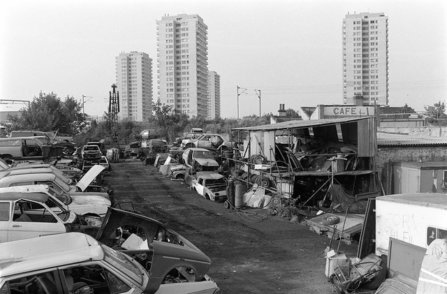
I turned around on Grinstead Road and made this picture as I returned to Evelyn Street. Directly ahead on the other side of Evelyn St was the car auction site shown in a previous post, and towering above that two of the towers on the Pepys Estate. On my right was the grim factory wall of the former galvanised iron and zinc Ida works, at the back of Neptune Wharf on the now filled-in Surrey Canal

Clare Villas, Evelyn St, Deptford, Lewisham, 1988 88-10h-26-Edit_2400
Clare Villas, Evelyn St, Deptford, Lewisham, 1988

Clare Villas at 114-116 Evelyn Street and the neighbouring semi-detached pair Oak Villas whose doorway is at the left of the picture show us that there were then some wealthy local residents. These houses back on to Deptford Park and probably date from when this land was market gardens around the time this was bought by the London County Council in 1884. I think one of the two pairs was a little earlier than this date; Pevsner mentions both Clare Villas and Oak Villas, dating the latter to 1881.

Clare Villas, Evelyn St, Deptford, Lewisham, 1988 88-10i-22-Edit_2400
Clare Villas, Evelyn St, Deptford, Lewisham, 1988 88-10i-22

Another picture of Clare Villas. I walked further along Evelyn Street stooping to take a couple of pictures of a large block on the corner with Bestwood Street, with six rounded columns going up between its four storeys of windows with a vaguely deco feel, I think where MacDonalds now is, which I seem to have forgotten to digitise, along with an interestingly angled four-storey building with balconies on the north side of the junction, also not digitised.

Bestwood St, Rotherhithe, Southwark, 1988 88-10i-26-Edit_2400
Bestwood St, Rotherhithe, Southwark, 1988 88-10i-26

I often saw this block of two storey properties with their neatly trimmed hedges from the top floor of a bus, but this time I was on foot and stopped to make a couple of pictures, of whcih this, with its row of striped posts is more successful. Though I think it looked better from the higher viewpoint of the bus. This is a council development from the 1930s.

Lower Rd, Plough Way, Rotherhithe, Southwark, 1988 88-10i-14-Edit_2400
Lower Rd, Plough Way, Rotherhithe, Southwark, 1988 88-10i-14

Scorer’s Corner has conveniently placed road signs among its wealth of text to tell us that this is the corner of Plough Way and Lower Road. The buildings on Lower Road were demolished before 2008 and the site remained empty until replaced by a rather boring development in 2015-6. This includes the site of the Dreadnought pub at right, first recorded in 1849, although its mock Tudor frontage is rather later.

The buildings along Plough Way at left are still standing, though the Prince of Wales pub, there since at least 1861 closed and became a betting shop around 2012.

The Crystal Ball, Rotherhithe New Rd, Rotherhithe, Southwark, 198888-10i-15-Edit_2400
The Crystal Ball, Rotherhithe New Rd, Rotherhithe, Southwark, 198888-10i-15

The Crystal Ball frontage at 30 Rotherhithe New Road survived until around 2011 although I think the shop probably closed rather earlier. The building was then converted into residential use.

The Crystal Ball, Rotherhithe New Rd, Rotherhithe, Southwark, 1988 88-10i-16-Edit_2400
The Crystal Ball, Rotherhithe New Rd, Rotherhithe, Southwark, 1988 88-10i-16

It name ‘The Crystal Ball’ was inspired by the pub next door, the Crystal Tavern, first recorded here on the corner of Rotherhithe Old Road in 1852 but the current building, a fine example of a late Victorian pub, is dated 1895. Although it still has the pub sign (altered to read ‘Christ All Tavern’) and the Courage cockerel you can see in part at top left of this picture, it has since 1996 been home to the Christian Arise & Shine Evangelistic Association as their London Outreach Centre.

I think this walk ended here, at Surrey Quays Station, though it was then a rather longer an inconvenient journey for me by Underground back to Waterloo, requiring changes at Whitechapel from the East London Line to the District, then at Embankment onto the Northern Line one stop to Waterloo. The extension of the Jubilee Line to Stratford, opened at the start of 2000 made journeys to Rotherhithe considerably more convenient.


Liquor, Motors, Furniture, Packing & Timber

Liquor, Motors, Furniture, Packing & Timber My previous post on this walk in in Deptford on October 1988, More From Deptford, ended at Tooheys Liquor Barn on Evelyn Road, where this section starts.

Liquor Barn, Evelyn St, Deptford, Lewisham, 1988 88-10h-62

Toohey’s Brewery was founded by two brothers, John Thomas Toohey,born in COunty Tipperary whose family emigrated to Melbourne in 1841, and his younger Australian-born brother Matthew.
They ran pubs in Melbourne and then moved to Sydney where they set up their brewery in 1869, brewing Tooheys Black Old Ale. The company went public in 1902 and began brewing lager in 1930, though normally it comes in rather smaller bottles than this one. After various mergers and takeovers the company is now owned by Japanese brewer Kirin. Evelyn St. Wines of which this was a part was on this site until around 2015.

City Motor Auctions, Evelyn St, Deptford, Lewisham, 1988 88-10h-64-Edit_2400
City Motor Auctions, Evelyn St, Deptford, Lewisham, 1988 88-10h-64

City Motor Auctions Ltd was just to the east of the Liquor Barn on Evelyn St and car auctions, latterly under the name Docklands City Car Auctions continued here until around 2014. Like the Liquor Barn it became a part of the large development site

Bucks,  Furniture Warehouse, Evelyn St, Deptford, Lewisham, 1988 88-10h-52-Edit_2400
Bucks, Furniture Warehouse, Evelyn St, Deptford, Lewisham, 1988 88-10h-52

Bucks were still here at Bridge Wharf immediately to the west of the former Surrey Canal until around 2012 and their site was then briefly taken over by the car auctions, with Bucks returning briefly when those moved to Charlton at the start of 2015. The site was derelict by the end of 2015 and demolition was complete by 2017.

I was unsure if the circular bricked area with a post at its centre was a relic of the former wharf or simply a sculpture recalling the past. I couldn’t see any particular purpose in it, so it was probably art!

Evelyn St, Deptford, Lewisham, 1988 88-10h-53-Edit_2400
Evelyn St, Deptford, Lewisham, 1988 88-10h-53

Ocean wharf was at the south-west corner of the bridge built to take Evelyn Street over the Surrey Canal. Parker Packing Co Ltd were presumably the Parker whose corner was a few yards away on the opposite side of Evelyn St on its corner with Dragoon Road. The sign at an angle points to Neptune Wharf and a sign for a company dealing in polythene sheeting, polythene & paper sacks and other items, while a larger sign behind the branches is completely blank.

Timber Sheds, former Surrey Canal, Evelyn St, Deptford, Lewisham, 1988 88-10h-54

The view from Blackhorse Bridge looking towards the southwest where once the Surrey Canal ran, with timber sheds along its east bank. Timber would have been a major part of the canal traffic, as the Surrey Docks were largely used for timber imports and had large timber ponds. By 2008 the timber sheds had been replaced but otherwise the view was much the same, but in 2016 the empty space was filled by a large Shurgard self-storage shed.

Timber Sheds, Blackhorse Road, Deptford, Lewisham, 1988 88-10h-56
Timber Sheds, Blackhorse Road, Deptford, Lewisham, 1988 10h-56

The view of the timber sheds in the previous picture from Blackhorse Road, replaced some years ago by the Blackhorse Business Park.

Grinstead House, Grinstead Rd, Deptford, Lewisham, 1988 88-10h-34-Edit_2400
Grinstead House, Grinstead Rd, Deptford, Lewisham, 1988 88-10h-34

All the buildings along Grinstead Road have been demolished and replaced by residential properties. This was the only building I found of interest in the long stretch facing Deptford Park. The park was opened to the public in 1897 and probably Grinstead Road dates from then or shortly afterwards. I can find no explanation for the street name.

Grinstead House, Grinstead Rd, Deptford, Lewisham, 1988 88-10h-36-Edit_2400
Grinstead House, Grinstead Rd, Deptford, Lewisham, 1988 88-10h-36

Another view of its distinctive doorway. I can find nothing out about this property and there are few if any clues although it interested me enough to take nine frames concentrating on the doorway. The logo above the door is I think made of the letters J & J and this house was around halfway down the street, a short distance past the former galvanised iron and zinc Ida works, at the back of Neptune Wharf. It probably dates from the early 20th century.

To be continued in a later post.


More from Deptford 1988

More from Deptford 1988 continues my walk around New Cross and Deptford. The previous post was Deptford Broadway And New Cross Road.

Deptford High St, Deptford, Lewisham, 1988 88-10g-51-Edit_2400
Deptford High St, Deptford, Lewisham, 1988 88-10g-51

13 Deptford High Street is distinguished by the impressive pillars of its entrance and a fine rounded frontage. Whoever it was built for was obviously wealthy and perhaps a shipowner or merchant for goods landed locally either on Deptford Creek or on the Thames, perhaps tea from China. Tea was taxed heavily – 119% – until 1784 and this led to considerable smuggling but parliament reduced to tax then to 12.5% making tea available to a wider range of the population and ending the illegality. Though the East India Company retained its monopoly until 1834.

The house, built on what was then Butt Lane is locally listed is thought to have been built in the early 18th century but its rounded front was probably added around a hundred or so years later.

Deptford High St, Deptford, Lewisham, 1988 88-10g-52-Edit_2400
Deptford High St, Deptford, Lewisham, 1988 88-10g-52

The ‘A One CAFE’ at 18 Deptford High St looked as if it was no longer in business, though its door still is decorated with ice-cream cones. The doorway leading to the upper residential floors has the message ‘Gays Rule’ and is I think boarded up. This building is still there, its ground floor now a Vets, its brickwork plastered over and generally looking in rather better repair.

Unfortunately this picture is slightly out of focus (though the grain is sharp) and I cannot make out some of the finer detail of the building.

Deptford High St, Deptford, Lewisham, 1988 88-10g-56-Edit_2400
Deptford High St, Deptford, Lewisham, 1988 88-10g-56

I took only a couple of pictures as I walked up Deptford High Street to its north end and its junction with Evelyn Road/Creek Road, which still looks much the same as in my picture except that all the shops have changed hands at least once.

No 227 was in very poor condition and there was considerable building work there a few years ago but the general appearance is much the same, though it has long lost the shopfront and signage. This Grade II listed house, shop and bakehouse was built in 1791 for Thomas Palmer and improved in the early 19th century, although the ‘RCHME DEPTFORD HOUSES: 1650 to 1800’ survey in 1997-8 suggested it was “perhaps a single late-17th-century house with the front house added c. 1700, extensively rebuilt 1791-2” and says it “has its origins in the period 1654-1692 during which John Evelyn developed a corner of his Sayes Court estate corresponding to Nos 217-227 with a block of nine buildings set back from the road.” It does go on to say the house “was all but wholly rebuilt for Palmer in 1791-2” and remained a bakers until the 1990s.

The Tideway Clothing Stores is now an off-licence and supermart. The Courage Pub at right was torn down illegally without permission in 2019; it had been there at least since the 1820’s and though it looks as if it was still open, closed as a pub around the time I made this picture. The building became offices for a firm of solicitors, and the ground floor was used for art classes. The Deptford Dame published a report of the proposals for its reconstruction in 2021.

Panda, Car Hire, Watergate St, Deptford, Lewisham, 1988 88-10g-41-Edit_2400
Panda, Car Hire, Watergate St, Deptford, Lewisham, 1988 88-10g-41

Watergate Street is essentially the continuation of Deptford High Street to the north, leading to the River Thames. At the extreme left of this picture you can see a pillar of another Deptford pub, the Harp of Erin at 2 – 4 New King Street on the corner between this and Watergate Street. The pub which went under a variety of names over the years as Round the Bend, Nobody’s Inn, Looney Tunes, closed as simply The Harp in 2014.

Panda Car Hire and taxi service to Airports, Theatres, Stations was next to the pub on Watergate St and had this rather odd imitation half-timbering which attracted my attention. Panda Cars seemed a strange business name, usually used to refer to small police cars driven by police officers which were often painted black and white. The building is still there, and in the same business as Water Gate Cars but has now a rather plainer frontage.

Parker's Corner, Evelyn St, Deptford, Lewisham, 1988 88-10g-46-Edit_2400
Parker’s Corner, Evelyn St, Deptford, Lewisham, 1988 88-10g-46

I walked west along Evelyn Street. Parker’s Corner was around half a mile away, just before what is clearly a bridge although the Surrey Canal which used to go under it has long been filled in. I’d photographed this corner three years previously and wrote this about it: “Parkers Corner was next to the former Surrey Canal Blackhorse bridge in Evelyn Street on the corner of Dragoon Road.

Parker’s Timber were based at a wharf on the canal on the northeast of the bridge. The company moved to Belvedere, Kent in the 1960s. Although I was a great fan of Bird, someone else had beaten me to paint Charlie on the wall. ” In this frmae you can still see ‘Charlie’ though a little faded. The sign at top left is for Victoria Wharf, the site behind the wall, and lists some of the businesses there. The modern building behind, Parker House at 144 Evelyn Road, was demolished in 2015

Law Bros, Grove St, Deptford, Lewisham, 1988 88-10g-21-Edit_2400
Law Bros, Grove St, Deptford, Lewisham, 1988 88-10g-21

The Victoria Wharf site stretched along Dragoon St from Evelyn Street to Grove Street where Law Bros had this building. Rather oddly a sign at right told me the Bros were Stewart & Alice and their business appear to be in Calor Gas according the the five signs in the picture. At left were signs for two other businesses on the wharf and above the doorway was another for Andrews.

I wondered what this building had been built as; it was marked as ‘Chapel’ on old large-scale OS maps on Grove St beside the wharf entrance. A very bad photograph in the Deptford Archives enabled me to identify it as Victoria Hall Methodist Church, opened in 1857 and demolished in 2015 as a part of the Timberyard development.

Scrap Dealer, Oxestalls Rd, Deptford, Lewisham, 1988 88-10g-14-Edit_2400
Scrap Dealer, Oxestalls Rd, Deptford, Lewisham, 1988 88-10g-1488-10g-14

Oxestalls Road was created around 1966 when there was considerable redevelopment in the area with the creation of the Pepys estate, and it goes across the former route of the Surrey Canal at an elevated level. This view is looking roughly east and you can see the chimneys and roof of The Victoria pub on Grove Street above the sheds to the left of the picture along with a chimney which I think is at Deptford Power Station.

Holsten Pils, Liquor Barn, Evelyn St, Deptford, Lewisham, 1988 88-10g-15-Edit_2400

Tooheys Liquor Barn on Evelyn Street with the trailer of a lorry carrying a Holsten Pils waggon, probably designed to be horse-drawn. It appears to be part of the Evelyn Cash & Carry shed. In the background is Eddystone Tower on Oxestalls Road, 26 floors and 257ft high, part of the GLC Pepys Estate built in 1962.

My walk around Deptford will continue in a later post.


Deptford Broadway And New Cross Road

Deptford Broadway And New Cross Road – this continues my walk in October 1988 from the previous post, More Deptford And A Little Greenwich.

Deptford Broadway, Deptford, Lewisham, 1988 88-10f-25-Edit_2400
Deptford Broadway, Deptford, Lewisham, 1988 88-10f-25

The last image in my previous post was a general view of the north side of Deptford Broadway from close to the corner with Brookmill Road, and I commented on the โ€˜Antique Warehouseโ€™ built for โ€˜Montague Burton, The Tailor of Tasteโ€™. I walked west along Deptfprd Broadway to take this picture from a closer viewpoint. As well as the antiques, this building was also in use as a Snooker Club, boast 16 full size tables and open 22 hours daily. Over the central door are the names Southampton and Bournemouth.

The name โ€˜Montague Burton the Tailor of Taste Ltdโ€™ dates from the registration of the limited company in 1917 and was almost certainly originally visible in the large panel on the frontage although I can see no trace of it in my photograph. Burton’s architect Harry Wilson designed a whole range of similar variants of these Art Deco stores for towns and cities across the country in the 1930s, and there is a splendid ‘Spotters Guide‘ online – although it doesn’t mention Deptford. Over the central door are the names Southampton and Bournemouth, and stores often carried a list of a few of the leading branches across the frontage at the top of the ground floor windows. Burtons and Woolworths both built many branches in a Deco style and appear to have copied ideas from each other.

Deptford Broadway, Deptford, Lewisham, 1988 88-10f-26-Edit_2400
Deptford Broadway, Deptford, Lewisham, 1988 88-10f-26

A slightly wonky view of No8 Deptford Broadway taken from the other side of the road. Almost all of these images were made with a 35mm Zuiko shift lens where the optical elements could be pushed both horizontally or vertically to enable me to produce images without converging or diverging verticals and play other small tricks with perspective. I still occasionally find myself trying to push other lenses in the same way and they don’t!

The Zuiko lens was a good example of this type of lens, but not entirely simple to use; it was a “manual lens” and you viewed the subject and made any necessary lens shift with the lens at its widest F2.8 aperture, then pressed a small lever to stop down the lens iris to the smaller aperture needed for the exposure. At full aperture the corners of the image were not sharp, and sometimes I failed to stop down sufficiently (or at all) to bring them into proper focus.

For this image I didn’t quite get the camera back vertical and the verticals in the building diverge, something rather less common in photographs than converging vertical. The shopfront here clearly goes across one building and a part of its neighbour (the rest of which housed the Dover Castle pub) and its missing panel allows us to view the lower part of the first floor window. Both these buildings have now been replace by a rather mediocre modern development

Deptford Seventh Day Adventist Church, New Cross Rd, New Cross,, Lewisham, 1988 88-10f-12-Edit_2400
Deptford Seventh Day Adventist Church, New Cross Rd, New Cross, Lewisham, 1988 88-10f-12

Continuing west, Deptford Broadway turns into New Cross Road where this charming building was built as a private house, but around 1900 the New Cross Equitable Building Society – which was founded elsewhere in New Cross in 1866 – moved in. It remained here until the Registrar of Friendly Societies closed it down in 1984, for unsafe financial practices involving large borrowings which later became rather normal.

The building then became the Deptford Seventh Day Adventist Church as my photograph shows; in 1991 they bought and moved to rather large premises on the corner of Devonshire Drive and Egerton Drive, the former St Paul’s, built as an Anglican Church in 1865-6 by the prolific church architect S S Teulon which closed in 1978, and was then used by other church groups and scouts until becoming Greenwich Seventh Day Adventist Church. Since 1994 470 New Cross Road has been the Iyengar Yoga Institute

Zion Chapel, New Cross Rd Baptist Church, New Cross Rd, New Cross,, Lewisham, 1988 88-10f-13-Edit_2400
Zion Chapel, New Cross Rd Baptist Church, New Cross Rd, New Cross, Lewisham, 1988 88-10f-13

More or less next door at 466 is this short passageway leading to Zion Chapel. Its Grade II listing places it in Brockley (its electoral ward) and dates it 1846. The listing does not mention the gateway and lantern which I think add greatly to its appeal – and which my choice of viewpoint was carefully chosen to include and emphasise.

Seventh Day Adventist, Baptist, Church,New Cross Rd, New Cross,, Lewisham, 1988 88-10f-15-Edit_2400
Seventh Day Adventist, Baptist, Church,New Cross Rd, New Cross, Lewisham, 1988 88-10f-15

Another picture shows the Adventist Church, the house flanking the passage to Zion Chapel and its lantern and gateway, with at the left a part of Addey & Stanhope School. Both schools were ancient foundations in Deptford, Stanhope School being founded by the vicar of Deptford, George Stanhope in 1714. Addey School was only founded in 1821, but the money came from the will of John Addey (1550-1606), the Master Shipwright at Deptford Dockyard who left ยฃ200 for the poor of Deptford. The two schools were merged in the late 19th century and moved to this location in 1899. It has since expanded considerably.

Fire Brigade Union, New Cross Rd, New Cross, Lewisham, 1988 88-10f-01-Edit_2400
Fire Brigade Union, 435, New Cross Rd, New Cross, Lewisham, 1988 88-10f-01

This house along with the others in the blocks on both sides of Mornington Road now look considerably smarter than in 1988. It appears to have once been some kind of offices of the Fire Brigade Union, FBU, founded in 1918. But it made me feel rather strange…

Two doors down, at 439 was the site of the 1981 New Cross Fire which killed 13 young black people, with one survivor taking his own life 2 years later. The police investigation of the fire which concluded, according to Wikipedia “that there was no evidence of arson and that the fire was believed to be accidental” enraged the black community and lead to a “Black People’s Day of Action” with 20,000 people marching from New Cross to Hyde Park. The Wikipedia article states ‘The New Cross fire, described by Darcus Howe in 2011 as “the blaze we cannot forget”, is significant as a turning point in the relationship between Black Britons, the police and the media, and marks an “intergenerational alliance to expose racism, injustices and the plight of black Britons“.’

New Cross Rd, New Cross,, Lewisham, 1988 88-10g-63-Edit_2400

New Cross Rd, New Cross,, Lewisham, 1988 88-10g-63

This doorway is still there at 455 New Cross Road, though looking just a little different and now with a metal gate. It seems a particularly elaborate entrance to the flats above the shops, and there was something about the light in the segment window above the door which made me see it as the dome of a head, some great intelligence incorporated into the building. Or perhaps I was hallucinating.

To be continued in a later postโ€ฆ


Stowage, Deptford

Stowage, Deptford – Stowage is the place were things were stored and Stowage was from 1600 until 1782 a storage area for the East India Company who also built ships here. The name was not just for the street but for a wider area including the site of Deptford Power Station, the world’s first commercial-scale high voltage power station by Sebastian Ziani de Ferranti in 1889.

The Hoy, Deptford Power Station, Stowage, Deptford, Greenwich, 1988 88-10e-34-Edit_2400
The Hoy, Deptford Power Station, Stowage, Deptford, Greenwich, 1988 88-10e-34

The Hoy pub was open on the corner of Stowage at 193 Creek Road at least by 1840 but closed in 2008, becoming a cafรฉ. Some reports say it lost its licence because of a large number of reports of drug use. It looked closed and unoccupied when I walked past a few months ago. Until the 1920s there were two pubs actually in Stowage, the Old George and the Fishing Smack, both open in the 1820s.

Stowage, Deptford, Greenwich, 1988 88-10e-35-Edit_2400
Stowage, Deptford, Greenwich, 1988 88-10e-36

The General Steam navigation Co Ltd established its shipyard on Stowage at the mouth of Deptford Creek in 1825, using it to build and maintain its paddle steamers. The site became part of Deptford Power Station for the Deptford East HP station which opened in 1953.

Stowage, Deptford, Greenwich, 1988 88-10e-26-Edit_2400
Stowage, Deptford, Greenwich, 1988 88-10e-26

The area has a long and interesting history. Stowage was the first base of Trinity House, who were close to St Nicholas’s Church at the west end of Stowage from 1511-1660 before moving to the City of London, and this was the location of the first Trinity House Almshouses. According to the entry in Pepys Diary for Friday 8 April 1664 he went with Sir William Batten, then the Master of Trinity House to see the new almshouses which were being built at Deptford. They were demolished around 1877.

Stowage, Deptford, Greenwich, 1988 88-10e-11-Edit_2400
Stowage, Deptford, Greenwich, 1988 88-10e-11

The walk District 45 created by the Royal Geographical Society is a fine introduction to the area and one I recently followed (with a few of my own additions) with a couple of friends. It is based on Charles Booth’s walk around the area with the local police in 1899 and you can read Booth’s notebooks on the LSE’s Charles Booth’s London web site (his handwriting is occasionally a little difficult) which provide some further notes to those in the RGS walk.

Stowage, Deptford, Greenwich, 1988 88-10e-13-Edit_2400
Stowage, Deptford, Greenwich, 1988 88-10e-13

In his notes, Booth described Stowage as “A stinking unpaved lane with wharves on north side until the bend is passed โ€ฆ occupied by a low rough waterside population. ” He went on to say “Most people living here work at one of the factories along the Creek. Besides the chemical works there are numerous business places employing a large number of โ€˜handsโ€™. The Steam Navigation Company has a large yard in the Stowage.

All these works are busy and work is plentiful so that no man need be unemployed. Women work
in woodyard and laundry, girls in the tin factory or as โ€˜gut girlsโ€™ in the meat market cleaning the entrails of the slaughtered beasts
. “

Stowage, Deptford, Greenwich, 1988 88-10e-12-Edit_2400
Stowage, Deptford, Greenwich, 1988 88-10e-12

I walked along the short street on various occasions in the 1980s and 90s, and it seems to me that relatively little had changed, except there were rather fewer houses and people living on the streets. It was a street were there were often small groups of men who looked shifty and where I didn’t always feel able to stop and take photographs and where much that went on was perhaps on the edge of the law. Often there were fires burning and foul smoke, perhaps getting rid of rubber and plastic from various scrap metal objects.

Stowage, Deptford, Greenwich, 1988 88-10f-64-Edit_2400
Stowage, Deptford, Greenwich, 1988 88-10f-64

I wrote “It was also an area where anyone with a camera aroused suspicion, if not outright hostility. If you were lucky people just asked accusingly โ€œYou from the council?โ€, but there were others who made rather more direct threats. it was an area where there were dodgy deals, stolen cars and other things going on that it wasnโ€™t healthy to poke your nose into. Most of the time I kept my Olympus OM1 under my jacket as I walked along.”

Stowage, Deptford, Greenwich, 1988 88-10f-65-Edit_2400
Stowage, Deptford, Greenwich, 1988 88-10f-65

Other photographers were less timid than me – and had rather different interests in the area. One I knew slightly was Jim Rice, and for his Deptford Creek project he got to know many of those in the area and made some striking portraits.

Stowage, Deptford, Greenwich, 1988 88-10f-51-Edit_2400
Stowage, Deptford, Greenwich, 1988 88-10f-51

Greenwich and Deptford Creek October 1988

Caesars American Restaurant, Waterloo Rd, Lambeth, 1988 88-10e-55-Edit_2400
Caesars American Restaurant, Waterloo Rd, Lambeth, 1988 88-10e-55

I had spent several days wandering around Hackney in the previous months and decided it was time to go back south of the river and picked on Deptford for my next walk. I’d decided to get a train from Waterloo East to Greenwich as my starting point, but arrived in to Waterloo with some time to spare and walked briefly along Waterloo Road. You won’t find Caesars there now, its place taken by a vape shop and Tesco Express.

Norman Rd, Greenwich, 1988 88-10e-56-Edit_2400
Norman Rd, Greenwich, 1988 88-10e-56

I took the train to Greenwich Station and came out onto Norman Road which is on the east side of Deptford Creek. There are still some industrial sites here but the area to the north shown in my photograph now has tall blocks of flats both on the creek side (to the left of my picture) and on the right. There was no access to the Creek here.

Posters, Norman Rd, Greenwich, 1988 88-10e-41-Edit_2400
Posters, Norman Rd, Greenwich, 1988 88-10e-41

The area around Deptford Creek now has many artists studios, but back in 1988 I wasn’t expecting to see this kind of display in the area, and it wasn’t at all clear whether this was a result of fly-posting followed by vandalism or art, though I inclined to the latter. It certainly had become art by the time I photographed it.

Deptford Creek, Creek Rd, Deptford, Greenwich, 1988 88-10e-44-Edit_2400
Deptford Creek, Creek Rd, Deptford, Greenwich, 1988 88-10e-44

Finally on Creek Road I was able to see the creek itself, looking across to Deptford from the Greenwich end of the bridge. In the distance is the spire of St Paul’s Deptford. Tall blocks built around 2017 on Copperas Street now block that view.

Deptford Creek, Creek Rd, Deptford, Greenwich, 1988 88-10e-45-Edit_2400
Deptford Creek, Creek Rd, Deptford, Greenwich, 1988 88-10e-45

Walking across the bridge gave me this view of the Deptford side. Creek Road Bridge is a lifting bridge and in 1988 often caused severe traffic delays in the area when lifted at high tides to allow vessels to pass. I think bridge lifts are now rare, though at least until recent years they were still occasionally needed to allow vessels carrying aggregate to berth at Brewery Wharf just below the bridge on the Greenwich side.

In the distance you can see the Deptford Creek Railway Bridge which was also a lifting bridge, though of very different design. I understand this is now welded in place and incapable of lifting.

Deptford Creek, Creek Rd, Deptford, Greenwich, 1988 88-10e-46-Edit_2400
Deptford Creek, Creek Rd, Deptford, Greenwich, 1988 88-10e-46

Although Deptford Creek forms the boundary between Deptford (in the London Borough of Lewisham) and Greenwich for much of its length, the area around its mouth from a little south of Creek Road as far west as Watergate Street in Deptford is in the London Borough of Greenwich, including the whole now former site of Deptford Power Station. Both sides of the Creek were industrial in 1988, though the last of the three power stations had ceased operation in 1983, and it was spectacularly demolished in 1992. The first station, designed by Sebastian de Ferranti and opened in 1889 was the world’s first ‘central’ power station, operating at high voltage and on an unprecedented scale and closed in the 1960s.

Deptford Creek, Creek Rd, Deptford, Greenwich, 1988 88-10e-32-Edit_2400
Deptford Creek, Creek Rd, Deptford, Greenwich, 1988 88-10e-32

Much of the Deptford side of the Creek north of Creek Road was occupied by scrap metal dealers and in 1988 this brick building at Crown Wharf was the offices of London Iron & Steel Limited.

Deptford Creek, Creek Rd, Deptford, Greenwich, 1988 88-10e-33-Edit_2400
Deptford Creek, Creek Rd, Deptford, Greenwich, 1988 88-10e-33

The Creek turns west after going under Creek Road, then around to the north to enter the RIver Thames. There is a large pile of scrap on the wharf in front of the disused power station and Turbulence, a general cargo vessel, 1426 tons gross built in Selby, Yorkshire in 1983 is moored there. Large heaps of sand and gravel are at an aggregate works on the Greenwich bank, though previously there had been a gas works here.

Today the scene is entirely different, with large residential developments on both sides of the Creek, at Millennium Quay on the west and New Capital Quay on the east. A new footbridge joining the two across the mouth of the Creek was opened in 2015. This is a swing bridge which also occasionally has to be opened to let vessels pass at high tide.

My walk continues in a later post.


Bank, London Bridge, Fish Island, Hackney Wick

Bank, Victoria Park, Fish Island, Hackney Wick: In 1988 I was still teaching a full timetable at the sixth-form and community college where I worked, but because I took an evening class on Tuesdays I was able to finish the week’s teaching at noon on Friday. As a union rep I had persuaded my members against national union advice to some deviations from the national conditions that suited the peculiar circumstances of the college and made such arrangements possible.

Most of the pictures I made back in 1988 were either taken during the college holidays – we kept more or less normal school terms – or at weekends, but at noon on some Fridays I would rush down to the caretakers stores where I kept my bike, pedal home furiously, dump the bike, pick up my camera bag and rush to the station for a train to London. Until the clocks went back at the end of October there was then time for a few hours walking and taking pictures – in late October sunset is around 5.45pm. I think the pictures in this post were probably taken on the last occasion that year that my journey was worthwhile.

Doorway, Bank Station, Bank, City, 1988 88-10d-25-Edit_2400
Doorway, Bank Station, Bank, City, 1988 88-10d-25

I didn’t make many pictures on this Friday afternoon – around 16 black and white frames and perhaps two or three in colour, perhaps partly because I broke my journey to make this picture. Rather than taking the train from Richmond to Homerton or Hackney Wick, I went up to Waterloo and took the Waterloo & City line to Bank. I’d some time earlier photographed this doorway at Bank station and had for reasons now unknown to me decided I needed another and different image. Possibly I’d been reminded of it when the earlier picture, a closeup of the three heads, was used on a bookjacket.

It perhaps took me a few minutes at Bank to find the doorway still there on King William Street on the side of the splendid Hawksmoor church of St Mary Woolnuth. Having make the single exposure shown here, I made my way to a bus stop for a No 8 bus to Bethnal Green and then walked up Grove Road to Victoria Park.

Old London Bridge, stone alcove, Victoria Park, Tower Hamlets, 1988 88-10d-26-Edit_2400
Old London Bridge, stone alcove, Victoria Park, Tower Hamlets, 1988 88-10d-26

I’d realised when I got home from my previous walk that I had not photographed the shelters which were stone alcoves from the Old London Bridge. That bridge, built in 1176-1209 had until 1760 been cluttered with houses and shops, leaving only a narrow path across the river. These were cleared in 1760-63, more than doubling the width of the bridge, and seven stone alcoves were installed along each side.

The bridge was demolished in 1831, but these alcoves were sold and two found there way to Victoria Park when it was opened in 1845. Another is in a courtyard at Guy’s Hospital and two ended up on an estate in East Sheen along with some of the balustrade, though only one now remains in the grounds of some 1930s flats at Courtlands, close to the 1st Richmond Scouts HQ.

Percy Dalton, Dace Rd, Hackney Wick, Tower Hamlets, 1990, 90-9h-46

From Victoria Park I walked across the footbridge over the East Cross Route to Hackney Wick, then turning south and making my way down Wansbeck Road to the Northern Outfall Sewer on Wick Lane. Steps there took me down to Dace Road and along to Old Ford Locks. Unfortunately although I took a few picture on the walk, none are among those I’ve digitised. So here’s one I took in 1990 on Dace Road of Percy Dalton’s peanut factory.

Loading Bay, Lock, Old Ford, Lea navigation, Tower Hamlets, 1988 88-10e-61-Edit_2400
Loading Bay, Lock, Old Ford, Lea navigation, Tower Hamlets, 1988 88-10e-61

I walked across the gates at Old Ford Lock and took a few pictures there, including this one of the loading bay at Swan Wharf.

Bridge, White Post Lane, Lea Navigation, Hackney Wick, Tower Hamlets, 1988 88-10e-62-Edit_2400
Bridge, White Post Lane, Lea Navigation, Hackney Wick, Tower Hamlets, 1988 88-10e-62

The I walked north on the towpath. Now there are two new bridges on this stretch, from Stour Road and Monier Road, but in 1988 the next crossing was at White Post Lane.

Bridge, White Post Lane, Lea Navigation, Hackney Wick, Tower Hamlets, 1988 88-10e-65-Edit_2400
Bridge, White Post Lane, Lea Navigation, Hackney Wick, Tower Hamlets, 1988 88-10e-65

At left is the splendid 1913-14 Queen’s Yard works, part of the Clarke, Nickolls & Coombs Ltd “Clarnico” sweet and chocolate factory, formerly the largest employer in the area. Much of their five works were damaged or destroyed by wartime bombing and this building needed some restoration. The company was bought by Trebor in 1969 and the works closed. The white building fronting the canal beyond the bridge was the cocoa bean roasting factory built around 1900.

I walked over the bridge and along to Hackney Wick station for a train to Richmond on my way home.


Car Spares And Fly Tipping In Hackney Wick

The final few hundred yards of my walk in Hackney on a Sunday in October 1988 took me to Hackney Wick station and I made a few views using the height of the footbridge across the East Cross Route and also from Hackney Wick station where the railway line runs on a viaduct. The previous section of this walk is Homerton to Hackney Wick.

Footbridge, Hackney Wick, Hackney, Tower Hamlets, 1988 88-10d-56-Edit_2400
Footbridge, Hackney Wick, Hackney, Tower Hamlets, 1988 88-10d-56

Looking roughly north you can see the tower blocks of the Trowbridge Estate. Some had already been demolished by 1988 – the programme had been started in 1985 and was completed by 1996.

Car Spares, Hackney Wick, Hackney, 1988 88-10d-42-Edit_2400
Car Spares, Hackney Wick, Hackney, 1988 88-10d-42

Coming down the footbridge I got a better view of the large car spares yard on Rothbury Road, past which you can see the embankment carrying the North London Line. At right is the top of a cafe and towering above the railway the remaining towers of Hackney Wick’s Trowbridge Estate. Perhaps given its history my my confusion with Trowbridge and the accident-prone frigate HMS Troutbridge in BBC radio’s long running series with Lesley Phillips, Jon Pertwee, Ronny Barker and others, The Navy Lark was understandable.

Car Spares, Rothbury Rd, Hackney Wick, Tower Hamlets, 1992, 92-8d-41

I didn’t photograph the front of the car spares site on Rothbury Road on this occasion – it had been a long walk and I was tired and just wanted to get to the station in time for a train towards home. So here are a couple of pictures from around four years later, when little had changed.

Fence, Car spares, Rothbury Rd, Hackney Wick, Tower Hamlets, 1992 TQ3684-009

And one in colour.

Fly tipping, Rothbury Rd, Hackney Wick, Hackney, 1988 88-10d-31-Edit_2400
Fly tipping, Rothbury Rd, Hackney Wick, Hackney, 1988 88-10d-31

The area at the Hackney Wick end of the footbridge was a favourite with fly-tippers, sometimes making it hard to use the bridge.

Wallis Rd, White Posts Lane, Hackney Wick, Tower Hamlets, 1988 88-10d-34-Edit_2400
Wallis Rd, White Posts Lane, Hackney Wick, Tower Hamlets, 1988 88-10d-34

The whole right hand side of White Posts Lane at the right of this picture was redeveloped in 2018-9, but the low section of wall from earlier demolition in my picture was still there after that though now – like much of Hackney Wick, highly decorated with graffiti. A considerable amount of graffiti in the Wick was removed in tidying up the area for the 2012 Olympics but was soon re-stablished. Wallis Road at left led me to the station.

Hackney Wick, Hackney Wick Station, Tower Hamlets, 1988 88-10d-36-Edit_2400
Hackney Wick, Hackney Wick Station, Tower Hamlets, 1988 88-10d-36

From the footbridge at Hackney Wick station there were views over the surrounding area. The station has been rebuilt since I made this picture, and now has an entrance on the south side of the line.

This was the end of my rather long walk in the London Borough of Hackney in October 1988 which had begun at the southern end of Stoke Newington in the post South Stokey & Hornsey Detached.


Homerton to Hackney Wick

Homerton to Hackney Wick – This walk I made in October 1988 continues from where my previous post Morning Lane, Paint, Handbags and Printers ended.

Homerton High St, Homerton, Hackney, 1988 88-10d-01-Edit_2400
Homerton High St, Homerton, Hackney, 1988 88-10d-01

Immediately east of Mackintosh Lane on the south side of Homerton High St at No 178-84 was an unusual arched brick wall, which attracted my attention. Thistle House at 178-82 was a hostel with 33 rooms in multiple occupation. Part of the wall shown in this picture has now been demolished to allow storage of large rubbish bins. The wall goes in front of two distinct houses, both of which have one circular window – but in the joined house it is above the second floor window.

Barnabas Rd, Homerton, Hackney, 1988 88-10d-63-Edit_2400
Barnabas Rd, Homerton, Hackney, 1988 88-10d-63


Barnabas Rd runs south from Homerton High Street past Homerton Station. In 1988 the premises of printers Alan Moor & Co at No 24 was up for auction. It is still there and remains a handsome villa – my photograph doesn’t really do it justice. I suspect it dates from around 1860 when Barnabas Road was called Church Road, (it was renamed in 1936) but can find no details. The rather ugly porch has I think been extended since 1988.

The Immaculate Heart of Mary & St Dominic, RC, Church, Kenworthy Rd, Homerton, Hackney, 1988 88-10d-64-Edit_2400
The Immaculate Heart of Mary & St Dominic, RC, Church, Kenworthy Rd, Homerton, Hackney, 1988 88-10d-64

Originally called the The Church of the Immaculate Heart and St. Dominic it was designed by C A Buckler and built on what was until 1939 Sidney Rd two years after a mission was founded here in 1873. The church, completed in 1883, was badly damaged by bombing and fire in 1941 and was rebuilt in 1955-57. My picture shows it with shops on the corner of Wick Rd, where there is still an Indian takeaway.

Hackney Hospital, Homerton High St, Kenworthy Rd, Homerton, Hackney, 1988 88-10d-65-Edit_2400
Hackney Hospital, Homerton High St, Kenworthy Rd, Homerton, Hackney, 1988 88-10d-65

I went up Kenworthy Road back to Homerton High St, stopping on the corner of Ward Lane to make this picture of the East Wing of Hackney hospital, which I think is Pavilion B, built in 1880-82, designed by William Finch, a typical design for the time with long airy ‘Nightingale Wards’ and towers at the corner containing sanitary facilities. (I stayed on a similar ward in a south London hospital in 2003 just before it was demolished – and collapsed in the disconnected sanitary area after an operation, fortunately in reach of the red emergency cord which I came around sufficiently to pull and bring medical staff running to my aid.) Although Hackney Hospital closed in 1995, parts are still in use for mental health services and a notice calls this the John Howard Centre, which provides low and medium secure mental health services for North East London.

Shops, Homerton High St, Homerton, Hackney, 1988 88-10d-66-Edit_2400
Shops, Homerton High St, Homerton, Hackney, 1988 88-10d-66

These buildings are still there at 201-205 Homerton High Street, though in different hands. Back in 1988 a Bookmakers next to a Turf Accountant (a rather upmarket term for the same thing) seemed excessive, while F A MURRELLS business was completely hidden by shutters. It seemed to be some kind of miniature business, the whold width of the property perhaps around 7 ft with a tiny door only suitable for a slim child in the shutters. Whatever was going on inside – or rather had once gone on inside – obviously involved something of some value, worth protecting with an AFA Burglar Alarm, perhaps a jewellers or pawnbrokers? But this tiny shop had obviously been fairly recently sold – and now appears to be a residential property.

The Adam & Eve, pub, Homerton High St, Homerton, Hackney, 1988 88-10d-51-Edit_2400
The Adam & Eve, pub, Homerton High St, Homerton, Hackney, 1988 88-10d-51

There has been an Adam & Eve tavern in Homerton High Street since at least 1735, but its fine frontage is dated from 1915 and was recently restored. Its cream terracotta front includes a large relief showing very chastely the couple before the fall but underneath an apple tree. In 1988 it was a Taylor Walker pub (though Taylor Walker had been taken over and closed in 1960), now it is described as a gastro-pub, with fresh food from the farm daily and offering “CURING – MICROBREWERY – ALLOTMENT”. The Taylor Walker pub sign was rather better and had above the field gun that came from the Clerkenwell Cannon brewery they took over in 1929.

East Cross Route, Hackney Wick, Hackney, Tower Hamlets, 1988 88-10d-55-Edit_2400
East Cross Route, Hackney Wick, Hackney, Tower Hamlets, 1988 88-10d-55

The East Cross Route was a part of the disastrous Ringways plan for concentric motorway rings around London. This was one of two major parts of the of the innermost Ringway 1 which actually got built between 1967 and 1973. The cost and environmental devastation caused by the building of the Westway in North Kensington led to a huge backlash which led to the cancellation of the remaining parts of the scheme.

The East Cross Route was less controversial, partly because it was in East London and most politicians and others didn’t much care about what happened there, but also because it largely replaced an existing rail line which had long separated the communities on each side. For much of its length there was in any case little between the road and the natural boundary of the River Lea and the Lea Navigation.

There were relatively few roads which ran across the area, and the links across the new road were maintained with both Wick Lane and Wick Road still leading to Hackney Wick. Olf Ford Road no longer led to Old Ford, except by a footbridge, but for vehicles the detour was relatively short. The bridge I was on when I made this picture carries a footpath across Victoria Park from Cadogan Terrace to Rothbury Road in Hackney Wick. The Trowbridge Estate built in 1965-9 had 7 rather striking 21-storey tower blocks. Demolition of these had begun with Northaird Poiont in 1985 and all had gone by 1996.

The final post in this series, appearing shortly, will include my pictures from Hackney Wick where my walk ended.


Morning Lane, Paint, Handbags and Printers

Morning Lane, Paint, Handbags and Printers – continuing my walk in October 1988 from where I finished the previous post, Shops, Houses, A Library, Car Sales 1988 on Morning Lane in Hackney.

Morning Lane, Hackney, 1988  88-10c-33-Edit_2400
Morning Lane, Hackney, 1988 88-10c-33

This row of shops is at 163-173 Morning Lane, a few yards west of Ponsford Street, and still looks much the same, although 173 at right, derelict in 1988 and its doors and windows covered with corrugated iron sheeting has been rebuilt with two extra floors, one set back in the roof, and has lost or covered up the rather attractive doorway between it and 171. Surprisingly Sang Kee is still there, with a rather brighter shop front, though the CHINESE FOOD TO TAKE AWAY is no longer advertised as HOT. The bookmakers and Property Consultants have closed, and although there were various fast-food outlets which replaced the Morning Lane Fish Bar I think these properties are now residential.

Morning Lane, Hackney, 1988  88-10c-35-Edit_2400
Morning Lane, Hackney, 1988 88-10c-35

This rather attractive building 1930s building on Morning Lane was demolished in 2008-9 to build the Cardinal Pole Catholic School. The school was named for the last Catholic archbishop of Canterbury, Cardinal Reginal Pole, archbishop from 1556 to 1558; the new building brought together the school which was previously on Parin three sites and was a part of the Hackney Building Schools for the Future (BSF) programme. When I photographed it was in use by Hackney Council and the row of posters outside warned of the dangers to local public services of government rate capping.

Morning Lane, Hackney, 1988 88-10c-21-Edit_2400
Morning Lane, Hackney, 1988 88-10c-21

Bergers came to Hackney from Shadwell in 1780, making dyestuffs and became a major manufacturer of paint and varnish from the 1860s. After various mergers etc they became Berger, Jensen & Nicholson and finally a part of Crown Paints, but they left the area in 1970. Most of their extensive buildings were demolished, but this handsome 1934 laboratory building at 205 Morning Lane survived until 2008, being used as a health centre and later taken over by Hackney Social Services.

Persaud Handbags Ltd, Rosina St, Homerton, Hackney, 1988 88-10c-24-Edit_2400
Persaud Handbags Ltd, Rosina St, Homerton, Hackney, 1988 88-10c-24

There is still a carwash on Rosina St, a short cul-de-sac south of Homerton High Street, though it looks rather different, and rather to my surprise the factory building behind is still standing, its front entrance in Shepherd’s Lane, and looking rather more dilapidated. Spitalfields Life ran a story, At Persauds’ Handbag Factory in 2011 showing work continuing in the building still run by the Persaud family under the name J&R Designs. Unfortunately the company was wound up in 2016, though the works appeared to be still in use in 2021.

Sedgwick St, Homerton, Hackney, 1988 88-10c-11-Edit_2400
Sedgwick St, Homerton, Hackney, 1988 88-10c-11

Sedgwick St also leads south from Homerton High St, with a footpath at its end leading under the North London Line at Homerton Station. I think everything in this photograph has now been demolished.

St Barnabas Hall, School. Church, High Street, Homerton, Hackney, 1988 88-10c-13-Edit_2400
St Barnabas Hall, School, Church, High Street, Homerton, Hackney, 1988 88-10c-13

St Barnabas Church was built on Homerton High St in 1845-7, designed in a late medieval style in Kentish Ragstone by Hackney-born Arthur Ashpitel (1807-69). The adjoining St Barnabas Hall and Schools were added in 1884, also in ragstone but in a Tudor style. According to its Grade II listing, part of the costs were provided by “Joshua Watson (1771-1855), the leader of an influential group of Evangelical churchmen known as the Hackney Phalanx.” The vicarage, forecourt wall and war memorial have separate Grade II listings.

Mackintosh Lane, Homerton, Hackney, 1988 88-10c-15-Edit_2400
Mackintosh Lane, Homerton, Hackney, 1988 88-10c-15

Mackintosh Lane is a narrow road parallel to Sedgwick Street a few yards to the east, with the two streets joining at the southern end immediately north of Homerton Station on the North London Line, now a part of London’s Overground. The buildings on the left – the east side of the street – which have a hanging sign for a printing works called either MB or M3 Printers have been replaced by flats, though one building just visible at the end of the street remains. Those at the right remain, extensively refurbished around 2013.

In 1940 the east side of Mackintosh Lane as listed on London Wiki was home to the following
1 Apex Insulation Co Ltd, insulating material manufacturers
1 Excelvac Flask Co, vacuum flask makers
1 Gainsborough Sheet Metal Works
3 Rowlands (Homerton) Ltd, leather goods manufacturers
5,5A & 6 Hirst Harold, leather manufacturer
6 Richford & Co Ltd, iron founders
Orcene Co Ltd (The), detergents
7 Parapads Ltd, tailors padding manufacturers
Cornish & Holland, pianoforte key manufacturers (Nestor works)
Marshall F H, cabinet maker.

Now Googling Mackingtosh Lane reveals a non-profit art gallery and “a truly unique wedding venue” in a”1950’s building … once a print factory loading bay”. Times change.