Bermondsey Wall – St Saviour’s and Chambers Wharf 1988

Bermondsey Wall – St Saviour’s and Chambers Wharf 1988 continues from the previous post Bermondsey – Rubber, Antiques, Murals & A Martyr 1988

88-10o-24-Edit_2400
Sr Saviour’s House, Tower Bridge, Bermondsey Wall West, Bermondsey, Southwark, 1988 88-10o24

I walked up George Row, following what had been the main course of the River Neckinger to Bermondsey Wall and St Saviour’s House, where I made one of my favourite images of London. The building, as No 21 Bermondsey Wall West, gets a short mention in Southwarks St Saviours Dock Conservation area appraisal from 2003 which notes it “has recently been restored and extended, losing some of its character“, though perhaps the main loss has been of its view of Tower Bridge with all that is now visible being the street side of modern riverside luxury flats.

Information I’ve been able to find on-line tells me only what the eye can see (though not all in my picture) which is that it has a “white rendered wall punctuated only by a large door with a classical segmental pediment, and a simple circular window above it.” It obviously gets its name from St Saviour’s Monastery and from its appearance I think was possibly a Catholic institution of some nature. When I posted on-line a view showing the rear of this building (since obscured by an extension) in 1983 a year or two ago I wrote:

“Google maps describes St Saviour’s House as a ‘Religious institution’ and it looks rather like a convent or convent school but it appears now to be expensive flats – around £1m for 2 bed – and one estate agent describes it as a ‘warehouse conversion’.

The road by St Saviour’s House is still narrow and with a slight curve rather like that in the picture, possibly originally following the bank of the river or a tidal canal. The front of St Saviour’s House is on George Row, where the River Neckinger ran, with a bridge over it here. The tidal canals had water let in every few days to for the mill immediately to the west, and the Neckinger, the Thames, St Saviour’s Dock and a canal alongside Wolseley St (then London St) formed the boundaries of the slum notorious in the early 19th century as Jacob’s Island, used by Dickens in Oliver Twist.

River Thames, Tower Bridge, Pier, Bermondsey Wall West, Bermondsey, Southwark, 1988 88-10o-26-Edit_2400
River Thames, Tower Bridge, Pier, Bermondsey Wall West, Bermondsey, Southwark, 1988 88-10o26

Much of the riverside here is now full of luxury flats and is private here. On Bermondsey Wall West there is an area where you can look out along the river to Tower Bridge but a new block on the end of the older warehouses restricts the view.

Bermondsey Wall West, Bermondsey, Southwark, 1988 88-10o-12

This warehouse block, now converted to flats and offices as Tempus Wharf is still there at 29 Bermondsey Eall West, just to the east of the junction with Flockton St. This five storey warehouse dating dating from 1865-70 and is Grade II listed as Chambers Wharf, a rather confusing name as there was a much larger building known as Chambers Wharf a short distance to the east.

88-10o-14-Edit_2400
Bermondsey Wall West, Bermondsey, Southwark, 1988 88-10o-14

On the 1896 OS Town plan this is named as Brunswick Wharf. It was built on the former site of Murrell’s Wharf as a granary. Later it was combined with the Seaborne Coal Wharf next door on the east as Sterling Wharf for paper and card. Chambers bought up many of the wharves along here in the 1930s and erected their large cold store (demolished in 2008-9) a little to the east. I think the name Tempus Wharf is just a little bit of Latin added to give it a little more class.

Bermondsey Wall West, Bermondsey, Southwark, 1988 88-10o-15-Edit_2400
Bermondsey Wall West, Bermondsey, Southwark, 1988 88-10o-15

A more distant view of the east side of St Saviour’s House from Bermondsey Wall West shows the large area of blank white rendered flat wall. In the redevelopment this was stepped out into George Row and perforated with windows and garage doors, with only a short section of the original now visible. It also gives an impression of the state of the area back in 1988

88-10p-03-Edit_2400
Robson Road Haulage, Chambers St, Bermondsey, Southwark, 1988

This building and the taller ones behind were a part of the Chambers Wharf Cold Stores site.

88-10p-64-Edit_2400

When Chambers Wharf and Cold Stores Ltd built their giant cold stores in the 1930s they were in a vaguely Deco style, but those parts rebuilt after wartime bomb damage were rather plainer. The buildings were huge, and resulted in the closing of a section of Bermondsey Wall, dividing it into West and East, with the frontage here on Chambers St. The river frontage had 3 berths and there were frequent services from the continent bringing meat and other perishable goods here. It closed as a cold store in the 1980s and was briefly used as a gold bullion & document store.

Various plans were put forward for its redevelopment, including as a heliport for London, which the graffiti here, ‘BUILD YOUR HELIPORT IN YOR BACK GARDN NOT OURS’ shows was not welcome in the area and a strong local campaign by CHOP saw an end to that proposal. Finally planning permission was given for a residential development. The cold stores were demolished around 2008 but progress on the site has been held up by the Thames Tideway Tunnel super-sewer works for which it it a major site.

88-10p-65-Edit_2400
Chambers Wharf, Chambers St, Bermondsey, 1988 88-10p-65

A final picture for this post of another part of the Chambers Wharf site, still with its sign. I turned around and walked back to Bermondsey Wall West, where the next post on the walk will begin.


Bermondsey – Rubber, Antiques, Murals & A Martyr 1988

The previous episode of this walk was Bermondsey Street & Guideline Stores, 1988, and the first two pictures complete my post on that. Two days later I began a new walk a little to the north in Bermondsey.

Bermondsey St, Bermondsey, Southwark, 1988 88-10o-42-Edit_2400
Bermondsey St, Bermondsey, Southwark, 1988 88-10o-42

Rubber, Antiques, Murals & A Martyr 1988

This row of frontages, rather tidied up, is still present on Bermondsey St, though I think there may have been considerable changes behind the facades. That at the right of my picture, then No 151 was a part of A E Bickel and Co Ltd, offering ENGINEERS TOOLS AND EQUIPMENT, INDUSTRIAL RUBBER GOODS and MANUFACTURERS OF INDUSTRIAL LEATHER AND CANVAS GOODS. This private limited company is still in business but describes this at Companies House as ‘Buying and selling of own real estate’ and there is a large development, Bickel’s Yard, with a private courtyard to the east of Bermondsey St along the north side of Bell Yard Mews.

Bermondsey St, Bermondsey, Southwark, 1988 88-10o-43-Edit_2400
Bermondsey St, Bermondsey, Southwark, 1988 88-10o-43

At the centre of the picture on the corner of Newham’s St is Bermondsey Market Antiques Warehouse, in a Grade II listed early 19th century cloth factory, described as “Brown brick with stone Tuscan cornice and pediment. The building now houses a pan-Asian cocktail bar and grill. You can see from the signs at the left edge of the picture that a great deal of gentrification was in progress back in 1988.

John Felton Rd, Bermondsey, Southwark, 1988 88-10o-31-Edit_2400
John Felton Rd, Bermondsey, Southwark, 1988 88-10o-31

My walk had ended at the south end of Bermondsey St, where I took a bus towards Waterloo, but two days later I was back in Bermondsey, this time getting of a bus on Jamaica Road and walking northe up George Row. Google Maps does not include John Felton Road, which was a short street running east from George Row and has been renamed Sugar Lane. This wall with a mural around some temporary open space has long disappeared with new building, but it is hard to know why Bermondsey has lost a reference to a man who stood up for his Catholic faith and paid dearly.

Catholic martyr John Felton was given a cruel execution for fixing a copy of Pope Pius V’s Bull ‘Regnans in Excelsis’ excommunicating Queen Elizabeth, to the gates of the Bishop of London’s palace near St. Paul’s. Felton’s family came from Norfolk but he lived at Bermondsey Abbey. His action was seen as a great threat to the Queen continuing to reign, an act of High Treason.

After being arrested and taken to the Tower of London he spoke of his glory in having made the Bull public, and took the diamond ring from his finger and sent it to Elizabeth to show he bore her no personal malice, but insisted she was a Pretender with no right to the throne.

He was tortured on the rack but refused to falsely implicate the Spanish Ambassador in his actions and four days later was drawn on a hurdle to St Paul’s Churchyard where he was hung briefly before being cut down alive for quartering. His daughter’s account of the event alleges that after the hangman had pulled out the heart from his body and was holding it alive he managed once or twice to utter the holy name of Jesus. His severed head and body parts were ‘carried to Newgate to be parboiled, and so set up, as the other rebels were’ as a warning to others. He was beatified in 1886 by Pope Leo XIII.

Felton had been a man of considerable wealth, and his wife had been childhood friends with Queen Elizabeth and a maid of honour to Queen Mary. As well as the diamond rign, said to be worth £400, his plate and jewels, valued at £33,000 were seized for the queen.

East Lane, John Felton St, Bermondsey, Southwark, 1988 88-10o-34-Edit_2400
East Lane, John Felton Rd, Bermondsey, Southwark, 1988 88-10o-34

This long block of council flats on the Dickens Estate is Oliver House, now at the corner of Sugar Lane and East Lane, though there is no longer a mural on the wall as it was painted over around 2010. It was no great work of art and had faded badly but it seems a pity it has not been replace by something more colourful than a blank brown wall.

St Josephs, Primary School, George Row, Bermondsey, Southwark, 1988 88-10o-21-Edit_2400
St Josephs, Primary School, George Row, Bermondsey, Southwark, 1988 88-10o-21

The Fosters pub on George Row was The George at 19 George Row, on that site since at least 1824. Still open in 1988 on the corner of George Row and John Felton Rd and Flockton Street it closed in 2001 was demolished in 2003.

St Joseph’s RC Primary School remains in use. The Convent of the Sisters of Mercy in Bermondsey was established around 1838 to serve the growing Irish Catholic population in the area and they set up a primary school in the area. Later they educated older children too. St Joseph’s was completed in 1913, and served for years as an All Age Mixed RC School. Catholic education in the area was reorganised in 1949 and it then became St Joseph’s RC Primary School. It now has some extensive new buildings as well as the old school.

George Row, Bermondsey, Southwark, 1988 88-10o-22-Edit_2400
George Row, Bermondsey, Southwark, 1988 88-10o-22

The building on my right is Fleming House on George Row, part of Bermondsey Council’s Dickens Estate. At the centre of the picture is the fine warehouse still on the corner of Jacob Street, and at left the seven floors of Peter Butler House, built for Bermondsey Council in the mid-1950s as a later addition to the Dickens estate.

This walk will continue in a later post.


Bermondsey Street & Guideline Stores, 1988

The previous post on this walk, Alaska, The Grange and Leather, 1988 ended at the London Leather, Hide and Wool Exchange in Weston St, Bermondsey.

Leathermarket St, Bermondsey, Southwark, 1988 88-10n-22-Edit_2400
Leathermarket St, Bermondsey, Southwark, 1988 88-10n-22

I turned into Leathermarket St and a few yards down photographed this four storey building at No. 20-22 – this was the warehouse of leather factor, for once not a typo. Factors were agents who sold goods on commission, actually storing them in their properties, on behalf of the actual manufacturers of the goods. When I made this picture it was home to some studios and a couple of other businesses, each with a floor, though the basement was vacant, and you can see the lights are on through the second floor window.

The frontage can still be seen, looking a little tidier on Leathermarket St, and standing back you can also see the stepped back two-flor loft extension. The bricked up windons on the wall just visible at the left have now been covered with false black doors and at the centre of this wall is now an artwork by Joseph Kosuth, ‘A Last Parting Look (for C.D.)’ which consists of a quotation from Dicken’s Pickwick Papers, unveiled in 2006.

Morocco St, Bermondsey St, Bermondsey, Southwark, 1988 88-10n-23-Edit_2400
Morocco St, Bermondsey St, Bermondsey, Southwark, 1988 88-10n-23

Taken from Morocco Street and looking across to 103 and 105 Bermondsey St the overall view at first glance remains now much the same as in 1988. The Grocer’s shop is now a café. But the lower building to the right, No 105, has mysteriously grown to be a replica of its neighbour, complete with fake crane on its upper storey.

And the pub at 99-101, of which only a small sliver is visible, was then the Yorkshire Grey – and a pub of that name had been there since at least the 1820s, though the building dates from 1908. For a while it became The Honest Cabbage restuarant and since around 2003 a Michelin rated gastropub, The Garrison.

Bermondsey St, Bermondsey, Southwark, 1988 88-10n-24-Edit_2400
Bermondsey St, Bermondsey, Southwark, 1988 88-10n-24

78 Bermondsey Street with its jutting out first floor window and attic was one of the buildings in the area I photographed most, and was Grade II listed. It dates from the late 17th century though the shopfront is a twentieth century alteration. Just beyond are more offices of Ash & Ash, printers suppliers who occupied these premises and later became sellers of computer printers.

Although still listed at this address in web trade catalogues the offices their name is long gone from the shopfronts and there are other companies housed here including a dedicated Pilates studio. These buildings from the mid-18th century are also Grade II listed.

Bermondsey St, Bermondsey, Southwark, 1988 88-10n-26-Edit_2400
Bermondsey St, Bermondsey, Southwark, 1988 88-10n-26

A more frontal view of 78 Bermondsey St. There are two logos on the plates by the right-hand door, one of which appears to be for IBI and another which looks familiar but I can’t for the moment place.

Bermondsey St, Bermondsey, Southwark, 1988 88-10n-13-Edit_2400
Bermondsey St, Bermondsey, Southwark, 1988 88-10n-13

The notice states that these premises have been acquired for development. Thomson Bros Ltd, established in 1857 were packaging specialists and shared the gateway with Tempo Leather Co Ltd at 55 Bermondsey St. Thomsons had move to Bermondsey St in 1952. Their sign at right of the picture is still there and the fine Victorian facade has been restored, and this is now the entry to ‘The Tanneries’.

Bermondsey St, Bermondsey, Southwark, 1988 88-10n-16-Edit_2400
Bermondsey St, Bermondsey, Southwark, 1988 88-10n-16

This frontage with an ornamental frieze about its first floor at 63 Bermondsey St is now an estate agents, established in 1998. To its right, Bramah House at 65-71 was in my pictures. It is said to be a former tea warehouse but recently renovated as offices for a number of companies, including architects. In 1988 the building was occupied by Turner Whitehead Industries Ltd, polythene converters.

I’m not sure what connection the building has with Bramah, who were one of the most famous names in tea, and in 1992 a Bramah Tea & Coffee Museum was opened not far away on Butler’s Wharf, later moving to Southwark St and closing in 2008 after its founder, Edward Bramah, died. Various of his ancestors invented the modern lavatory, the tea caddy and the Bramah lock and also include Sir Joseph Banks, who in 1788 suggested that tea could be grown in North East India, not just in China – with obvious advantages to the British Empire. The building in Bermondsey St was bought by life assurance company Canada Life in 2016 for £14.25 million.

Morocco St, Leathermarket St, Bermondsey, Southwark, 1988 88-10o-54-Edit_2400
Morocco St, Leathermarket St, Bermondsey, Southwark, 1988 88-10o-54

Guideline Stores on the corner of Morocco St and Leathermarket St , just a few yards from Bermondsey Street is a rather strange building with its windowless rounded corner tower. A former spice warehouse said to date from the it was converted to luxury flats in 1997. No signage was visible on the white painted area but as a part of its gentrification, a painted sign ‘THE MOROCCO STORE’ was added by the developers, who also obliterated its previous name ‘Guideline Stores’. Its address is now 1 Leathermarket Street. The building is said to be Victorian, though some sources suggest it is older. Although several buildings around were listed this remained unlisted despite – or perhaps because of – its distinctive character.

My walk was now almost complete, but 2 days later on Sunday 30th October I returned to
Bermondsey for my next walk, and I will end this one and continue in Bermondsey in a later post.


Alaska, The Grange and Leather, 1988

The previous post of this walk, Alma Grove & Grange Road, Bermondsey, 1988, ended on Grange Road.

Alaska, The Grange and Leather, 1988: The area of Bermondsey south and east of Bermondsey Street used to be known as The Grange, though I think now estate agents have re-christened it Bermondsey Spa. It was once the farm or grange of Bermondsey Abbey which covered much of the locality from the Norman conquest until the dissolution of the monasteries by Henry VIII. Bermondsey Priory was established by Cluniac monks around 1089 and enlarged into an abbey around three hundred years later. Estate agents have renamed the area Bermondsey Spa.

Alaska Works, Grange Rd, Bermondsey, Southwark, 1988  88-10m-14-Edit_2400
Alaska Works, Grange Rd, Bermondsey, Southwark, 1988 88-10m-14

The gateway on Grange Road with its carved seal was the works entrance to C W Martin & Sons Ltd who made products from sealskins, mainly imported from Alaska and Canada. The Alaska factory dated from 1869, though it was only taken over by Martin and a partner four years later. The seal skins were de-haired, dressed and died in the factory, which employed around a tenth of all UK fur workers. In its final years until it closed in the 1960s it was owned by Martin Rice Ltd.

Traditionally sealskin was used to make waterproof jackets and boots by the Inuit and other aboriginal people, and seal fur was used for warm coats. Sealskin made tobacco pouches for sailors and sporrans for Scotsmen. Although there are now bans in many countries on the export and import of seal pelts, the trade continues, and seal fur is still used as trims by some of the leading fashion brands.

Alaska Works, Grange Rd, Bermondsey, Southwark, 1988  88-10n-64-Edit_2400
Alaska Works, 61, Grange Rd, Bermondsey, Southwark, 1988 88-10n-64

The market for seal products diminished in the twentieth century and Martin’s increasingly moved into other fur products such as sheepskin jackets and the cleaning of fur coats etc. In 1932 the factory was rebuilt in a striking Art Deco design by Wallis, Gilbert & Partners and it was partially rebuilt after being damages in fire damage. It closed in the 1960s. At some time the legend MARTIN’S on the tower was replaced by the ALASKA now present.

The building was redeveloped as offices in the early 1990s and converted to residential use together with new development on the former Grange Road Baths site later in that decade. Like many former industrial and commercial buildings of merit it reflects a long-held prejudice of the listing authorities and is unlisted. For many years too there was (and perhaps it persists) a peculiar snobbishness among architectural historians and critics against what the called ‘moderne’ buildings.

88-10n-55-Edit_2400
Jaguar Specialists, Grange Rd, Bermondsey, Southwark, 1988 Car side and wheels on brickwork. 10n53

Perhaps surprisingly, this house at 8 Grange Road with its neighbours in a row of four houses to the left of the picture was Grade II listed in 1972. They date from around 1800.

Jaguar Specialists,  Grange Rd, Bermondsey, Southwark, 1988 88-10n-53-Edit_2400
Jaguar Specialists, Grange Rd, Bermondsey, Southwark, 1988 Car side and wheels on brickwork. 10n55

What attracted me was of course the unlisted (and since removed) part car body advertising the Jaguar Specialists above its ground floor windows. You can just see some marks left by this on the brickwork, but the name board has gone without trace. Above the archway at right is still the notice GREATER LONDON COUNCIL PRIVATE ACCESS DO NOT OBSTRUCT and there is not a gate across the entrance

Former, Bacon's School, Grange Rd, Bermondsey, Southwark, 1988 88-10n-42-Edit_2400
Former Bacon’s School, Grange Rd, Bermondsey, Southwark, 1988 88-10n-42

Josiah Bacon who had become wealthy as a leather merchant left an annuity in 1703 of £150 a year to establish a Free School, at first in St Mary’s Church on Bermondsey St. It later moved to a building on Grange Road which was replaced by this one in 1890. The school moved to Pages Walk in 1962, later becoming a City Technology College. It moved to Rotherhithe in 1991 and is is now co-educational secondary school and sixth form with academy status since 2007.

London Leather, Hide and Wool Exchange, Weston St, Bermondsey, Southwark, 1988 88-10n-35-Edit_2400
London Leather, Hide and Wool Exchange, Weston St, Bermondsey, Southwark, 1988 88-10n-35

I’ve written at some length before about the London Leather, Hide and Wool exchange in Weston Street. Leather traders had moved from Leadenhall Street in the City to a new Skin Market on an adjoining site in 1832-3 and 50 years later decided on building a new headquarters for the Leather Industry next door, engaging noted local architect George Elkington. Perhaps his flamboyant and eclectic design was made to please the committee responsible, and it was described as ‘an ornament to the district‘.

London Leather, Hide and Wool Exchange, Weston St, Bermondsey, Southwark, 1988 88-10n-34-Edit_2400
London Leather, Hide and Wool Exchange, Weston St, Bermondsey, Southwark, 1988 88-10n-34

It’s overdone porch is supported by Atlas on each side, with a head in the centre that reminds me of Old Father Thames. Above the ground floor windows are five roundels representing various stages of the preparation and sale of leather; fellmongering to scrape the skins clean, tanning to harden the leather, flattening the skins, storing them for sale and finally a customer inspecting a hide.

London Leather, Hide and Wool Exchange, Weston St, Bermondsey, Southwark, 1988 88-10n-33-Edit_2400
London Leather, Hide and Wool Exchange, Weston St, Bermondsey, Southwark, 1988 88-10n-33

Originally on the rounded tower at the corner with Leathermarket street there was a clock and above this a balcony and cupola, but these were not replaced after wartime damage. The building had a club area for the leather merchants on its first floor as well as public rooms and a tavern at the rear, now a pub. The exchange closed in 1912.

London Leather, Hide and Wool Exchange, Weston St, Bermondsey, Southwark, 1988 88-10n-21-Edit_2400
London Leather, Hide and Wool Exchange, Weston St, Bermondsey, Southwark, 1988 88-10n-21

Bermondsey had a long history of tanning leather and in 1703 The Master, Wardens and Comonalty of the Art or Mistery of Tanners of the Parish of St Mary Magdalen Bermondsey of Surrey received a royal charter making them a guild responsible for the training of tanners and the inspection of tanning within a 30 mile radius of Bermondsey, which continued in force until 1835. Tanning was one of the major industries in the area, but the last tannery in the area closed in 1990. The guild still exists and awards bursaries and prizes etc to young people in the area.

My walk around the leather district will continue in a later post.


Alma Grove & Grange Road, Bermondsey, 1988

My previous post on this walk, West Lane & Spa Road Bermondsey 1988, ended in the Longfield esate on Fort Road.

Man, Pickaxe, Bermondsey, Southwark, 1988 88-10m-51-Edit_2400
Man, Pickaxe, Bermondsey, Southwark, 1988 88-10m-51

I met this man working I think somewhere on the Longfield Estate, and as often happens he was interested in seeing me wandering around with a camera and stopped his work to pose for me.

Alma Grove, Bermondsey, Southwark, 1988 88-10m-55-Edit_2400
Alma Grove, Bermondsey, Southwark, 1988 88-10m-55

Streets such as Alma Grove and one I had walked down earlier in the area Balaclava Rod clearly show that this area was built up around the time of the Crimean War of 1853-6. when Britain and its allies, France, the Ottoman Empire and Piedmont-Sardinia defeated Russia. It was a war largely about Palestine (then part of the Ottoman Empire) and the relative religious rights there for the Orthodox Church, backed by Russia and the Roman Catholic Church, but also against imperial expansion by Russia as the Turkish Ottoman empire was declining. The Allies landed in Crimea won a battle at Alma in September 1854, then managed to repel a Russian counterattack in October at Balaclava, but with heavy British losses.

The Crimean War was an important milestone in the history of photography as the first to be widely recorded in photographs, taken using the cumbersome wet-plate process by Roger Fenton, whose work was also a part of what was probably the first major mass propaganda exercise aimed at the growing British middle class and industrial working class.

The infamous Charge of the Light Brigade took place at Balaclava, and Lord Lucan who passed on the misleading order which led to it had his home close to where I now live. Though the local Lucan Arms pub named in his family’s honour is now ironically renamed ‘The Retreat’.

Grange Cafe, Grange Rd, Bermondsey, Southwark, 1988 88-10m-24-Edit_2400
Grange Café, Grange Rd, Bermondsey, Southwark, 1988 88-10m-24

Walking westwards along Southwark Park Road takes you, after the junction with Dunton Road into Grange Road, where I admired the frontage of the Grange Café. THis later became the Jasmine Garden Chinese take-away and is now Chicken World, but has long since lost its interesting frontage, though the pillars at each end remain.

F T W, Motorcycles, Grange Rd, Bermondsey, Southwark, 1988 88-10m-25-Edit_2400
F T W, Motorcycles, Grange Rd, Bermondsey, Southwark, 1988 88-10m-25

Although there was once a magazine ‘Forever Two Wheels’ or ‘FTW’ I suspect the name of this motorcycle shop on Grange Road probably came from the initials of its owner. Ii think this shop and the row of houses has since been demolished. As well as selling motorbikes it was also a bike breaker, stripping down bikes no longer in working order to sell as spare parts.

The Look In, Grange Rd, Bermondsey, Southwark, 1988 88-10m-26-Edit_2400
The Look In, Grange Rd, Bermondsey, Southwark, 1988 88-10m-26

The Look In offering House Clearances and Removals was very firmly shuttered and closed when I made this picture in 1988. Certainly I couldn’t look in. It was next to F T W motorcycles. The shop at left appears to be number 85, but numbering in Grange Road is difficult to follow. I think these shops were shortly after replaced by a rather anonymous housing block.

F T W, Motorcycles, Grange Rd, Bermondsey, Southwark, 1988 88-10m-12-Edit_2400
F T W, Motorcycles, Grange Rd, Bermondsey, Southwark, 1988 88-10m-12

As I was photographing the shop fronts this man came out from FTW Motorcycles and we talked for a few minutes, after which I asked him if I could take his photograph. I took two frames and both are just a little sharper on the shopfront than on his face.

I went on from here to take a number of pictures of the Alaska Works, where my next post on this walk will begin.


Tories Out March – 1st July 2017

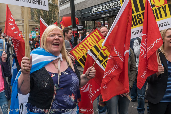
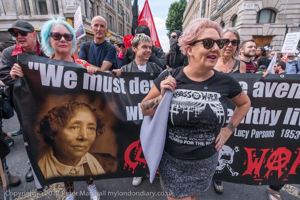
Class War wrap a march steward in their banner at the start of the march

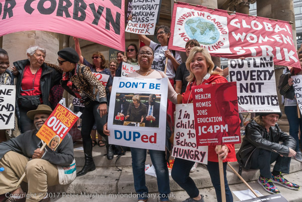
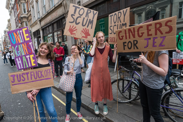
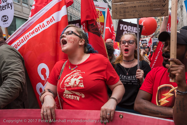
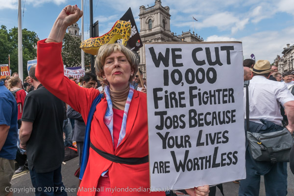
Tories Out March – 1st July 2017: Five years ago, shortly after the Labour right working inside the party had managed to prevent a Corbyn victory by sabotaging the campaign for the 2017 General Election, the People’s Assembly Against Austerity organised a march through London calling for Theresa May and the Conservatives to go.

Of course they didn’t go, and later when Boris Johnson called an election over Brexit, he gained a landslide victory, rather than the close call in 2017 which left Theresa May having to bribe the Northern Irish DUP, a deeply bigoted party with links to Loyalist terrorists to support her.

This reliance on the DUP has eventually led to the current problem over the Irish Sea border arrangements which Boris Johnson persuaded the EU to adopt as a vital part of his Brexit deal, and which the government is now pushing through a bill to enable us to renege on.

And the Johnson administration has continued and worsened the Tory policies which in 2017 should have resulted in a Labour victory. In my account of the protest march 5 years ago today I wrote

“The election showed a rejection of … austerity policies and the Grenfell Tower disaster underlined the toxic effects of Tory failure and privatisation of building regulations and inspection and a total lack of concern for the lives of ordinary people. The protesters, many of whom chanted their support of Jeremy Corbyn, say the Tories have proved themselves unfit to govern. They demand a decent health service, education system, housing, jobs and living standards for all.”

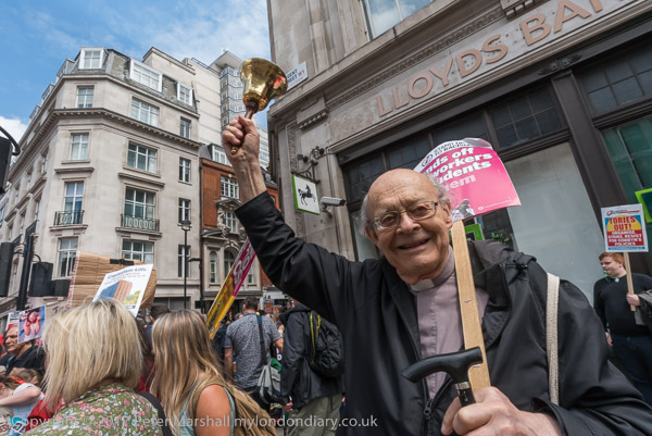
Rev Paul Nicolson from Taxpayers Against Poverty rings his bell

The full facts of the sabotage of the Labour election campaign from inside the party had not then come to light – and we are still waiting for the Forde inquiry into the leaked report which exposed the racism, hyper-factionalism and electoral sabotage by party officials as well as the misguided attempts of the Corbyn leadership such as the expulsion of Jackie Walker and the resignations of Chris Williamson and Ken Livingstone.

But although this was largely a march of Labour supporters there were still a number of groups on the march who were critical of Labour’s policies and the practices of London Labour councils, particularly on housing, where councils are “demolishing council estates and colluding with huge property developers to replace them with expensive and largely private housing. It is a massive land grab, giving away public land often at far below market value and pricing the former residents out of London in what they call ‘regeneration’ but is quite clearly a process of social and ethnic cleansing.”

It is also a process that has resulted in considerable personal financial advantage for some of those who have led it, with councillors and officers either leaving to work for the developers or in organisations set up by councils to manage their estates. Setting up organisations such as the TMO responsible for the unsafe condition of Grenfell Tower has enabled these bodies to hide information about such activites as using consultants to advise them on circumventing adequate fire inspections outside of the purview of Freedom of Information requests.

Most obvious among these groups was Class War, alway ready to make their views known and to challenge authority. At the start of the march close to the BBC they had a little run-in with the march stewards, which resulted in them briefly wrapping their banner around one of him – though of course they soon released him. Later at the rally in Parliament Square I unfortunately missed a confrontation in which Lisa McKenzie stood in front of both Len McCluskey, General Secretary of Unite the Union and Labour Leader Jeremy Corbyn and loudly asked them the simple question ‘When are you going to stop Labour councils socially cleansing people out of London?’. Both men simply ignored her and walked away.

Much more about the event and many more pictures at Tories Out March.

West Lane & Spa Road Bermondsey 1988

My previous post on this walk was Thames, Rotherhithe & Wapping 1988 and ended next to the isolated former offices of Braithwaite & Dean, close to the Angel pub on the bank of the Thames.

Servewell Cafe, West Lane,Bermondsey, 1988 88-10l-34-Edit_2400
Servewell Cafe, West Lane,Bermondsey, 1988 88-10l-34

I walked a short distance west by the river, photographing some recent flats on Bermondsey Wall East and the riverside warehouse at Corbett’s wharf, since discretely refurbished (not digitised) before turning down West Lane where there was more new housing and finding The Evangelical Church of the Deaf which I think was where there is now a new block of flats on Paradise Street.(also not digitised.)

The Servewell Cafe was then at number 14, and is now a few doors down in larger premises, its former site now an Indian Takeaway. The barbers on the corner remains a Gents Hairdresser, but the wool shop is now ‘glue bermondsey’ creative space.

Bermondsey & Rotherhithe, War Memorial, West Lane, Jamaica Rd, Bermondsey, Southwark, 1988 88-10l-35-Edit_2400
Bermondsey & Rotherhithe, War Memorial, West Lane, Jamaica Rd, Bermondsey, Southwark, 1988 88-10l-35

The Bermondsey & Rotherhithe War Memorial is immediately in front of the shops on West Lane, close to its junction with Jamaica Road on a wide area of pavement. It was erected here replacing a temporary memorial in 1921 “to the honoured memory of the men of Bermondsey and Rotherhithe who fell in the great war 1914 – 1918” and later inscriptions were added for the Second World War, including “In remembrance of all those civilians and members of the civil defence and fire brigade services who lost their lives in this community 1939 – 1945.” The coat of arms is that of the former Metropolitan Borough of Bermondsey with its motto ‘Prosunt Gentibus Artes‘ (arts profit the people). Among the sponsors of the memorial was the then owner of Peak Freans, Arthur Carr.

Scott Lidgett Crescent, Bermondsey, Southwark, 1988 88-10l-36-Edit_2400
Scott Lidgett Crescent, Bermondsey, Southwark, 1988 88-10l-36

John Scott Lidgett (1854-1953) was a Methodist minister, educationalist and politician who was at various times the first President of the Methodist Conference, vice-chancellor of the University of London. He played an important role in the development of women’s colleges and university support for teach training. He became an alderman of the London County Council and led the Progressive Party on the LCC from 1918-28.

In 1891 he established the Bermondsey Settlement, the only Methodist settlement, and became its warden. Among those that this attracted to devote themselves to come and live and work in the community were Ada and Alfred Salter. The settlement closed in 1969.

These solidly built houses were a part of the continuing redevelopment of the area which had been begun by Bermondsey Council – with the Salters as councillors and later Mayor and MP respectively, beginning at Wilson Grove in 1927. In the ten years after the war, the council and the LCC built 9,600 homes.

Salvation Army, Hostel, Spa Road, Bermondsey, Southwark, 1988 88-10l-11-Edit_2400
Salvation Army, Hostel, Spa Road, Bermondsey, Southwark, 1988 88-10l-11

The Salvation Army Social Services Hostel for Men on Spa Road was much needed in one of the country’s most deprived areas when this ‘elevator’, designed to both house men and provide some paid work to prepare them for work outside, opened in 1899. It was a waste paper depot and the men were employed in sorting the waste – recycling is nothing new.

Back in my childhood, before going to church my father would sort all the waste paper which had found its way into our house, flattening the sheets, piling them on top of each other before rolling them up and tying the roll with string, to be put out next to the dustbin for the council to collect.

The Spa Road hostel also housed some Belgian refugees in the First World War and Italian prisoners of war at the end of WW2. A laundry was added in the 1920s. By the time I photographed it the laundry had closed but the centre also offered other work, including basket-weaving, carpentry, candle-making, and picture-framing. It finally closed in 2001 and was demolished in 2003. The site is now occupied by a large block of flats.

Bermondsey Municipal Offices, Spa Road, Bermondsey, Southwark, 1988 88-10l-14-Edit_2400
Bermondsey Municipal Offices, Spa Road, Bermondsey, Southwark, 1988 88-10l-14

Bermondsey Town Hall was only Grade II listed 10 years after I made this picture. It was built as an extension to the existing Victorian Bermondsey Town Hall in 1928-1930, architect Henry Tansley indulging in a deliberate recreation of the 19th century Greek Revival. I’ve not digitised the picture I took of its grand frontage, but only this image showing a detail of the building, including some of its listed railings.

Planning permission was granted in 2012 for the conversion of the building into 41 homes and is now rather confusingly called Old Town Hall Apartments.

BermondseyCentral Library, Spa Road, Bermondsey, Southwark, 1988 88-10l-15-Edit_2400
Bermondsey Central Library, Spa Road, Bermondsey, Southwark, 1988 88-10l-15

Similarly I’ve yet to digitise the more overall image of the library which is in the background to this picture. The gate pier and railings are all that remains from another municipal building, the old Bermondsey Town Hall which was heavily damaged by wartime bombing and demolished in the 1960. The gate was kept when a new ‘One Stop Shop’ replaced the ruins, and it was retained when this was in turn demolished and replaced by ‘The Exchange’ around 2013. Its ground floor is now a Sainsbury’s Local.

Flats, Fort Rd, Bermondsey, Southwark, 1988 88-10m-65-Edit_2400
Flats, Fort Rd, Bermondsey, Southwark, 1988 88-10m-65

I wanders a little around the area by Spa Gardens making an image of new housing in Hazel Way and old in Balaclava Rd and then this which I think is Dartford House in Fort Road, part of the Longfield Estate.

To be continued…


Thames, Rotherhithe & Wapping 1988

From Southwark Park Schools which ended the previous post on this walk, Rotherhithe New Road & Southwark Park Schools, I walked a few yards up Southwark Park Road to the corner with Banyard Road, where I photographed the taxi office (still there but changed from A-Z Star Cars to 5 Star Cars) with the pub on the opposite corner, the Southwark Park Tavern, now closed and converted to residential around 2003.

There was a pub around here, the Green Man, possibly on this site before Southwark Park opened in 1869 but I think this building probably came shortly after the park was opened, and is opposite the Carriage Drive leading into the park.

Unfortunately I haven’t yet digitised this picture, nor one of rather plain two-storey terrace on Banyard Rd or an image showing a play area in the park. I hurried through the park to the Jamaica Road gate at its north, crossing to make my way to Kings Stairs Gardens and the River Thames.

River Thames, Downstream, Rotherhithe, Southwark, 1988 88-10l-63-Edit_2400
River Thames, Downstream, Rotherhithe, Southwark, 1988 88-10l-63

The two jetties visible here I think have now gone and there is certainly no line of lighters as in this picture, and there is one striking new building on the riverfront.

River Thames, Downstream, Rotherhithe, Southwark, 1988 88-10l-65-Edit_2400
River Thames, Downstream, Rotherhithe, Southwark, 1988 88-10l-65

A second picture taken with a short telephoto lens from almost exactly the same place shows the central area more clearly, with new flats being built on Rotherhithe St.

Wapping, River Thames, Rotherhithe, Southwark, 198888-10l-51-Edit_2400
Wapping, River Thames, Rotherhithe, Southwark, 198888-10l-51

Looking across the Thames downstream, with Free Trade Wharf at the extreme right and just to the left the cylinder ventilation shaft of the Rotherhithe tunnel in the King Edward Memorial Park. Both Metropolitan Wharf and New Crane Wharf are covered iwth scaffolding.

Wapping, River Thames, Rotherhithe, Southwark, 1988 88-10l-52-Edit_2400
Wapping, River Thames, Rotherhithe, Southwark, 1988 88-10l-52

Part of St John’s Wharf and King Henry’s Wharves seen across the River Thames.

Wapping, River Thames, Rotherhithe, Southwark, 198888-10l-53-Edit_2400
Wapping, River Thames, Rotherhithe, Southwark, 1988 88-10l-53

More of St John’s Wharf, including one of the earlier warehouse conversions and the Grade II listed Wapping Police Station, built 1907-10, Metropolitan Police architect John Dixon Butler. At extreme left is a part of Aberdeen Wharf built in 1843–4 by the Aberdeen Steam Navigation Company.

Wapping, River Thames, Rotherhithe, Southwark, 1988 88-10l-54-Edit_2400
Wapping, River Thames, Rotherhithe, Southwark, 1988 88-10l-54

The end of Aberdeen Wharf is at the right edge of this picture, and at its left the Wapping Police Boatyard, an unnecessarily ugly building opened in 1973. The new building in the centre of the picture also seems something of an eyesore, at least at its ends.

Wapping, River Thames, Rotherhithe, Southwark, 1988 88-10l-55-Edit_2400
Wapping, River Thames, Rotherhithe, Southwark, 1988 88-10l-55

Continuing up-river from the Police Boatyard are St Thomas Wharf, Pierhead Wharf, Oliver’s Wharf – the first warehouse in Wapping to be converted into luxury flats in 1972 – and Wapping Pierhead, with houses designed by Daniel Alexander in 1811 and the main entrance to London Docks.

Bermondsey, River Thames, Rotherhithe, Southwark, 1988 88-10l-41-Edit_2400
Bermondsey, River Thames, Rotherhithe, Southwark, 1988 88-10l-41

Looking upriver on the south bank with Tower Bridge at the extreme right and Guy’s Hospital tower just left of centre. Cherry Garden Pier is at left.

Silver Jubilee, marker, EIIR, River Thames, Rotherhithe, Southwark, 1988 88-10l-43-Edit_2400
Silver Jubilee, marker, EIIR, River Thames, Rotherhithe, Southwark, 1988 88-10l-43

There is still a marker for the Queen’s Silver Jubilee here but it looks far less impressive than this rugged stonework I photographed in 1988. London has also gained quite a few tall buildings, but the view along the river remains clear and you can still see the dome of St Paul’s Cathedral.

Braithwaite & Dean, Rotherhithe St, Rotherhithe, Southwark, 1988 88-10l-44-Edit_2400
Braithwaite & Dean, Rotherhithe St, Rotherhithe, Southwark, 1988 88-10l-44

41 Rotherhithe St, now apparently 1 Fulford St at least according to Google Maps, was the offices of lighterage company Braitwaite & Dean, where their lightermen would come to collect their weekly wage. Apparently it was known locally as the Leaning Tower of Rotherhithe, though the building’s lean is more apparent from across the river than in my picture.

It was left more or less alone on this stretch of the river with just the Angel pub equally isolated a few yards upriver after Bermondsey council bought many of the buildings in 1939 to create a park, with wartime bombing continuing the demolition job. There was some temporary housing by the river when I first walked along here in the early 1980s, but that soon disappeared.

My walk in Bermondsey continued – more about it in a later post.


Rotherhithe New Road & Southwark Park Schools

Rotherhithe New Road & Southwark Park Schools – October 1988

Rotherhithe New Rd Bermondsey, Southwark, 1988 88-10k-31-Edit_2400
Rotherhithe New Rd Bermondsey, Southwark, 1988 88-10k-31

I’m not entirely sure whether my next pictures, taken on Rotherhithe New Road were a part of the same walk as my previous post in this series, Down the Blue, Spa Road & Old Jamaica Road 1988 or the start of my next visit to the area from roughly where that ended.

This window was somewhere not far from Raymouth Road which I probably walked down to get to Rotherhithe New Road, and I liked the design of the window with its tall thin iron supports, though it was hard so see them through the branches – which perhaps added to their attraction. I can’t find the actual location and it may well have been demolished.

Debnams Rd, Rotherhithe New Rd Bermondsey, Southwark, 1988 88-10k-34-Edit_2400
Debnams Rd, Rotherhithe New Rd, Bermondsey, Southwark, 1988 88-10k-34

This is the corner of Debnams Road with Rotherhithe New Road and it was obviously the ‘5 Star Batteries’ painting on the first floor wall together with the other signage that made me photograph it. 203-5 is now covered with pebbledash and for some years had an advertising hoarding on this side wall, but this is now gone. The premises have changed hands several times, and in recent years have been a glazing firm, an African Food Store and now ‘Posh Hair Salon’.

Rotherhithe New Rd Bermondsey, Southwark, 1988 88-10k-22-Edit_2400
Rotherhithe New Rd, Bermondsey, Southwark, 1988 88-10k-22

Next to the railway arches on the south side of Rotherhithe New Road in what is now called Jarrow Road I couldn’t resist this smiling lorry for ‘Wood Be Good Paint Strippers’.

Rotherhithe New Rd Bermondsey, Southwark, 1988 88-10k-23-Edit_2400
Rotherhithe New Rd Bermondsey, Southwark, 1988 88-10k-23

This obviously dilapidated building was on Rotherhithe New Road close to the railway bridges and I think was demolished to build the Rotherhithe Business Estate at 214 Rotherhithe New Rd. Unfortunately I have no idea what it had been – if anyone knows please tell me in the comments.

Cain Hill Cafe, Rotherhithe New Rd, Bermondsey, Southwark, 1988 88-10k-11-Edit_2400
Cain Hill Cafe, Rotherhithe New Rd, Bermondsey, Southwark, 1988 88-10k-11

The Cain Hill Cafe which offered hot meals served all day, sandwiches and rolls was at the side of this railway bridge on Rotherhithe New Rd. This was demolished to give a wider entrance to the Rotherhithe Business Estate.

Southwark Park Schools, Southwark Park Rd, Bermondsey, Southwark, 1988 88-10k-12-Edit_2400
Southwark Park Schools, Southwark Park Rd, Bermondsey, Southwark, 1988 88-10k-12

Southwark Park Schools on Southwark Park Road, Grade II listed as an early example of a London Board School by E.R.Robson 1873-4. This frontage is a part of the original building which was extended in the 1890’s and 1910, and sensitively comprehensively redeveloped around 2010 retaining the listed buildings.

My photograph shows one of the two ‘2 sculptural reliefs which depict children learning; to each an inscription panel with the words “School Board for London”
and “Southwark Park Schools
“.’

From here I walked down to the River Thames, where the next post on this walk will continue.


Surrey Docks & North Bermondsey 1988

I can no longer remember whether the short excursion to Greenland Dock from Rotherhithe came at the end of my previous walk or a few days later at the beginning of my walk on 28th October 1988, though of course it doesn’t really matter. The story of my previous walk began at Greenwich and Deptford Creek October 1988 and ended with Deptford to Rotherhithe October 1988.

I’m unsure now whether I took the fist few of these pictures at the end of my previous walk or at the start of my next one, but it hardly matters as they are in the same area and within a few days of each other.

Lifting Bridge, Dockside sheds, Redriff Rd, Rotherhithe, Southwark, 1988 88-10j-03-Edit_2400
Lifting Bridge, Dockside sheds, Redriff Rd, Rotherhithe, Southwark, 1988 88-10j-03

This is one of the two bridges that linked the riverside areas of Rotherhithe and the Surrey Docks to the area around Lower Road and Surrey Quays station, then on the East London which ran between Shoreditch and alternately to New Cross or New Cross Gate, linking to the District line at Whitechapel. Both have been preserved, though not in working order and this one a short distance from it former site.

At the centre of the picture you can see the curved lower end of the bridge and below it the flat rail on which it rolled back to raise the bascule, with a heavy counterweight above so very little power was needed to raise the bridge.

Greenland Dock, Rotherhithe, Southwark, 1988 88-10h-12-Edit_2400
Greenland Dock, Rotherhithe, Southwark, 1988 88-10h-12

Several relics from the working docks, including this capstan are still present at the east end of Greenland Quay.

Greenland Dock, Rotherhithe, Southwark, 1988 88-10h-13-Edit_2400
Greenland Dock, Rotherhithe, Southwark, 1988 88-10h-13

Four people in kayaks link up and stop to talk to each other in Greenland Dock. I was standing at the end of Greenland Quay and looking towards the tower blocks of the Barkantine Estate on the Isle of Dogs across the Thames.

Southwark Park, Rotherhithe, Southwark, 1988 88-10j-62-Edit_2400
Southwark Park, Rotherhithe, Southwark, 1988 88-10j-62

My next picture was made in Southwark Park, which I think I walked through to Jamaica Road. I’m not absolutely sure what the building in the background was, and I think the area it was in has now been re-developed. Somewhere in the north-east corner of the park it was probably a part of the former St Olave’s Hospital which closed in 1984 and was demolished and replaced by Ann Moss Way in the 1990s.

I seem deliberately to have tried to make this picture mysterious, taking three near-identical frames, an unusual number for me at the time when film was relatively expensive.

Major Works, James Jackson and Co, Jamaica Rd, Bermondsey, Southwark, 1988 88-10j-65-Edit_2400
Major Works, James Jackson and Co, Jamaica Rd, Bermondsey, Southwark, 1988 88-10j-51

This works was next to Major Road, though I’m not sure if it took its name from the road or gave its name to it. It was demolished to build Bermondsey Underground Station on the Jubilee Line Extension which opened at the start of 2000. According to the text on its frontage the company was ‘Established 1827’ and made ‘Flooring Adhesives, French Polishes, Wax Polishes, Varnishes, Seals, Staines – Etc.’

Jamaica Rd area, Bermondsey, Southwark, 1988 88-10j-51-2-Edit_2400
Jamaica Rd area, Bermondsey, Southwark, 1988 88-10j-51-2

Relatively few streets in the area aspire to a No 90 and none that I can find that look anything like this now. This was a part of a terrace of 5 similar houses starting at a street corner, with two pairs of doors on the street and one around the corner as another frame (not digitised) shows. It appears to be later Victorian and I suspect has been demolished. The gate was perhaps a 1930s addition.

Lockwood Square, Bermondsey, Southwark, 1988 88-10j-52-Edit_2400
Lockwood Square, Bermondsey, Southwark, 1988 88-10j-52

Lockwood Square was a 1960’s addition to the council’s Southwark Park Estate with flats around a central grass area. There had been a Lockwood Street here and it was probably badly damaged by wartime bombing. The buildings are bounded by Drummond Road, Clements Road and Southwark Park Road. Some of the ground floor is garages and there are a few shop units. To the north is a play area and Saint Crispin with Christ Church Bermondsey and the similar block of New Place Square.

To be continued…