Thames Path – Pangbourne – Cholsey

Whitchurch from the bridge from Pangbourne

Thames Path – Pangbourne – Cholsey: At the start of 2010 we were still walking sections of the Thames Path. On New Years Day we had walked from Reading to Pangbourne, and on the following day caught the train back to Pangbourne to begin our day’s journey there.

The Thames from the Thames Path along a hillside west of Whitchurch

We were heading to Cholsey, around 8 miles away, an easy distance suitable for a short day with over an hour’s rail travel at each end. Cholsey is a small village and has a railway station a little over a mile from the Thames Path with trains back to Reading from where trains run – if rather slowly – back to Staines.

Gatehampton Bridge

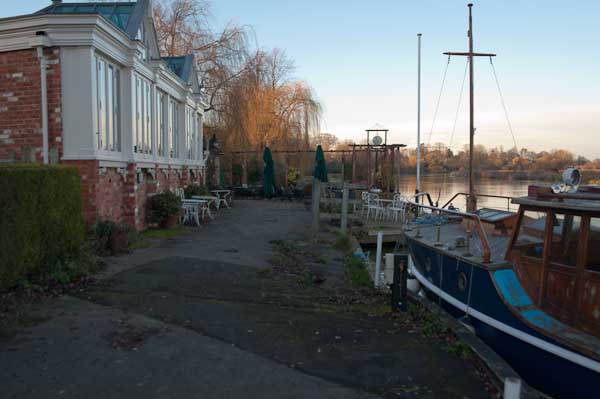
Pangbourne is a much larger village, and its station is a short walk from where we joined the Thames Path, and there were a few shops where we could buy some crisps and sweets to supplement the sandwiches in our bags and even a public toilet, so a very useful place to start a walk.

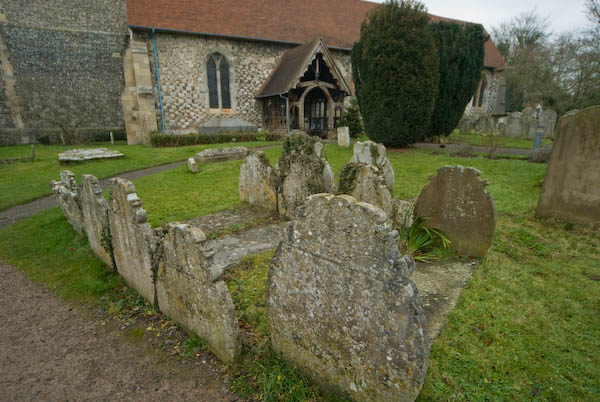
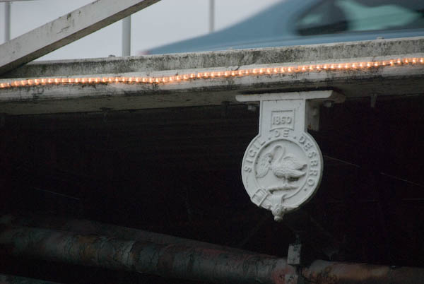
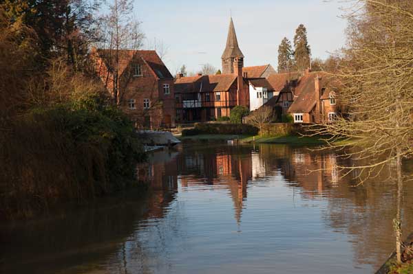
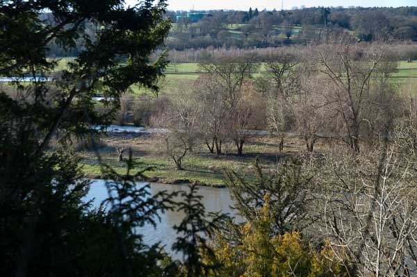
Before our walk really started we spent a little time in Pangbourne, visiting the parish church and photographing the Pang before rejoining the Thames Path at Whitchurch Bridge. Crossing the bridge takes you to Whitchurch, perhaps a prettier village than Pangbourne. Here the path takes quite a long detour away from the river bank and up on a hillside, with some extensive views through trees of the river and country to the south, before going back down to the riverside.

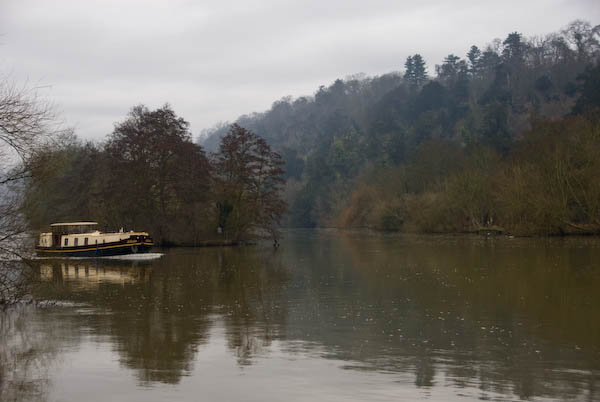
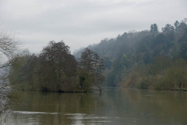
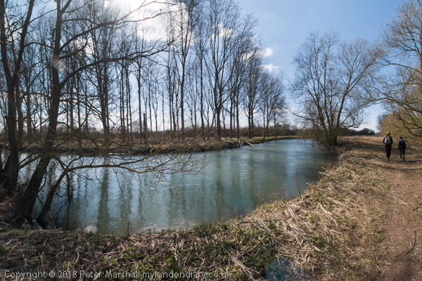
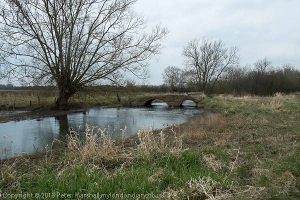
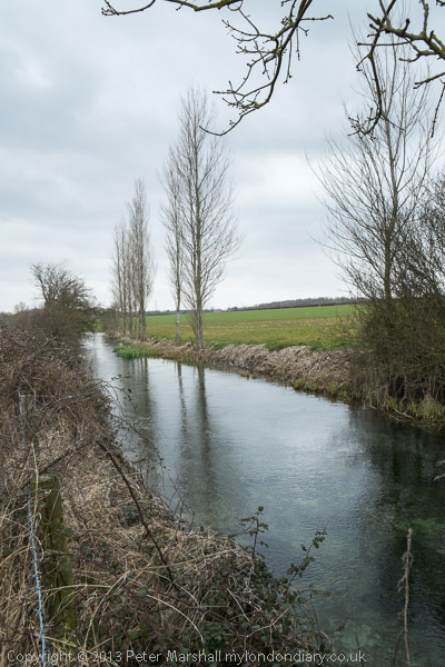
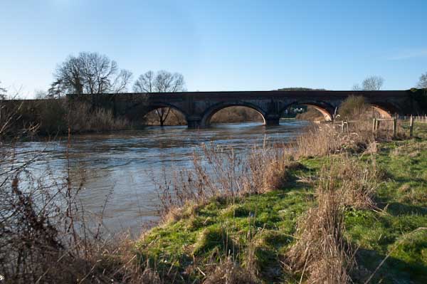
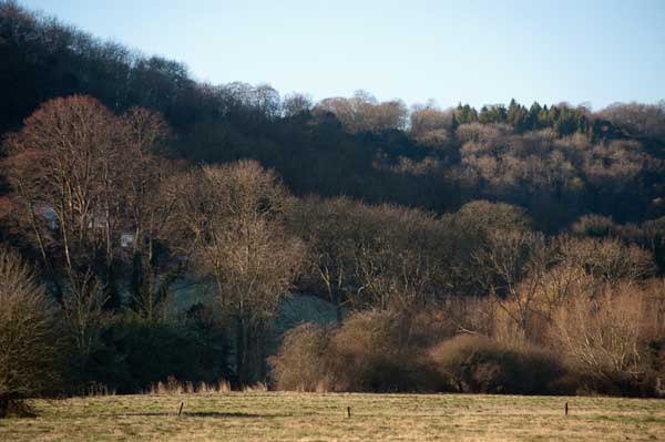
The railway line crosses the path and the river at Gatehampton Bridge, built by Brunel for the GWR main line in 1838 but the path stays on the north bank, passing between the tree-covered slopes of the Goring Gap, where the river cut through to seperate the Chilterns from the Berkshire Downs. Winter sun on the leafless bare branches was magical.

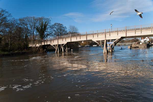
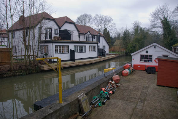
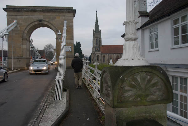
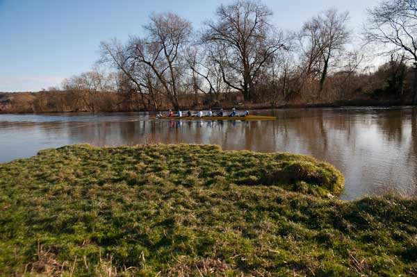
The bridge linking Goring on the north bank with Streatley on the south seems a rather primitive and temporary wooden structure, but has been here since 1923 when it replace the earlier bridge from 1837. Before then there had been both a ferry and a ford, though this was probably more often passable on horseback than on foot. It takes two bridges to reach Streatley from where the Thames Path proceeds westward on the south bank.

Streatley from Goring lock

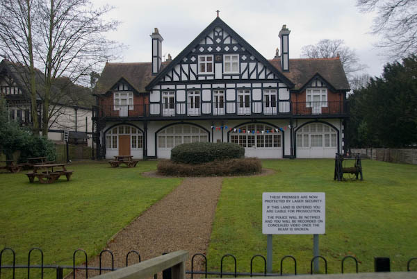
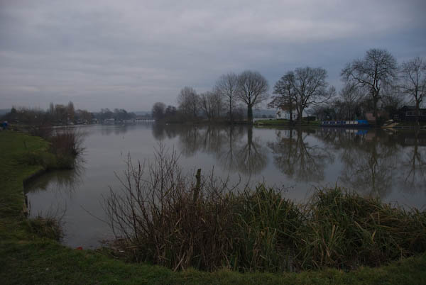
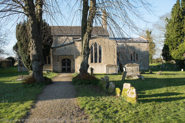
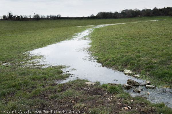
At Streatley, a village until 1938 owned by the Oxfordshire brewers Morrell we visited the church and then set out on a partly underwater path by the river. December 2009 had been one of the wettest months on record and we began to doubt the wisdom of We thought about turning back and abandoning the walk, taking a train from Goring, but after seeing a walker paddle through towards us decided to continue.

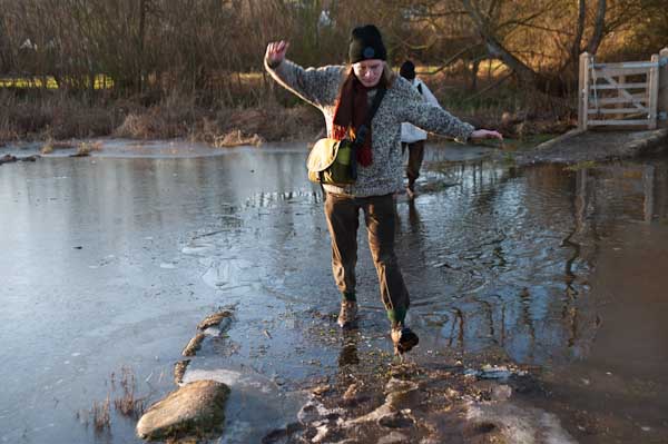
Fortunately it was only a few inches deep, but despite our boots I think we all got wet feet. The day was around freezing, but walking kept our feet warm, and many of the smaller puddles along the rest of our route were frozen over, as well as the mud, and it was much easier to walk than had it been warmer.

The Beetle and Wedge at Mouslford looked very closed

A little further on the tow path moves from the south to the north bank, not a great problem in the past for craft being towed who could pole over to the other side, but more so for walkers, who need to take a path away from the river and along a main road for a mile or so leaving the path were it went down towards the Moulsford railway bridge and continuing to a footpath beside the railway to Cholsey station.

More pictures from this walk at Pangbourne – Cholsey and more from the previous day’s walk at Reading – Pangbourne. You can read my original post at Thames Path.


Thames Path: Maidenhead – Marlow

Thames Path: Maidenhead – Marlow – A New Year’s Eve Walk

Back in 2007 our New Year’s Eve walk was a little more distant than we will attempt this year, though we started from the same place. This year public transport will be rather less available and less reliable than it was 14 years ago, thanks only partly to Covid which this year will put many train and bus drivers into isolation at short notice.

Maidenhead

But we’ve seen an increasing trend over recent years to close various rail lines for engineering works over all of our holiday periods, and travelling anywhere on New Year’s Eve had begun increasingly to resemble Russian Roulette. I can’t understand why the railways now seem to need so many more closures for repairs than they used to; perhaps less work is now carried out overnight.

Ray Mill Island behind Boulters Lock, Maidenhead

We spent a few years walking the Thames Path, from the Estuary beyond its official ending to the source, taking the route in short sections, perhaps ten or twelve miles at a time, with the start and finish determined by where trains and buses could take us until we were some way west of Oxford. It was only for the final three days from Hinton Waldrist to Kemble we had to spend a couple of nights staying at Buscot and Cricklade.

Protected by Laser Security

But to get to Maidenhead we had to take a train to Windsor & Eton Riverside, run from there to Windsor Central to take the train to Slough where we could change for the train to Maidenhead. And after our walk to Marlow we could catch a train back to Maidenhead, another to Slough and then Windsor. At least on the return journey we had time to walk for the connection. It worked in 2007, but the chances of 4 trains running without any cancellations in the early evening of New Years Eve 2021 seem low.

Cliveden woods and River Thames

The section from Maidenhead to Marlow is only around 8 miles, though as usual we made a few detours on the way to explore some of the places it took us through. As the pictures show, the day was a dull one and I left the pictures making that clear rather than try to brighten them up.

Cookham Parish Church

The pictures on My London Diary are generally in the order of the route, and the captions there give some information about the walk. On the introductory page I wrote a very short text, and here it is in full (with the odd typo corrected):

The Thames path between Maidenhead and Marlow is quite picturesque, but full of evidence of how the rich get rich by theft. Anyone attempting to tow their boat will find that large sections of the towpath are now fenced in as private property. For walkers, the lack of access opposite Cliveden is annoying – you can really only see this part of the Thames from the river.

Maidenhead – Marlow
The Stanley Spencer Gallery is in the former chapel at the centre of the old village of Cookham

Parts of the route were familiar to me from earlier walks, and I’d recommend doing this walk on a day of the year when the Stanley Spencer Gallery in Cookham is open – and there are also several pubs worthy of some attention where I wasn’t allowed this time to linger.

I think these paired triangles which are navigational transit markers, placed in pairs a set distance apart for craft to time how long they take between them and thus calculate their speed.

On Marlow Bridge I photographed the seals which state SIGIL DE DESBRO and back in 2007 I invited people to e-mail me to explain these. Sigil is simply an archaic word for a seal or pictorial symbol, from the Latin ‘sigillum’. De for ‘of’ comes from the Norman invasion and Desbro is a shortened form of Desborough, one of the three Chiltern Hundreds which dates back to pre-Norman times, though then made up of a number of smaller hundreds.

But by the time the bridge was built the hundreds were largely or entirely historical, and the Chiltern Hundreds last had a real steward in the sixteenth century. In 1624 it was made illegal for Members of Parliament to retire from office, and still are appointed as either ‘Crown Steward and Bailiff of the Chiltern Hundreds’ or of the Manor of Northstead as a legal fiction enabling them to do so.

Marlow Bridge and Church

The name Desborough came back into use in 1905 when William Henry Grenfell who had been an MP for 25 years and made is home in Taplow was sent to the House of Lords as the 1st Baron Desborough. For 35 years he was President of the Thames Conservancy Board and was responsible for the Desborough Cut, a navigational shortcut on the Thames between Walton and Weybridge which, together with the island it created were named after him.

Looking back towards Bourne End

Given there is little or no commercial traffic on the Thames the creation of the cut now seems rather pointless. Although it saves around 1.2 km on the route, the longer passage is far more interesting. But it was perhaps more a scheme to create jobs for men in the depression than anything else.

More at Maidenhead – Marlow.

Thames Path

One of the many things I ought really to do is to put together a book of my pictures of the Thames Path. Of course quite a few others have done so, but I think mine would provide a slightly different view.

I think I’ve walked every section of it over the years, parts of it many times, though there may possibly be a few yards I’ve missed actually in London where there are routes on both sides of the river. I’ve also gone rather further east on both banks, as the Thames Path stops rather prematurely at the Thamea Barrier while the paths continue.

I’ve never quite been to the mouth of the Thames, traditionally marked at various places including the the Nore sandbank, Yantlet Creek – where the City put up the London Stone, and though I cycled to Leigh-on-Sea in 2005 I think I missed the Crow Stone.

Most of the sections of path upstream from Windsor I’ve walked on various days with my family. As far as a little above Oxford it’s fairly easy to travel by public transport to the start of a day’s walk and back from the end, but above that there are few buses and no stations until you get close to the source. So the final (or initial) 60-70 km had eluded us.

In 2013, my elder son planned the expedition to complete the route, booking bed and breakfast for the three of us at Buscot and Cricklade so we had three days to walk. On the Tuesday following Easter, two trains (both running late) took us to Oxford, despite Easter Holiday engineering works still in operation and we took the bus to Hinton Waldrist. For the last five miles we were the only passengers and the bus had a problem in the village squeezing past a parked tractor.

We were still a couple of km away from the Thames Path, but the sun was out and despite being rather close to zero it was good walking weather. The map and guide book said there was still a ford across an old stream of the river at Duxford which would have saved us some walking, but there had been considerable rain in previous weeks and it was clearly impassable; even on the longer way round we occasionally needed to detour around flooded sections of path.

We just made it for a late lunch before the pub at Tadpole Bridge stopped serving, having seen only one other person on the first five miles or so of our walk. It was good to have a pint, though the food suffered from the restaurant’s aspirations, and service was fast. The river winds considerably around here and I think we walked at least twice as far as a crow might fly to get to Radcot and from there on to Kelmscott where we again paused. We were a day early for the first opening of the Manor there, perhaps as well as we didn’t have time to appreciate it, but we did visit William Morris’s grave and the local pub before continuing our slog to Buscot Manor, an interesting and welcoming place to spend the night.

The following morning after a very large breakfast with other guests we made a short tour of the village before continuing along the Thames Path towards Lechlade, where I was forced to waste time snared into a tea shop by my companions. Eventually we made it and walked on past the start of the Thames and Severn canal to the Church of St John the Baptist at Inglesham, a splendid medieval survival thanks to the efforts of William Morris, who along with his pre-Raphaelite friends founded the Society for the Protection of Ancient Buildings (SPAB) or ‘Anti-Scrape’ to oppose the gothicisation of buildings such as these.

Then came the worst section of the Thames Path, a mile or so on the verge of the busy A361 followed by another couple along a bridle path and country lanes out of sight of the river. Between Inglesham and Castle Eaton there is no real Thames Path – except for a couple of hundred yards beside the river in the 4 or 5 mile stretch. Though except for the A361 it is a decent country walk. The route does run beside the river from Castle Eaton to Cricklade where we made for the oldest and poshest pub, the White Hart where we were booked. And after finding our room found a good Indian restaurant not far away.

After a disappointing breakfast we took a short walk around Cricklade before continuing our journey. Flooding in the area meant the path had been diverted but it wasn’t a bad diversion and we were soon walking with the river through a land almost entirely covered by unfilled gravel pits, something there is no shortage of close to home. These cover the land east and west of the charming village of Ashton Keynes, west of which it’s hard to decide where the river actually flows. According to the Thames Path Guide, the Thames follows several coursed through Ashton Keynes, though some distance further up you do walk beside a decent small river.

Past the A 329 the river rather peters out, and by the time we reached Thames Head on the A 433 Fosse Way all that was left was damp grass. Across the road we struggled up a small hill to the official source, a dry spring that is marked by a stone placed here by the Thames Conservators. From here it was downhill to Kemble Station and a long wait for a train to Swindon, where we changed for Reading and then another train home.

More details and many more pictures on My London Diary.
Thames Path: Cricklade to the Source
Thames Path: Buscot to Cricklade
Thames Path: Shifford to Buscot

Greenwich Riverside Walk

One of my favourite London walks has for many years been beside the River Thames on the path downstream from Greenwich. I first walked it in the 1970s and went back occasionally over the years, both on foot and later taking my Brompton bicycle to it on the train. When I was on foot I often went as far as Woolwich, not a great distance but I was always a photographer rather than a walker. Other riverside walks began from Woowlich or railway stations further east including Erith, Dartford and Gravesend.

On October 18th 2018 my walk was rather shorter as I was with three other photographers, and we began at North Greenwich. Parts of the riverside walk had recently reopened after closure for the continuing process of ruining the Thames by lining it with tall blocks of expensive flats and I was keen to walk it again after some years away.

There were other reasons for the walk too. One was a visit to the Pelton Arms, arguably Greenwich’s finest pub. Its in a homely area, developed like the pub around 1844, though the Grade II listed street of granite setts from around 1870 stops a few yards short. It’s just a short walk from Granite Wharf, which got its name as it was here than Mowlem landed its granite from Guernsey that once paved much of the streets of London. But the real attraction is its fine range of real ales and comfortable atmosphere – and, although quiet when we visited is one of South London’s leading music venues.

We were also on our way to an evening event across the river in North Greenwich, and after a meal in the centre of the town hopped on the DLR at Cutty Sark for the single stop to Island Gardens and a short walk to where another of our photographer friends, Mike Seaborne was having the launch of his book on the Isle of Dogs. It was getting a little late when we had finished our meal otherwise I would have suggested going across the river on foot, not walking on the water but under it in the Greenwich foot tunnel.

There are many more pictures from the walk on My London Diary. Most but not all are ultra-wide views with a horizontal angle of view of over 140 degrees. Often I crop these to a more panoramic format, but here I decided to leave them covering the full frame to fit better with the few less wide-angle images. All except one in this post are ultra-wide and they are presented in the order of the walk.


All photographs on this and my other sites, unless otherwise stated, are taken by and copyright of Peter Marshall, and are available for reproduction or can be bought as prints.