Posts Tagged ‘Westminster’

Camera Place and the Grosvenor Canal 1988

Saturday, September 4th, 2021

Camera Place, Chelsea, Kensington and Chelsea, 1988 88-5c-64-positive_2400
Camera Place, Chelsea, Kensington and Chelsea, 1988 88-5c-64

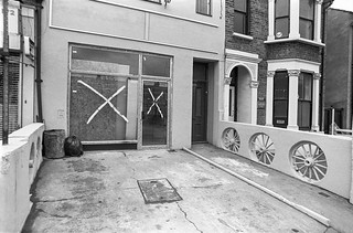
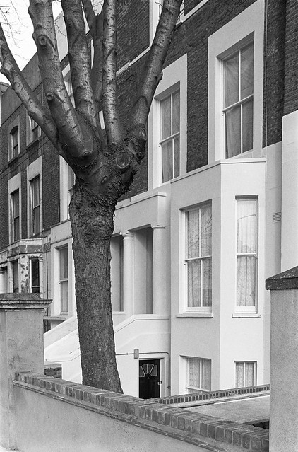
Having found there was a street in Chelsea named Camera Place I had to photograph it. It’s a short street and my picture shows around half of it, looking roughly west towards Limerston St. Chelsea used to have a Camera Square, Camera Street and Little Camera Street which have since disappeared, but as they were built in the 1820s they almost certainly have little to do with photography. By 1918 Camera Square had become something of a slum and the area was demolished, rebuilt as Chelsea Park Gardens with up-market housing in suburban garden village fashion, though retaining a rigidly square layout without the typical sinously curving streets.

The view in Camera Place has changed little; some new railings and the small tree is now rather large.

Elm Park Mansions, Park Walk, Chelsea, Kensington and Chelsea, 1988 88-5c-62-positive_2400
Elm Park Mansions, Park Walk, Chelsea, Kensington and Chelsea, 1988 88-5c-62

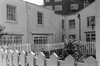
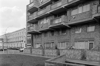
Elm Park Mansions has five large blocks around a courtyard, with one of the blocks (flats 25-54) occuping half the length of the north side of Camera Place, behind and to my right as I took the previous picture. The mansions with 189 mostly one and two bedroom flats were built by the Metropolitan Industrial Dwellings Company on land leased to them by Major Sloane Stanley in 1900. The Freehold for the property was taken over by the leaseholders in 1986 and since then the state of the properties has been improved. Two bed flats have sold in recent years for around £800,000.

Elm Park Rd, Chelsea, Kensington and Chelsea, 1988 88-5b-15-positive_2400
Elm Park Rd, Chelsea, Kensington and Chelsea, 1988 88-5b-15

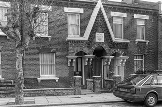
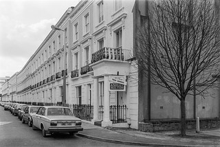
Elm Park Road dates from 1875 when Chelsea Park House was demolished and the houses, many designed by George Godwin, were built between then and 1882. The central house in this picture, at 76 Elm Park Road for built for Paul Naftel, (1817-91) a Guernsey born watercolour painter and his wife and family who came to London in 1870. He moved here in around 1884 and the adjoining houses were also homes to landscape artists. Naftel later moved out to Strawberry Hill, Twickenham where he died.

Grosvenor Canal, Grosvenor Rd, Pimlico, Westminster, 1988 88-5e-12-positive_2400
Grosvenor Canal, Grosvenor Rd, Pimlico, Westminster, 1988 88-5e-12

The Grosvenor Canal was began by the Chelsea Waterworks Company who had leased the land from Sir Richard Grosvenor in 1722, and enlarged a creek there to supply drinking water and also to create a tide mill used to pump the water. When their lease expired in 1823, the then Earl of Grosvenor decide to put in a lock and turn the creek into a canal, extending it to a basin where Victoria Station now stands, around half a mile from the Thames. It opened in 1824 carrying coal, wood and stone into the centre of a rapidly growing area of London.

Grosvenor Canal, Grosvenor Rd, Pimlico, Westminster, 1988 88-5e-13-positive_2400
Grosvenor Canal, Grosvenor Rd, Pimlico, Westminster, 1988 88-5e-14

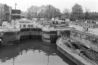
Victoria Station was built over the canal basin, and more of the canal closed in 1899 for a station extension. Westminster City Council bought what was left of it in 1905, then filled in more of it in 1927 for the Ebury Bridge estate.

Grosvenor Canal, Grosvenor Rd, Pimlico, Westminster, 1988 88-5e-14-positive_2400
Grosvenor Canal, Grosvenor Rd, Pimlico, Westminster, 1988 88-5e-14

The canal continued in use by the council taking refuse in barges from Westminster and other local authorities downriver to be dumped until 1995, making this vestigial canal the last in London in commercial use. In 2000 it began to be developed as an expensive waterside development, with the lock being retained but a boom across the entrance from the Thames prevents access for boats despite mooring pontoons inside the development.

Western Pumping Station, Bazalgette, Thames Water, Grosvenor Rd, Pimlico, Westminster, 198888-5e-15-positive_2400
Western Pumping Station, Grosvenor Rd, Pimlico, Westminster, 1988 88-5e-15

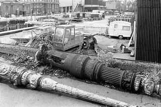
The Chelsea Water Works continued to extract water from the Grosvenor Canal until an Act of Parliament prevented extraction of water from the Thames in London in 1852 and they moved up-river to Surbiton. Sewage was increasingly becoming a problem as London grew and the ‘Great Stink’ of 1858 prompted Parliament into action, passing a bill in 18 days to construct a new sewerage system for London.

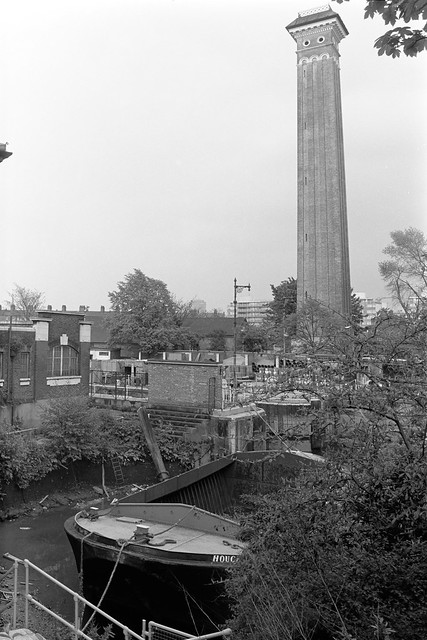
The solution by Joseph William Bazalgette was a system of sewers that delivered the sewage around 8 miles downriver to Beckton on the north bank and Crossness on the south, through main high level middle and low level sewers through North London and main and high level sewers in South London. The plans included stone embankments beside the river – the Victoria, Chelsea and Albert embankments which he designed.

Lamp post, Western Pumping Station, Thames Water, Grosvenor Rd, Pimlico, Westminster, 1988 88-5e-16-positive_2400
Lamp post, Western Pumping Station, Thames Water, Grosvenor Rd, Pimlico, Westminster, 1988 88-5e-16

Bazalgette didn’t do everything himself, but he kept a very close eye on every aspect of his great project, and some of the specifications he laid down – such as the use of Portland Cement – have kept the system running despite increasing demands since it was completed in 1875. Now it is being augmented by the new ‘Super Sewer’ running underneath the river, the Thames Tideway.

As well as engineering considerations, Bazalgette was also a stickler for the aesthetics and there are some fine examples of Victorian design in his works. The Pumping Station which housed the powerful steam engines needed to send the sewage on its way, as well as its chimney (in a picture above) and the Superintendents House here are all Grade II listed.


All photographs on this and my other sites, unless otherwise stated, are taken by and copyright of Peter Marshall, and are available for reproduction or can be bought as prints.


Grosvenor Canal, Chelsea & Belgravia 1988

Wednesday, July 28th, 2021

Grosvenor Canal, Grosvenor Rd, Chelsea, Westminster, 1988 88-4n-53-positive_2400
Grosvenor Canal, Grosvenor Rd, Chelsea, Westminster, 1988 88-4n-53

The Grosvenor Canal, now only vestigial, is one of London’s least-known canals, opened in 1824 when the Earl of Grosvenor decided to add a lock and turn what had been a tidal creek with a tide mill and feeding reservoirs for drinking water at Chelsea Waterworks (at right in picture) into a short canal, around three quarters of a mile long ending at a large basin, Grosvenor Basin. The lock needed two gates at the end where it connected to the river as the canal level could be higher or lower than the tidal river. The main traffic then on the canal was coal for the many houses in Westminster.

Victoria Station was built on much of this basin site in 1858, and when the station was expanded in 1902, the upper half of the canal was closed and the lower half sold to Westminster City Council who used it for barges carrying refuse. They closed more in 1925 to build the Ebury Bridge estate, but a short section was still in use, with barges taking Westminster’s rubbish onto the Thames, when I made this picture. It was then the last commercial canal in London. It closed in 1995 and has since been redeveloped as Grosvenor Waterside. More on Wikipedia

Savills, Sloane St, Sloane Square, Kensington & Chelsea, 1988 88-4n-61-positive_2400
Savills, Sloane St, Sloane Square, Kensington & Chelsea, 1988 88-4n-61

An estate agent selling the grand houses in the area with offices in a rather grand Grade II listed house on Sloane St, dating from the late 18th century. The listing text notes that the ground floor – reached up eight steps from the pavement – is in commercial use and describes the ground floor windows as wide, “with stucco fan motif lunettes above”.

Bourne St, Belgravia, Westminster, Kensington & Chelsea, 1988 88-4n-62-positive_2400
Bourne St, Belgravia, Westminster, Kensington & Chelsea, 1988 88-4n-62

A long white passageway with a charming lamp at the end hanging from wrought iron supports, behind a slightly more prosaic wrought iron gate. I wouldn’t have photographed it, not having a great love of the twee, but for the rather more practical lamp fitting at left with its cable housing leading rather nicely vertically down the wall to the curving shadow on the floor.

Bourne St, Belgravia, Westminster, Kensington & Chelsea, 1988 88-4n-63-positive_2400
Bourne St, Belgravia, Westminster, Kensington & Chelsea, 1988 88-4n-63

White fences have had a particular attraction for photographers since an iconic image by Paul Strand at Port Kent in 1916, though I make no suggestion that this is anywhere in the same league. But it did seem an awful lot of white fence in a rather confined space.

Skinner Place,  Belgravia, Kensington & Chelsea, 1988 88-4n-64-positive_2400
Skinner Place, Belgravia, Kensington & Chelsea, 1988 88-4n-64

Skinner Place looked like something from a rather meaner part of London, perhaps somewhere in Bethnal Green mysteriously translocated into Belgravia (which would have increased its price by a large factor.) But it was the huge union flag blocking the end of the street that I really liked, along with the rounded block of flats behind.

Cranley Mews, South Kensington, Kensington & Chelsea, 1988 88-4o-15-positive_2400
Cranley Mews, South Kensington, Kensington & Chelsea, 1988 88-4o-15

The Henry Smith Charity was established on the death of Henry Smith (1549-1628) who lived and profited through interesting times, lending money to many landed families and amassing large landholdings from their misfortunes. He left detailed instructions for the administration of his estates, and the charity trustees in 1640 bought “a marshy estate of mainly market gardens just outside London, in the parish of Kensington.” According the the charity web site, “Nearly four centuries after we were first established, The Henry Smith Charity is one of the largest grant making charities in Britain; making grants of £39.8 million in 2020.”

Smiths Charity, corruption, Cranley Mews, South Kensington, Kensington & Chelsea, 1988 88-4o-14-positive_2400
Smiths Charity, corruption, Cranley Mews, South Kensington, Kensington & Chelsea, 1988 88-4o-14

I spent some time reading the notices in this picture, but ended up little the wiser about the eviction of Major Parson in the 1970s, and the corruption alleged to have been involved. Reading a post from David Swarbrick about a 1974 legal case did little to help me but may held my legal friends.

Click on any of the above to see a large version and explore more pictures in my album 1988 London Photos.


All photographs on this and my other sites, unless otherwise stated, are taken by and copyright of Peter Marshall, and are available for reproduction or can be bought as prints.


Knightsbridge – Around Hyde Park

Sunday, July 11th, 2021

Rutland Gate, Westminster, 198888-4c-55-positive_2400
Rutland Gate, Westminster, 1988 88-4c-55

The Rutland Gate to Hyde Park from Knightsbridge is just to the west of Hyde Park Barracks, and Rutland Gate is a rather strange double square with bits that extends south from there. These houses are at its south-west extremity, and that in the right is called Clock House, though I think you have to imagine the clock in the circular window above the door. It does have a statue on its roof, or possibly on that of an adjoining building, which appears to be some kind of classical figure. The frontage dates from its conversion to a ‘bijou residence’ between the wars, and the statuary arrived in the 1960s when Austin Blomfield remodelled the house for a former Lord Mayor of London, Sir Henry Aylwen.

Asia, John Henry Foley, Albert Memorial, Hyde Park,Westminster, 1988 88-4d-02-positive_2400
Asia, John Henry Foley, Albert Memorial, Hyde Park,Westminster, 1988 88-4d-02

Down the road at the Albert Memorial there is no shortage of sculptures, although I’m unsure why this rather large and half-dressed woman seated on an elephant should have been chosen to represent Asia. I suspect she more represents the fantasies of the sculptor than anything else.

Victoria Grove, Kensington, Kensington & Chelsea, 1988 88-4d-12-positive_2400
Victoria Grove, Kensington, Kensington & Chelsea, 1988 88-4d-12

Albert is also remembered in Albert Mews, through the archway on this picture of Victoria Grove. Victoria Grove runs from Gloucester Road to Victoria Road.

Kensington Court Place, Kensington & Chelsea, 1988 88-4d-16-positive_2400
Kensington Court Place, Kensington & Chelsea, 1988 88-4d-16

Kensington Court Gardens is a large mansion block built on the site of the Kensington Lawn Tennis Club in 1887-9 which was bought by Albert Barker. The block was designed by Henry Peck and built by Frederick Moir of Moir, Wallis and Company who moved into a flat there. The street, then Charles St, was renamed to Kensington Court Place in 1908. Flats then were advertised at between £195-£250 per year – equivalent allowing for inflation to £25,000 to £33,000. Some are quite large – one recent advertised had 4 bedrooms, 2 reception rooms, a large study, large kitchen/breakfast room and 3 bathrooms.

The flats have a blue plaque for T S Elliot who moved to flat 3 after his secret marriage to his secretary and editor Valerie in 1957 when he was 68 and she was 30. He died in 1965 but she continued to live her until her death in 2012

Hyde Park Gate,Kensington & Chelsea, 1988 88-4d-21-positive_2400
Hyde Park Gate,Kensington & Chelsea, 1988 88-4d-21

The blue plaque to sculptor Jacob Epstein is on a tall house at 18 Hyde Park Gate where he lived from 1929 until his death in 1959. Almost opposite is another blue plaque for novelist and playwright Enid Bagnold, and a little further down the road one for Winston Churchill who bought the house as his London base after his election defeat in 1945. Widely regarded as a hero for leading the country through the war, he is also vilified for his attacks on miners in Tonypandy, the deaths of millions of Indians in the Bengal famine, his approval of area bombing of German cities – surely a war crime – and many other actions.

Hyde Park Gate,Kensington & Chelsea, 1988 88-4d-22-positive_2400
Hyde Park Gate,Kensington & Chelsea, 1988 88-4d-22

The flag outside 45 Hyde Park Gate is the Australian flag as this is the Australian High Commissioners official residence. The house has been greatly altered and enlarged since it was built in 1838 as Stoke Lodge by Robert Thew, a major in the East India Company’s artillery.

Hyde Park Gate,Kensington & Chelsea, 1988 88-4d-31-positive_2400
Hyde Park Gate,Kensington & Chelsea, 1988 88-4d-31

Hyde Park Gate also includes sections running along the south side of Kensington Road as well as a road leading south. These modern flats are on the north east corner I think date from around 1972 when I think the houses on both sides of the entrance to the street were demolished.

Hyde Park Gate,Kensington & Chelsea, 198888-4d-32-positive_2400
Hyde Park Gate,Kensington & Chelsea, 1988 88-4d-32

Reading the list of well-known people who have lived in Hyde Park Gate in the Survey of London and on Wikipedia it seems almost every house could have a blue plaque. This one is for Lieutenant General Robert Stephenson Smyth Baden-Powell, 1st Baron Baden-Powell, OM, GCMG, GCVO, KCB, KStJ, DL though there isn’t room for all that on the plaque at 9 Hyde Park Gate, which simply records “Robert Baden-Powell 1857-1941 Chief Scout of the World lived here”.

All pictures are from my album 1988 London Photos. Clicking on any of the images will take you to a larger versinon in the album from where you can navigate forward or backward through all the images.


All photographs on this and my other sites, unless otherwise stated, are taken by and copyright of Peter Marshall, and are available for reproduction or can be bought as prints.


Knightsbridge and Brompton, 1988

Sunday, July 4th, 2021

Brompton Square, Knightsbridge, Kensington & Chelsea, 1988 88-4b-13-positive_2400
Brompton Square, Knightsbridge, Kensington & Chelsea, 1988 88-4b-13

I can’t look at the picture without thinking there should be people on folding bicycles cycling around this small oval island.

Brompton Square isn’t a square, but a long thin rectangle with a garden at its centre off the Brompton Rd, and at its far end is this rounded terrace with its own small oval of private garden in front of it. The square was developed by James Bonnin in 1821 and appears to have changed little with most of the houses now Grade II listed. Three houses sport blue plaques, including one for Stéphane Mallarmé who lived at No 6 in 1863, but the street had and has other famous residents, including “Britain’s most successful serial confidence trickster”, Achilleas Kallakis who bought No 31 at centre-right in this picture in the 2000s for £28 million, proceeding to have the garden dug out for a three-storey basement.

Andrew Ritchie, the inventor of the Brompton Bicycle company was working as a gardener in the area while working on the prototypes for his folding bike and took the name from the Brompton Oratory, whose dome was visible from his bedroom workshop. I’ve ridden a Brompton since 2002, though still prefer my 1980s road bike.

Fairholt St, Knightsbridge, Kensington & Chelsea, 1988 88-4b-21-positive_2400
Fairholt St, Knightsbridge, Kensington & Chelsea, 1988 88-4b-21

You will search in vain for the Prince of Wales pub in Fairholt St, replaced in 2015-7 by a “Luxury infill development” featuring something like the retained pub front, a “hi-end single family dwelling, a stone throw from Harrods” which ” boasts a two-level basement, 5 bedrooms, a lift, a spa and a home cinema”, designed by AR Architecture with a construction budget of £3m. The development gained the architects the “Best Architecture Single Residence” award by the United Kingdom Property Awards 2019-20.

The pub was established in 1831 in what was then Middle Street, Montpelier Row. In 1989 it was renamed ‘The Swag & Tails’, and changed from a friendly local to a gastro-pub. According to the Closed Pubs UK web site it was bought and closed in 2009, reportedly “by Tamara Ecclestone (daughter of F1 supremo Bernie) with a view to either rebuilding or expanding the premises considerably and turn it into a late night venue.”

Montpelier Terrace, Knightsbridge, Kensington & Chelsea, 1988 88-4b-33-positive_2400
Montpelier Terrace, Knightsbridge, Kensington & Chelsea, 1988 88-4b-33

This gatepost in Montpelier Terrace has lost the small and rather delicate urn which surmounted it in 1988, and the gardens here are now rather better kept and the houses in a much smarter condition. There is now very little of the small pockets of attractive dereliction that relieved the area then.

Sculpture, Knightsbridge, Kensington & Chelsea, 1988 88-4b-52-positive_2400
The Seer, Sculpture, Knightsbridge, Kensington & Chelsea, 1988 88-4b-52

Gilbert Ledward (1888-1960) produced many war memorials and other monumental architecture with a number of examples still visible around London – including the Venus Fountain in Sloane Square and the bronze sculptures on the Guards Memorial in Horseguards Parade. The Seer was produced around 1957 for the forecourt of Mercury House, 195-199 Knightsbridge, built in 1956–9.

Mercury House was demolished in 2002, replaced by The Knightsbridge Apartments, completed in 2005. I don’t know what has become of ‘The Seer’. Feel free to comment if you do.

Sculpture, Edinburgh Gate,  Knightsbridge, Kensington & Chelsea, 1988 88-4b-62-positive_2400
Sculpture, Edinburgh Gate, Knightsbridge, Kensington & Chelsea, 1988 88-4b-62

This was the last sculpture completed by Jacob Epstein (1880-1959) shortly before his death and depicts a father, mother, son and dog rushing forwards off from the plinth, encouraged by Pan, the Greek God of the Wild, playing his pipes. Variously known as The Rush of Green, Pan or The Bowater House Group, it was commissioned by the chairman of the Land Securities Investment Trust to stand in front of their newly built offices at Bowater House. When this was demolished in 2006 to be replaced by a yet more hideous new development the sculpture was removed and in 2010 re-installed some distance west in the re-located Edinburgh Gate, its figures again rushing into the green of Hyde Park.

Russian Orthodox Cathedral of the Dormition, Ennismore Gardens, Knightsbridge, Westminster, 1988 88-4c-46-positive_2400
Russian Orthodox Cathedral of the Dormition, Ennismore Gardens, Knightsbridge, Westminster, 1988 88-4c-46

Originally built as All Saints, an Anglican Church, in 1849, desinged by Lewis Vulliamy in a Lombard style rather than the prevailing Gothic, the church ran out of cash and was only completed in 1860. Then it was given a facelift in 1891-2, with a new west front based on the Basilica of St Zeno of Verona in Verona, Italy. A parish merger made the church redundant in 1955 and it was leased to a Russian Orthodox congregation, who consecrated it in the name of one of their great feasts, the Dormition of the Mother of God. It was later bought by the Russian Orthodox Church.

Ennismore Mews, Knightsbridge, Westminster, Kensington & Chelsea,1988 88-4c-34-positive_2400
Ennismore Mews, Knightsbridge, Westminster, Kensington & Chelsea,1988 88-4c-34

These mews were built for the coaches for the large houses in Ennismore Gardens and Rutland Gate with stabling for the horses and rough accomodation for the servants who looked after the horses and drove the carriages. Ennismore Mews were rather grander than most, reflecting the quality of the houses in Ennismore Gardens which were developed in the 1868-74 by Peter and Alexander Thorn. Their company also built a new Blackfriars Bridge, and used some of the stone salvaged from the old bridge to face the Ennismore Gardens houses. The mews buildings were rather more basic structures, and have been converted to residential use, now selling for around £3.75m.

Ennismore Gardens, Knightsbridge, Westminster, 1988 88-4c-52-positive_2400
Ennismore Gardens, Knightsbridge, Westminster, 1988 88-4c-52

I was amused by the range of rather unusual structures, including the tower of Holy Trinity Brompton and the dome of the London Oratory along with some lesser features. The gateway at left is the entrance to Ennismore Garden Mews.

Click on any of the pictures to go to a larger version in my album 1988 London Photos from where you can browse these and other pictures.


All photographs on this and my other sites, unless otherwise stated, are taken by and copyright of Peter Marshall, and are available for reproduction or can be bought as prints.


More Around Belgravia 1988

Saturday, June 26th, 2021

Flats, Ebury St, Belgravia, Westminster, 1988 88-3g-43-positive_2400
Flats, Ebury St, Belgravia, Westminster, 1988 88-3g-43

The Cundy Street flats, architect T P Bennett, were built as low cost housing by the Grosvenor Estate in 1950-52. As Pevsner points out, the blocks have curved balconies typical of the 1930s but with upright columns typical of the 1950s. I think this block is probably Stack House.

Flats, Cundy St, Belgravia, Westminster, 1988  88-3g-55-positive_2400
Flats, Cundy St, Belgravia, Westminster, 1988 88-3g-55

Cundy St gets its name from a family who were for several generations surveryor, builders and architects to the Grosvenor estate, probably from Thomas Cundy (see below). Planning permission has recently been granted for the demolition of Kylestrome House, Lochmore House, Laxford House, Stack House, Walden House and their replacement by a new estate which will include shops and a new playground. It will include affordable homes and care homes and assisted living for the over-65s but looks rather duller. The plans have upset some of the wealthier residents in surrounding areas because of a loss of light.

Coleshill Flats, Peabody Trust, Pimlico Rd,Belgravia, Westminster, 1988  88-3g-45-positive_2400
Coleshill Flats, Peabody Trust, Pimlico Rd,Belgravia, Westminster, 1988 88-3g-45

This Peabody estate close to Sloane Square is made up of two separate blocks, Lumley and Coleshill flats, which were constructed in the 1870s.

National Audit Office, Buckingham Palace Road, Belgravia, Westminster, 1988  88-3g-53-positive_2400
National Audit Office, Buckingham Palace Road, Belgravia, Westminster, 1988 88-3g-53

Built in 1938 as the Empire Air Terminal in a streamlined “moderne” style by architect Albert Lakeman with a sculpture of winged figures above a globe, Wings Over the World by Eric Broadbent. Passengers for Imperial Airways flights could check in here and be taken by special Pullman Trains from a platform on the adjacent Victoria Station to Southampton Water for flying boat services, while those for European destinations were ferried by coach to Croydon Airport. Unfortunately the terminal opened only three months before the war stopped private flights. Imperial Airways became a part of British Overseas Aiways Corportation (BOAC).

National Audit Office, Buckingham Palace Rd, Belgravia, Westminster, 1988 88-3h-55-positive_2400
National Audit Office, Buckingham Palace Rd, Belgravia, Westminster, 1988 88-3h-55

After the war, the building was reasonably placed for coaches along the A4 to Heathrow and was renamed the BOAC Terminal and later the British Airways Terminal. It closed in 1980, but had earlier been made largely redundant by the opening of the West London Air Terminal in a temporary building on the Cromwell Road in 1957, replace by a purpose built building in 1963. Check-ins there ended in 1974 and in 1980 both this and the British Airways Terminal were sold. This was listed in 1981 and became the home of the National Audit Office in 1983, though after extensive restoration in 2009, large parts are now rented out. The West London Air Terminal was demolished and the site became a Sainsbury’s supermarket.

Eaton Square, Belgravia, Westminster, 1988  88-3g-65-positive_2400
Eaton Square, Belgravia, Westminster, 1988 88-3g-65

66 Eaton Square is described in its Grade II listing test as a part of a grand terrace of houses from the mid 19th century, though I’ve chosen to turn away from most of its grander features and look away down the street and across Eaton Gate.

In 1821, Thomas Cundy became surveyor of the Grosvenor Estate and adapted earlier plans for the area before selling building leases from 1825, mainly to Thomas Cubitt (1788-1855). The ground was rather marshy, and Cubitt brought earth he was then digging out at St Katherine’s Dock to raise it. Work began on Eaton Square, named after the Duke of Westminster’s Cheshire Eaton Hall, in 1827, with the planting of the gardens, but it took longer to complete the houses around the square, though these, probably by Cubitt, were apparently completed by 1843. But the whole square was only finished by another builder in the 1850s.

Eaton Square is not a square, but a rather elongated rectangle around 500 metres long. Even including the mews behind the grand houses it is less than 200 m wide.

Cadogan Gate, Knightsbridge, Kensington & Chelsea, 1988 88-3h-22-positive_2400
Cadogan Gate, Knightsbridge, Kensington & Chelsea, 1988 88-3h-22

This house at 6 Cadogan Gate on the corner of Pavilion Rd stands out among the taller red-brick mansions and is more a continuation of the mews buildings in Pavilion Rd, but with a rather less usual architecture, with those circular ground floor windows, rather ecclesiastical tall oval-arched sash window on the first floor and its mansard roof. It probably dates from around 1879.

This is an address mentioned in the Panama Papers, the giant 2016 leak of more than 11.5 million financial and legal records exposing a system that enables crime, corruption and wrongdoing, hidden by secretive offshore companies, though of course the activities with which this address is connected could be entirely legal.

Cadogan Square, Knightsbridge, Kensington & Chelsea, 1988 88-3h-23-positive_2400
Cadogan Square, Knightsbridge, Kensington & Chelsea, 1988 88-3h-23

I think this is 59 Cadogan Square, where a large second floor flat was recently on offer for £7m. Cadogan Square is one of the most expensive residential streets in the United Kingdom, with all but around three houses converted into flats, and these houses are estimated to be worth £25m.

The large tall houses were built between 1877 and 1888 for the Cadogan Estate in Flemish inspired red brick which I find overpowering, but in the centre of the square there is a residents’ only garden where they can sit and, at least in summer the red-brick hell is largely hidden by trees.

More from my Flickr Album 1988 London Photos in later posts.


All photographs on this and my other sites, unless otherwise stated, are taken by and copyright of Peter Marshall, and are available for reproduction or can be bought as prints.


More from Brent 1988

Friday, June 11th, 2021

Church of God of Prophecy, High St, Harlesden, Brent, 1988 1988 88-3c-41-positive_2400
Church of God of Prophecy, High St, Harlesden, Brent, 1988 88-3c-41

One of our better selling ‘newpapers’ recently published yet another sensationalist feature about no-go areas in some of our cities, where white men fear to tread. Back in the 1980s it wasn’t Muslim fundamentalists that were alleged to make our sity streets unsafe, but largley Caribbean and African gangs that were supposed to be roaming the streets in certain areas of the city, and one of those that people used to warn me about was Harlesden. But as in other such areas, although I was walking the streets with aroun £10,000 pounds worth of photographic gear in a bag on my shoulder I met with no problems.

High St, Harlesden, Brent, 1988 88-3c-51-positive_2400
High St, Harlesden, Brent, 1988 88-3c-51

Partly of course I had little or no trouble becuase of the time of day I usually worked, seldom in the evenings whe there are more people who might be a threat on many streets. And if I saw people dealing in drugs or other illegal activities I might cross the steer. And I certianly avoided dark alleys. But I can’t recall any such things being necessary in Harlsden. Often people would ask me why I was taking pictures, and I’d make an effort both in general terms and about the specific scene. And while they might not have always appreciated what I was saying it did sometimes make them see the scene at least partly as I did – perhaps with the rather odd game of noughts and cosses iin the picture above.

The Creole Organisation, High St, Harlesden, Brent, 1988 88-3c-52-positive_2400
The Creole Organisation, High St, Harlesden, Brent, 1988 88-3c-52

I don’t know what The Creole Organisation at186 High St Harlesden did, but Harlesden was a leading centre of Creole Music back at this time, and the record label Creole Records used an identical logo on some releases of its ‘Harlesenden Sounds’. It was based at 91-93 High Street, Harlesden. More recently it has been a solicitor’s and estate agents, but I think it is now a private house.

Harlesden Tyres, High St, Harlesden, Brent, 1988 88-3c-53-positive_2400
Harlesden Tyres, High St, Harlesden, Brent, 1988 88-3c-53

Harlesden Tyres on the corner of Nightingale St and the High St caught my attention becuase of its signage, and in particular the two Michelin Men.

Tejal Motors, High St, Harlesden, Brent, 1988 88-3c-54-positive_2400
Tejal Motors, High St, Harlesden, Brent, 1988 88-3c-54

While across Nightingale Rd, Tejal motors had a good selection of arrows in three different styles an a long list of repairs it could do while you wait.

Marshall Bros, Kilburn Lane, West Kilburn, Westminster, 1988 88-3d-02-positive_2400
Marshall Bros, Kilburn Lane, West Kilburn, Westminster, 1988 88-3d-02

Given my name it would have been difficult to walk past Marbro House, home to Marshall Bros, Builders Merchants at 266a Kilburn Lane. It clearly appeared to have been built for some other purpose, and before becoming a Builder’s merchants was a Methodist Chapel. It has now lost these steps and doorway on Kilburn Lane and has been converted into flats with an entrance around the corner in Herries St. I think it is just across the border in the City of Westminster.


All photographs on this and my other sites, unless otherwise stated, are taken by and copyright of Peter Marshall, and are available for reproduction or can be bought as prints.


West Kilburn 1988

Wednesday, June 2nd, 2021

Droop St, West Kilburn, Westminster, 1988  88-3b-36-positive_2400
Droop St, West Kilburn, Westminster, 1988

William Austin’s first job was apparently as a scarecrow at 1d per day, but he left the farm and came to London to find work as a labourer. Although illiterate, unlike most navvies he prospered and became a drainage contractor at a time when London was rapidly expanding, his success probably in no small part due to his espousal of the temperance movement.

First Ave, West Kilburn, Westminster, 1988  88-3b-41-positive_2400
First Ave, West Kilburn, Westminster, 1988

There is surprisingly little information about Austin on the web other than that he became a philanthropist and founded the Artizans, Labourers and General Dwellings Company in 1867, and that he left the company in 1870. Almost certainly this lack of information reflects his humble origins.

Harrow Rd, West Kilburn, Westminster, 1988  88-3b-42-positive_2400
Harrow Rd, West Kilburn, Westminster, 1988

At first the company built houses in the provinces, but after Austin left turned their attention to London, and between 1872-7 developed the Shaftesbury Park estate in Battersea with around 1,200 working class homes.

Harrow Rd, West Kilburn, Westminster, 1988  88-3b-43-positive_2400
Harrow Rd, West Kilburn, Westminster, 1988

Also in 1973 the company bought 80 acres north of the Grand Union Canal and the Harrow Road in what was then a detached part of the parish of Chelsea. The area was developed on a grid pattern with north-south roads called First Avenue, Second etc up to Sixth Avenue and the east-west streets being simply named with the letters of the alphabet, A-P.

Second Ave, West Kilburn, Westminster, 1988  88-3b-44-positive_2400
Second Ave, West Kilburn, Westminster, 1988

Later these street names were expanded to fuller names starting with these letters, though I have no idea what possessed someone to make D Street into Droop Street, surely one of the more depressing street names in London.

Fourth Ave, West Kilburn, Westminster, 1988  88-3b-45-positive_2400
Fourth Ave, West Kilburn, Westminster, 1988

The architect of the estate with its then fashionable gothic touches was self-taught Robert Austin (perhaps a son of the founder?) with later work by Roland Plumbe. There are 53 properties on the estate which are Grade II listed. During the development in 1877 most of the company managers were charged with mismanagement and corruption, the entire board of directors replaced, the manager and chairman of the board jailed and Austin sacked.

Queens Park Hall, Artizans, Labourers & General Dwellings Company, Harrow Rd, Westminster, 1988 88-3b-54-positive_2400
Queens Park Hall, Artizans, Labourers & General Dwellings Company, Harrow Rd, Westminster, 1988

The company recovered and finished the job, going on to build other estates around London, including Noel Park in Wood Green and Leigham Court in Streatham. The Queen’s Park estate along with most of their other estates was transferred to the respective local authority in 1966. Most is in Westminster with a smaller part in Brent.

Kilburn Spring Co, Kilburn Lane, Kensal Green, Brent, 1988 88-3c-12-positive_2400
Kilburn Spring Co, Kilburn Lane, Kensal Green, Brent, 1988

All photographs on this and my other sites, unless otherwise stated, are taken by and copyright of Peter Marshall, and are available for reproduction or can be bought as prints.


More from around the Harrow Road

Friday, May 28th, 2021
Chippenham Rd, Maida Hill, Westminster, 1988 88-3a-45-positive_2400
Chippenham Rd, Maida Hill, Westminster, 1988

These rather plain and solid houses on Chippenham Road, on the edge of the Elgin Estate are fairly typical of the area. Though built on a fairly large scale for families with reasonably substantial incomes, most are now divided into perhaps half a dozen flats, with the smallest one-bed flats costing around £400,000. Unlike the nearby tower blocks which lasted only around 25 years they are still going strong well over a hundred years since they were built.

Aldsworth Close, Maida Hill, Westminster, 1988 88-3a-51-positive_2400
Aldsworth Close, Maida Hill, Westminster, 1988

Aldsworth Close is a fairly short street close to the canal in Maida Hill, close enough for estate agents to call it ‘Little Venice’ which it clearly isn’t. Taken from Aldsworth Close I think the picture shows the front of a long block between Downfield Close and Aldsworth Close, with addresses and garages on Downfield Close but these front entrances on Aldsworth Close. Modern estates like to have such confusion in their addresses, and I think the right hand of the picture may have yet another name, Clearwell Drive.

Aldsworth Close, Maida Hill, Westminster, 1988 88-3a-52-positive_2400
Aldsworth Close, Maida Hill, Westminster, 1988

The Victorian terrace at left (and below) is still present on the north side Amberley Road and its eastern part was demolished to build these new streets. Previously the land between Amberley Rd and the canal was occupied by a number of timber wharves, a saw mill and an engineering works. Until 1867 it was the site of Westbourne Manor House.

88-3a-53-positive_2400
Amberley Rd, Maida Hill, Westminster, 1988

This west part of Amberley Road remains as a long Victorian terrace. I don’t know why the eastern part was demolished, but possibly like many areas of London, particularly industrial areas such as this by the canal were badly damaged by wartime bombing. But little of London’s Victorian housing enjoys any real protection against redevelopment – and even less of more recent building. In particular around 200 council estates are currently under some threat, including a number of particular architectural merit, with some, such as the Heygate Estate in Southwark already lost and others including Lambeth’s Central Hill already marked down for demolition. Many have now realised that it makes much more sense to rehabilitiate rather than demolish Victorian houses and it now seems possible that climate change will cause a rethinking about demolition of more recent buildings, and ensure new buildings are again built to last.

Grand Union Canal, Paddington Arm, Maida Hill, Westminster, 1988  88-3a-64-positive_2400
Grand Union Canal, Paddington Arm, Maida Hill, Westminster, 1988

The view looking east from the Harrow Road bridge across the canal. You can still see this bridge across the canal, carrying pipes or cables, and the building on the left, 324 Harrow Road now stands out in white. There is now an Academy in a new building rather than a school in Amberley Rd, with a new block of flats on the canal side.

Grand Union Canal, Paddington Arm, West Kilburn, Westminster, 1988  88-3b-32-positive_2400
Grand Union Canal, Paddington Arm, West Kilburn, Westminster, 1988

This stretch of canal is from around mile further west along the towpath and at right the unmistakble form of Trellick Tower can be seen. My viewpoint was a small canalside garden on the Harrow Road and in the distance you can see the ‘ha’penny’ bridge from the Harrow Road across to Kensal Town which I had photographed in earlier years. The buildings on the left, 432-487 Harrow Rd, built by the Artizans’, Labourers’, and General Dwellings Co, who developed the area as working class housing fromm 1875, are still there but I think those at the right on Kensal Rd have all been replaced. I think I made it holding out my camera at arm’s length over the canalside fence which resulted in this tilted view.

Library, Harrow Rd, West Kilburn, Westminster, 1988  88-3b-33-positive_2400
Library, Harrow Rd, West Kilburn, Westminster, 1988

On the other side of the Harrow Road to where I made the previous picture is the Queen’s Park public library, one of the amenities provided when the area was developed by the Artizans’, Labourers’, and General Dwellings Co. There were no pubs on the estate, built to strict temperance principles, but they provided this space for the Chelsea vestry to build the Kensal New Town Library which opened in January 1890. This oddly detached part of Chelsea became a part of the Metropolitan Borough of Paddington when this was formed in 1901 and it remained Paddington’s only public library for 30 years. Until around 1920 you had to be a resident of Queen’s Park to use the library – and residents paid an extra amount in their rates for the privilege, whether they took advantage of it or not. In the 1965 local government reorganisation the library and this area became a part of the borough of Westminster, though much of Queen’s Park is in Brent.


All photographs on this and my other sites, unless otherwise stated, are taken by and copyright of Peter Marshall, and are available for reproduction or can be bought as prints.


Maida Hill & Elgin, 1988

Wednesday, May 26th, 2021

Prince of Wales Cinema, Bingo Hall, 331 Harrow Rd,  Westbourne Park, Westminster, 1988  88-3a-12-positive_2400
Prince of Wales Cinema, Bingo Hall, 331 Harrow Rd, Westbourne Green, Westminster, 1988

Although most Londoners will have heard of Maida Vale, few will have heard of Maida Hill, and those that have will probably – like me – be very unsure of where it changes to Westbourne Green or West Kilburn. Many of the old London district names have more or less disappeared, and estate agents take remarkable liberties with the boundaries of areas they feel are currently more upmarket.

Harrow Rd,  Westbourne Park, Westminster, 1988  88-3a-13-positive_2400
Harrow Rd, Westbourne Green, Westminster, 1988

Part of the reason for this is increased mobililty, particularly in those areas of London were many live in private rented accomodation, often with short-term leases or where for various reasons tenants often move very frequently. Most of the inner London boroughs were developed by before the First World War, and grew up first around the old named village centres – and later around the railway stations, underground stations and tram routes.

Shops, Harrow Rd, Maida Hill, Westminster, 1988 88-3a-43-positive_2400
Shops, Harrow Rd, Maida Hill, Westminster, 1988

People know Maida Vale mainly because it has an Underground Station – something Maida Hill lacks. And most – including myself – tend to forget that the area is Westbourne Green and call it after its station, Westbourne Park. The ease of travel – by rail, bus and bike, and later by car loosened the links of people to their native villages and of course many more came into the new houses in London from other parts of the country, and later the world.

Walterton Rd, Elgin Ave, Maida Hill, Westminster, 1988 88-3b-66-positive_2400
Walterton Rd, Elgin Ave, Maida Hill, Westminster, 1988

I grew up in the town on the edge of London where my father had been born in 1899. He’d worked elsewhere – including a couple of years when the army and air force took him to France and Germany, but had also commuted to various jobs in towns and areas around, including Kew, Guildford and Harrow thanks to buses or a motorbike. But back in the 1950s when I walked down the main road with him he would still be greeting almost everyone we met by name.

Walterton Rd, Elgin Ave, Maida Hill, Westminster, 1988 88-3a-16-positive_2400
Walterton Rd, Elgin Ave, Maida Hill, Westminster, 1988

Captioning my photographs, even those where I know exactly where they were taken, I often have difficulty in deciding the name of the district in which they were taken. Sometimes I come back to one later and change my mind. Deciding which London Borough they are in is generally easier – the borough boundaries are marked by lines on maps, although sometimes, particularly where the boundary runs down the centre of a road I give both if I’m unsure what side of the road it is on. A minor confusion is that some London boroughs share a name with a district which is a part of them. I could write things like Camden, Camden, but it seems redundant to repeat it.

The Elgin Estate is possibly in Paddington, North Paddington or in Maida Hill, though the area is also sometimes simply referred to by the major road it is close to, the Harrow Road. When I put these pictures on-line I chose Maida Hill, simply because this was printed closer on the street map I was using.

Elgin Estate, Elgin Ave, Harrow Rd, Maida Hill, Westminster, 1988 88-3a-21-positive_2400
Elgin Estate, Elgin Ave, Harrow Rd, Maida Hill, Westminster, 1988

The triangle between Harrow Road, Elgin Avenue, and Chippenham Road contained some of the areas worst housing and the Greater London Council demolished these and built 300 maisonettes and flats in what was originally called the Walterton Road estate but later renamed the Elgin Estate. Started in 1966, the first tenants moved in in 1968.

It included two 22-storey tower blocks, Chantry Point and Hermes Point. A survey in 1983 found them and the rest of the estate in very poor condition and the GLC began a full-scale process of repairs. Unfortunately once work began it was brought to a halt when dangerous asbestos was found in the two tower blocks, which by then had been transferred to Westminster Council, though the GLC was still responsible for major works.

Elgin Estate, Elgin Ave, Harrow Rd, Maida Hill, Westminster, 1988 88-3a-11-positive_2400
Elgin Estate, Elgin Ave, Harrow Rd, Maida Hill, Westminster, 1988

Westminster stopped letting the blocks to new tenants though some lettings continued on short-term licences and other flats were squatted and the properties rapidly deteriorated. When the GLC was abolished in 1986 full responsibility passed to Westminster Council who secretly decided to sell the whole estate to private developers who intended to demolish the lot and rebuild at twice the density with one of the towers becoming a hotel.

Elgin Estate, Elgin Ave, Harrow Rd, Maida Hill, Westminster, 1988 88-3a-24-positive_2400
Elgin Estate, Elgin Ave, Harrow Rd, Maida Hill, Westminster, 1988

When the plans leaked, residents formed an action group demanding the council drop the plans and setting up their own proposals to save the homes. The council wanted to get rid of social tenants and replace them by wealthier home owners, to increase the Tory vote in the area, part of a process of exporting Westminster homeless families to boroughs on the edge of London and outside to places such as Staines. The Elgin estate – despite being known as having an asbestos health risk – was also used as a dumping ground for council tenants who were moved out of marginal wards. It was a policy that in 1997 was found by the High Court to be unlawful. The council appealed and won, but then lost in the House of Lords in 2001 when Lady Porter, leader of the council from 1983 to 1991 was ordered to pay a surcharge (including interest) of £43.3 million. She moved most of her money to Israel and to other family members and pleaded poverty, but eventually settled with a payment of £12.3 millioon.

Elgin Estate, Elgin Ave, Harrow Rd, Maida Hill, Westminster, 1988 88-3a-44-positive_2400
Elgin Estate, Elgin Ave, Harrow Rd, Maida Hill, Westminster, 1988

By 1988 when I made these pictures around a third of properties on the estate were empty with doors and windows blocked by steel sheets to keep out squatters who already occupied many of the flats in the two towers. But the 1988 Housing Act gave the remaining residents the chance to form a housing association, Walterton and Elgin Community Homes, which was then able to hold a ballot and acquire the homes from Westminster Council. In March 1989 WECH became the first ‘Tenants’ Choice’ landlord to be approved by the Housing Corporation, and despite various dirty tricks by the council, in 1991 was not only given the properties free of charge, but also awarded the maximum possible amount from the council of £77.5 million to cover the cost of repair (though this was only around a half of what was thought to be needed.

A vote by residents was 72% in favour of the transfer to WECH which was made in April 1992. Redevelopment of the area was carried out with extensive consultation with them, and involved an expensive demolition of the two towers in 1994, replaced by low rise housing.


All photographs on this and my other sites, unless otherwise stated, are taken by and copyright of Peter Marshall, and are available for reproduction or can be bought as prints.


7 Days to save the NHS

Friday, April 30th, 2021

‘7 Days to Save our NHS’ on Westminster Bridge, 30th April 2015

Any remaining doubts about the Tory party’s intentions to privatise the NHS should have been eliminated by the recent appointment of Samantha Jones, the outgoing chief executive of Operose Health, as an “expert adviser for NHS transformation and social care“.

Openrose is the British subsidiary of giant US private healthcare firm Centene, and recently bought AT Medics, a GP led company that was ran many of London’s GP surgeries and other primary care services. Openrose was already running around 20 GP surgeries as well as various opthalmology services, a dermatology clinic in Kent and an urgent treatment centre in Birmingham.

Despite health secretary Matt Hancock’s claims that his proposed changes to the NHS would put an end to 30 years of NHS privatisation, the process is currently being accelerated, with these and other changes making it easier for US and other companies to take control of parts of the NHS.

The launch of the ‘7 Days to Save our NHS’ Campaign’ on April 30th, 2015 came a week before the 2015 General Election, and urged people to use their vote on May 7th to save the NHS. It was one of many protests against the creeping privatisation of our health service that I’ve photographed, along with more protests over hospital closures and other attacks on the service which left it in a poor state at the start of the Covid pandemic.

Fortunately – and largely thanks to the dedicated work of NHS staff – it more or less coped, but at the price of far too many deaths in hospitals and care homes, with high levels of hospital-acquired infection due to a lack of proper protection – and we saw photographs of staff having to improvise with bin bags.

But although some of us could have used our vote to try to save the NHS, for many their was no such credible alternative. Both of our major parties have been guilty of privatising the NHS, with New Labour responsible for much of the present crisis in our healthcare system, particularly for saddling hospital trusts with crippling long-term debts through insanely thought out and poorly negotiated private finance initiative hospital building projects – which have forced programmes of hospital closures. The https://www.express.co.uk/news/uk/355999/Who-now-owns-the-NHS-and-can-they-cure-it Daily Express described these in 2012 as “a Klondike gold strike for investment firms” which will result in the taxpayer paying £301billion to receive facilities worth £57.4 billion.

And many MPs – mainly but not entirely Tory – are very much in on the gravy train that NHS privatisation is already providing, and very much rubbing their hands in anticipation of more. In 2015 the https://www.mirror.co.uk/news/politics/former-private-health-firm-chief-23838725 Daily Mirror published what they called a full list of MPs with links to private healthcare firms. Among the 70 on that list were the then prime minister David Cameron, Andrew Lansley, described as ‘Former Health Secretary & architect of privatisation’, former Home Secretary David Davis, and most of the leading Tories – including current secretary of state for health and social care Matt Hancock MP.

NHS banner on Westminster Bridge
‘7 Days to Save our NHS’ Campaign launch


All photographs on this and my other sites, unless otherwise stated, are taken by and copyright of Peter Marshall, and are available for reproduction or can be bought as prints.