Posts Tagged ‘Poplar’

Bow Creek: Priors to Pura Foods

Monday, February 15th, 2021

Bow Creek, Leamouth Rd, Leamouth, Tower Hamlets, Newham, 1982 36v-23_2400

Goiong down Leamouth Road roughly south and parallel to the river there were a few places where you could look back up to the East India Dock Road and the disused railway bridge that crossed the creek a little to the south of the road. The bridge had carried a line which came from where Canning Town Station now is along the route now followed by the DLR but continuing across the river to pepper warehouses for the East India Docks opposite the docks on the eastern side of Leamouth Road, still shown on my 1939 Philip’s A B C Pocket Atlas-Guide to London and its Outer Districts.

J J Prior, Ship Repairs, Orchard Wharf, Bow Creek, Leamouth Rd, Leamouth, Tower Hamlets, 1982 36v-36 (2)_2400

Where the river swung around the Limmo Peninsula – now the Bow Creek Ecology Park – the view was wide open with the river only separated from the road by an open fence. Close to the bend to the west was Orchard Wharf, where J J Prior were still carrying out ship repairs. The flats in the background are on the other side of the East India Dock Road.

Pura Foors, Bow Creek, Tower Hamlets, 1983 36v-21_2400

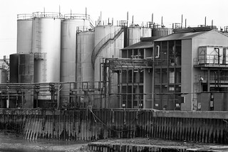
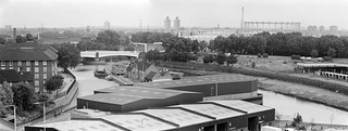
Looking up the creek on the eastern side of the peninisula was the west bank of the second peninsula, occupied by a large edible oil factory, Pura Foods, the smells from which were often rather noticeable. There were local campaigns to have this factory shut down, and eventually it did move out, relocating a few miles down-river. This peninsula is now redeveloped as City Island.

Pura Foods, Orchard Place, Leamouth, Tower Hamlets, 1982 32f-33_2400

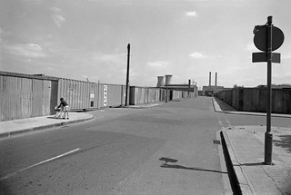
Roads in this area were disrupted when the Lower Lea Crossing was built – it opened in 1991. When I first went to photograph the area, Leamouth Road (historically called Orchard St) continued to meet Orchard Place at a T-junction, with Orchard Place going north to the Pura Food site and south, then turning east to Trinity Buoy Wharf.

Pura Foods, Bow Creek, Tower Hamlets, 1989 89-4c52_2400

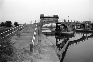
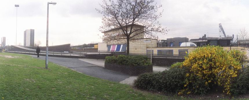
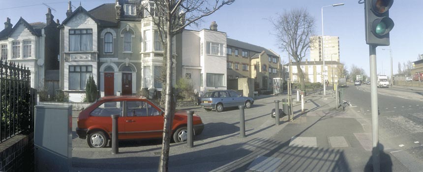
Although there were still high walls along the northern section of Leamouth Rd, there was a clear view of Bow Creek looking south from the East India Dock Road only around a hundred yards east of where the river, here flowing roughly north, went under the bridge in the opposite direction.

Bow Creek, Pura Foods, Essex Wharf, Wharfside Rd, East India Dock Rd, Newham, Tower Hamlets, 1989 89-4b12_2400

Wharfside Road comes in a short tunnel under the East India Dock Road on which I was standing to take this picture, leading to Essex Wharf and the saw mills for the timber yard. The Docklands Light Railway now runs along here on the route of the the former rail line to the pepper warehouses, just in front of the line of parked cars in this picture.

There is now a footbridge across the DLR leading to a riverside path, built at around the same time as the new railway, the gates to the bridge were kept locked for most of its first twenty years but now seem to be permanently opened, and it provides a good short cut to Canning Town Station, whose riverside entrance was also locked for years after it was built, as well as to a new footbridge to City Island which replaced the factory here. You can also now walk or cycle down here to the right to visit the Bow Creek Ecology Park. Although very different it is still an interesting area in which to walk.

Clicking on any of the above images will take you to larger versions in my Flickr album on the River Lea. A further post will start at Wharfside Road and look at my pictures moving along Bow Creek towards the Thames.


All photographs on this and my other sites, unless otherwise stated, are taken by and copyright of Peter Marshall, and are available for reproduction or can be bought as prints.


South of Bow Locks – the 1980s

Saturday, February 6th, 2021

Bow Creek, Bow Locks, Hackney, Tower Hamlets, 1983 36v-52_2400

Back in the 1980s it wasn’t possible to walk beside Bow Creek from Bow Locks south to the East India Dock road, as the banks were occupied by various industrial and commercial sites, including two gas works and West Ham power station. And although there have been plans by the councils for many years, even today you can only walk down on the Newham bank as far as Cody Dock, on a path opened to the public some years ago with the ridiculous name of the Fatwalk, but since renamed. There is a tantalising walkway visible continuing past the dock along the former power station bank, but this is still closed to the public.

Clinic, Bromley-by-Bow, Tower Hamlets, 1983 35v-35_2400

While this was a limitation, it was also an opportunity to explore the two areas where roads ran close (or not too close) to Bow Creek to both the east in West Ham and west in Bromley and Poplar, and I was rewarded by some images I found interesting, though parts of my walks were along fume laden streets with heavy traffic.

Blackwall Tunnel Northern Approach, Tweed House, view, Bromley-by-Bow, Tower Hamlets, 1983 35v-3pan_2400

Tweed House, a tall block of council flats on the Blackwall Tunnel Approach Road next to the Limehouse Cut enabled me to take some pictures which I more recently stitched together to create two panoramas of the area – the individual pictures are also in the Flickr album. Click to see the larger versions on Flickr.

Blackwall Tunnel Northern Approach, Tweed House, view, Bromley-by-Bow, Tower Hamlets, 1983 35v-4-pan_2400

From various places both on to the east and west of Bow Creek I found rather satisfyingly bleak views of the distant power station, including one with a young mother with a small baby in a pram.

Lochnagar St, Bromley-by-Bow, Tower Hamlets, 1983 36v-42_2400

Others were emptier still, like this

Lorry Park, Gillender St, Bromley-by-Bow, Tower Hamlets, 1982 32e-42_2400

or more minimal and just occasionally rather threatening; some streets around here featured in crime films and TV dramas of the era, gangster London.

Lochnager St, Poplar, Tower Hamlets, 1982 32e-34_2400

But there was also a little chance for fun, with a cafeteria with two giant cooling towers to take away the cooking fumes and the unlikely name of Oasis.

Oasis, Cafeteria, Cafe, Bidder St, West Ham, Newham, 1983 36v-12_2400

Poplar Gas Works was on a rather smaller scale to Bromley-by-Bow, but its gas holders still dominated the working class housing around it. Two young girls playing on the grass came to see what I was doing and insisted on being photographed, though I perhaps should have stepped back a foot or two to avoid cropping their feet to get the gasholder in the frame.

Girls, Gasholder, Poplar Gas Works, Rutland Terrace, Oban St, Poplar, Tower Hamlets, 1983 35v-55_2400

At East India Dock Road I was able to return to Bow Creek – and things got even more interesting (and although very different they still are) as I hope to show you in the next installment of my work from the Flick album River Lea – Lea Navigation – 1981-92 – the pictures above are all on Page 4.

Clicking on any of the images above should take you to a larger version on Flickr, and you can also go on to explore the album from there.


All photographs on this and my other sites, unless otherwise stated, are taken by and copyright of Peter Marshall, and are available for reproduction or can be bought as prints.


Meridian 2

Wednesday, August 26th, 2020

Continuing with pictures from my walk along the Greenwich Meridian in Greater London in 1984-6.

Stratford Bus Station – Peter Marshall, 1995

My walks took me as close to the line of the Meridian I had pencilled on my 1983 1:25000 OS map as possible, though that line may not have been quite exact. I think it goes through the area at the extreme left of the picture above, here just a few yards east of the roadway. My series of walks kept as close as possible to the pencil line, but it often runs through private property, buildings, across rivers etc and many detours, some quite lengthy were required.

Barge carries contaminated earth from Poplar gasworks site, Peter Marshall, 2011

One of those fairly lengthy detours was north from Poplar, where the line ran through the gas works site and across Bow Creek. It wasn’t until 2011 that I was able to go onto the former gas works site, having been engaged to photograph the use of a barge to carry away the heavily contaminated soil from the site. The line crosses the river here, going through the left end of the large shed close to the opposite bank, near to Cody Dock. This is also part of a private business estate, though you can now walk along the roadways in it. There are several such areas I have been able to photograph in later years, but I won’t add any other later pictures to these posts.

Stratford Station – Peter Marshall, 1995

The line continues through the east end of Stratford Station.

Thinking of the line of the Meridian, I had decided it was appropriate to use a panoramic format, and these pictures were all taken with a swing lens panoramic camera. I think at the time I owned two such cameras, an expensive Japanese model and a cheap Russian one. The Russian was a little more temperamental and it was sometimes difficult to wind on the film, but had a much better viewfinder and I think was probably used for most of these. Both give negatives which are roughly the width of medium format film – 55-58mm – but only 24mm high, the limit of 35mm film, giving a roughly 2.3:1 aspect ratio. There is no discernible difference in image quality.

Langthorne Rd, Leyton – Peter Marshall, 1995

Both used 35mm film and curve it in the horizontal plane around a little over a third of the outside of a circle, with the lens pivoting roughly 130 degrees around the centre of that circle during the exposure. This keeps the distance between the centre of the lens and film constant, avoiding the distortion produced by using flat film, where the edges of the film are further from the lens node. This gives a very noticeable distortion with ultra-wide lenses, limiting them to an angle of view (horizontal) of roughly 100 degrees.

St Patrick’s Cemetery, Leyton

Swing lens cameras are limited in angle of view only by the mechanical limitations and can generally cover 130-140 degrees. But the curvature of the film does produce its own unique view. Assuming you keep the camera upright, straight vertical lines remain straight as the film is not curved vertically, but non-vertical lines show curvature, increasingly so as you move away from the centre of the film. You can see this clearly in the shop window in Langthorne Rd.

Whipps Cross – Peter Marshall, 1985

To be continued…