Posts Tagged ‘house’

Girls, Houses and St John

Wednesday, September 20th, 2023

Girls, Houses and St John: The second and final set of missing pictures from my walk on June 4th June 1989 – continuing from Stockwell- Chapel, Church, Jazz & Housing

Two girls, Stockwell, Lambeth, 1989 89-6b-23

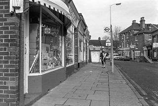
These two feisty young girls demanded to know what I was doing taking pictures in their manor, outside Cassell House close to the corner of Stockwell Rd and insisted that I take their picture. I think that probably they were sisters although they are dressed rather differently. The older of the two is wearing earrings. They are now 34 years older and if they see their picture I hope they like it.

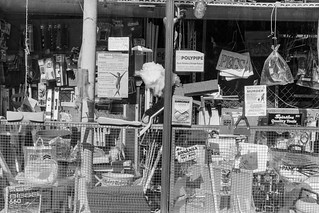
Across the road you can make out Joseph Yates Timber Merchants at 17-19 Stockwell Road, whose shop was still there though boarded up in 2008. Together with the house behind it was replace by a new block shortly after, the shop becoming EZ Homeware and around 2018 a vape shop, Ez Cloudz.

House, 349, Clapham Rd, Clapham, Lambeth, 1989 89-6b-25

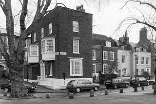
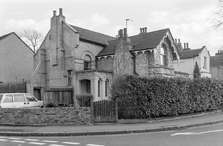
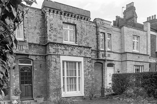
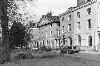
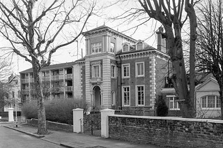
I turned left around the corner into Clapham Road, walking down towards Clapham, crossing Mayflower Road to a group of impressive Queen Anne style red-brick houses – I think this was number 349.

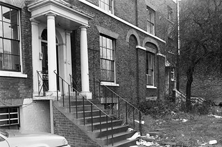
As you can see these houses have quite long front gardens which were then rather overgrown. I think the house had long been divided into flats. There is a broken window on the ground floor which looks as if it is boarded up. These buildings are locally listed

House, 357, Clapham Rd, Clapham, 1989 89-6b-11

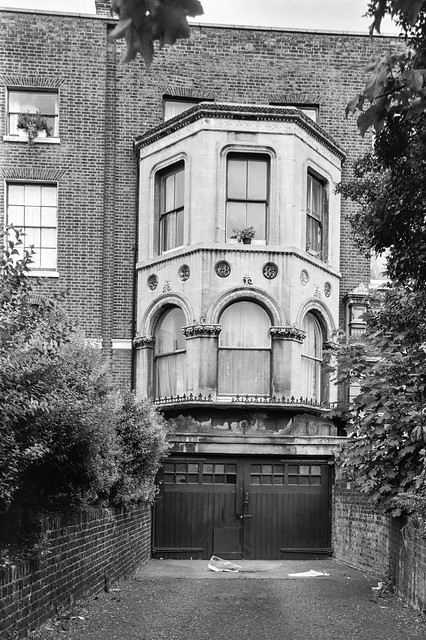
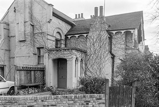
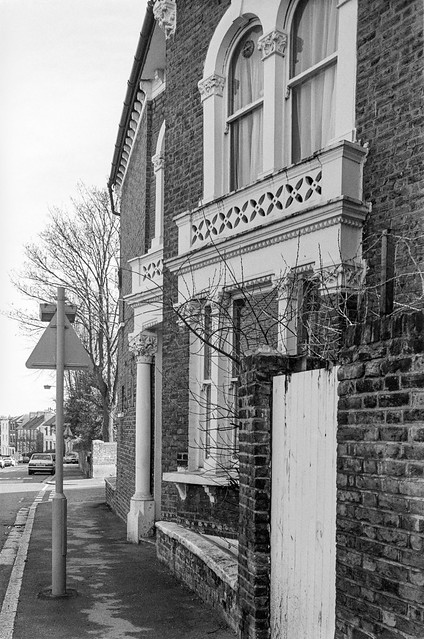
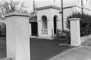
This is a bay extension on 355 Clapham Road, which I found more interesting than the Grade II listed house at the left of the picture, the listing text of which begins “Substantial early C19 house, one of a pair of which the other is so much altered as not to be of special interest.” According to the Survey of London the house was first occupied in 1792.

House, 357, Clapham Rd, Clapham, Lambeth, 1989 89-6b-12

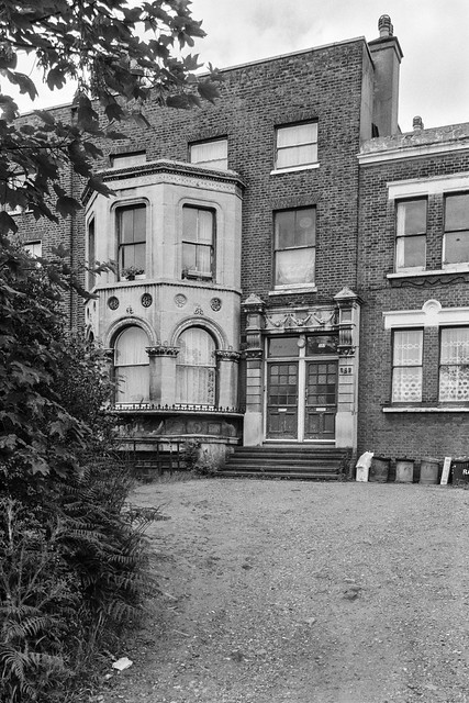
Another view of 357 makes it clear that the two storey bay above a basement garage in the previous picture is indeed a part of this house.

I think its doorway with the two front doors is probably also a later addition, though again I found it of interest, though its listed neighbour retains its original and perhaps more common if still fine entrance. I think my taste in buildings allows rather more for eccentricity while those who make the listings are more concerned with age and consistency of style.

House, 369, Clapham Rd, Clapham, Lambeth, 1989 89-6b-13

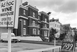
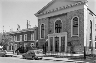
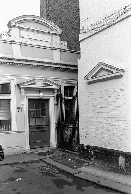
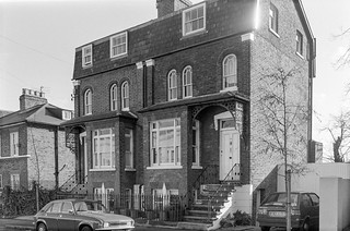
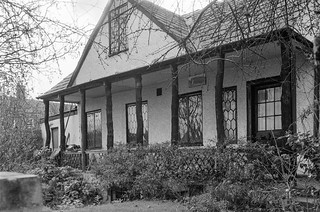
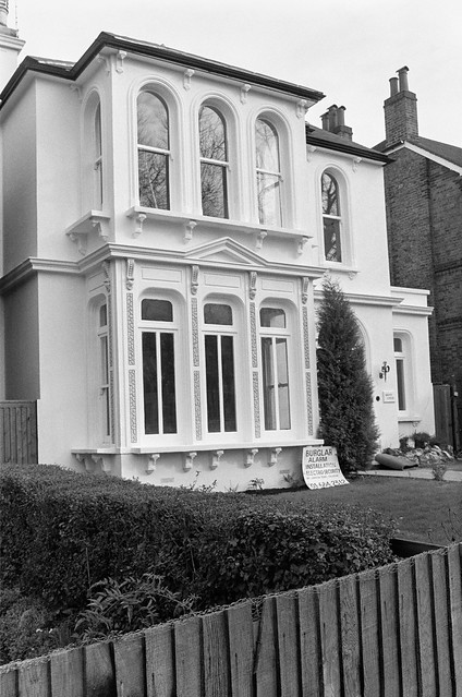
Listed as The Garden House with location ‘Union Mews, Lambeth, London SW9’ in 1981, this is an unusual house at 369 Clapham Road with no front door, though it does have a fairly plain Doric entrance around the side on the left. It was first occupied in 1815, and was built on land acquired by the Duke of Bedford in the early 18th century and let by him to Robert Robson. There is a fairly lengthy description of the house in the Survey of London volume orginally published by the LCC in 1956 which ends with “The premises are now occupied by Messrs. Ashton Brothers and a garden with seats extends from the pavement edge back to the house.”

My picture shows Ashton Funerals at the site in 1989 with ‘PRIVATE CHAPELS FUNERALS CREMATIONS’ and their name in large signage on rails on the frontage, and a well-kept garden, though I couldn’t resist including the Ad Hoc Wine Warehouse signs as well. The house is now flats and the Ashton signage has gone, and the wine warehouse having become car hire has now been demolished as a part of a new block of flats including and existing property at 363.

St. John the Evangelist, Clapham Rd, Clapham, Lambeth, 1989 89-6b-14
St John the Evangelist, Clapham Rd, Clapham, Lambeth, 1989 89-6b-14

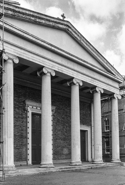
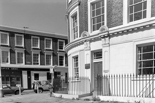
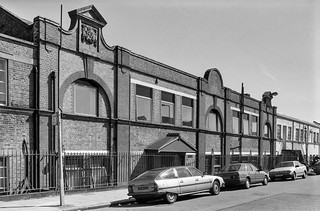
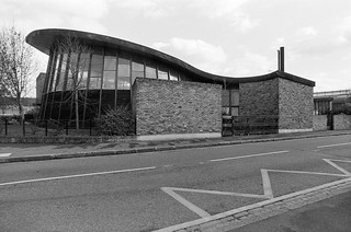
Built 1840-42, architect Thomas Marsh Nelson the church is Grade II listed. A confined site led to an unusual orientation. It was truncated in 1986 and the Diocese of Southwark website comments “In short, this building has suffered due to a lack of clarity from its earliest day. First of all when the east-west axis was reversed and latterly the internal alterations described above. These changes plus the ravages of dry rot have left the interior merely as a jumble of ill-defined spaces without any overall cohesion.”

However the simple classical exterior is impressive, and rather unusual for the date of construction.

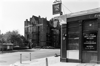
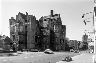
Various events and visits took me out of London for the next few weekends and it was July before I could return for my next walk around part of the city.


Hanover, Belgrave, Chapel, Shops, Taxis

Sunday, June 18th, 2023

Hanover, Belgrave, Chapel, Shops, Taxis: Two days after my previous walk, on Sunday 6th May 1989 I was back on the streets with my cameras, this time getting off the bus at Oval station in Kennington.

Hanover Arms, House, Hanover Gardens, Kennington Park Rd, Kennington, Lambeth, 1989 89-5c-64

A few yards down Kennington Park Road from the Oval Station is Hanover Gardens, and on the corner the Hanover Arms. The pub has been here at least since the 1850s and is still open, getting rather more custom when there is cricket at the Oval a short walk away. Its Grade II listing calls the house ‘Early-mid C19’ but describes the ground floor pub as early C20. I’ve never been inside, but used to walk past it occasionally when a friend had a flat in Hanover Gardens in the 1970s.

The six monarchs of Britain from George I in 1714 to Victoria were known as Hanoverians, but after Queen Victoria married Prince Albert of Saxe-Coburg and Gotha they took over his family designation, changing the name to Windsor in 1917.

My interest was more in the splendid house of the same period on the opposite corner, 324 Kennington Park Rd. I don’t think this is listed, though much of Hanover Gardens is.

Hanover Arms, Belgrave Hospital for Children, Kennington Park Rd, Clapham Rd, Kennington, Lambeth, 1989 89-5c-52

Turning around from almost the same spot I made a photograph of the pub sign with its coat of arms and beyond, on the opposite side of the road, the fine Grade II* listed Belgrave Hospital for Children.

This voluntary hospital was founded in 1886 in Pimlico, and moved to this building in 1903, though the building, begun in 1899 was only completed in 1926. Part of the money for its building came in a donation by music hall star Dan Leno of £625 made after his last show and a few days before his death in 1904.

Belgrave Hospital for Children, Clapham Rd, Kennington, Lambeth, 1989 89-5c-53

The building is in red brick by Henry Percy Adams and Charles Holden and bears some resemblance to a Scottish castle. Its foundation stone was laid by the oddly named Princess Henry of Battenberg in June 1900. It became part of Kings College hospital on formation of the NHS in 1948 and closed in 1985. Left empty it was squatted for some time and then converted to expensive flats in the 1990s.

The building was designed in a roughly cruciform plan with separate ward wings that could be isolated in case of an outbreak of a highly infections disease.

Belgrave Hospital for Children, Clapham Rd, Kennington, Lambeth, 1989 89-5c-54

Kennington Park Road changes its name to Clapham Road at the junction just north of the hospital, something which has often confused me. The two previous pictures were taken from Kennington Park Road, but this was definitely made on Clapham Road.

The lettering in the sign ‘THE BELGRAVE HOSPITAL FOR CHILDREN SUPPORTED BY VOLUNTARY CONTRIBUTIONS’ has a playful Arts & Crafts font, very much of the time the building was commenced and perhaps more suitable for a children’s hospital than the more stern architecture

Claylands Road Chapel, Claylands Road, Kennington, Lambeth, 1989 89-5c-55

Claylands was a mansion built in the area of marshy land often flooded by the River Effra aournd 1800 by brick merchant John Fentiman who drained the land around. In 1836 he let his son, also John Fentiman, erect this excellent example of a Congregational Chapel on the corner of Claylands Raod and Claylands Place.

It prospered for some years and in 1899 a Sunday School was built behind it. Both went out of use, probably in the 1930s and were being used to store building materials when it was bought in the late 1960 by a firm of architect who restore it to use as their offices, renaming it ‘Old Church Court’.

Shop Window, Brixton Rd, Kennington, Lambeth, 1989 89-5c-42

I walked though from Clapham Rd to Brixton Road along Handforth Road, taking this picture of a shop window on Brixton Road. I was attracted by the clutter of tools and other objects, but also by two posters in the window.

One showed a dynamic young woman and was advertising dance workouts, but the other had the stark word ‘MURDER’, a poster from the Metropolitan Police asking for assistance in a recent murder outside a public house.

Works, Kennington Park Estate, Cranmer Rd, Kennington, Lambeth, 1989 89-5c-43

This 1906 factory building on the north side of Cranmer Road has since been converted as part of Kennington Park Business Centre with Salisbury House, Norfolk House, Worcester House and Winchester House.

The buildings on the northern part of this site were once the garage for London’s first motor taxi fleet, the General Cab Company Ltd, with 1,500 taxis based here, and I think these buildilngs may have been workshops for the company. Some time in the 1990s I took a very small part in the industrial archaeology recording of this site, but can’t find the details.

Shops, Brixton Rd,  Kennington, Lambeth, 1989 89-5c-43
Shops, Brixton Rd, Kennington, Lambeth, 1989 89-5c-43

From the corner of Cranmer Road I made this picture of the terrace of shops at 26-36 on the west side of Brixton Road. The River Effra once ran along the centre of the road here – and possibly still does in a sewer.

The central shops seem to have been built first first with those on both ends being added with a different design later. The houses at 22-4, beyond the shops, are Grade II listed.

My walk will continue along Brixton Rd in a later post.


Highgate, Swains Lane And Dartmouth Park, April 1989

Tuesday, March 14th, 2023

This is the second and final part of my walk on Friday 7th April 1989 which had started at Gospel Oak station and I had walked up to Highgate. You can read the first part at Highgate April 1989.

Highgate Literary, Scientific Institution, South Grove, Highgate, Camden, 1989 89-4a-11

I took another picture of the Highgate Literary & Scientific Institution, but didn’t explore much more at the top of the hill.

Pond Square, Highgate, Camden, 1989 89-4a-22

Though I did take a few more pictures, but have only digitised this one. I was eager to go down the hill again, this time taking Swain’s Lane, by the side of the Literary & Scientific Institution.

Swain’s Lane is rather steeper than West Hill and apparently had got its name from being used by pig herders and was first recorded in writing as Swayneslane in 1492. It provided access to farms on either side and only the top few yards were developed for housing before 1887. Fortunately I was walking down hill and hadn’t brought my bike as riding up this lane would have been something of a challenge.

House, Swains Lane, Highgate, Camden, 1989 89-4b-63
Lodge, Swain’s Lane, Highgate, Camden, 1989 89-4b-63

Even now much of Swain’s Lane is undeveloped as it runs between one of London’s great cemeteries, Highgate Cemetery and one of its fine parks, Waterlow Park, both behind brick walls with just a narrow pavement. Below Waterlow Park on the east side is the newer part of Highgate Cemetery, which includes Karl Marx’s Tomb.

The Grade II listed building is the picture is the Lodge at the Swain’s Lane entrance to Waterlow Park, built in the mid-19th century in a fine example of Victorian Gothic, though the chimneys are more Tudor. The post at right is for the park gate and I took just a brief stroll inside before continuing my walk. On warmer days I’ve explored the park rather more and sometimes found a bench to eat my sandwiches as well as taking a few pictures.

In 1992 I visited and took some pictures in both the West and East parts of Highgate cemetery, some of which are on-line in Flickr, but on this walk I didn’t have time to stop and just went on down the hill.

House, Swains Lane, Oakeshot Ave,  Highgate, Camden, 1989 89-4b-52
Mansion, Swains Lane, Oakeshot Ave, Highgate, Camden, 1989 89-4b-52

Immediately south of the West cemetery is the Holly Lodge Estate, with mansion blocks on Makepeace Avenue and Oakeshott Avenue. The website tells that in 1809 Harriot Mellon, a young actress acquired a large villa later known as The Holly Lodge here, and after she married banker Thomas Coutts in 1815 both house and grounds were enlarged and landscaped. She died in 1837, leaving the property and her fortune to one of the most remarkable women of the Victorian age, her husband’s ganddaughter, Angela Burdett-Coutts.

When she died in 1906 her husband tried to sell the entire property with no success, but then managed to sell off some of the outlying parts – including Holly Terrace on West Hill and South Grove House, both mentioned in the previous post on this walk but it was not until 1923 that the main part was sold off and development of the Holly Lodge Estate began.

This area was acquired by the “Lady Workers’ Homes Limited to build blocks of rooms and flats for single women moving to London in order to work as secretaries and clerks in the city on the Eastern side of the estate.

These blocks built in the 1920s had fallen into a poor state of repair by the 1960s and were acquired on a 150-year lease in 1964 by the Metropolitan Borough of St Pancras – and so are now owned by the London Borough of Camden. The council for some years continued with the policy of only housing women on the estate but this has now lapsed.

The flats were designed without separate kitchens and with shared bathrooms and toilets as bed-sits for single women – and the estate was built with a long-demolished community block with restaurant, reading and meeting rooms and a small theatre, and behind it three tennis courts. Some of the bed-sits have been converted into self-contained flats but others still share facilities.

Raydon St, Dartmouth Park Hill, Highgate, Camden, 1989 89-4b-42

I returned to Waterlow Park, making my way through it to Dartmouth Park Hill and on to take thsi picture of some very different housing on the Camden’s Whittington Estate. But by now I was in a hurry and the light was fading a little and I took very few photographs (none online) as I made my way through the streets of Dartmouth Park to Highgate Road and Grove Terrace and on to Gospel Oak station for my journey home.


London & Brighton, Graffiti, Boys At Colmore Press

Saturday, February 4th, 2023

My posts on this walk in Peckham in March 1989 began with Shops, Removals, Housing and the Pioneer Health Centre, and this post continues from where that post ended, on Queen’s Road, Peckham.

House, Queen's Rd, Peckham, Southwark, 1989 89-3a-41
House, Queen’s Rd, Peckham, Southwark, 1989 89-3a-41

Houses at 142-148 on Queen’s Road are Grade II listed, as well as 152-158 further east, toegther with 2-6 St Mary’s Road. I don’t think there is now a number 150, and these form a fairly continuous group of large early 19th century houses. My picture shows 146-148. I also photographed but have not digitised the pair of houses at 156-158, the latter also known as St Mary’s Court.

No 148 has the name EVAN COOK Ltd on its door, a private limited company dissolved in 2015 whose activities are listed as ‘Other transportation support activities‘ and offered Export Packaging, Removals and Storage. They appear to have owned a number of properties in south London. In my previous post I included a photograph of their large premises on Lugard Road, where the company name is remembered in Evan Cook Close. The company had begun by selling second-hand furniture around here in 1893.

London & Brighton, pub, Asylum Rd, Queens Rd, Peckham, Southwark, 1989 89-3a-44

I walked under the railway bridge at Queens Road station (the apostrophe in Queen’s seems optional in this area) and on the corner of the road was this pub opposite the station named for the London & Brighton Railway. Formed in 1837 in 1846 it merged with four other railway companies to become the London, Brighton and South Coast Railway (LB&SCR) and in 1923 this became part of the Southern Railway, until nationalisation.

But the South London line from London Bridge to a new Peckham station here only opened to passengers in 1867, after the merger. The road, formerly Peckham Lane, was renamed after Queen Victoria in 1866 and the station was soon renamed to Queen’s Road. I think the Peckham on its name came much later to avoid confusion with other London stations, Queen’s Road Battersea and Queen’s Road Walthamstow.

The pub was closed in 2008 but its sign – a different one from that in my picture – stands as a sad reminder on Queen’s Rd. The building remained standing until 2013 and was a popular squatted centre with parties and music gigs for some time with some interesting murals. It was replaced by a four storey block of flats, London & Brighton Appartments, with shops and parking on the ground level.

Ora Lighting, Kings Grove, Peckham, Southwark, 1989 89-3a-45

The next turning to the east going north from Queen’s Road is King’s Grove. This small works has been converted into a taller block at 2c King’s Grove, Quay 2c. Designed by owners architect Ken Taylor and sculptor Julia Manheim on a site described as a former milk depot this now now houses design and sculpture studios and three flats. Built into the front wall is a large window used to display art works, the m2 Gallery, using what would otherwise have been a blank wall of a small room containing gas, water and electric meters etc. The building, completed around 2003 has featured in some Open House weeks.

Graffiti, Wood's Road, Peckham, Southwark, 1989 89-3a-33
Graffiti, Wood’s Road, Peckham, Southwark, 1989 89-3a-33

The letters appear to be Eco Charp which meant nothing to me. I now find from Flickr that he was a teenage graffiti tagger from a local Greek/Cypriot family who were in various businesses including ice cream vans in the area and connected with the Peckham snooker hall at 267 Rye Lane which in the 1990s became the rave nightclub Lazerdrome. Apparently his family made clear to Eco Charp when he was about 18 that he had to grow up and stop his graffiti activities.

The house is the Grade II listed 2 Wood’s Road, which featured in one of my posts on earlier walks in the area, first built in the late 17th century but much altered in the 19th and recently renovated.

Colmore Press, Colmore Mews, Wood's Road, Peckham, Southwark, 1989 89-3a-23
Colmore Press, Colmore Mews, Wood’s Road, Peckham, Southwark, 1989 89-3a-23

This disused print works was on Colmore Mews, a small street off Wood’s Road. just south of Queen’s Road. Two young boys were climbing up the side of the disused building. This was at the rear of the offices of the of the company at 62a Queen’s Road, Peckham. None of th buildings visible in the picture remain. The fence at left was around the playgorund at the rear of the school on Woods Rd, now John Donne Primary School.

Boy, Colmore Mews, Wood's Road, Peckham, Southwark, 1989 89-3a-25
Boy, Colmore Mews, Wood’s Road, Peckham, Southwark, 1989 89-3a-25

As often happened, one of the boys asked me to take his picture, and I obliged. Behind him on both sides were some of the buildings on both sides of Colmore Mews, now replaced.

Boys, Colmore Press, Colmore Mews, Wood's Road, Peckham, Southwark, 1989 89-3a-11
Boys, Colmore Press, Colmore Mews, Wood’s Road, Peckham, Southwark, 1989 89-3a-11

His friend then also wanted his picture taken and I took two more pictures of the two boys as they went back to climbing up the wall before continuing on my walk.

Boys, Colmore Press, Colmore Mews, Wood's Road, Peckham, Southwark, 1989 89-3a-12
Boys, Colmore Press, Colmore Mews, Wood’s Road, Peckham, Southwark, 1989 89-3a-12

Back in 1989 it was still not unusual for children to play on the streets – just as I had with my friends as a working class child. I didn’t think they were likely to come to much harm.

I returned back to Queen’s Road where a later post will continue. The previous (and first) post about this walk was Shops, Removals, Housing and the Pioneer Health Centre


Consort Road Peckham

Thursday, January 12th, 2023

The previous post on this walk on Sunday 12th February 1989 was Gold Bullion, Victoriana, Flats, Insurance and Vats – Peckham.

House, Consort Rd, Peckham, Southwark, 1989 89-2e-16

Back in the 1930s there were at least five Albert Roads in London, along with a number of Albert Streets, Albert Mews etc and the authorities embarked on an orgy of renaming to sort out the confusions that could arise. Albert had been particularly popular after Prince Albert of Saxe-Coburg and Gotha had married Queen Victoria in 1840 and at the time of his death in 1861, and some, such as Consort Road, were renamed to reflect their original dedication.

15 Consort Road is Grade II listed and described as “Mid C19, recently restored” and it rather looks as if my picture was taken during that restoration, with the house in excellent condition but the garden rather lacking. Its listing is perhaps more about its part in a group of similar houses rather than its individual merit, and 11,13 and 17 are also listed.

Rather better known now is its new neighbour, 15 and a half Consort Road, an long, low and unobtrusive house now alongside the right hand side of this house with a wood-covered frontage extending a little closer to the road. From the front it rather looks like a garage which someone forget to put in the door, but it was a truly innovative building by Richard Paxton Architects in 2002, shortlisted in the RIBA Awards 2006, and featured on TV’s Grand Designs.

House, Consort Rd, Peckham, Southwark, 1989 89-2f-64

Two railway lines with three bridges cross Consort Road just a few yards from each other, one leading from Peckham Rye to Nunhead and the other from Peckham Rye to Queen’s Road Peckham, along which is now planned to build an urban linear corridor park, the Coal Line, which I visited in 2015.

The bridges and the area around them have changed considerably since 1989. But I think the viaduct is of the line to Nunhead and this house on the edge of the workhouse site has since been demolished.

Consort Works, House, Consort Rd, Peckham, Southwark, 1989 89-2f-65

Limited were in a post-war building on Consort Road just a little south of the railway bridges and I think they made waterproof products using rubber on glass cloth. Their building replaced some older Victorian terrace housing, some of which was still there at the right when I made this picture. I think the company under a slightly different name is still in business elsewhere.

These buildings have all been replaced by modern flats and an industrial unit.

Closed Shop,  Consort Rd, Peckham, Southwark, 1989 89-2f-66
Closed Shop, Consort Rd, Peckham, Southwark, 1989 89-2f-66

This shop was obviously on a street corner, almost certainly one of the four corners with Consort Road and Brayards Rd. I was interested in the shapes and the tiling as well as the fly posting and crude graffiti – which appears to be two practices at producing the final result at right, perhaps a stylised ’68’. The doorway with a rusticated keystone seemed unusually tall and narrow. It was probably Victorian although the shopfront seemed later.

Gold Diggers Arms, pub, Brayards Rd, Consort Rd, Peckham, Southwark, 1989 89-2f-62

The Gold Diggers Arms was a sizeable pub on the northeast corner of Brayards Road and Consort Road and was still in business when I made this picture. It had been here since at least 1871, but closed in 2001 and was demolished in 2005. The site is now a modern development, Dayak Court, flats above ground floor commercial premises.

The Hooper Hall, Consort Rd, Peckham, Southwark, 1989 89-2f-53

Hooper Hall at 111 Consort Road opened as a mission of St Mary Magdalene in St Mary’s Rd in 1907, which was destroyed by a land mine in 1940. Worship continued here and in the church hall while money was raised to build a new church, opened in 1962 and itself replaced in 2011. The mission has lasted rather better.

A notice tells us that in 1989 it was used by both St Mary Magdalene and the Peckham Christian Fellowship. Later it became home to the Christ Miracle Gospel Ministries International but was put up for sale in 2012, and I think the church moved to Edmonton. A fence was put up around Hooper Hall around 2015 as if building work was about to begin, but little seems to have happened since. It appears still to be available for sale.


This walk will continue in a later post. The first post on this walk was Aged Pilgrims, Sceaux, Houses & Lettsom.


School, Meeting House, Houses & Shops – Peckham

Wednesday, January 4th, 2023

The previous post on this walk on Sunday 12th February 1989 was A Market, Chapel & More Houses – Peckham

School, Bellenden Rd, Peckham, Southwark, 1989 89-2e-45
Highshore School, Bellenden Rd, Peckham, Southwark, 1989 89-2e-45

You will look in vain for this school on Bellenden Road now. The school, a special school, moved to a shared site with Archbishop Michael Ramsey School,Camberwell in 2013 leaving the building empty. It was demolished in 2015 and replaced by Cherry Garden special school, which moved out of Bermondsey to here.

I’m unsure as to the date of this school, though it was clearly postwar, possibly dating from the 1960s. Perhaps surprisingly it was not mentioned by Cherry and Pevsner in their London 2: South volume though it seemed to me to be clearly of architectural interest. Southwark Council described it as “a distinctive post-war school” but wanted to knock it down so went on to say “it is not of sufficient quality of construction nor is it sufficiently unique to warrant the particular protection given by listing“. I can’t comment on the structural soundness from the four pictures I took but can’t think where you can find a similar building. It gets a rather deprecating comment in the Holly Grove Conservation Area Appraisal, “Highshore School, immediately adjacent to the conservation area, was built using standardised lightweight constructional systems and open site-planning principles which undermine the established morphology of street frontages“, not fitting in neatly with the Georgian housing in the area.

House, Highshore Rd, Peckham, Southwark, 1989 89-2e-33
House, Highshore Rd, Elm Grove, Peckham, Southwark, 1989 89-2e-33

This house is on the corner of Higshore Road and Elm Grove and I think its address is 64 Elm Grove. It is certainly a very impressive and substantial late Victorian house with a quirkiness I found appealing enough to take a second frame.

House, Highshore Rd, Peckham, Southwark, 1989 89-2e-34

Post Office Depot, Highshore Rd, Peckham, Southwark, 1989 89-2e-35

I didn’t photograph the listed houses in Highshore Road, perhaps suffering from a surfeit of rather standard Georgian or early Victorian houses in the area. Fine though they are I didn’t feel a need to photograph all of them.

The Post Office Depot is rather less usual and carries a ‘Historic Southwark’ board as well as being Grade II listed. This is possibly the earliest building in what was then known as Hanover Street, built in 1816 as the Friends Meeting House, apparently on the site of a pond. It was considerably enlarged in 1843.

Shops, Rye Lane, Peckham High St, Peckham, Southwark, 1989 89-2e-21

These buildings are stll there at the north end of Rye Lane, though now with different shops, but almost all the buildings visible on Peckham High Street in the picture have gone. There is still a bank at 65 Peckham High Street the extreme corner of which can just be seen but the rest of the buildings including the Midland Bank have gone, with a walkway here now leading to the Peckham Pulse Leisure Centre built in 1998.

Shops, Peckham High St, Peckham, Southwark, 1989 89-2e-22

I took another picture of these shops from a slightly different viewpoint to one I had made a month earlier which I wrote about aat some length in a post on that earlier walk. The building housing ‘Stiletto Ecpresso’ has been replaced since 1989 by a taller and rather less interesting structure but the rest still look much the same, though with different uses.

Canal Head, Peckham High St, Peckham, Southwark, 1989 89-2e-23

Had I been aware of the changes that were soon to take place in this area I would have made more than this picture at Canal Head. This was the start of the walk along the route of the Peckham Branch of the Surrey Canal, at the back of what is now the The Drovers Arms, roughly at the south-east corner of the more recent Leisure Centre.

Doorway, Peckham High St, Peckham, Southwark, 1989 89-2e-24

The Drovers Arms has the address 71-79 Peckham High St and tucked away down a short driveway at its read is this building at 71, now a dental surgery, Peckham Dental Care. The building at right with a bricked up and painted over doorway is the pub, which has a rather grander and more useful entrance on the High Street, opened in 2000.

The main building at 73-79 was built around the end of the 19th century, according to Historic England by architects J & J W Edmeston, for the London and South Western Bank. The Edmestons were a family of architects working in London, of whom the best known was probably James Edmeston Jr (1823-98). I think 71 may be a little earlier.


This walk will continue in a later post. The first post on this walk was Aged Pilgrims, Sceaux, Houses & Lettsom.

A Market, Chapel & More Houses – Peckham

Friday, December 23rd, 2022

The previous (and first) post on this walk was Aged Pilgrims, Sceaux, Houses & Lettsom.

House, Lyndhurst Way, Peckham, Southwark, 1989 89-2d-25

At the end of Lyndhurst Grove I came to Lyndhurst Way and had to make the choice of whether to turn left or right along it. Both ways looked interesting but I chose left and found a short terrace or four rather unusual houses at 13-19, two of which had the decoration on the window bays. There are also differences in the treatment of the doorway and windows of these two houses, which are the only ones of the four with entrances leading down to the pavement – those at the end of the block have their doors at the sides.

I continued to Lyndhurst Square then turned back, walking down Lyndhurst Way to Holly Grove, taking a few pictures on the way, none of which are online.

House, Holly Grove, Peckham, Southwark, 1989 89-2e-55

Holly Grove was developed by George Choumert (1746-1831), a Frenchman who married Lydia Fendall from a wealthy family of tanners in Bermondsey. He had a number of houses built in what was then George Lane around 1815-20. This picture shows No 14 and 15 – the houses are numbered consequently as there are no houses on the north side of the road which is Holly Grove Shrubbery, ‘a Victorian shrubbery with a serpentine boundary with a footpath winding through it’ between Holly Grove (then South Grove) and Elm Grove. All the houses from 5-24, 32 and 33 are Grade II listed.

Indoor Market, Rye Lane, Peckham, Southwark, 1989 89-2e-56

Peckham Indoor Market was built around 1938 or shortly after as Rye Lane Bargain Centre with an imposing frontage for a narrow arcade leading back to a large covered market. It’s a style that rather makes it look like a cinema. Across the top is the message ‘Come Rain Or Shine It’s Always Fine at Peckham Indoor Market’.

In the early 2000s the market at the back was reduced in size with part now redeveloped as flats but the front section remains and is now Rye Lane Market, housing over 50 small shop units.

Rye Lane Chapel, Rye Lane, Peckham, Southwark, 1989 89-2e-41

You can read a detailed history of the chapel up to 1927 on the web. The first Baptist worship in the area was begun around 1817 when Mr Spencer, a deacon from Blackfriars Baptist church moved into what is now Peckham Hill St, a more rural location, for the sake of his health and began services in his home. Soon the congregation got too large for this and they bought a plot of land on Rye Lane and built a large and expensive chapel on the corner of Blenheim Grove and Rye Lane which opened in 1819.

Unfortunately when the railway came the chapel was exactly where it ran and the railway company were to build their station. So the chapel had to go, and a new chapel was built on the opposite side of the road a short distance to the north in 1863. That one was built on a firm concrete foundation and is still standing and still in use, having been restored after wartime bomb damage.

Houses, Elm Grove, Peckham, Southwark, 1989 89-2e-43

I turned back west from Rye Lane along Elm Grove, which contains a number of houses of interest, including half a dozen that are Grade II listed but it was this group that prompted me to take a photograph.

Elm Grove was developed around 1830 although from the maps it appears much was added later in the century, and these probably date from the middle of the century. In the Holly Grove Conservation Area document the photograph from Elm Grove of these houses comes with the description “a row of pale brick houses (No. 48-54) built with prominently projecting square bays and distinctive Gothic features on the upper storey, particularly the window glazing patterns and parapet detailing.” There is more about them and other houses in Elm Grove later in the document

This walk will continue in a later post.


Vestry Road, Camberwell to Lyndhurst Grove, Peckham

Thursday, December 22nd, 2022

The previous and first post on this walk was Aged Pilgrims, Sceaux, Houses & Lettsom.

Vestry Rd, Camberwell, Southwark, 1989 89-2d-53

Vestries such as that in the parish of Camberwell St Giles were the bodies that provided municipal services before local government was organised into boroughs – and in this area the Metropolitan Borough of Camberwell took over their duties in 1900. In the 1820s and 1830s the Vestry here was responsible for the closing down of Camberwell Fair, as a part of “widespread campaign in the early 19th Century, to impose social and moral control over the growing working classes“.

Perhaps Vestry Road got its name as the vestry bought the land and began the development there. The road is not present on Cary’s New Plan of London in 1837, but was present with these houses shown on the Ordnance Survey‘s map surveyed in 1869 to 1871, when the road ended a little past Grace’s Road. These houses were probably quite new then. The road was extended further south by thhe mid 1890s.

The Maisonettes, Vestry Rd, Camberwell, Southwark, 1989 89-2d-55

The Maisonettes at the north end of Vestry Road face Lucas Gardens. They were built in 1907.

Immediately to the north of these maisonettes is the Camberwell Bunker Garden, on top of the now disused Southwark Borough Control Bunker, a cold-war control centre built underneath a now demolished health centre on the corner of Peckham Road and Vestry Road.

Houses, Vestry Rd, Camberwell, Southwark, 1989 89-2d-56

This long terrace of mid-19th century working class homes at 2-24 is probably the earliest development on Vestry Road.

Trees, Lucas Gardens, Vestry Rd, Camberwell, Southwark, 1989 89-2d-42

Around 1790 a terrace of 12 Georgian houses was built on the south of Peckham Road called East Terrace, and in the 1880s these became an extension to the Camberwell House Lunatic Asylum which had opened on the opposite side of Peckham Road in 1846. It was one of the largest asylums in London, with only that at Bow being larger.

The asylum remained private when the NHS was formed and closed in 1955. It had extensive gardens for its patients to roam, and those on the north side provided a site for the Sceaux Gardens estate while on the south they formed this public park, Lucas Gardens.

House, Crofton Rd, Camberwell, Southwark, 1989 89-2d-34

I walked down Vestry Road to Lyndhurst Grove and then east along this to Crofton Road. There are a very large number of similar houses in this area and I cannot decide exactly where I made this picture. These houses are I think late Victorian.

House, Talfourd Rd, Camberwell, Southwark, 1989 89-2d-36
House, Talfourd Rd, Peckham, Southwark, 1989 89-2d-36

Charles Booth described Talfourd Road as ‘good middle-class‘ and it has a varied selection of houses. Some of these were already present on the 1860 map. Wikipedia lists two notable Talfourds:
“Sir Thomas Noon Talfourd (1795–1854), English judge, politician, and writer” and “Francis Talfourd (1828–1862), English lawyer and dramatist, son of Thomas”. Neither seems to have any obvious connection with Peckham, but the street seems to have been named after the judge.

Although my contact sheet labels this as Talfourd Road and it is certainly somewhere close I cannot find the exact location of this property.

House, Lyndhurst Grove, Peckham, Southwark, 1989 89-2d-24
Houses, Lyndhurst Grove, Peckham,, Peckham, Southwark, 1989 89-2d-24

96 and 98 Lyndhurst Grove are rather easier to find, roughly opposite the end of Denman Road. According – as usual – to Wikipedia, John Copley, born in 1772 in Boston became 1st Baron Lyndhurst and “was a British lawyer and politician. He was three times Lord High Chancellor of Great Britain” and “Thomas Denman, 1st Baron Denman, PC was an English lawyer, judge and politician” and Lord Chief Justice between 1832 and 1850. This is a thoroughly legal area.

More on this walk in later posts.


Peckham Rye to Goose Green – 1989

Sunday, December 18th, 2022

More from my walk in south London on Sunday 5th February 1989. The previous post was Around Rye Lane Peckham 1989.

Antiques, Lock, Peckham Rye, Peckham, Southwark, 1989 89-2c-62

There is still a doorway here between 56 and 58 Peckham Rye, but the lock above it has gone and it now has a sign for Ezel Court at 56 A and B and 58 A and B. The Antique shop was for some years Delta Tavern, an Arfican Restaurant, then a café called Pedler and most recently a bar and restaurant Good Neighbour. The building building to the right of the doorway is also now a bar.

At top left of my picture who just get a glimpse of the rather finely decorated upper storeys of the two late Victorian buildings at 58 and 60, though for some reason I didn’t bother to cross the road to photograph these.

Shop Window, Peckham Rye, Peckham, Southwark, 1989 89-2c-64

This window was just a few doors further down at No 64 and I liked the symmetry of its display, though broken by the two identical photographs of a woman looking in the same direction. I don’t think I was at all clear as to what was behind this window – or what the woman in her strongly patterned dress and gloves was meant to represent. And at the centre of the window display is a thick book on a table, a Thesaurus.

The attractive grille above the door is no longer there, and was probably salvaged and sold when the shopfront was updated. In more recent years this has been occupied by an estate agent, a pizza takeaway and beauty salons.

In the reflection you can see the extensive premises of G Austin & Sons Ltd offering secondhand furniture and antiques, now I think replaced by a three-storey block of flats.

Man, Regency Carriage Company, Peckham Rye, Peckham, Southwark, 1989 89-2c-65

I was always happy to photograph people who saw me taking pictures and wanted to have their picture made, though I very seldom took down details so I could give them pictures. So this young man, posing for me in 1989 will not have seen this picture, unless he has visited the page on Flickr only since January 2021 – it has never been published elsewhere.

The Regency Carriage Company has long gone from this site, though the building remains, rather altered. It was for some time an estate agents but has for around ten years been Rye Cars. But the yard in which the cars for sale were neatly aligned is now covered by flats.

St John the Evangelist, East Dulwich Road, East Dulwich, Southwark, 1989 89-2c-66

St John the Evangelist was built in 1865 to the designs of local architect Charles Bailey, but was badly bombed in 1940. Reconstruction began in 1947, incorporating the remaining apse and tower which dominate my picture and was completed in 1951.

House, East Dulwich Road, East Dulwich, Southwark, 1989 89-2c-52

126 East Dulwich Road faces the west end of Goose Green on the corner of Grove Vale and I liked the uncompromising stare of the head above its simple but impressive doorway.

Houses, East Dulwich Road, East Dulwich, Southwark, 1989 89-2c-53

A pair of doorways with heads, with a simiilar design and I think on the same row of houses facing Goose Green as the previous image.

Goose Green School, Grove Vale, East Dulwich, Southwark, 1989 89-2c-54

I walked a few yards north up Grove Vale to photograph this fine Grade II listed example of a school built as Grove Vale School for the School Board for London in 1900 to the Baroque Revival designs of T J Bailey

I turned around here and walked down to Lordship Lane where my next post on this walk will begin.


My account of this walk from 5th February 1989 began with A Pub, Ghost Sign, Shops And The Sally Ann.


The Groves of Camberwell

Tuesday, December 13th, 2022

My previous post about this walk on 5th February 1989 was Denmark Hill, Ruskin and on to Dulwich.

Shops, Melbourne Grove, East Dulwich, Southwark, 1989 89-2b-61

Nothing much caught my attention on the walk from the hospital and then up Melbourne Grove until I came to this hosrt row of shops just before reaching Grove Vale. I think all of these buildings are still there but the bus stop has gone and all of the buildings have changed use and there is no longer a Grove Vale Library opposite the top of the road, it having moved into a new building around the corner on Railway Rise, behind M&S.

House, Camberwell Grove, Camberwell, Southwark, 1989 89-2b-63

I walked up Grove Vale under the railway bridge where it becomes Dog Kennel Hill and up there to turn into Grove Hill Road which led me to the southern end of Camberwell Grove – this picture was taken at their junction. When Hermitage at 220 Camberwell Grove was built the road was known as 220 Camberwell Grove. Its Grade II listing describes it as an early 19th century cottage. It was built as a rustic cottage with these timber posts supporting the deeply overhanging roof to form this verandah.

The cottage was one of the properties built for John Coakley Lettsom (1744 – 1815) a doctor who founded the Medical Society of London and had a considerably grander villa a little to the south at Grove Hill, demolished in the early 1800s. is now rather more covered by greenery, making photography more difficult.

House, Camberwell Grove, Camberwell, Southwark, 1989 89-2b-64
Houses, Camberwell Grove, Camberwell, Southwark, 1989 89-2b-64

Immediately north of the cottage is this impressive row of houses. Nos 200-218 are Grade II listed and were built as a block from around 1845.

House, Camberwell Grove, Camberwell, Southwark, 1989 89-2b-66

This unusual verandah and window was at the side of one of the houses on Camberwell Grove, at No 195.

Many if not most properties in Camberwell Grove and nearby are Grade II listed, and 195 seems to be the only one unlisted on this section of the road, all fine Regency properties, though this part of the house appears to be a later addition. Perhaps 195 is unlisted because unlike the other properties it it built up to the pavement edge and some may feel it spoils the long vista of houses well back from the pavement.

House, Grove park, Camberwell Grove, Camberwell, Southwark, 1989 89-2b-52
House, Grove Park, Camberwell Grove, Camberwell, Southwark, 1989 89-2b-52

On the corner with Grove Park is this rather odd conglomerate with what appears to have been a classical entrance lodge welded unhappily into a later mansarded house.

Houses, Camberwell Grove, Camberwell, Southwark, 1989 89-2b-54

Perhaps the gem of Camberwell Grove, this is Grove Crescent, a Grade II listed terrace of 4 linked pairs of houses dating from around 1830 at 169-183 Camberwell Grove.

House, Grove Park, Camberwell, Southwark, 1989 89-2b-55

Grove Park has a few large villas from the 1830s and 40s, but is mainly a late Victorian speculative development of large houses probably from the 1890s, with a few variations on three versions of large semi-detached houses. It is made up of several roads, all confusingly called Grove Park. This detail shows the entrance at the west of 125 Grove Park, just a few yards from Camberwell Grove.

House, Grove Park, Camberwell, Southwark, 1989 89-2b-56

This is White Lodge at 55 Grove Park, which stands out in this short leg of the road in a row of late-Victorian red-brick houses, which it presumably pre-dates.

House, Grove Park, Camberwell, Southwark, 1989 89-2b-41

This grandly Italianate mansion, Pelham House, 14 Grove Park, is on the corner with Pelham Grove, and is now flats with a considerably more recent block of flats at The Birches on the opposite corner.

House, Grove Park, Camberwell, Southwark, 1989 89-2b-43

This house, one of three similar houses at 17-19 Grove Park was in a derelict state back in 1989 but looks very smart now.

There were many other buildings in Grove Park which I might have photographed and a couple I did but haven’t digitised, but I felt it was time to move on, and walked to the east along Grove Park to where my next post will begin in Chadwick Road in Peckham.


My account of this walk from 5th February 1989 began with A Pub, Ghost Sign, Shops And The Sally Ann.