Stratford Marsh: Sewage and Rivers

Northern Outfall Sewer, Lea Navigation, Stratford Marsh, Newham, 1983 36o-24_2400
Two pipes and behind them the Northern Outfall Sewer

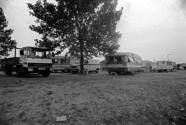
Part of Bazalgette’s great plan for freeing the Thames in central London from being a huge open sewer was to build large sewage pipelines to sewage works to the east of London. North of the river, the Northern Outfall Sewer, built in 1960-65, channels sewage from high level sewers serving North London and those from Central London to run under an embankment from Wick Road, across the Lea Navigation at Old Ford and past Stratford’s ‘Cathedral of Sewage’ at Abbey Mills which pumps up sewage from lower level sewers serving West London to join it and flow together to the sewage works at Beckton, the effluent from which is discharged into the Thames. Above the large pipes is a path for pedestrians and cyclists, rebranded at great expense as ‘The Greenway’ in the early 1990s.

Lea Navigation, Stratford Marsh, Newham, 1983 36o-34_2400
These two pipes close to the Greenway are perhaps for gas.

It provides a useful traffic-free route across Newham, but access to it is often poor, particularly for cyclists and for the past 15 or so years has been blighted by closures of various sections, particularly in Stratford Marsh for the 2012 Olympics and Crossrail construction as well as sewer maintainance. It should be open again now and is an interesting walk, though the slightly sweet sickly smell may put some off.

Towards Bow, from Northern Outfall Sewer, Stratford Marsh, Newham, 1983 33x-14_2400
Stratford Marsh and Bow, 1983
Lea Navigation from Northern Outfall Sewer, Stratford Marsh, Stratford, Newham, 1990 90-9h56_2400
The sewer path provides an elevated viewpoint. Lee Navigation and Bow 1990

Stratford Marsh north of the Northern Outfall was bounded by water. The Old River Lea ran from Carpernters Road through Carpenter’s Lock to join the Lea Navigation just south of Old Ford Lock and immediately north of the outfall. Along its east side was the Waterworks River (carrying most of the flow from the Lea and passing under the sewer close to Stratford High St, which it flowed under close to City Mill Lock. Running West from the other end of the lock was St Thomas’s Creek joining to the Navigation at Bow Bridge, and north the City Mill River linking to the Old River Lea.

City Mill River, Stratford Marsh, Newham, 1983 35p-24_2400
A rare boat makes its way around the Bow Back Rivers. City Mill River, 1983

Until the closure for the Olympics it was possible for boats to navigate around the area, leaving the navigation just above Bow Bridge on St Thomas’s Creek, going north up the City Mill River, then west along the Old River Lea back to the navigation, all these rivers being at the same level. In quite a few days of walking around the area I only saw two boats making the trip.

Signal Box, Stratford Station, Stratford, Newham, 1983 35p-65_2400
Channelsea River at Stratford Station, 1983

Another smaller channel, the Pudding Mill River, ran a little to the west of this down from the Old River Lea, disappearing under the railway lines which cut through Stratford Marsh (a couple of pictures in a later post.) This river I think disappeared completely under the stadium in the Olympic makeover; while all around them was changed (including the soil, much imported from elsewhere) the other watercourses in this area emerged largely unscathed though there were changes south of the High St, and I think the Channelsea River was possibly further marginalised.

Channelsea River, Jupp Rd, Stratford, Newham, 1983 35p-62_2400
Channelsea River, Jupp Rd, Stratford, 1983

Towards Hackney Wick 1982

I continue my virtual walk downriver towards Hackney Wick.

Clapton Park Estate, Clapton Park,  Hackney, 1982 32k-64_2400

Past the Clapton Park Estate: Norbury Court, Bakewell Court, Ambergate Court and Sudbury Court at 172 Daubeney Road, each 20 stories with 114 flats, approved by Hackney Council in 1968. Three were demolished by explosions in 1993-5 but Sudbury Court was sold to a private developer who gave it a relatively minor make-over and renamed it Landmark Heights.

Clapton Park Estate, Clapton Park, Hackney, 1982 32k-53p_2400

Somewhere I passed a canal-side factory –

Hackney Wick, Tower Hamlets, 1983 36n-46_2400

as well as the wide expanse of Hackney Marshes, with what must surely be more football pitches and anyone needs

Hackney Marsh, Hackney Wick, Hackney, 1982 32z-62_2400

as well as some wilder areas where the hogweed grows

Hackney Marsh, Hackney Wick, Hackney, 1982 32u-13_2400

and was ambushed by a group of children

Hackney Wick, Hackney, 1982 32k-51_2400

who demanded I take their pictures.

Hackney Wick, Hackney, 1982 32k-42_2400

Clost to Eastway I came across a travellers site

Travellers site,  Eastway, Stratford, Newham, 1983  36o-12_2400

close to the River Lea, here looking a very serious river away from the navigation.

River Lea, Eastway, Stratford, Newham, 1983  36o-13 (2)_2400

My walk continued but in a less linear fashion wandering around Hackney Wick – in the next episode. You can see all the pictures and more in my album River Lea – Lea Navigation 1981-1992.


All photographs on this and my other sites, unless otherwise stated, are taken by and copyright of Peter Marshall, and are available for reproduction or can be bought as prints.


Lea Valley 1993 – Around Tottenham Hale

Stonebridge Lock, Northumberland Park, 1983 37c-22_2400

Continuing my pictures from walks along the River Lea and Lea Navigation in 1983 which are in my Flickr album River Lea – Lea Navigation 1981-1992.

Tottenham Hale station on the Victoria Line was a convenient starting point for walks both north and south along the Lea navigatiion, which is crossed by Ferry Lane around 200 metres from the station.

Stonebridge Lock is around 3/4 miles north up the path from Ferry Lane, where steps lead down to the towpath immediately after you cross Pymmes Brook. The view above is looking south back towards Tottenham Hale.

Lea Navigation, Tottenham, 1983 34l-51_2400

Thames Water Sludge Mains Bridge No 3 crosses the Navigation closer to Ferry Lane, and as well as a crudely painted landscape also carried racist graffiti from the National Party, a splinter group of the National Front which was active from 1976-83.

Ferry Lane, Tottenham, 1983 34l-64_2400

A lone tree behind a gate somewhere on Ferry Lane (or its eastern continuation, Forest Road.)

Flood Channel, Leyton, Waltham Forest, 1982 32d-46_2400

The Lee Flood Relief Channel at Forest Rd. There are now tall recently built blocks of flats replacing the inustrial units and garage in this picture.

Ferry Lane Wharf, Tottenham Hale, Hackney, 1982 32d-56_2400

This extensive range of warehouses fronting the navigation immediately south of Ferry Lane has now been demolished and replaced by housing.

Ferry Lane Wharf, Tottenham Hale, Hackney, 1982 32d-55_2400

There is a channel here from the River Lee Diversion which takes excess water from the river and navigation north of Enfield, though usually most of the flow in this rejoins the navigation around half a mile further south.

Ferry Lane Wharf, Tottenham Hale, Hackney, 1982 32d-53_2400

The pattern of waterways it the Lea Valley is difficult to understand and as well as the diversion there are also various flood channels, as well of course as tributaries such as the Pymmes Brook and Dagenham Brook. In the old days there were various man-made channels to feed water mills, while more recently, particularly in the twentieth century various projects to control flooding in the area.

Flickr album River Lea – Lea Navigation 1981-1992.


All photographs on this and my other sites, unless otherwise stated, are taken by and copyright of Peter Marshall, and are available for reproduction or can be bought as prints.


Pymmes & Tottenham Marsh 1983

Pymmes Brook,  Edmonton, 1983 37c-55_2400

The Pymmes Brook is a stream in north London which runs from Barnet and joins the River Lea at Tottenham. It got its name from William Pymme who was given land in Edmonton by Edward II in the fourteenth century.

Pymmes Brook,  Edmonton, 1983 37c-56_2400

Although it begins from underground springs at Monken Hadley Common in the London Borough of Barnet, these supply relatively little of the water which reaches the River Lea, particularly when the river is in flood, augmented by water runoff from streets and sewage overflows along with the more normal industrial effluent. Because it used often to flood in its lower course, much is now in deep concrete channels, and in some places is culverted.

Pymmes Brook,  Edmonton, 1983 37c-65_2400

I’m no longer sure exactly where I took most of these pictures of the Pymmes Brook, but I think they were just a little after it flowed under the North Circular. I think some may actually be of the Salmons Brook which runs down from Enfield and joins it in Upper Edmonton. This gets its name not from the fish – which were probably once found in it before the area became urban and industrial – but from the 13th century landowner John Salemon.

Pymmes Brook,  Edmonton, 1983 37c-23_2400

The river runs more or less parallel to the Lea Navigation just a few yards away across Tottenham Marshes and only finally flows into the Lea close to Ferry Lane in Tottenham Hale.

Chalk Bridge, Tottenham, 1983 34l-13_2400

My pictures of the Lea continue south from Chalk Bridge and past Tottenham Marshes.

Lea Navigation, Tottenham Marshes, 1983 34l-31_2400

On the east side are the large Banbury and Lockwood reservoirs, part of a series up the Lea Valley providing water for much of east London.

Banbury Reservoir, from Lea Navigation, 1983 34l-24_2400

This is one of the most picturesque sections of the River Lea, certainly in its lower reaches. I could almost imagine Izaak Walton walking along here in conversation (as Piscator) with his friends Venator and Auceps on May Day holding the discussion of the relative merits of fishing, hunting and fowling as recorded in his ‘The Compleat Angler‘.

Lea Navigation, Tottenham Marshes, 1983 37c-33_2400

More pictures from the Lea in my Flick album River Lea – Lea Navigation 1981-1992


All photographs on this and my other sites, unless otherwise stated, are taken by and copyright of Peter Marshall, and are available for reproduction or can be bought as prints.


Before the Olympics – The River Lea

The Source of the River Lea, Leagrave, Luton, Beds, 1982 33d-56_2400
The source of the River Lea, Leagrave, Beds

Back in 1981 I kind of stumbled across the River Lea as I walked and photographed eastwards out of the city through Wapping, Limehouse and Poplar to Bow and Canning Town. Of course I’d known about it since my youth, growing up in Middlesex; it was our eastern boundary where civilisation ended and Essex began, but never something we visited.

I began at Bow Creek, the River Lea’s tidal section which leads to its confluence with the River Thames at Leamouth, but soon after began to explore Stratford Marsh, a remarkable wilderness area around the Bow Back Rivers. I’d gone to Bow having heard a short radio report that commercial traffic on the Lea Navigation was to end in a few weeks time, and found it more or less already had, though I was able to find a couple of loaded barges moored by a wharf next to the Bow flyover, as well as quite a few barges empty and apparently abandoned.

River Lea, near Luton, Beds, 1983 33e-14_2400
River Lea

I put together a proposal to document the area around the Lea navigation and sent it, including some of the pictures I had already made, to try to obtain some funding for an extensive project on the area. Later I found the esteemed photographer I had approached to endorse my project was not one of the charmed circle who advised the funding body and promoted their own former students and protégées – and that outsiders were seldom if ever funded.

Works, Broxbourne area, Herts, 1983 34z-52_2400

When my rejection came I was downhearted – particularly by seeing some of the projects that did get support – and also rather angry. I still saw it as a worthwhile project and thought about ways I could carry it out funding it myself. I had little cash and a young family to support, so I had to keep costs to a minimum. I had to stick to using 35mm, to load cassettes from bulk film, do all the processing and printing myself and to give up the idea of producing a book.

White House Cafe, Lea navigation. Broxbourne area, 1983 34z-11_2400

Probably working with 35mm improved the project, giving me more flexibility than using medium format, where my choice of focal lengths would have been much more restricted. But loading cassettes from bulk did lead to more problems than using factory loaded film and my home processing facilities were a little on the primitive side. For some of the work I used Kodak Technical Pan, an extremely fine-grain film designed for high contrast copy work which could be tamed for pictorial use with reduced development – but which also meant reduced speed – depending on the developer used from ISO6 to ISO32. Later Kodak Technidol developer became available and made it much less sensitive to small changes in development time or agitation, and the results were more reliable. Technical Pan was I think discontinued in 2004.

Lea Navigation,  Broxbourne area, Herts, 1983 35a-32_2400

I worked on the project on occasional days in 1982-3, extending it to cover the area around the River Lea from its source to the Thames and then moved on to other things. Occasionally though I returned to the Lea and took more pictures, particularly in 1992 around Stratford Marsh, and later in that decade around Ponders End. In the early years of this century I walked the length of the river over several stages with my family and later went back a cycled much of it after I bought a Brompton folder which I could easily take on trains to suitable starting points. By this time I’d also exhibited work from this project in several shows. When the site for the London Olympics was announced in 2005 I began putting it on line, setting up the web site The Lea Valley and planning the book ‘Before The Olympics‘, which eventually I self-published on Blurb – and is still available.

In the last few days I’ve gone back to my contact sheets from 1981-3 and digitised a number of new images from them and am now beginning to upload them to Flickr, along with a few already from 1990-1992 previously scanned.

Riverside Cafe, Waltham Abbey, River Lea, Lea Navigation,  Broxbourne area, Herts, 1983 35a-42_2400

So far I’ve uploaded only the few images I made between the source at Leagrave (augmented as I made the exposure by a French photographer friend) to somewhere around Cheshust, close to the edge of Greater London. You can see more from this stretch already on Flickr, but there are very many more taken inside London Boroughs to come.

Broxbourne area, Herts, 1983 34z-46_2400

Some apologies. Some of the images are without full location details, which I have lost, and others were scanned with carrier glass that has caused clear ‘Newton’s rings’ in shadow areas, which are impossible to entirely retouch, though perhaps one day I’ll re-digitise them. Some of the negatives have also been damaged by an insect infection which takes extensive retouching and is in some images impossible to completely remove.

I’ll make further posts after I upload more pictures to the album, and will probably upload images from later years too.

River Lea – Lea Navigation 1981-1992


All photographs on this and my other sites, unless otherwise stated, are taken by and copyright of Peter Marshall, and are available for reproduction or can be bought as prints.