Posts Tagged ‘Lea Valley’

Ponders End & Edmonton

Monday, December 7th, 2020

Lea Navigation, Brimsdown, Ponders End, 1983 34m-22_2400

I’m not sure why the name Ponders End so appeals to me. It has a rather down to earth quality (or perhaps down to water) which is apparently reflected in its etymology, stretching back over 600 years to the Ponder family, with a John Ponder being recorded as far back as 1373. He or his family apparently got their name because they kept or lived by a fishpond or mill pond on the River Lea. Ponders End was their end of Edmonton.

Lea Navigation, Ponders End, 1983 34m-23_2400

The River Lea was important for the movement of people and goods from the earliest times and was improved for navigation at various times in the middle ages; later the first modern gated lock on a river was built at Waltham Abbey in 1577 and the basis of the current Lea Navigation – including the Limehouse Cut – were laid in the 1770s, though there were further improvements well into the 20th century. You can read more on Wikipedia. In recent convention the spelling Lea is used for the river and natural features, and Lee for those man-made features such as the navigation but I tend to use Lea for both.

Lea Navigation, Ponders End, 1983 34m-24_2400

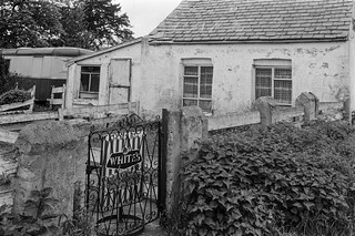
Because of its good transport links to London, industry began to arrive here in the 19th century, with wharves along the canal. Later with the growth of motorised transport development became centred along the Great Cambridge Road, the A10, a short distance to the west, particularly after its improvement in the 1930s. When I took these pictures back in 1983 the area was full of factories, but many were derelict, their demise accelerated by Thatcher’s national flight from manufacturing – something which was at the centre of my recording of out post-industrial landscape

Lea Navigation, Brimsdown, Ponders End, 1983 34m-32_2400

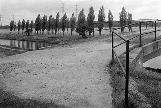
The area had turned its back on the canal where all commercial traffic had ceased a couple of years earlier, but many of the structures were still present. Now almost all have been replaced by warehousing and some residential development. In later years I photographed around the little that remained, including Wright’s Flour Mill, parts of which date from the 18th century.

Lea Navigation, Brimsdown, Ponders End, 1983 34m-36_2400

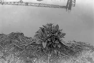
Back in 1983, there was no GPS and it was hard to determine the exact location of the pictures I took as I walked beside the navigation, and I made few records that would help. In a few pictures it is possible to see features which still exist, particularly the tall blocks of council flats close to Ponders End station.

Thorn Lighting, Edmonton, 1983 37e-34_2400

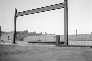
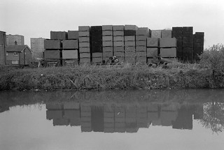
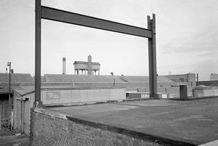
The last two pictures are of one of Edmonton’s best known and largest industries, Thorn Lighting. Julius Thorn opened his Atlas Lamp Works Ltd in Edmonton in 1932, and later at the start of the war a second factory in Tottenham. The company is now part of the Austrian company Zumtobel. I think that these two pictures are part of their Angel Road site. The main production moved from here to Merthyr Tydfil soon after the Second Wolrd War, but speciality lamps were produced here until around the late 1960s.

Thorn Lighting, Edmonton, 1983 37e-35_2400

More pictures in River Lea – Lea Navigation 1981-1992 on Flickr. Click on any of the pictures above to go to a larger version in that album, where you can also comment on the pictures.


All photographs on this and my other sites, unless otherwise stated, are taken by and copyright of Peter Marshall, and are available for reproduction or can be bought as prints.


More from the Lea: Enfield

Saturday, December 5th, 2020

Enfield, 1983 34y-16_2400
Enfield, 1983

I’ve now put more photographs in my Flickr album River Lea – Lea Navigation 1981-1992 to add pictures from Broxbourne to the River Thames to my earlier uploads.

Enfield Lock, 1983 34y-35 (2)_2400
Enfield Lock

I’ve gone through the contact sheets from 1981-3 and selected and digitised a few more pictures I found of interest to add to those I’d scanned preparing for earlier shows, but I think there are pictures from some of the later years in that period I may add later.

Lea Navigation, Brimsdown, Ponders End, 1983 34n-52_2400

But for the moment this album is complete – with 418 pictures. Because I made these on a number of different visits to the area, it was difficult to put them into sensible order – and a few are still obviously in the wrong place. But I’ve tried to put them at least largely in order as the valley leads down to the River Thames at Leamouth.

Lea Navigation, Brimsdown, Ponders End, 1983 34n-41_2400

Back in 1981-3 I was not too concerned with the exact locations of the pictures, and my contact sheets seldom have little indication except for the contents of the pictures. I can no longer find the notebooks in which I wrote about the project, though a few of the vintage prints have locations on them and a couple even grid references. I’ve tried to give locations on Flickr, and already a few viewers have been able to help me on this, and correcting a few mistakes I made. Corrections and comments are always welcome, and clicking on any of the images in this post will take you to a larger version where you can post comments.

Broxbourne, 1983 37d-55_2400

So, for example, this picture I’ve captioned simply ‘Broxbourne, Herts, 1983‘ but I could be quite wrong. It could be Cheshunt or somewhere else. And I’d be happy to be told exactly where it is. It’s easier to remember pictures further south as I’m more familiar with the area, though thanks to some who have already corrected a few of my confusions such as mistaking the Clapham Park flats for the Trowbridge Estate.

Lea Navigation, Brimsdown, Ponders End, 1983 34n-42_2400

Most of the pictures in today’s post are from Enfield, Ponders End or Brimsdown, in the London Borough of Enfield, where a large industrial area is located to the west of the canal. I think most of the structures I photographed back then have since been replaced.

Lea Navigation, Brimsdown, Ponders End, 1983 34m-14_2400

In a later post I’l post more selected pictures from Ponders End and Edmonton and then further south. But you can see them already at Flickr album River Lea – Lea Navigation 1981-1992.


All photographs on this and my other sites, unless otherwise stated, are taken by and copyright of Peter Marshall, and are available for reproduction or can be bought as prints.


Before the Olympics – The River Lea

Sunday, November 29th, 2020

The Source of the River Lea, Leagrave, Luton, Beds, 1982 33d-56_2400
The source of the River Lea, Leagrave, Beds

Back in 1981 I kind of stumbled across the River Lea as I walked and photographed eastwards out of the city through Wapping, Limehouse and Poplar to Bow and Canning Town. Of course I’d known about it since my youth, growing up in Middlesex; it was our eastern boundary where civilisation ended and Essex began, but never something we visited.

I began at Bow Creek, the River Lea’s tidal section which leads to its confluence with the River Thames at Leamouth, but soon after began to explore Stratford Marsh, a remarkable wilderness area around the Bow Back Rivers. I’d gone to Bow having heard a short radio report that commercial traffic on the Lea Navigation was to end in a few weeks time, and found it more or less already had, though I was able to find a couple of loaded barges moored by a wharf next to the Bow flyover, as well as quite a few barges empty and apparently abandoned.

River Lea, near Luton, Beds, 1983 33e-14_2400
River Lea

I put together a proposal to document the area around the Lea navigation and sent it, including some of the pictures I had already made, to try to obtain some funding for an extensive project on the area. Later I found the esteemed photographer I had approached to endorse my project was not one of the charmed circle who advised the funding body and promoted their own former students and protégées – and that outsiders were seldom if ever funded.

Works, Broxbourne area, Herts, 1983 34z-52_2400

When my rejection came I was downhearted – particularly by seeing some of the projects that did get support – and also rather angry. I still saw it as a worthwhile project and thought about ways I could carry it out funding it myself. I had little cash and a young family to support, so I had to keep costs to a minimum. I had to stick to using 35mm, to load cassettes from bulk film, do all the processing and printing myself and to give up the idea of producing a book.

White House Cafe, Lea navigation. Broxbourne area, 1983 34z-11_2400

Probably working with 35mm improved the project, giving me more flexibility than using medium format, where my choice of focal lengths would have been much more restricted. But loading cassettes from bulk did lead to more problems than using factory loaded film and my home processing facilities were a little on the primitive side. For some of the work I used Kodak Technical Pan, an extremely fine-grain film designed for high contrast copy work which could be tamed for pictorial use with reduced development – but which also meant reduced speed – depending on the developer used from ISO6 to ISO32. Later Kodak Technidol developer became available and made it much less sensitive to small changes in development time or agitation, and the results were more reliable. Technical Pan was I think discontinued in 2004.

Lea Navigation,  Broxbourne area, Herts, 1983 35a-32_2400

I worked on the project on occasional days in 1982-3, extending it to cover the area around the River Lea from its source to the Thames and then moved on to other things. Occasionally though I returned to the Lea and took more pictures, particularly in 1992 around Stratford Marsh, and later in that decade around Ponders End. In the early years of this century I walked the length of the river over several stages with my family and later went back a cycled much of it after I bought a Brompton folder which I could easily take on trains to suitable starting points. By this time I’d also exhibited work from this project in several shows. When the site for the London Olympics was announced in 2005 I began putting it on line, setting up the web site The Lea Valley and planning the book ‘Before The Olympics‘, which eventually I self-published on Blurb – and is still available.

In the last few days I’ve gone back to my contact sheets from 1981-3 and digitised a number of new images from them and am now beginning to upload them to Flickr, along with a few already from 1990-1992 previously scanned.

Riverside Cafe, Waltham Abbey, River Lea, Lea Navigation,  Broxbourne area, Herts, 1983 35a-42_2400

So far I’ve uploaded only the few images I made between the source at Leagrave (augmented as I made the exposure by a French photographer friend) to somewhere around Cheshust, close to the edge of Greater London. You can see more from this stretch already on Flickr, but there are very many more taken inside London Boroughs to come.

Broxbourne area, Herts, 1983 34z-46_2400

Some apologies. Some of the images are without full location details, which I have lost, and others were scanned with carrier glass that has caused clear ‘Newton’s rings’ in shadow areas, which are impossible to entirely retouch, though perhaps one day I’ll re-digitise them. Some of the negatives have also been damaged by an insect infection which takes extensive retouching and is in some images impossible to completely remove.

I’ll make further posts after I upload more pictures to the album, and will probably upload images from later years too.

River Lea – Lea Navigation 1981-1992


All photographs on this and my other sites, unless otherwise stated, are taken by and copyright of Peter Marshall, and are available for reproduction or can be bought as prints.