More from Deptford 1988

More from Deptford 1988 continues my walk around New Cross and Deptford. The previous post was Deptford Broadway And New Cross Road.

Deptford High St, Deptford, Lewisham, 1988 88-10g-51-Edit_2400
Deptford High St, Deptford, Lewisham, 1988 88-10g-51

13 Deptford High Street is distinguished by the impressive pillars of its entrance and a fine rounded frontage. Whoever it was built for was obviously wealthy and perhaps a shipowner or merchant for goods landed locally either on Deptford Creek or on the Thames, perhaps tea from China. Tea was taxed heavily – 119% – until 1784 and this led to considerable smuggling but parliament reduced to tax then to 12.5% making tea available to a wider range of the population and ending the illegality. Though the East India Company retained its monopoly until 1834.

The house, built on what was then Butt Lane is locally listed is thought to have been built in the early 18th century but its rounded front was probably added around a hundred or so years later.

Deptford High St, Deptford, Lewisham, 1988 88-10g-52-Edit_2400
Deptford High St, Deptford, Lewisham, 1988 88-10g-52

The ‘A One CAFE’ at 18 Deptford High St looked as if it was no longer in business, though its door still is decorated with ice-cream cones. The doorway leading to the upper residential floors has the message ‘Gays Rule’ and is I think boarded up. This building is still there, its ground floor now a Vets, its brickwork plastered over and generally looking in rather better repair.

Unfortunately this picture is slightly out of focus (though the grain is sharp) and I cannot make out some of the finer detail of the building.

Deptford High St, Deptford, Lewisham, 1988 88-10g-56-Edit_2400
Deptford High St, Deptford, Lewisham, 1988 88-10g-56

I took only a couple of pictures as I walked up Deptford High Street to its north end and its junction with Evelyn Road/Creek Road, which still looks much the same as in my picture except that all the shops have changed hands at least once.

No 227 was in very poor condition and there was considerable building work there a few years ago but the general appearance is much the same, though it has long lost the shopfront and signage. This Grade II listed house, shop and bakehouse was built in 1791 for Thomas Palmer and improved in the early 19th century, although the ‘RCHME DEPTFORD HOUSES: 1650 to 1800’ survey in 1997-8 suggested it was “perhaps a single late-17th-century house with the front house added c. 1700, extensively rebuilt 1791-2” and says it “has its origins in the period 1654-1692 during which John Evelyn developed a corner of his Sayes Court estate corresponding to Nos 217-227 with a block of nine buildings set back from the road.” It does go on to say the house “was all but wholly rebuilt for Palmer in 1791-2” and remained a bakers until the 1990s.

The Tideway Clothing Stores is now an off-licence and supermart. The Courage Pub at right was torn down illegally without permission in 2019; it had been there at least since the 1820’s and though it looks as if it was still open, closed as a pub around the time I made this picture. The building became offices for a firm of solicitors, and the ground floor was used for art classes. The Deptford Dame published a report of the proposals for its reconstruction in 2021.

Panda, Car Hire, Watergate St, Deptford, Lewisham, 1988 88-10g-41-Edit_2400
Panda, Car Hire, Watergate St, Deptford, Lewisham, 1988 88-10g-41

Watergate Street is essentially the continuation of Deptford High Street to the north, leading to the River Thames. At the extreme left of this picture you can see a pillar of another Deptford pub, the Harp of Erin at 2 – 4 New King Street on the corner between this and Watergate Street. The pub which went under a variety of names over the years as Round the Bend, Nobody’s Inn, Looney Tunes, closed as simply The Harp in 2014.

Panda Car Hire and taxi service to Airports, Theatres, Stations was next to the pub on Watergate St and had this rather odd imitation half-timbering which attracted my attention. Panda Cars seemed a strange business name, usually used to refer to small police cars driven by police officers which were often painted black and white. The building is still there, and in the same business as Water Gate Cars but has now a rather plainer frontage.

Parker's Corner, Evelyn St, Deptford, Lewisham, 1988 88-10g-46-Edit_2400
Parker’s Corner, Evelyn St, Deptford, Lewisham, 1988 88-10g-46

I walked west along Evelyn Street. Parker’s Corner was around half a mile away, just before what is clearly a bridge although the Surrey Canal which used to go under it has long been filled in. I’d photographed this corner three years previously and wrote this about it: “Parkers Corner was next to the former Surrey Canal Blackhorse bridge in Evelyn Street on the corner of Dragoon Road.

Parker’s Timber were based at a wharf on the canal on the northeast of the bridge. The company moved to Belvedere, Kent in the 1960s. Although I was a great fan of Bird, someone else had beaten me to paint Charlie on the wall. ” In this frmae you can still see ‘Charlie’ though a little faded. The sign at top left is for Victoria Wharf, the site behind the wall, and lists some of the businesses there. The modern building behind, Parker House at 144 Evelyn Road, was demolished in 2015

Law Bros, Grove St, Deptford, Lewisham, 1988 88-10g-21-Edit_2400
Law Bros, Grove St, Deptford, Lewisham, 1988 88-10g-21

The Victoria Wharf site stretched along Dragoon St from Evelyn Street to Grove Street where Law Bros had this building. Rather oddly a sign at right told me the Bros were Stewart & Alice and their business appear to be in Calor Gas according the the five signs in the picture. At left were signs for two other businesses on the wharf and above the doorway was another for Andrews.

I wondered what this building had been built as; it was marked as ‘Chapel’ on old large-scale OS maps on Grove St beside the wharf entrance. A very bad photograph in the Deptford Archives enabled me to identify it as Victoria Hall Methodist Church, opened in 1857 and demolished in 2015 as a part of the Timberyard development.

Scrap Dealer, Oxestalls Rd, Deptford, Lewisham, 1988 88-10g-14-Edit_2400
Scrap Dealer, Oxestalls Rd, Deptford, Lewisham, 1988 88-10g-1488-10g-14

Oxestalls Road was created around 1966 when there was considerable redevelopment in the area with the creation of the Pepys estate, and it goes across the former route of the Surrey Canal at an elevated level. This view is looking roughly east and you can see the chimneys and roof of The Victoria pub on Grove Street above the sheds to the left of the picture along with a chimney which I think is at Deptford Power Station.

Holsten Pils, Liquor Barn, Evelyn St, Deptford, Lewisham, 1988 88-10g-15-Edit_2400

Tooheys Liquor Barn on Evelyn Street with the trailer of a lorry carrying a Holsten Pils waggon, probably designed to be horse-drawn. It appears to be part of the Evelyn Cash & Carry shed. In the background is Eddystone Tower on Oxestalls Road, 26 floors and 257ft high, part of the GLC Pepys Estate built in 1962.

My walk around Deptford will continue in a later post.


Canonbury, Green Lanes and Balls Pond Road

My next walk on Wednesday 3rd August 1988 began on a train going over the River Thames at Strand on the Green, the North London Line, taking me to Highbury & Islington from where I walked through Canonbury to Green Lanes, where I photographed an interesting pair of houses and found some rather poetic graffiti on my way to Newington Green and went on the the Balls Pond Road.

Grosvenor Ave, Canonbury, Islington, 1988 88-8c-14-Edit_2400
141 Grosvenor Ave, Canonbury, Islington, 1988 88-8c-14

In my dreams last night I was sitting in front of my computer and just turning it off after searching for the location of this house, which on my contact sheet is simply given as ‘?Highbury Grove’, and it flashed onto Google Streetview as the application closed. I was just coming round and wasn’t sure whether this was dream or memory, so as soon as I got back in front of the screen today I looked up where I thought it had been – and found no such street existed. However a few more minutes searching – and looking at the next image on the contact sheet helped – I recognised it as 141 Grosvenor Ave in Canonbury.

The house next door in the semi-detached also had those distinctive vertical brick panels in the colums of the porch and at the side of the windows, but they have been disguised I think by white masonary paint, and possibly others have suffered a similar fate.

But the dream got me thinking more about taking these pictures and about my photography generally as I lay half awake in bed. I think I had walked around half a mile before making my first picture on this walk, past many other houses and shops I might have stopped to photograph but had not done so and I reflected on this. I’ve always been a rather timid photographer and often find it difficult to start taking pictures until something jolts me out of this, and once I’ve got going my reluctance fades. Making a photograph exposes not just the film (or these days the sensor) but also the photographer.

Green Lanes, Highbury, Islington, Hackney, 1988 88-8d-65-Edit_2400
Green Lanes, Highbury, Islington, Hackney, 1988 88-8d-65

I can’t remember the exact route I took to Green Lanes, perhaps up Petherton Road, as the few pictures I made (not on-line) are typical of the area but not easy to locate, but I then walked south towards Newington Green, but a grid reference written on this frame of the contact sheet together with the street name Green Lanes suggests this shop window was near Aden Grove.

The curling notices suggest that Enright & Co Ltd m(established 1875) had left the building some time earlier, and although they say Houses Wanted, the upper left ‘Sorry Nothing’ was probably more appropriate. I rather liked the rather ghosty reflections in the glass, including my legs in the centre of the frame.

Roughly one in four of the pictures I made on this walk are on-line, and four of the ten from this particular film are these consecutive images from this section of Green Lanes.

Green Lanes, Highbury, , Islington, Hackney, 1988 1988 88-8d-66-Edit_2400
Green Lanes, Highbury, Islington, Hackney, 1988 1988 88-8d-66-Edit_2400

There are still several of these ‘Mid-Late 19c’ houses on Green Lanes, roughly oposite Aden Grove and they are locally listed at 57-63 for their ‘truncated Dutch gables’. The bars on the windows at right have gone but they still otherwise look much the same.

Graffiti, Green Lanes, Highbury, , Islington, Hackney, 1988 88-8d-51-Edit_2400
Graffiti, Green Lanes, Highbury, , Islington, Hackney, 1988 88-8d-51

Two writers appear to have taken advantage of this long stretch of white wall, probably empty industrial premises of some kind. Possible the “BIRD Turning in the sky air below the clouds’ there is no corner…” got in first complete with its extra apostrophe and the later writer (perhaps F. Ratttttl)tadded a line above and below, with some other additions including from an Arsenal fan.

Green Lanes here is on the border of the two London Boroughs of Hackney and Islington and I’ve included both boroughs in the captions even when I’m sure which side of the border I took the pictures on.

Graffiti, Green Lanes, Highbury, , Islington, Hackney, 1988 88-8d-52-Edit_2400
Graffiti, Green Lanes, Highbury, Islington, Hackney, 1988 88-8d-52

On the side of a boarded up shop, just off Green Lanes on the corner of Springdale Road was a more organised piece of writing, possibly advice to Fred to build a cradle for his baby. The reflecttion at left clearly shows the two buildings still on either side of Pegasus Close.

Annette Works, Halliford St, Ecclesbourne Rd, Islington, 1988 88-8d-31-Edit_2400
Annette Works, Halliford St, Ecclesbourne Rd, Islington, 1988 88-8d-31

For once a picture which includes precise information on its location, the Annette Works on the corner of Halliford St and Ecclesbourne Rd in Islington. The house at 61 Halliford Street was or had been home to Multi-Print Co, and this side of it has now been extensively rebuilt. I wondered briefly if there might be some connection to Annette Crescent, a listed crescent not far away on the Essex Road, but failed to find any further information. It seems unlikely as Annette Crescent was named for its developer, Thomas James Annett, only picking up the ‘e’ in later years.

Southgate Rd, Kingsland, Islington, Hackney, 1988 88-8d-36-Edit_2400
Southgate Rd, Kingsland, Islington, Hackney, 1988 88-8d-36

Southgate Road is another street on the Hackney/Islington border. There were no Vacancies at No 81, which is now together with No 83 ‘The Sydney Building’ a ‘warehouse conversion’ into flats with a rather prettier garden, roses replacing the buddleia.

Mildmay Rd, Canonbury, Islington, Hackney, 1988 88-8d-26-Edit_2400
Mildmay Rd, Canonbury, Islington, 1988 88-8d-26

This picture appears to show a woman looking out of a upper floor window but this is actually a painting on the wall. But there was a real woman coming along the street towards me. There is still a mural visible on the wall which can be seen rather better from Wolsey Road, but is largely obscured by an overgrown tree. I’m not sure if this upper part above and behind the main painted wall is still there.

The mural was painted in 1981 by Carolyne Beale for Mildmay Housing Action Area and is now in very poor condition, cracking badly. You can see a good colour picture of it all before the tree grew online, with a second picture of this lady at the window. I don’t think I photographed the mural properly, though I may have done.

More from the Balls Pond Road and Dalston in another post.


Click on any of the images in the post to see a larger version in my album 1988 London Photos, from where you can browse other images.


More St John’s Wood

Alexandra Rd, South Hampstead,  88-7g-63-positive_2400
Alexandra Rd, South Hampstead, 88-7g-63

Although the title of this post is ‘More St John’s Wood’, my walks were not constrained by local authority boundaries but often by more important physical restraints, here the main west coast railway line from Euston, and I walked beyond the St John’s Wood boundary a little into South Hampstead or Swiss Cottage.

I can find out little about Hillgrove Estate designed by Peacock, Hodges and Robertson for the LCC around 1960 and inherited by Camden following the local government reorganisation in that decade. This piece of sculpture is not on the list of public art in Camden and unfortunately I failed to record any details of it when I made this picture in 1988 if any were available then. Perhaps someone seeing this will be able to give details in a comment.

7, Boundary Rd, St John's Wood, Westminster, 1988 88-7g-65-positive_2400
7, Boundary Rd, St John’s Wood, Westminster, 1988 88-7g-65

This stucco detached villa dating from the 1840s is only Grade II listed for its ‘group value’, one of quite a number of similar properties in the area, though distinguished for me by its two substantial eagles on top of very substantial gate posts. The house next door, shown in the next few pictures, was much more remarkable.

Boundary Road, as its name suggests, marks a boundary, now between the City of Westminster – which includes St John’s Wood – and the London Borough of Camden, with this and other properties on its south side being in St John’s Wood. It was once a farm track on the boundary between two estates.

Alhambra Cottage,  Boundary Rd, St John's Wood, Westminster, 1988 88-7g-66-positive_2400
Alhambra Cottage, Boundary Rd, St John’s Wood, Westminster, 1988 88-7g-66

Alhambra Cottage is at 9 Boundary Rd certainly one of the most remarkable houses in London, a Grade II listed detached villa in a very detailed Islamic style and I made a number of photographs from the road outside. Later in 2011it was one of the buildings whose garden I photographed for the ‘Secret Gardens of St John’s Wood‘ project initiated by Mireille Galinou of the Queens Terrace Café and shown there in November 2011.

Alhambra Cottage, Boundary Rd, St John's Wood, Westminster, 1988 88-7g-53-positive_2400
Alhambra Cottage, Boundary Rd, St John’s Wood, Westminster, 1988 88-7g-53

Another view of Alhambra Cottage.

Alhambra Cottage, Boundary Rd, St John's Wood, Westminster, 1988 88-7g-54-positive_2400
Alhambra Cottage, Boundary Rd, St John’s Wood, Westminster, 1988 88-7g-54

I’m surprised not to find more information about this cottage online. Possibly the interest in the Alhambra may have been stimulated by the writing of American author Washington Irving who visited the Alhambra in 1828 and published his Tales of the Alhambra in 1832 and the lithographs of John Frederick Lewis, who became known as ‘Spanish’ Lewis published three years later.

At this time of year perhaps I should also mention that it was Irving who first put Santa (or rather St. Nicholas) flying over the rooftops at Christmas.

12 Blenheim Rd, St John's Wood, Westminster, 1988 88-7g-42-positive_2400
Loudon Rd area, St John’s Wood, Westminster, 1988 88-7g-42

This Grade II listed semi-detached house dates from the 1840s, but was altered in the mid-19th century. ‘An Englishman’s home is his castle‘ and this seemed to epitomise the proverb, with its castellated tower and sturdy gate. All that was lacking was a drawbridge.

Carlton Hill area, St John's Wood, Westminster, 1988 88-7g-44-positive_2400
Carlton Hill area, St John’s Wood, Westminster, 1988 88-7g-44

And finally before I left the area, another house with a tower, somewhere on my wandering between the junction of Abbey Road and Blenheim Rd and FInchley Rd. I took a few more pictures on my way south through St John’s Wood, but none are online.


Click on any of the images above to go to a larger version in my album 1988 London Photos, from where you can browse the album.


More from Maida Vale, 1988

Warwick Farm Dairies, Elgin Ave, Shirland Rd, Maida Vale8, Westminster, 1988 88-7d-51-positive_2400
Warwick Farm Dairies, Elgin Ave, Shirland Rd, Maida Vale8, Westminster, 1988 88-7d-51

J Welford & Son’s Warwick Farm Dairies is still there on the corner of Elgin Avenue and Shirland Road, still looking much as it did when I took this photograph in July 1988, with I think the only noticeable change being in the name of the shop. Now it is over a hundred years since Welford’s became part of United Dairies and cows were kept in the large yard and its buildings behind, but there is still a cow’s head on the second storey of this corner building.

Shirland Rd, Maida Vale, Westminster, 1988 88-7d-53-positive_2400
Shirland Rd, Maida Vale, Westminster, 1988 88-7d-53

When walking around the streets with a camera around my neck I often was accosted by children clamouring for me to take their picture, and I never refused, though occasionally when I was running out of film I might only pretend to do so. Here the interest was perhaps as much in the BMX bikes and the sweater this young man was wearing as in him or the background.

Beachcroft House, Shirland Rd, Maida Vale, Westminster, 1988 88-7d-54-positive_2400
Beachcroft House, Shirland Rd, Maida Vale, Westminster, 1988 88-7d-54

Westminster Council demolished this care home on Shirland Road in January 2018, replacing the low building and garden with two large 5 storey blocks, one a replacement Beachcroft House care home opened in 2019 and run by Gold Care Homes and the other a block of 31 luxury flats, The Masefield, sold to finance the project.

Shirland Rd, Maida Vale, Westminster, 1988 88-7d-55-positive_2400
Shirland Rd, Maida Vale, Westminster, 1988 88-7d-55

Not one door but seven on the front of a former shop somewhere in the short row of five shops at 113-121 Shirland Rd. It rather amused me. Perhaps 30 years ago when I first needed a computer desk I spent some time looking at those available before deciding they looked small and rather flimsy and I could do a better job myself by cutting up an old door I’d replaced in the house, cutting off part horizontally to use as the desktop (its top surface covered by hardboard a previous resident had added) and the top section sawn vertically to give two side supports. A couple of lengths of 2×4″ hardwood provided some bracing close to floor level – and the footrest on which my feet are now resting as I write. It took me 10 minutes to measure and sketch the design and a morning to make and seems likely to last longer than me.

Delaware Mansions, Delaware Rd, Maida Vale, Westminster, 1988 88-7d-41-positive_2400
Delaware Mansions, Delaware Rd, Maida Vale, Westminster, 1988 88-7d-41

Delaware Mansions calls itself on its web site “The best mansion block in Maida Vale!2. Although Delaware Road was planned in 1875 by the developers of the Paddington Estate, the Paddington Trustees and the Church Commissioners as one of an alphabetical series of streets along with Ashworth, Biddulph and Castellain but the site was allotments until this block was built in 1903-1904 designed like many Maida Vale mansions by Boehmer and Gibbs. The road was only then properly made up.

The Church commisioners sold the entire Maida Vale Estate in 1981 with tenants being given a 20% discount on the market value and long leases. They sold the freehold to Fleksun in 1990.

BBC Maida Vale Studios, Delaware Rd, Maida Vale, Westminster, 1988 88-7d-44-positive_2400
BBC Maida Vale Studios, Delaware Rd, Maida Vale, Westminster, 1988 88-7d-44

Although I’d often heard that a radio programme had been made in the BBC Maida Vale Studios I had no real idea where they were until I walked down Delaware Rd. They are opposite Delaware Mansions, whose web site tells me they were originally “the Maida Vale Skating Palace and Club, which opened in 1909 and had one of the largest and most elegant roller-skating risks in the world. It could accommodate hundreds of skaters and seated 2,620 people at any one time.” It was one of the first studios for the BBC and home to many famous programmes; in 2018 the BBC announced plans to close it.

Lauderdale Rd, Castellain Rd,Maida Vale, Westminster, 1988 88-7d-34-positive_2400
Lauderdale Rd, Castellain Rd,Maida Vale, Westminster, 1988 88-7d-34

This was obviously once a rather sporting area, as on the next street to the east, at the corner of Castellain Road and Lauderdale Road was the Tennis and Squash shop, though this was in 1988 the Maida Vale Driving School and has boards showing a varied selection of vehicles for sale in the window. Now it is a flower shop.

This is on the end of a row of shops, Lauderdale Parade. I’ve found no explanation for the rather curious motif on the end wall which has a lion’s head at its centre. Lauderdale Mansions in several blocks were the first mansion blocks to be built in Maida Vale in 1897. Actor Alec Guinness was born there in 1914.

Elgin Ave, Maida Vale, Westminster, 1988 88-7d-36-positive_2400
Elgin Ave, Maida Vale, Westminster, 1988 88-7d-36

I can find little information about 203 Elgin Avenue, a large detached house on the corner of Biddulph Road. On the side of the house is the date AD 1890.

I took the short walk up Biddulph Road and into Paddington Recreation Ground, where I photographed a few people cycling around the paved track (not online) and probably visited the public toilets before returning to Elgin Ave, photographing the side of this house again.

This seems a good place to finish this post – more from Maida Vale in a later post.


To Kilburn High Rd 1988

West Kilburn Baptist Church, Carlton Vale, West Kilburn, Brent, 1988 88-5l-33-positive_2400
West Kilburn Baptist Church, Carlton Vale, West Kilburn, Brent, 1988 88-5l-33

My wanderings around Kilburn Park had taken me back through the South Kilburn Estate to Carlton Vale and this fine example of a Baptist Church, built for the Rev Thomas Hall in 1865. Money was tight, but his brother who was an architect worked on the plans without payment. According to the Commemoration Booklet issued for its centenary the foundation stone was laid on ‘Several coins of the Realm bearing the portrait of her most Gracious Majesty Queen Victoria – one shilling, one sixpence, one halfpenny‘ and ‘the text, “Other foundation can no man lay than that is laid, which is Jesus Christ” (1 Corinthians 3:11).’ Six years later, the church still owed £380 of the £1250 it cost to build.

Willesden Lane, Brondesbury, Brent, 1988 88-5l-21-positive_2400
Willesden Lane, Brondesbury, Brent, 1988 88-5l-21

From Carlton Vale I continued northwest up Salusbury Road then turned right along The Avenue in Brondesbury to reach Willesden Lane opposite this house which is numbered as 66 Cavendish Rd, although this frontage is on Willesden Lane. This house struck me as having a intriguing individuality, although certainly not great architecture, incorporating several distinct variations of style and a rather oddly situated small window. Currently divided into around 13 small flats a planning application has been submitted to demolish it and use the site with its long garden along Willesden Lane to build a new 5 to 6 storey building with 21 flats.

Lawrence & Aitken, Albion Works, Kimberely Rd, Brondesbury, Brent, 1988 88-5l-23-positive_2400
Lawrence & Aitken, Albion Works, Kimberely Rd, Brondesbury, Brent, 1988 88-5l-23

Lawrence & Aitken , incorporated in 1927 but founded earlier and now dissolved, filed its last accounts in 1990. It gave the nature of its business as “Manufacture of other articles of paper and paperboard n.e.c. -” and was said to employ five people. The works date from 1904 and were built for cardboard makers Lawrence & Aitken under an agreement with the Simms Manufacturing Company Limited which is reproduced (but very hard to read) on the RAC website. The works is still there, though the building on the right has been replaced by housing called Kimberley Court.

Willesden Lane, Brondesbury, Brent, 1988 88-5l-24-positive_2400
Willesden Lane, Brondesbury, Brent, 1988 88-5l-24

In one of those mysteries that I’ve sometimes come across, the extension at left to J Green’s shop at 136 Willesden Lane has grown to the same height as the rest and the building is now wider, having four windows at first and second floor levels and a new floor on top while retaining the Graeco-Egyptian style of the original.

Both 134 and 136 were built for John Cramb, monumental mason supplying many monuments in the cemetery opposite, 134 in 1896 designed by George Neal and 136 by F C Dare in 1883-1884 . Both are locally listed.

Willesden Lane, Brondesbury, Brent, 1988 88-5l-26-positive_2400
Willesden Lane, Brondesbury, Brent, 1988 88-5l-26

These shops are still there but I think all now different businesses. So many flats and shops were for sale in 1988.

Willesden Lane, Brondesbury, Brent, 1988 88-5l-12-positive_2400
Willesden Lane, Brondesbury, Brent, 1988 88-5l-12

Missing ‘O’, ‘M’, ‘B’ and ‘G’ perhaps made this frontage more interesting.

The National Club, Kilburn High Rd, Kilburn, Camden, 1988 88-5l-13-positive_2400
The National Club, Kilburn High Rd, Kilburn, Camden, 1988 88-5l-13

In 1910 after the death of its owner, The Grange, a large house with extensive grounds on Kilburn High Road was sold to Oswald Stoll, the owner of the London Coliseum, who began building a theatre here. By the time it opened in 1914 his plans had changed and it became the Grange Cinema, with over 2,000 seats.

The cinema closed in 1975 and was opened as Butty’s Club and Dance Hall by Kilburn Irish publican Michael ‘Butty’ Sugrue, and later in 1976 also became the Kilburn National Club, owned by three local brothers who were builders, originally from Tipperary. The club was a major music venue, where stars including Johnny Cash and David Bowie played (there is a longer list here, along with more detailed information about the site.)

Applications to demolish the building were turned down in 1991 as English Heritage had listed it earlier in the year, as was another application in 1993. After the National Club closed in 1999 the building remained empty until it became the Victory Christian Centre in 2001 – but the church was closed in 2002 by the Charity Commission who didn’t approve of Pastor Goodman’s extravagances on expensive holidays and cars and a house in Northants. In 2003 it became a site of the worldwide Universal Church of the Kingdom of God.

The Secondhand Furniture Shop, Kilburn High Rd, Kilburn, Brent, 1988 88-5l-15-positive_2400
The Secondhand Furniture Shop, Kilburn High Rd, Kilburn, Brent, 1988 88-5l-15

An interesting example of a window display.

Loveridge Rd, Kilburn, Camden, 198888-5l-16-positive_2400
Loveridge Rd, Kilburn, Camden, 1988 88-5l-16

A few yards east of Kilburn High Rd the Underground – here decidely overground – goes across Loveridge Rd. I liked the washing hanging over Loveridge Mews, not something often found across a London street.

Confusingly, the boundary between the London Boroughs of Camden and Brent runs down the Kilburn High Road, splitting Kilburn in two. I’m sure there are still some pictures in the album where I’ve indicated the wrong borough.


More Around Brompton: 1988

The Boltons, South Kensington, Kensington & Chelsea, 1988 88-4o-52a-positive_2400
The Boltons, South Kensington, Kensington & Chelsea, 1988 88-4o-52

If the houses around The Boltons are all much the same – the Grade II listing text for most simply tells you to see that for the first pair, 1 &2 – some distinguished themselves by their gates. Those of No 16 have lost their eagles since I made this picture, and the iron gates have lost both their angled top and the arch above as well as the rampant creeper but have gained an entryphone and a letter box. Walking down the street today there would be no picture to make here.

The Boltons, South Kensington, Kensington & Chelsea, 1988 88-4o-66-positive_2400
The Boltons, South Kensington, Kensington & Chelsea, 1988 88-4o-66

There are various designs of wrought iron gates to the houses around The Boltons, though quite a few share the same pattern. This one, I think at No 23, appealed to me more than most and I was fortunate to find it half opened, giving a clearer view of the tiled path and those ornamental ceramic leaves containing a small bush.

It also shows the peeling paint which still then could be seen on quite a few of these houses, which are now all I think pristine. I rather liked the impression it gave of these houses being old and lived in.

Jenny Lind, Boltons Place, South Kensington, Kensington & Chelsea, 1988 88-4o-55-positive_2400
Jenny Lind, Boltons Place, South Kensington, Kensington & Chelsea, 1988 88-4o-55

Boltons Place leads north from The Boltons to the Old Brompton Road and its east side is occupied by several large houses. That occupied by Jenny Lind, the ‘Swedish Nightingale’, has undergone various changes of street name and number since she moved in as the first occupier in 1874, and is in a rather different style to the rest of the area. In 1906 it was altered by the addition of a rather attractive semi-cicular bow window, hidden in my view. The effect is less austere, described in the Victoria History as “un-Godwinian suavity in a rather French way“.

School, Boltons Place, South Kensington, Kensington & Chelsea, 1988 88-4o-54-positive_2400
School, Boltons Place, South Kensington, Kensington & Chelsea, 1988 88-4o-54

The west side of Boltons Place is quite different, occupied by Bousfield Primary School. This primary school was built in 1954-6 by Chamberlin, Powell and Bon and is on the site of Beatrix Potter’s house and garden at 2 Bolton Gardens, where she lived for more than 40 years until she was married in 1913, a short walk from Brompton Cemetery where she found some of the names for her characters. The site became available thanks to wartime bombing.

The school is a heavily over-subscribed local authority school which had its origins in a school set up as a “poor school” for local Catholic children by the parish priest in the 1800s which was renamed Bousfield School in 1913. The children were transferred to the new school in 1956. Later the old building became another Catholic school.

Fulham Rd, Chelsea, Kensington & Chelsea, 1988 88-4o-43-positive_2400
Fulham Rd, Chelsea, Kensington & Chelsea, 1988 88-4o-43

The Fulham Road has a rather different atmosphere with this row of shops with an entrance probably for horses to be led through to stables behind. When I took the picture it led to the Hungry Horse Restaurant, and although the board with its two horses heads looks like that of a French horse butcher, the English menu will almost certainly not have included horsemeat – nor will it have had hay offer, so any horses would have remained hungry.

Now the gate seems closed and the area behind looks unused. Unsurprisingly the shop at left is now an estate agent.

Cinema, Fulham Rd, Drayton Gardens, Chelsea, Kensington & Chelsea, 1988 88-4o-44-positive_2400
Cannon Cinema, Fulham Rd, Drayton Gardens, Chelsea, Kensington & Chelsea, 1988 88-4o-44

The cinema opened as the Forum Theatre in 1930, designed by architect J Stanley Beard, featuring live variety shows with an orchestra. It was sold to Associated British Cinemas (ABC) in 1935 and lost its organ in the 1960s. Like others it got altered internally to provide first three then four, five when I made this picture and finally six screens. Now owned by Cineworld who have transferred it to their Picturehouse chain, it had further renovations in 2019.


All photographs on this and my other sites, unless otherwise stated, are taken by and copyright of Peter Marshall, and are available for reproduction or can be bought as prints.


More from Brent 1988

Church of God of Prophecy, High St, Harlesden, Brent, 1988 1988 88-3c-41-positive_2400
Church of God of Prophecy, High St, Harlesden, Brent, 1988 88-3c-41

One of our better selling ‘newpapers’ recently published yet another sensationalist feature about no-go areas in some of our cities, where white men fear to tread. Back in the 1980s it wasn’t Muslim fundamentalists that were alleged to make our sity streets unsafe, but largley Caribbean and African gangs that were supposed to be roaming the streets in certain areas of the city, and one of those that people used to warn me about was Harlesden. But as in other such areas, although I was walking the streets with aroun £10,000 pounds worth of photographic gear in a bag on my shoulder I met with no problems.

High St, Harlesden, Brent, 1988 88-3c-51-positive_2400
High St, Harlesden, Brent, 1988 88-3c-51

Partly of course I had little or no trouble becuase of the time of day I usually worked, seldom in the evenings whe there are more people who might be a threat on many streets. And if I saw people dealing in drugs or other illegal activities I might cross the steer. And I certianly avoided dark alleys. But I can’t recall any such things being necessary in Harlsden. Often people would ask me why I was taking pictures, and I’d make an effort both in general terms and about the specific scene. And while they might not have always appreciated what I was saying it did sometimes make them see the scene at least partly as I did – perhaps with the rather odd game of noughts and cosses iin the picture above.

The Creole Organisation, High St, Harlesden, Brent, 1988 88-3c-52-positive_2400
The Creole Organisation, High St, Harlesden, Brent, 1988 88-3c-52

I don’t know what The Creole Organisation at186 High St Harlesden did, but Harlesden was a leading centre of Creole Music back at this time, and the record label Creole Records used an identical logo on some releases of its ‘Harlesenden Sounds’. It was based at 91-93 High Street, Harlesden. More recently it has been a solicitor’s and estate agents, but I think it is now a private house.

Harlesden Tyres, High St, Harlesden, Brent, 1988 88-3c-53-positive_2400
Harlesden Tyres, High St, Harlesden, Brent, 1988 88-3c-53

Harlesden Tyres on the corner of Nightingale St and the High St caught my attention becuase of its signage, and in particular the two Michelin Men.

Tejal Motors, High St, Harlesden, Brent, 1988 88-3c-54-positive_2400
Tejal Motors, High St, Harlesden, Brent, 1988 88-3c-54

While across Nightingale Rd, Tejal motors had a good selection of arrows in three different styles an a long list of repairs it could do while you wait.

Marshall Bros, Kilburn Lane, West Kilburn, Westminster, 1988 88-3d-02-positive_2400
Marshall Bros, Kilburn Lane, West Kilburn, Westminster, 1988 88-3d-02

Given my name it would have been difficult to walk past Marbro House, home to Marshall Bros, Builders Merchants at 266a Kilburn Lane. It clearly appeared to have been built for some other purpose, and before becoming a Builder’s merchants was a Methodist Chapel. It has now lost these steps and doorway on Kilburn Lane and has been converted into flats with an entrance around the corner in Herries St. I think it is just across the border in the City of Westminster.


All photographs on this and my other sites, unless otherwise stated, are taken by and copyright of Peter Marshall, and are available for reproduction or can be bought as prints.


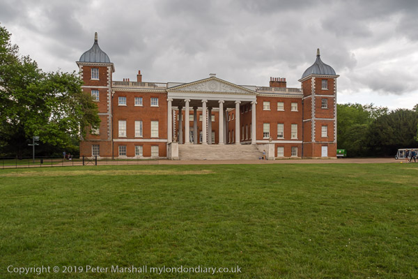
Osterley House

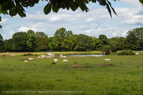
Osterley is a place few people seem to know about, though many pass through its station on the Picadilly Line between Central London and Heathrow or drive past it on the Great West Road. It’s place where few actually live, a handful of streets to the north of that road along with a huge estate of Osterley Park House and an even vaster area of Green Belt with sports areas and a golf club between Southall, Heston, Hanwell, Isleworth and Brentford, whose football club have a training site there. Now the M25 runs through the northern part, cutting it off even more.

I knew it from my early years, an easy bike ride from my home in a densely built up part of Hounslow, with a grand avenue of Sweet Chestnuts where you could rummage through the grass to pick up chestnuts to take home and roast in the oven. Doubtless in earlier years one might have been transported to Australia for such theft, but things were easier in the 1950s.

Later I ran through the ‘Hole in the Wall’ into the fields of Osterley Park on cross-country runs from my secondary school – at least until we learned to disappear into Jersey Gardens on the way there, hiding out enjoying a few fags until the mud-spattered runners came past on their way to the finish a few hundred yards away, coming in respectfully down the field.

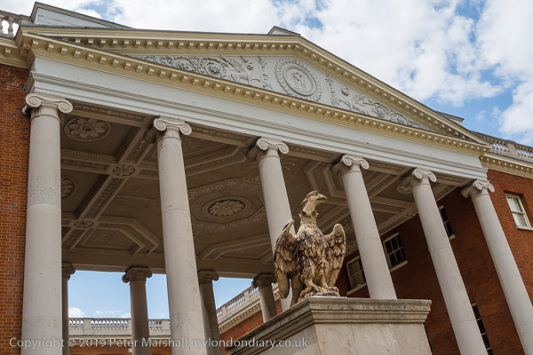
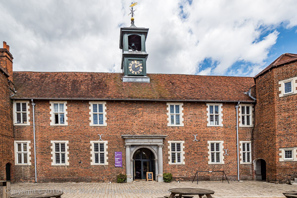
Osterley was a country house for two of the wealthiest of English Bankers, the first house built here for Sir Thomas Gresham in 1576.  Sir Francis Child acquired it after a mortgage default and his two grandsons had Robert Adam do a much more fashionable makeover in the 1760s. The stable block survived and now contains the shop and tea-room.

On the death of his brother the property as a whole passed to his younger brother Robert Child; when his only child, a daughter eloped with the Earl of Westmoreland the enraged father changed his will leaving the property in trust to his as yet unborn first granchild. She was born a couple of years later and went on to marry George Villiers, the 5th Earl of Jersey (later he got a royal licence to change his surname to Child Villiers) which explains why Osterley’s main road along which you approach the estate is Jersey Road.

The house was first opened to the public briefly by the 9th Earl in 1939, before becoming a Home Guard training establishment. After the war he moved to Jersey selling the furniture to the V&A and giving the house and park to the National Trust – who handed it over to the Ministry of Works and the V&A for restoration. There was some limited opening of the house to the public and I remember going there when quite young, but it was only in 1991 that it was handed back to the National Trust.

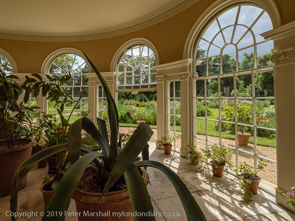
Our visit to Osterley was a short one, and I didn’t have time to go around the house but after a meal in the stables (not hay, but I don’t recommend it) did go into the gardens. Although the wider park is free to the public, there is a charge for the house and gardens, but free entry for members of the National Trust and the Art Fund.

More pictures at Osterley Park.
Images taken on National Trust property are copyright but not available for reproduction or sale.