Posts Tagged ‘Peckham Hill St’

Houses, Flats, Shops & Peckham Arch

Wednesday, December 7th, 2022

The previous post on this walk I made on Sunday 29th January 1989 was Laundry, Timber and Glengall Road. My walk ended on the site of Peckham Arch at Canal Head, but the arch was only built five years later. Despite local opposition Southwark Council seems now determined to demolish this local landmark.

Houses, Peckham Hill St, Peckham, Southwark, 1989 89-1i-34

These houses are at 10-16 Peckham Hill St. 10 and 12 appear to be lived in although 12 seems to be in poor condition, while 14-16 are derelict with broken windows and corrugated iron over the ground floor door and window of 14. Now the all look rather tidier and expensive. I think all these houses probably date from around 1840 or a little later. A terrace of smaller houses at 34-40 a little further south is listed and looks to me roughly of similar date. These are larger and grander houses, with two boasting substantial porches. The one at right I suspect has at sometime been rebuilt – perhaps after war damage and looks as if this was done in a plainer style.

Love One Another, flats, Commercial Way, Peckham, Southwark, 1989 89-1i-35

Plain flats with small balconies – large enough to perhaps put out a clothes horse or stand watching the street and enjoying a cigarette or a cup of tea. But the boarded up window at lower left and in one of those above the graffitied ‘LOVE ONE ANOTHER’ suggested to that this block was being emptied out for demolition. I wondered too what message had been painted over on the balcony – probably something short and crude.

Commercial Way is quite a long road, but my contact sheet gives a 100m grid reference which places these flats close to Cator St, and these flats, probably dating from the 1950s, have been replaced by more recent buildings.

Shops, Peckham High St, Peckham, Southwark, 1989 89-1i-24

I walked down the path following the former canal to Peckham High St, where you can still recognise the building that was Julian Jewellers, now a mobile phone shop, which also spills over into what was in 1989 Candyland. “SWEETER THAN THE REST – SPECIALISTS IN CUT PRICE CIGARETTES – 80 PECKHAM HIGH STREET” with two large cigarette adverts. Stiletto Expresso looks very closed in my picture – did it once sell shoes or coffee?The building in its place bears a slight resemblance but is now around twice the height.

The building at extreme right, mostly out of frame is also there, and until recently recognisable, but recently everything above the ground floor has been covered by an advertisement. The ground floor is now Mumasi Market.

The building on the left edge was demolished when the Peckham Arch was created in 1994., and I was standing where it now is to take this picture. The arch is now again under threat after an earlier proposal in 2016 for its replacement by a block of flats was defeated by determined local opposition. But Southwark Council still appear determined to remove it, despite it having become a landmark feature of Peckham, now much loved by residents and a great space for community activities.

The council make clear why they want to remove the arch, basically so they can build more flats in “a significantly larger development on site” with “more commercial and/or community space on the ground floor“. They do make a few other minor points, such as the current inconvenient cycle route, which could easily be remedied with the arch still in position. They claim that 80% of local residents in 2016 did not want to see the arch retained, which seems at odds with the views expressed by residents to the local press.

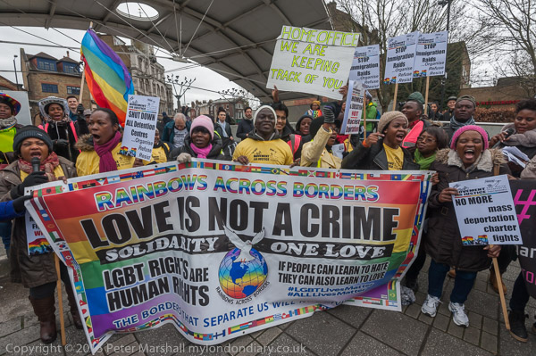
Whenever I’ve been in Peckham on a Saturday afternoon there has been something happening under the arch (and it’s particularly useful when it be raining.) Here’s one example:

Houses, Flats Shops & Peckham Arch

Peckham Pride – February 2016

Wikipedia states “The Arch was constructed in 1994 and was designed by architects Troughton McAslan as monument to and as instigator of regeneration in a borough which had suffered from years of decline.” It’s article goes on to quote various criticisms of the 2016 plan to demolish the arch. Although it has proved itself an ‘Asset of Community Value’, Southwark Council turned down the application by local residents to have it listed as such as they wanted to demolish it, though it seems impossible to read the reason they gave on the spreadsheet on the council site.

My walk on Sunday 29th January 1989 ended here on Peckham High Street, a convenient place to catch a 36 bus back to Vauxhall for my train home. The first post on this walk I made on Sunday 29th January 1989 was
Windows, A Doorway, Horse Trough and Winnie Mandela


Housing and the Grand Surrey Canal – 1989

Sunday, November 27th, 2022

The previous post on this walk I made on Sunday 29th January 1989 was Peckham – Pubs, Shops, AEU And A Fire Station.

Derelict House, Peckham Hill St, Peckham, Southwark, 1989 89-1h-22

These two large semi-detached houses are still there on Peckham Hill Street but now restored and in a very different condition. I think they are at Nos 102-108. Built around 1820 they were Grade II listed in 1972 and are part of the Peckham Hill Street Conservation Area designated in 2011. Although that at right seemed still occupied the left-hand pair looked to me as if it had been left empty to decay and I suspect may have once been squatted.

Bonar Garage, Bonar Rd, Peckham, Southwark 89-1h-14

Bonar Road was constructed across the back gardens of some of the houses in Peckham Hill Street and led to a depot for the Metropolitan Borough of Camberwell formed in 1901. Although this is now a part of the conservation area, no part of the Bonar Garage has survived. The house with the chimneys at left is I think onf of the listed buildings in the picture above, but whatever building had the square brick chimney on the right side has been demolished.

Surrey Canal Walk, Canal Bridge, Commercial Way, Peckham, Southwark, 1989 89-1h-12

A number of schemes for canals south of the Thames in London were proposed in the late 18th century and two were approved by Acts of Parliament in 1801. These were the Kent and Surrey Canal (later known as the Grand Surrey Canal) and the Croydon Canal from Rotherhithe. The horse-drawn Surrey Iron Railway roughly following the course of the River Wandle from Wandsworth to Croydon was also given approval the same year. A canal scheme for this was turned down as there were too many mills relying on the water from the Wandle.

Surrey Canal Walk, Canal Bridge, Commercial Way, Peckham, Southwark, 1989 89-1h-16
Surrey Canal Walk, Canal Bridge, Commercial Way, Peckham, Southwark, 1989 89-1i-02

The Grand Surrey Canal was authorised to go from Rotherhithe to Mitcham, with provision for branches, including to Vauxhall, but the proprietors had ambitions to extend it as far as Portsmouth. They began at the Thames in Rotherhithe and soon became a part of the new Surrey Docks scheme with an expanded basin and ship lock completed in 1807 into what became Stave Dock, with the canal running what became Russia Dock. Plans to join with the Croydon Canal at Deptford rather than that canal having its own line from the Thames provided an incentive to open the canal as far as the Old Kent Road by 1807.

Surrey Canal Walk, Canal Bridge, Commercial Way, Peckham, Southwark, 1989 89-1i-61

The Croydon Canal, not being involved with the new docks, got on with digging and the stretch from the Surrey Canal at Deptford was opened to West Croydon in 1809. It didn’t last too long never attracting a great deal of traffic and closed in 1836, though many of us will have travelled along parts of it as it was bought by the London & Croydon Railway company for their line from London Bridge to a station on the former canal basin at West Croydon. Parts of its route not needed for the railway are now parks and nature reserves.

The Grand Surrey Canal company had run out of money and needed another Act of Parliament in 1807 to raise money to go further and were able then to extend the canal to Camberwell, opening this section in 1810. Apart from the entrance lock there are no locks on the canal, but they would have been necessary to go further, and the company could not afford the extra expense, and this was the furthest it ever got, despite the original plans and dreams.

Surrey Canal Walk, Canal Bridge, Commercial Way, Peckham, Southwark, 1989 89-1i-61

Two more Acts of Parliament were needed to enable the company to raise money to cover costs and a short branch to a a large basin at Peckham was added, ocpening in 1826. Other plans put forward for extending the canal to Vauxhall and even Reading failed to attract investors.

But the Surrey Docks were developing and the canal got a new entrance lock in 1860, close to the earlier lock but leading into a new basin, Surrey Basin. There was a new entrance lock into the canal itself at Russia Dock. When Greenland Dock was extended in 1904, a lock from there became the start of the canal, almost a mile from its original entrance from the Thames.

Surrey Canal Walk, Canal Bridge, Commercial Way, Peckham, Southwark, 1989 89-1i-64

Surrey Docks were mainly used for timber, and this also made up much of the traffic on the canal, but an important customer was George Livesey’s South Metropolitan Gas Company with its Old Kent Road gas works relying on coal being brought to it on the canal on its own fleet of barges. Production of gas stopped on the site in 1953.

Other traffic on the canal also fell off dramatically, with many of the industrial sites which had sprung up beside it at various wharves along its length turned to road transport and new companies moved in which had no need for bulk transport. The canal became disused and most of it was filled in by 1960. The section down to the basin at Peckham now occupied by Peckham Library is a pedestrian and cycle route called both the Surrey Canal Walk and Surrey Canal Linear Path.

London Canals has a good account of the canal with some old photographs along with more recent images of various remaining features.

Flats, Willowbrook Estate, Peckham, Southwark, 1989 89-1h-14

Close to the canal was the Willowbrook Estate constructed by the London County Council in the early 1960’s and handed over to the London Borough of Southwark in 1980. It became a part of Southwark’s drastic 1995 Five Estates Peckham Masterplan and the large block at the left of this picture, the 112 home Tonbridge House was demolished, along with Tilbury Close while most of the lower maisonettes remain. The regeneration of the estate had begun in 1988 and was completed by 1995, although there has been considerable refurbishment since the estate voted to be taken over by Willowbrook TMC in 1998.

My 1989 walk in Peckham will continue in a later post.


The first post on this walk I made on Sunday 29th January 1989 was Windows, A Doorway, Horse Trough and Winnie Mandela.


Peckham – Pubs, Shops, AEU And A Fire Station

Sunday, November 20th, 2022

The previous post on this walk I made on Sunday 29th January 1989 was Windows, A Doorway, Horse Trough and Winnie Mandela.

Camberwell Fire Station,Peckham Road, Peckham, Southwark, 198989-1h-45-Edit
Camberwell Fire Station,Peckham Road, Peckham, Southwark, 198989-1h-45

The Grade II listed Camberwell Fire Station by Edward Cresy Junior dating from 1867 is the earliest surviving purpose-built fire station in London, possibly in the country. Two of the three ground floor appliance bays of this gothic building have been converted to windows. It is now South London Gallery Fire Station, a contemporary arts centre for the South London Gallery. It was replaced by a more modern fire station, now demolished, in 1920.

It was only listed in November 2008, and the official listing names it as Former Peckham Fire Station. The h listing text explains that “There are a small number of surviving fire engine sheds dating from the first half of the C19: simple, single cell buildings were designed to house a fire pump and built by local vestries or by public subscriptions. The Metropolitan Fire Brigade stations are of a different order: publicly-funded, multi-storey buildings designed to provide accommodation for the newly-created fire brigade officers and to house engines, horses and equipment. “

Peckham Lodge, Amalgamated Society of Engineers, Peckham Rd, Grummant Rd, Peckham, Southwark, 1989 89-1h-31

The Amalgamated Union of Engineering Workers had their headquarters here from 1900 until 1996 when they became a part of Amicus. Their slogan ‘Be United and Industrious’ is above the door in Grummant Rd. The building was threatened with demolition in 2007 but has so far survived.

Shops, Peckham High St, Sumner Ave, Peckham, Southwark, 1989 89-1h-32

The western start of Peckham High Street and a very down at heel side street, a dead end leading around to the back of the shops. Along it can be seen some buildings of St James the Great R C Primary School. There was a school entrance here, and a footpath still leads to Sumner Street along the side of a brick school wall. What was open space here, Jocelyn Street Park, has now become, despite some local protests, Peckham Flaxyard, a council development with a total of 168 homes, of which just over half are for social rent, and a 24 for shared ownership, with around 48 for sale or rent at market prices. Part of this site was formerly occupied by a factory making laundry machines.

The corner shop was built with an entrance to suggest it was a building of some status and it looks as if it dates from around the end of the Victorian era.

Shops, Peckham High St, Peckham, Southwark, 1989 89-1h-33

The rather grandiose building at left, in 1989 an Opticians, is now the Kentish Drovers, a Wetherspoon’s pub. Until the 1990s there was a pub of the same name on the opposite side of the road with the same name. Stockmen on foot driving flocks of sheep and herds of cows up from Kent to Smithfield market might take a rest or a reviving drink in Peckham before continuing their dusty slow journey to London Bridge and on to market.

I think the doorway at No 77 is probably also a part of the pub, though the door isn’t in use. Everything to the right of this – Hyper Records, Francis Chappell & Sons Funerals, Nature Trail Health Foods and the Soujourner Truth Youth Association at 83 Peckham High Street has since been demolished along with other buildings up to 89. This now the large covered space leading to Peckham Library, Peckham Square, Peckham Pulse and the Surrey Canal Walk.

Shops, The Crown, pub, Peckham High St, Peckham, Southwark, 1989 89-1h-36

The Crown pub was at 119 Peckham Hight St. The building is still there, on the corner of Mission Place but no longer a pub. There appears to have been a pub here in 1851 and was advertising drag nights when I photographed it. It apparently morphed into a bizarrely decorated Irish pub, with a tractor in the window and tables and chairs nailed to the ceiling complete with glasses and playing cards, but apparently Sally O’Brien’s was not a success and the pub soon closed, becoming a series of shops and agencies and most recently a Tapas restaurant.

Junction, Peckham Hill St, Peckham High St, Peckham, Southwark, 1989 89-1h-21

The Bun House, a pub at 96 Peckham High St on the left of this picture has the date 1898. It remained in business as a pub until January 2012 but is now a betting shop. There was a pub on this site at least by 1871. The rest of the frontages along the High Street also remain.

At right is M Manze’s Eel & Pie House, still in business, although temporarily closed in 1989. The vacant shop next door has had a number of occupants and is now a clothing shop. The crossing in the centre is still there but has only a short vestigial length of railings in a rather fancier style than those utilitarian ones in my photograph.

This junction is a convenient place for me to end this post which has mainly been on Peckham High Street. More on this walk shortly.