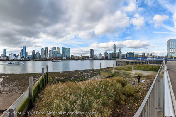
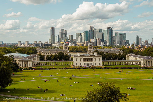
One of my favourite London walks has for many years been beside the River Thames on the path downstream from Greenwich. I first walked it in the 1970s and went back occasionally over the years, both on foot and later taking my Brompton bicycle to it on the train. When I was on foot I often went as far as Woolwich, not a great distance but I was always a photographer rather than a walker. Other riverside walks began from Woowlich or railway stations further east including Erith, Dartford and Gravesend.
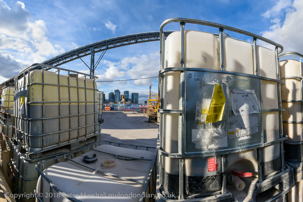
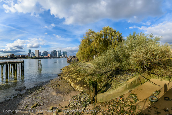
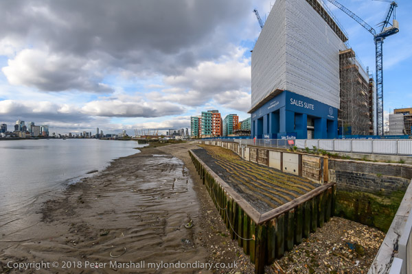
On October 18th 2018 my walk was rather shorter as I was with three other photographers, and we began at North Greenwich. Parts of the riverside walk had recently reopened after closure for the continuing process of ruining the Thames by lining it with tall blocks of expensive flats and I was keen to walk it again after some years away.
There were other reasons for the walk too. One was a visit to the Pelton Arms, arguably Greenwich’s finest pub. Its in a homely area, developed like the pub around 1844, though the Grade II listed street of granite setts from around 1870 stops a few yards short. It’s just a short walk from Granite Wharf, which got its name as it was here than Mowlem landed its granite from Guernsey that once paved much of the streets of London. But the real attraction is its fine range of real ales and comfortable atmosphere – and, although quiet when we visited is one of South London’s leading music venues.
We were also on our way to an evening event across the river in North Greenwich, and after a meal in the centre of the town hopped on the DLR at Cutty Sark for the single stop to Island Gardens and a short walk to where another of our photographer friends, Mike Seaborne was having the launch of his book on the Isle of Dogs. It was getting a little late when we had finished our meal otherwise I would have suggested going across the river on foot, not walking on the water but under it in the Greenwich foot tunnel.
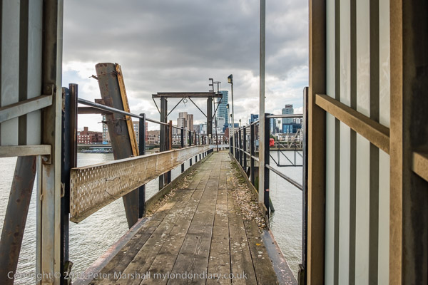
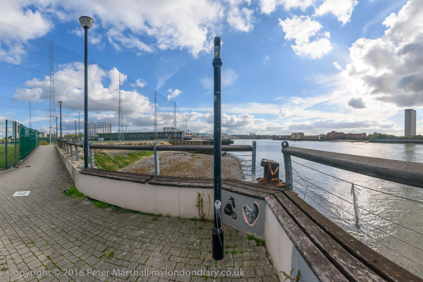
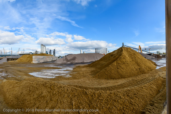
There are many more pictures from the walk on My London Diary. Most but not all are ultra-wide views with a horizontal angle of view of over 140 degrees. Often I crop these to a more panoramic format, but here I decided to leave them covering the full frame to fit better with the few less wide-angle images. All except one in this post are ultra-wide and they are presented in the order of the walk.
All photographs on this and my other sites, unless otherwise stated, are taken by and copyright of Peter Marshall, and are available for reproduction or can be bought as prints.
One of the blogs about London I keep my eye on and occasionally read with interest is the rather oddly named ‘Diamond Geezer‘, who posts daily articles, usually about his walks or bus rides around some of London’s more obscure areas. As someone who spent around 20 years walking around many of these taking photographs, I often find these interesting even though I don’t share his preoccupation with some of the minutiae of Transport for London’s oddities.
The two most recent of his posts have been Prime Meridian 0°Day 1 and Day 2 and by the time you read this, there will probably be a Day 3. Since he is only walking along the line (or rather as close to it as you can) in Tower Hamlets and Newham there probably won’t need to be a Day 4.
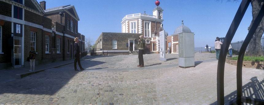
Greenwich Observatory – Peter Marshall, 1985
I was particularly interested because I carried out a similar but rather longer project in 1994-96, completing it despite failing to get any of the Millenium funding which was on offer. I began at what seemed the obvious place, the Royal Observatory in Greenwich – as this was the Greenwich Meridian. My walk, carried out over several days, was rather longer, ending more or less at the Greater London boundary in Chingford – and later I extended it south from Greenwich to New Addington at the southern boundary.
Greenwich Riverside – Peter Marshall, 1985
It was rather harder then to actually trace the Meridian on the ground. There were rather fewer actual markers then and I think no published walks along it. Although my application failed, others were successful and obtained funding to put in new Meridian markers and publish walks at the time of the Millenium and yet more have been added since.
West India Dock – Peter Marshall, 1985
Back in 1994-6 I had to draw my own line on my maps – it was only in 1998 that the line was added to the Ordnance Survey maps – in order to allow people to celebrate the Millennium on it. Back then we had no mobile phones and no GPS – the first phone based GPS navigation system was only introduced by Benefon in 1999 and it was a few years before this became universal.
Greenway & Channelsea River, Stratford – Peter Marshall, 1995
I first published these images on the web in 1996, having then recently acquired a colour film scanner. It wasn’t a very good scanner and getting good results from colour negative film was tricky. I think I scanned most of them again later, but some could still be improved.
In 1984, I more or less came to an end of my work on the River Lea (though I returned to it later) and the major focus of my photography shifted to London’s Docklands, and I’d photographed the West India and Millwall Docks as well as the Royal Docks, pictures from which I’m currently posting daily on Facebook. And later in that year I also went to the Surrey Docks, where work by the London Docklands Development Corporation was well advanced.
I was very aware of the political dimensions of the redevelopment, with the LDDC taking over from the elected local authorities and imposing its own largely business-led priorities which although accelerating the development distorted it away from the needs of the local area, and particularly away from the still pressing need for more social housing and for better employment opportunities for local people.
In those years I read every book in my local library on the history and geography of London, and began to build up my own collection of older works bought from secondhand bookshops and by post. Before the days of on-line listings I used to receive a monthly duplicated list of books on offer from a dealer I think in Brighton, and found many topographic and photographic items of interest, often very cheaply, and would look forward to receiving heavy parcels wrapped in several layers of newspaper. Yes, there was mail order before Amazon, and it was rather more exciting.
It was reading one of the books, Donald Maxwells ‘A pilgrimage of The Thames’, published in 1932 with his imaginative text and evocative drawings (some originally printed in the Church Times) that prompted me to walk in 1985 as he did from Gravesend west through Northfleet and Greenhithe exploring what he christened ‘the Switzerland of England’. As a rather more down-to-earth guide I also had the more academic ‘Lower Thameside’ picked up for pennies in a secondhand bookshop, which included a chapter on its 1971 cement industry by geographers Roy Millward and Adrian Robinson.
My series of walks traversed what was an incredible industrial and post-industrial landscape, altered on a huge scale by quarrying and industry, continuing past Gravesend along the riverside path past Erith and Woolwich to Greenwich and Deptford (areas also covered in my 1985 London Pictures), as well as walking further east to Cliffe and Cooling.
It was a project that I returned to for several years – and I went back to the area more recently when the Channel Tunnel Rail Link was being built as will as the occasional walk or bike ride over the years.
All photographs on this and my other sites, unless otherwise stated, are taken by and copyright of Peter Marshall, and are available for reproduction or can be bought as prints.
There are no adverts on this site and it receives no sponsorship, and I like to keep it that way. But it does take a considerable amount of my time and thought, and if you enjoy reading it, please share on social media. And small donations via Paypal – perhaps the cost of a beer – would be appreciated.
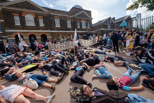
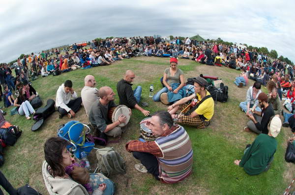
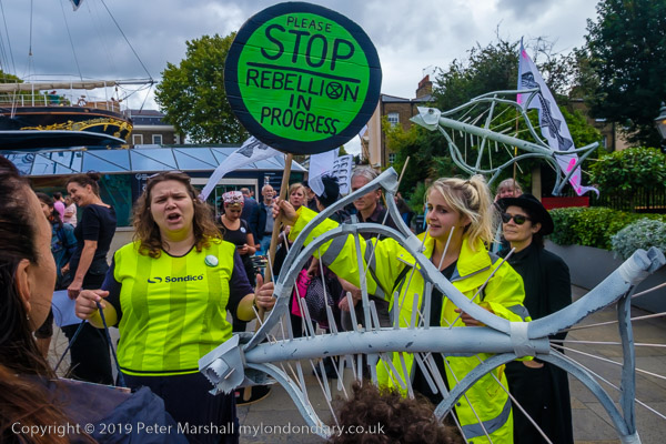
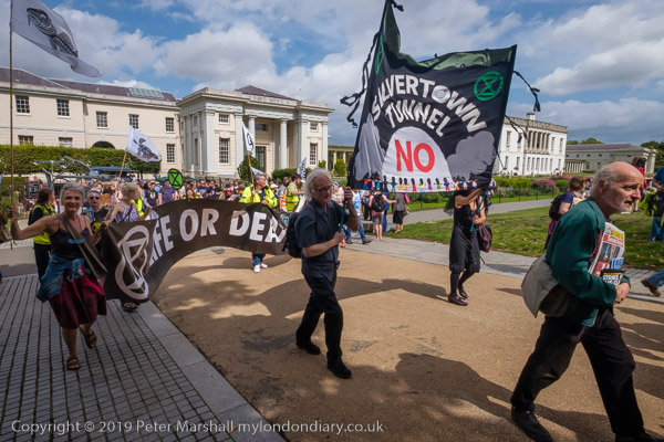
I’d walked halfway up the hill to Blackheath where South East London Extinction Rebellion were holding their two day South East London Rebel Rising festival, but had to rush off and run back downhill to catch a train back to the centre of London to cover events there. But I was able to return without having to climb the hill again, taking a train to Blackheath station which is at the top of the hill, and just a short walk to at Blackheath Lincoln Field where the Greenwich Observatory Die-In was going to start.
I arrived just in time as the march to the observatory was about to set off, and was able to photograph them as they walked across the common and into Greenwich Park.
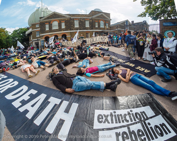
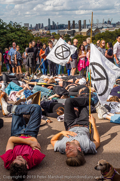
It wasn’t a huge group, which was just as well as they pretty well filled the space in front of the Royal Observatory which isn’t very large and a triangular area with very busy paths along two side, full of tourists going to see London’s finest view from the terrace just past the observatory or to visit the observatory. This is now a museum for tourists with a large meridian marker in the ground where people like to photograph themselves with a foot in each hemisphere (and I admit I’ve done so in the distant past.)
Back when I first visited the observatory it was free, but now it costs £16 for an adult ticket (cheaper if you book online.) When they started to charge for entry you could walk into the yard and photograph yourself on the meridian marker for free, but now you have to pay to get through the gate. Though there is a much older marker on the footpath just below if you want to save money.
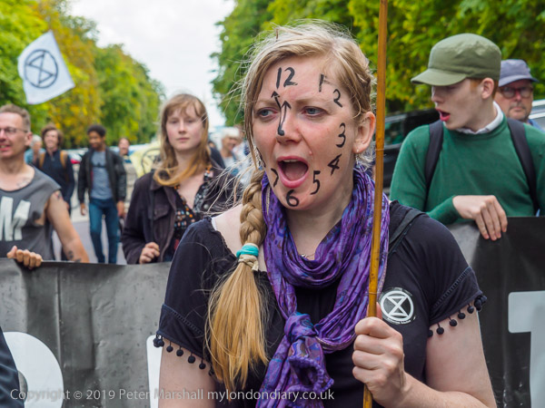
Greenwich advertises itself as the home of Greenwich Mean Time, and Extinction Rebellion chose the venue to point out that we are running out of time and need to take urgent action now to avoid mass extinction. Some of the protesters had ‘clock faces’ painted on their faces or carried clock posters.
While most of those present lay down for a ‘die-in’, others handed out leaflets and used a megaphone to speak to the tourists wandering past, some of whom applauded the action, while others either ignored it or just looked confused.
It was another event where my fish-eye lens came in useful, though even it wasn’t quite wide enough to take in the whole scene as I wanted. The top picture on this post shows a fisheye view, slightly cropped at top and bottom, and it couldn’t quite let me take the whole scene I wanted. I had to angle the lens down to get in the foreground banner as I couldn’t move further back and you can see a little cut-off at both top corners after a little attempt at correcting the verticals. Photoshop could of course have generated a little sky at the left and tree at right to fill the gap but I decided that would be cheating.
You can see some other pictures made both with the fisheye and, like that above this paragraph made with a rectilinear ultrawide lens – the 10-24mm Fuji zoom at 15mm equivalent focal length – on My London Diary, along with others made at longer focal lengths.
Back in the old days of British Rail (and at times after privatisation) I often used to enjoy taking pictures out of train windows. Then many carriages on suburban routes had doors between every pair of seats, and the doors had windows that you could slide down to around waist level and so take pictures unobstructed, though it might make it rather draughty for your fellow passengers. There were stern warnings about not leaning out of windows, and unless you braced yourself against the door frame it might have been possible to fall out, but you could photograph in any direction.
Some of the older rolling stock you needed to open the window to actually open the door at stations, as the doors only had handles on the outside, a useful safety precuation which made the carriages childproof and avoided any accidental opening, but sometimes meant infrequent travellers were trapped inside, unable to work out how to open them. Older readers too may remember the thick leather straps with holes to fit around a pin to hold the windows open at various levels.
Slightly more recent carriages came with a stiff handle you had to move sideways, protected by a raised surround, which only trapped mainly elderly ladies whose hands were no longer strong enough to move them and relied on other passengers to allow them to alight.
Now we have automatic opening doors and fixed windows with air conditioning on almost all services (though some still have narrow windows that don’t open enough to be useful) and can be sweat boxes when the air conditioning fails in summer or chill you if it can’t be switched off in winter. But more importantly for photographers, they have windows that are often scratched inside by bored travellers and almost always filthy outside. I have at times travelled with a cloth so when joining a train at the start of its journey I could select my seat and then step off the train to clean the window I was going to sit at so as to get a clearer view.
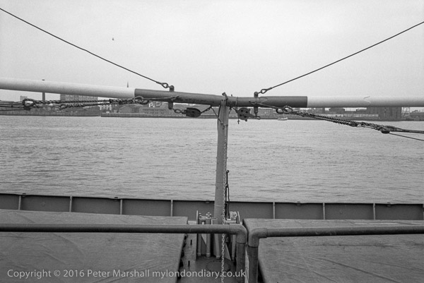
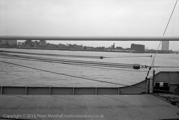
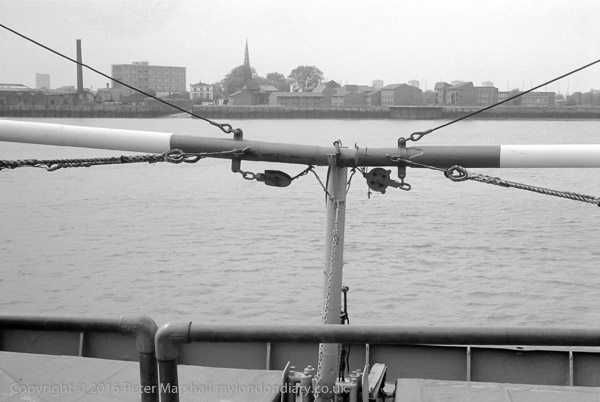
But either the train I joined at Charing Cross was new (and it did have that toxic smell of plasticiser) or had been recently cleaned, and for once I had a clear view. I hadn’t got onto the train to take pictures, just to get me to Blackheath, but it seemed to be too good a chance to miss, so I made a number of exposures.
The problem with photographing through glass is of course reflections. You can cut these down by removing any lens hood that would interfere and holding the front of the lens (or lens filter) directly against the glass. However this can cause vibration, so a small gap is a good idea, particularly while the train is in motion. Modern train windows are double glazed and while this close approach can avoid reflections from the pane you are in contact with, you still get them from the outer pane.
It also only works when the edge of the lens is in contact with the window all around, meaning you are restricted to views directly opposite the window and cannot aim the camera to left or right.
There is a solution to these problems, and it is in the form of a giant floppy lens hood with a hole at the centre which stretches to fit on the body of any lens. It’s called ‘The Ultimate Lens Hood‘ and is around 25cm across, and I have one sitting on my desk. The main problem with it (apart from looking rather eccentric) is that although it is a silicone rubbery thing that can squeeze down considerably, it is still too large to easily fit in my normal camera bag, at least without leaving out something essential like my sandwiches. So it was sitting there on my desk while I made these pictures 25 miles away. Slightly smaller versions are available and I think I might get one. Even a normal cheap rubber hood as I’ve used in the past can help a lot.
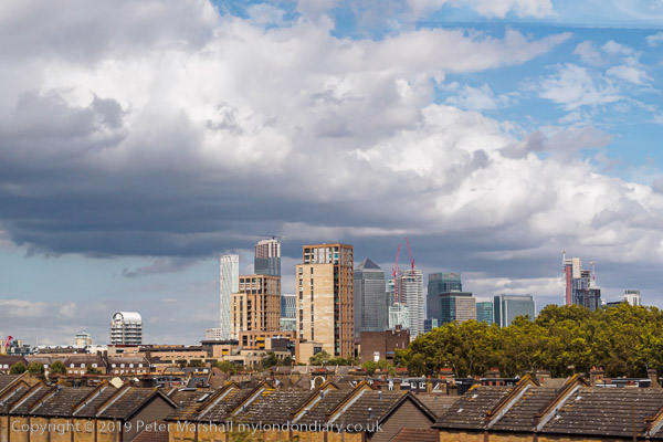
I was on my way to Blackheath to photograph an event that ended at the Royal Observatory at Greenwich, and my final pictures in this set were taken without benefit of any windows of the incredible view from the terrace in Greenwich Park north across the River Thames. It’s a view I first saw and photographed many years ago, and though rather changed since the building of Canary Wharf remains London’s most splendid.
I did try to take more pictures from the train on my return from Maze Hill to Waterloo, but the windows were not so clean, and only a few were usable – and then required considerable retouching.
All photographs on this and my other sites, unless otherwise stated, are taken by and copyright of Peter Marshall, and are available for reproduction or can be bought as prints.
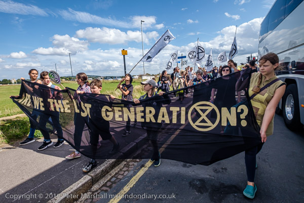
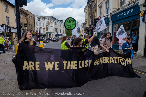
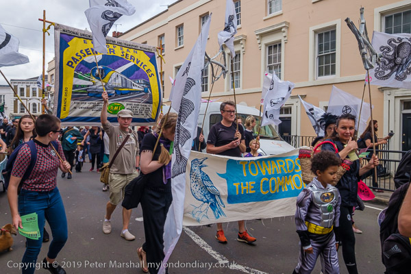
The banner ‘Are We The Last Generation blocks the main road for the march to take place
Lewisham Council’s web site records that Blackheath’s common has played host to more than its share of:
rebel gatherings
military encampments and exercises
royal meetings
religious festivals
sports
fairs
circuses
and a host of other activities.
And it goes on to list some of them, including Danish invaders in 1011, Wat Tylers anti-poll tax rebels in 1381, Jack Cade’s rebel yeomen in 1450, rebel Cornishmen in 1497 and John Wesley who preached there.
Clearly it is an area that has a strong association with rebels over the years and so it was highly appropriate that South East London Extinction Rebellion chose it for the location of their two-day festival on Global Climate Change.
I went to photograph their march from Greenwich to the festival site, and almost had to leave before it began, as the samba band which was to play a major role in bringin it to the notice of people in Greenwich was around an hour late in arriving.
I stayed with the marchers as they blocked the main streets of Greenwich and made their way up into Greenwich Park, climbing with them most of the way to the top of the hill before I had to leave and run downhill to catch a train back to central London and the next event I wanted to cover.
All photographs on this and my other sites, unless otherwise stated, are taken by and copyright of Peter Marshall, and are available for reproduction or can be bought as prints.
There are no adverts on this site and it receives no sponsorship, and I like to keep it that way. But it does take a considerable amount of my time and thought, and if you enjoy reading it, please share on social media. And small donations via Paypal – perhaps the cost of a beer – would be appreciated.
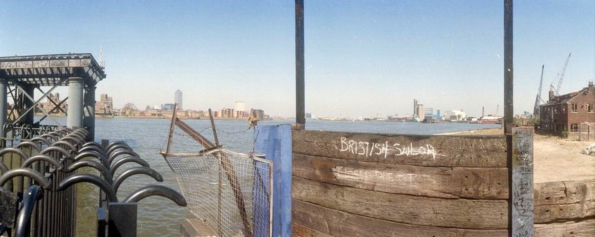
Enderby’s Wharf was where the cables that provided worldwide communication long before the age of radio and the satellites were made. The Telegraph Cable Works was established here in 1854 by Glass Elliott and William Henley, though Henley moved to North Woolwich. The company later merged with Siemens and were taken over by Submarine Telephones and Cables Ltd in 1979, later becoming part of Nortel and then Alcatel. The first transatlantic cables were made here and laid in the mid 1860s by the SS Great Eastern. Manufacture of cables here ceased shortly before I took this picture. There is a short length of cable by the riverside path and this piece of cable loading gear is still by the riverside.
Enderby House was built in 1830 for a member of the Enderby family, who were coopers in London and later moved into shipping and set up a patent rope, twine and canvas factory here, beofre losing their fortunes in the Antartic whaling industry. Grade II listed, it was deliberately allowed to deteriorate. As a condition of planning permission the developer were required to restore it to a decent condition and it is now incorporated into a larger building, though not I think as it originally was.
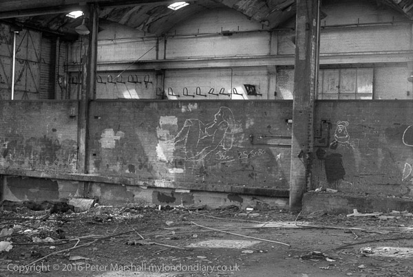
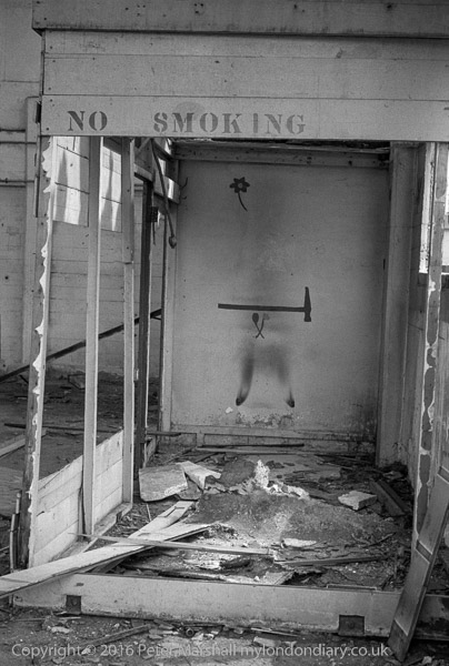
Disused Wharf, North Greenwich, Greenwich. 1980 24j-34: wharf, derelict, graffiti,
Another picture inside the derelict shed at Bay Wharf. Among the scrawlings on the wall was a rather better than averagely drawn chalked reclining nude, apparently signed by the artist, ‘John 25.5.80’, almost certainly the day before I took this picture on the Spring Bank Holiday, which that year was on May 26th. The view also shows some details of the building and its vaulted roof.
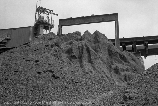
Sand and gravel wharf, North Greenwich, Greenwich. 1980 24j-41: wharf, sand, gravel,
Sand and Gravel at Granite Wharf. The site is now occupied by new and expensive flats. The whole area, including Greenwich Wharf, Lovells Wharf, Granite Wharf, Providence Wharf, Badcock’s Wharf, Pipers wharf and Cadet (or Paddock) Place is now known as Greenwich Wharf.
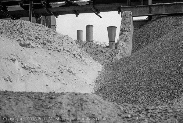
Sand and gravel wharf, North Greenwich, Greenwich. 1980 24j-42: wharf, sand, gravel,
More sand, aggregate and gravel at Granite Wharf, which remained in use by Tarmac until mid-2001. It was first let by Morden College to Victorian road builder John Mowlem in the 1840s.
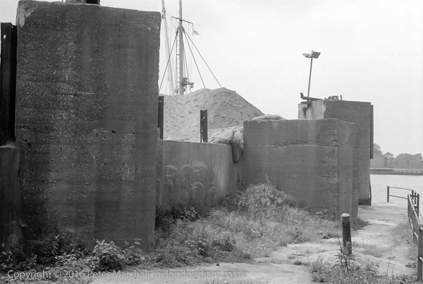
Riverside path, River Thames & Sand and gravel wharf, North Greenwich, Greenwich. 1980 24j-43: wharf, sand, gravel, footpath, river
I think the massive concrete blocks were bases for cranes at the wharf. The inlet here where Cadet Place left the riverside path was known locally as Dead Dog Bay, Mary Mills suggests possibly because animals which escaped the Foreign Cattle Market at Deptford and were drowned washed up here.
THe whole area is no covered by recently built flats, The River Gardens, where a 2-bed flat will cost you a little over £600,000, and Cadet Place no longer exists. A walkway, River Gardens Walk, with steps up from Banning St opposite Derwent St occupies roughly the same position.
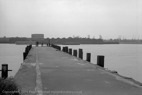
Pier, River Thames and view of Millwall, North Greenwich, Greenwich. 1980 24j-44: children, pier, river,
One of several piers on the riverside path, this may be at Primrose Wharf, but if so had been considerably modified since I took this picture. I don’t think the pier was officially open to the public at the time I made this picture.
Primrose Pier belonged to Amylum and was later opened by them to the public but in 1998 it was resurfaced and part-rebuilt by the Groundwork team, with reed beds being added on either side and disabled access provided.
This was I think taken from Ballast Quay or Lovell’s Wharf, and some of the buildings which can be seen across the river are easily identified.
One, a white building is clearly the Great Eastern (though then it was the Watermans Arms) part of the Cubitt Town development built by William Cubitt it opened as the Newcastle Arms. It is a few yards from the Newcastle Draw Dock
It was writer and broadcaster Dan Farson who changed its name to the Watermen’s Arms when he became landlord in 1962 (though he hired a couple who had worked at Streatham Conservative Club to actually run it for him) featuring it in a TV programme about music halls. He did the place up and got a number of well-known entertainers to visit and sing at the place – including Judy Garland and Shirley Bassey – and other celebrities to come and listen and recorded a few episodes of his ITV series ‘The Entertainers’ there, but the audience proved too rowdy and later shows were made in a recreation of the pub in the studio.
Farson’s tenure only lasted a couple of years and after he left the pub quickly began to run down (perhaps partly because of high costs of ‘protection’ for businesses in the area), becoming a venue for striptease and drag artists, though still occasionally being used for TV and films, and it closed in 2011.
New management converted it into a pub and backpacker’s hostel – and renamed it to The Great Eastern. I walked past on a very hot day last year, hoping to take a rest there and have a pint, but as I approached a fight was taking place between two police officers and a man outside the door, and I decided to walk on.
And just to the right you can see the spire of Christ Church sticking up above the spar.
River Thames and Millwall from Greenwich Riverside path, Greenwich. 1980 24h-66: river, ship,rigging
Another view from the same place shows a similar riverside vista, but this time extending to the tower block on the Samuda estate at the right. Apart from some housing not far from the Watermans Arms the rest of the buildings have I think been replaced by more recent developments.
River Thames and Millwall from Riverside path, North Greenwich, Greenwich. 1980 24j-15: river, rigging
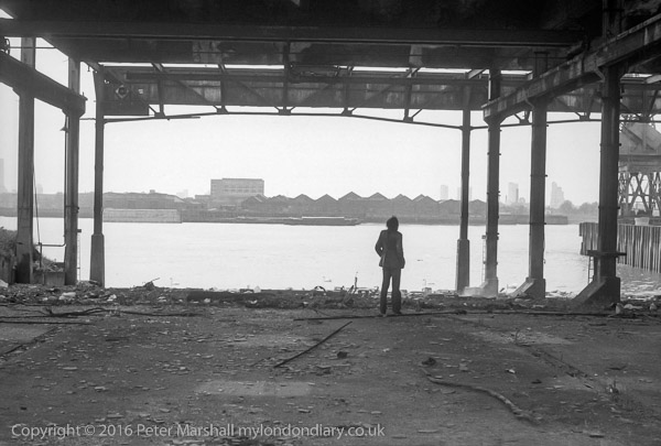
For once I know exactly where this picture was taken, at Bay Wharf, and it is now the premises of a dry dock company, formerly at Pipers Wharf (now part of the site of the Greenwich Wharf development) immediately south of the former Victoria Deep Water Terminal, though I think all the buildings on the site have been demolished.
The man looking into the river had come with me along the riverside walk, and had wandered into the shed while I was taking other pictures.
Bay Wharf appears to have been the site of the Great Breach or Horsehoe Breach of the sea wall at some time before 1622. The area was owned by Morden College and in the mid 19th century Bay Wharf was leased to various industries, including American boat builder Nathan Thompson,and his company, The National Company for Boat Building by Machinery, which went bankrupt more or less immediately and the lease taken over by Maudslay Son and Field in or before 1864, and they used the site to set up a shipbuilding operation, mainly concentrating on screw powered steam ships, and including an experimental ship for Henry Bessemer whose small steel works were at what later became the Victoria Deep Water Terminal.
But they became better known for two iron hulled sailing clippers, Blackadder in 1870 and Halloween in 1871. Blackadder had a very chequered career, leading to a number of court cases, but both boats were record breakers – with Halloween making passage from Shanghai to London in 91 days, knocking 19 days from Cutty Sark’s best. Maudsleay didn’t remain for long as ship builders, but continued to make marine boilers for some years before going bankrupt in 1902.
The site was then leased to Segar Emery, an American mahogany importer, and around 1945 became home to Humphrey & Grey (Lighterage) Ltd, part of Hays Wharf. These derelict buildings were their barge repair slips.
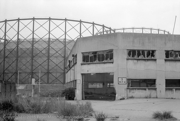
Taken from within a few feet of the previous image at Bay Wharf, but with my back to the river, looking towards the gas works.
No 1 gasholder, 180ft tall and 250 ft diameter was the first ever built with four lifts, rather than three and was completed in 1888. It was in use until recently despite some minor damage by the IRA in 1980, It could hold 8.2 million cubic feet. No 2 holder, at left in the picture, wider at 303ft diameter, was built in 1890 and was the ultimate in frame guiding gas holders, with 6 lifts, two of them ‘flying’ above the guide frame and could hold 12 million cubic feet. The two flying lifts were damaged by the 1917 Silvertown explosion and removed, and the whole holder demolished in 1985.
No. 1 gasholder is currently still standing, though currently threatened with demolition. Only a few gasholders around the country were selected for listing and preservation, and presumably despite its novelty when constructed this was not judged of sufficient interest, though it is a decision hard to understand except on commercial grounds.
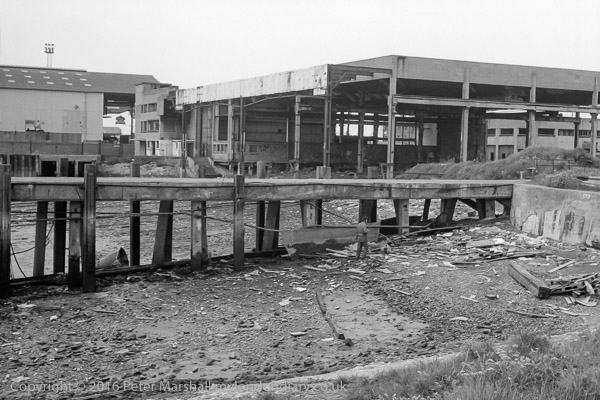
Another view of Bay Wharf, this time from the south of the breach, with the large shed on the site of the Maudsley shipbuilding works, though the building is much later, built as barge repair slips for Humphrey and Grey. The shed at left is I think a part of the Victoria Deep Water Terminal.
Mary Mills on her Greenwich Peninsula History web site mentions a jetty erected at Morden Wharf in 1859, which she says “it seems likely that this was in fact part of the area described under Bay Wharf” and I think this may be the jetty shown here.
As mentioned in a previous comment, Bay Wharf is now now the premises of a dry dock company, formerly around half a mile upstream, moved to facilitate the exploitation of the riverside there for expensive flats.
Disused Wharf, North Greenwich, Greenwich. 1980 24j-21: wharf, derelict,
All photographs on this and my other sites, unless otherwise stated, are taken by and copyright of Peter Marshall, and are available for reproduction or can be bought as prints.
There are no adverts on this site and it receives no sponsorship, and I like to keep it that way. But it does take a considerable amount of my time and thought, and if you enjoy reading it, please share on social media. And small donations via Paypal – perhaps the cost of a beer – would be appreciated.
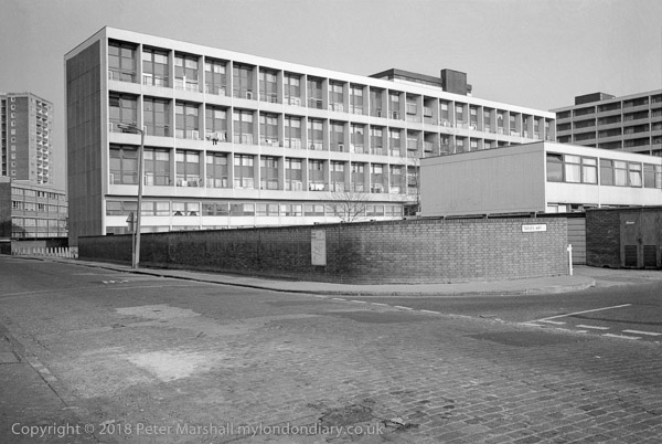
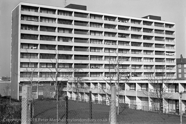
I woke up early this morning worrying about this picture, and that below of the Haddo estate in Greenwich, around Tarves Way off Norman Road close to Deptford Creek and Greenwich Station.
How is it that an estate which seems so neat and tidy and so well-loved both by the council and the residents behind their trim net curtains some 15 or 20 years after it was built in the 1960s (I can’t find the exact building date) had deteriorated to such an extent that the Haddo Estate around Tarves Way was one of the first to be ‘regenerated’ under New Labour with the homes emptied and demolished only 20 years later around 2003 at a cost of £90m?
Back around 2000, and to some extent now, politicians indulged themselves blaming the architect of these and other schemes, though more often it was perhaps the builders or system developers who were at fault for disasters such as Ronan Point, a short distance across the river. But many of the estates that have been or are being demolished were well designed, decently constructed and basically sound, perhaps good for at least another 50 years.
Many of the faults were faults of their time, which could have been prevented by proper maintenance or corrected with relatively inexpensive melioration – new windows, insulation etc. Resident caretakers and appropriate security systems – like those that turned Trellick Tower from sink to highly des res could perhaps have saved Haddo. Instead even many estates that were built with resident caretakers lost them, replaced by the occasional quick drive-by visit from a man in a council van – and the occasional heavy-handed police raid.
More fundamentally we have to ask how it happened that a housing policy once driven by social justice and civic pride that built many fine estates changed over that period to one led by estate agents, developers and profit. It happened under a regime that sought to remove all power from local authorities by a process of pauperisation and emasculation, forcing them to sell off properties at cut price and preventing them from using the proceeds to replace them.
And of course it goes wider than housing. Under Thatcher and Thatcherlite New Labour, greed and personal ambition at the expense of others became the order of the day. Our ideas about community, strong after the war and the era of the welfare state which followed it where whittled away by a leader who stressed self-reliance and the individual (or at best the nuclear family) and told us there was no such thing as society. Back in the early 80s I could walk around estates like this carrying a large bag of expensive camera gear and never feel any danger, but fifteen years later things had changed.
Part of the equation was certainly the relatively high standards, both of internal space in the dwellings and the green spaces around the buildings which make them such delectable targets for demolition and replacement with properties at high market or near market (the unaffordable “affordable”) returns.
I don’t know much of the details of the Haddo estate, either before or after its replacement, but have seen what has happened and is if anything now accelerating at other council estates in London, the majority in Labour-run boroughs.
Plans outlined in the building press showed ‘New Haddo’ was to have 510 homes, around half built for market rate sale, a third for some kind of so-called “affordable” rent and 85 for shared ownership. In most such regenerations by the time they come to completion, ways have been found to increase the proportion at market rates, by claiming that the developer cannot make sufficient profit – a figure set ludicrously high.
There appear to have been no homes in the new development at real social rents which most of those in the properties in my pictures will have been paying, and which will almost certainly have been sufficient to have paid off the council’s investment in building the estate.
There are no adverts on this site and it receives no sponsorship, and I like to keep it that way. But it does take a considerable amount of my time and thought, and if you enjoy reading it, please share on social media. And small donations via Paypal – perhaps the cost of a beer – would be appreciated.
All photographs on this and my other sites, unless otherwise stated, are taken by and copyright of Peter Marshall, and are available for reproduction or can be bought as prints.