20th April 2017
Hawthorn was a general cargo ship, gross tonnage 1197 tons, built by D.W.Kremer & Sohn GmbH & Co. in Elmshorn, Germany in 1967, and had various names and owners. She began as ORTRUD MÜLLER, and was then HUNNAU and FRANCINAPLEIN before coming to Liverpool owners in 1977 who named her HAWTHORN. In 1992 she became BLACKBIRD, and since then has been SMARAGD and GULF TRADER, and was last heard of as the LADY AGNES, registered in Kingstown (Saint Vincent and the Grenadines and not Hull), sailing under a Tanzanian flag and leaving Port-de-Paix in Haïti a few days ago.
My picture shows here moored in Alexandra Dock, Hull. The cranes are long gone too.
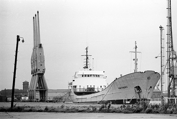
32p22: Hawthorn in Alexandra Dock, 1982 – Docks
21st April 2017
Taken somewhere on the walk from Alexandra Dock to King George V Dock, where you can see ships moored in the distance. It may be from where the path detoured slightly to cross the Holderness Drain which flows into the Humber here at Marfleet.
Drainage of the low-lying Hull valley has always been a problem, with flooding both from higher land to the north and tidal salt water from the Humber. Flood defences were certainly being built along the Hull and the Humber by the early 14th century, with simple sluices to allow water to flow into the rivers at lower tide levels. The sixteenth century saw the start of new drainage schemes, and a drain taking water from the north to the Humber at Marfleet was first proposed in 1671, but not dug. Just over a hundred years later a new plan was granted approval by Parliament, but with drainage into the Hull at Stoneferry, as Hull’s shipping owners argued the flow of this water was needed to stop Humber mud silting up the Old Harbour on the River Hull. It was only in 1832 that permission was obtained for an outlet at Marfleet.
In 1885 the Alexandra Dock was opened immediately to the west of the Holderness drain, and water was then pumped from the drain to raise its level and stop the mud-heavy Humber water entering the dock around each high tide. The King George V dock immediately to the east, opened in 1913 and used more water pumped from the drain for the same reason.
32p26: King George V Dock, 1982 – Docks
22nd April 2017
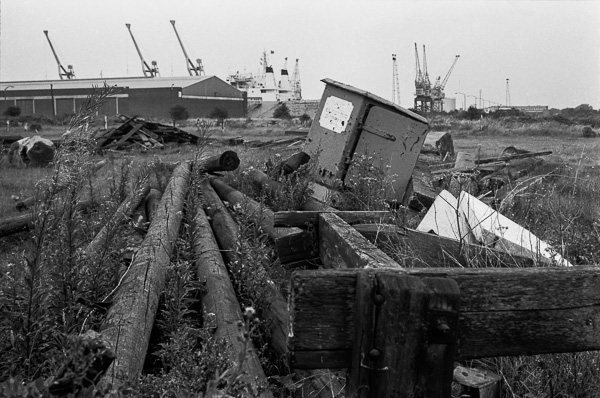
Victoria Dock had been closed for a dozen years, but there were still scattered remains of its past, including odd piles of sand and gravel and a few boats which had been left stranded on the dockside, some in various states of scrappage, producing at times a rather surreal landscape.
The picture was taken in the eastern part of the dock estate, and was a part of the area that until 1932 was one of Hull’s largest ship-building yards, Earle’s Shipbuilding & Engineering Yard.
32p31: Victoria Dock, 1982 – Docks
and
32p46: Victoria Dock, 1982 – Docks
23 April 2017
A long disused jetty leading out to the long West Wharf pier in the Humber off the west end of Alexandra Dock. The pier had a minimum water depth of 18ft.
This was the westernmost of three jetties leading to the wharf, and the only one without a railway line, presumably only used by workers on foot and lorries. The remains of the pier and jetties were still visible until the redevelopment of the site for Green Port Hull.
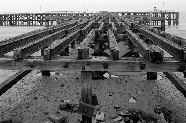
32p33: Western Jetty to West Wharf pier, Alexandra Dock, 1982 – Docks
24th April 2017
The Humber mud seems to stretch out from the river wall almost to the flimsy-looking wooden structure of the West Wharf around 400 ft away, and it seems unlikely that moorings there would still have enjoyed the 18ft of water at low tide which the Wharf had when built in 1911.
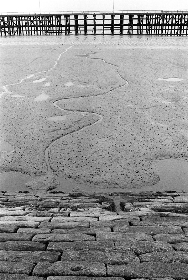
32p34: West Wharf, Alexandra Dock, Humber, 1982 – Docks
25th April 2017
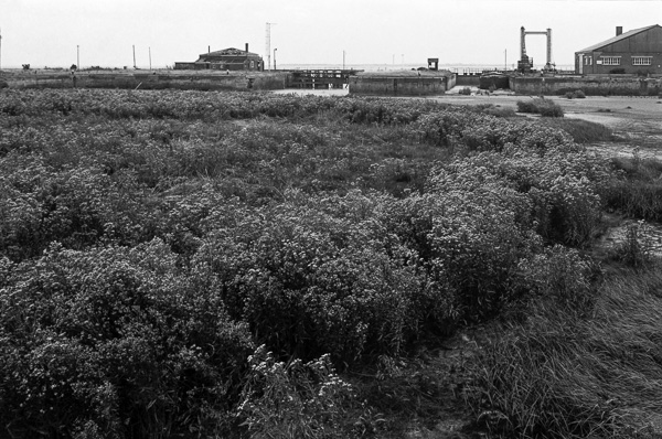
Until recently a public right of way ran across the lock gate here, and led on beside the Humber to King George V Dock and beyond, coming to a disappointing dead end in the middle of nowhere.
This path around the south of Alexandra Dock was diverted in 2012 as a part of the development to allow Siemens to build wind turbine blades here and enable them to be transported more readily to offshore locations.
All the dockside buildings have since been demolished, including the tall posts at right which carry a sign across between them at their top, with the name Alexandra Dock, designed to be clearly visible to those navigating the Humber. There was a similar structure at the entrance to Victoria Dock.
32p36: Alexandra Docks entrance lock, 1982 – Docks
26th April 2017
Taken from the dockside at the north of the Half Tide Basin, close to where a swing bridge led into the main Victoria Dock, already filled in when I made this picture. The two gates lead into the Outer Basin and on to the Humber. The wider of the two – on the left of picture – was 100ft wide and the narrower was used for barges. The Half Tide Basin enabled vessels to enter from the Humber at any time from when the tide was halfway in to when it was halfway out, hence the name, thus greatly increasing the time available for shipping into and out of the dock.
The main entrance had only a single gate and would be kept open while the tide was above half level, then closed to keep the water at half-tide level. Smaller vessels could use the narrower lock at right when the tide was out so long as the outer basin had enough water to float the boat, as the smaller size incurred less loss of water.
As can be seen, the dock was open to the Humber and had silted up considerably by 1982. There were plans to develop the dock as a marina, but these proved too expensive and the developers were allowed to permanently block the entrances. Virtually the only things that has survived from the working dock were the dock walls and the bridge across the entrance from this basin to the now completely filled in main dock to one side of me as I made this picture.
The dock now acts as drainage for Victoria Dock Estate which was developed from 1988; water is stored there and then discharged through small sluice gates when the tide is low. Unfortunately these gates are now silted up in the outer basin and pumps are needed to protect the estate from flooding, as this is cheaper than dredging. It is being used this year as the venue for a series of four performances in Hull’s year as UK City of Culture, ‘Flood‘, by theatre company Slung Low who are based in Leeds rather than Hull.
Floods of course continue to be a significant threat in Hull, with major floods in June 2007 and several others since, most recently in November 2016 when large areas of the city were again affected. Mostly these are now due to heavy rain across the area, though a tidal surge caused flooding in 2013. The tidal barrier is said to have saved 19,000 homes from flooding then, but it was a close call, with the water reaching around 8 inches from its top. More than 90% of the city is said to be below high tide level.
32p41: Half Tide Basin and entrance locks, Victoria Dock, 1982 – Docks
You can see the new pictures added each day at Hull Photos, and I post them with the short comments above on Facebook.
Comments and corrections to captions are welcome here or on Facebook.
______________________________________________________
There are no adverts on this site and it receives no sponsorship, and I like to keep it that way. But it does take a considerable amount of my time and thought, and if you enjoy reading it, a small donation – perhaps the cost of a beer – would be appreciated.
My London Diary : Buildings of London : River Lea/Lee Valley : London’s Industrial Heritage
All photographs on this and my other sites, unless otherwise stated, are taken by and copyright of Peter Marshall, and are available for reproduction or can be bought as prints.