My camera hasn’t yet travelled into the future, rather the opposite, as the pictures that I’ve just contributed to the 2012 pics blog run by David Boulogne actually date from 1990 and 1992. So far I’m the third photographer to contribute work to the site, after Boulogne himself and Dominik Gigler.
David describes this site, under the sub-heading memory for future generations as:
Collection of photographs about the east part of London where the core of the 2012 Olympics will take place. The project aims to capture a landscape in transition. Not only of the site but also of its surroundings. Anyone with original concept using film photography is welcome to send submission.
I think the first post on 2012 pics was made in March this year, although the pictures were from December 2009, and the site gives a good idea of what the site looked like around that time and since.
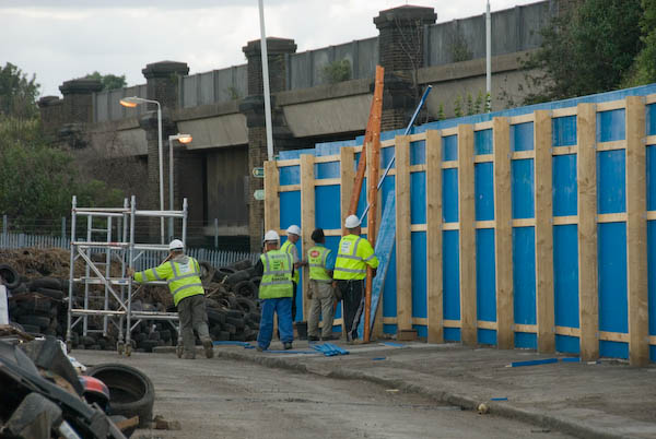
Of course its an area I’ve visited many times over the years and which is covered in my Blurb book, Before the Olympics, as well as on my River Lea – Lea Valley web site. There are also quite a few pictures on My London Diary, including this one of the blue fence being put up:

From My London Diary, June 2007
Among the five pictures on my first contribution to 2012 pics is one of ‘Pauls Cafe’ also known as ‘Cockney Hideout, which makes clear that there “aint no airs or graces ere“and there weren’t. Another shows the Pudding Mill river which at that time still flowed south under the Eastern Region main line. Now it just gives its name to a station on the Docklands Light Railway – alight there to visit the viewing platform/café on the Northern Outfall Sewer (now called the Greenway.) It’s name lives on too in ‘Pudding Mill River: Purveyors of Sporting Spirits and Foodstuffs‘ which according to their blog have been gathering the wild fruits of the Lower Lea Valley for generations, and which produced some amusing videos, including one of the Pudding Mill River Song which appealed to my warped sense of humour.
Pudding Mill is apparently the name given by the planners to the whole of the area to the south of the Olympic site between the railway and Stratford High St, the remaining parts of which are to be redeveloped after the Olympics.
I’ll be posting a further series of pictures to 2012 pics shortly, probably from my colour work along Carpenters Road and the surrounding area around five years ago.