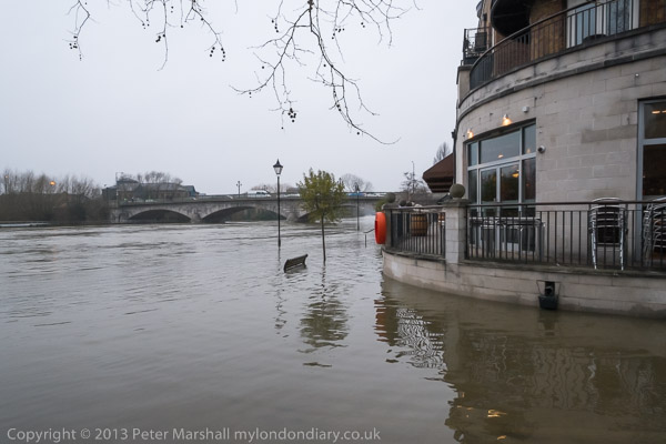
Riverside Path at Staines, 12 Jan 2014
I don’t have any great regard for the UK Environment Agency, particularly over flooding. They cause me a certain amount of grief and cost me several hundreds of pounds a year in increased insurance costs as well as what I pay towards them out of my taxes by classifying my home as being at high flood risk because of a stream at the bottom of the garden that ceased its natural flow thirty years ago, but they refuse to change their maps. But there is also a risk of flooding here from a considerably larger and more active river, the Thames. Its official route is around a quarter mile from here, but most of the land around here is low-lying, and once it floods the water can get into some fairly surprising places. Its a problem that is heightened by the fact that it mainly does so via the sewers, so that when it does so it brings not just water.
Flooded street at Staines, 12 Jan 2014
There have been two major floods in the area in living memory, the worst in 1947 when I was too young to notice and living several miles away and on ground perhaps 10 feet higher. But then this house had water in the foundations under its floorboards, but it didn’t come above them. For various reasons, almost all of those floorboards have gone, replaced by solid concrete floors, so that can no longer happen. In the 2003 floods we had floodwater in the street on the opposite side of our road, though the ditch which may be slightly lower, along with our side of the road and the house and garden remained dry.
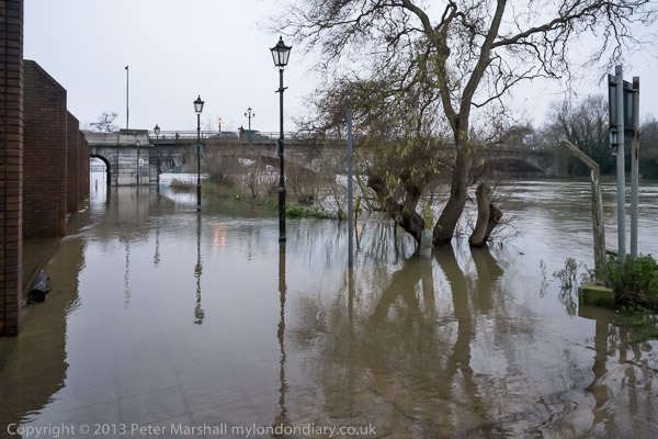
Riverside Path at Staines, 12 Jan 2014
But even so, when this year we again received an automated telephone warning call from the Environment Agency about the high risk of flooding in our area, we didn’t feel we could ignore it. We set around moving those things of value we normally keep on the floor to higher levels. Irreplaceable personal document files went on to the table, piles of valuable books on other furniture and so on. For almost a week we waited anxiously, kind of camping out around these piled up belongings, eating our meals on a small area of table left free facing them. But we were fortunate, and the water began to go down before it reached us and eventually we got another call to inform us we were out of immediate danger. The Thames is still at high levels, and it’s raining again as I write and the level has gone up a little in the past couple of days, but still, at least here, below danger level.
Riverside Path at Staines, 12 Jan 2014
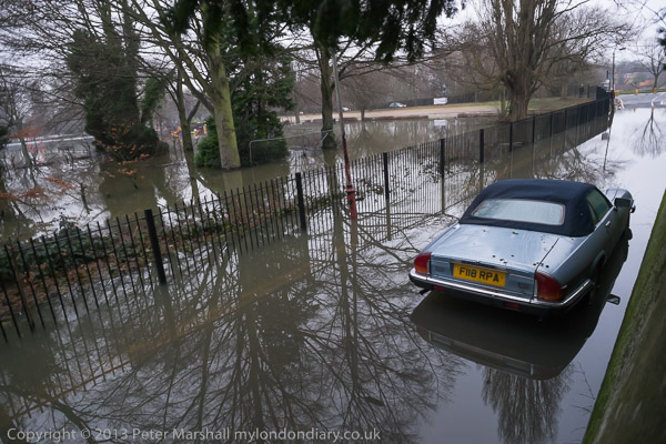
We were fortunate, but others in the area less so. At night when all else was quiet lying in bed I could hear the rush of water being punped out of the basement room of a house around 50 metres away, drowning the usual background of traffic on the motorways and the engines from the airport a couple of miles distant. One particularly low area a mile or so away was flooded as usual, and we saw people wearing waders bringing out plastic bags of belongings from a house on the island. Aerial photos showed large areas of land a few miles away under water, and the newspapers had pictures of mobile home sites with a foot or two of floodwater.
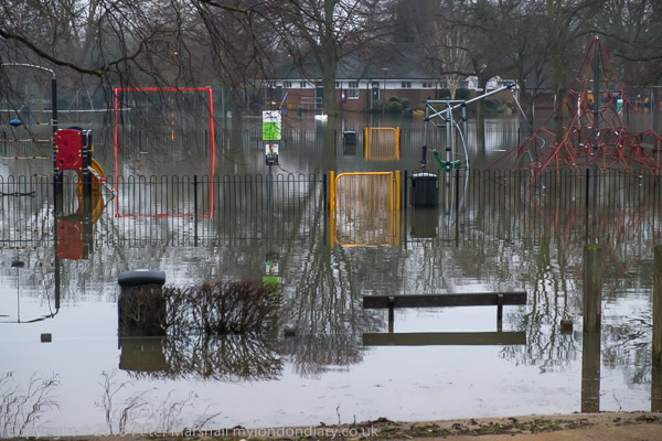
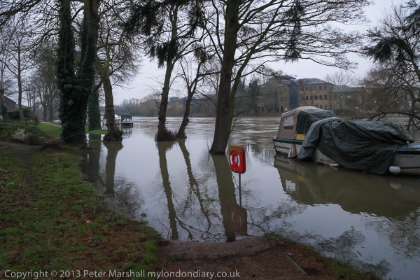
Lammas Park at Staines, 12 Jan 2014
I didn’t go out to take pictures of the floods. I had other things to cover away from where I live and I didn’t think those locally were generally spectacular and didn’t relish getting wet and cold. I don’t even own a pair of wellingtons and a bicycle probably isn’t the best form of transport – its OK riding through shallow water, but in floods its hard to see kerbs and other obstacles and you tend to fall off or have to put your foot down into cold water. I sure there are many better pictures of the flooding, even from this local area – and there were many others out with cameras taking pictures as I took a little walk for exercise late on Sunday afternoon (a day off from photography) when the light was falling with the Fuji EX-1 and its 18-55mm around my neck.