My previous post about my walks in North Kent ended at Rosherville, on the outskirts of Gravesend. Unfortunately I didn’t at the time know of the interesting history of the place, though I was impressed by some of the buildings and did return later to photograph some of them. But I did walk up to the rather impressive Lansdowne Square and I think it was from the steps there that I made the view above, looking across towards Tilbury and East Tilbury power station.
But you can now read much more thanks to the internet and Wikipedia than I was able to glean at the time from the very few books available to me that mentioned the area. Even in 1837 they had disused chalk pits, and one with an area of 17 acres (6.88 hectares) or around 10 football pitches became the ‘Kent Zoological and Botanical Gardens Institution’, better known more simply as Rosherville Gardens.
The gardens became a popular outing for people from London, with steamers bringing them down the Thames to a pier at Rosherville (fifty years later there was also a Rosherville Halt on the nearby railway line.) But it was a pleasure steamer taking people back to London from Rosherville that was involved in the largest shipping disaster on the Thames – and still the UK’s largest peacetime incident.
On September 3rd, 1878 at 7.40pm, the Princess Alice collided with the collier Bywell Castle at Tripcock Ness and sank. Eyewitnesses described the river as full of drowning people, like a flock of sheep; few people at that time could swim. Heavy clothes worn by women dragged them down into a slimy river as the accident occurred close to where the outfall sewers had just pumped London’s daily 75 million gallons of untreated sewage into the Thames. The exact number of those drowned (or poisoned) is not known, with estimates from 590 to almost 700, and they included around 250 children. There were fewer than 200 survivors.
The Princess Alice was licensed by the Board of Trade to carry 936 passengers and they had considered a single lifeboat and a longboat that together would hold around 60 passengers as sufficient – along with 12 lifebuoys.
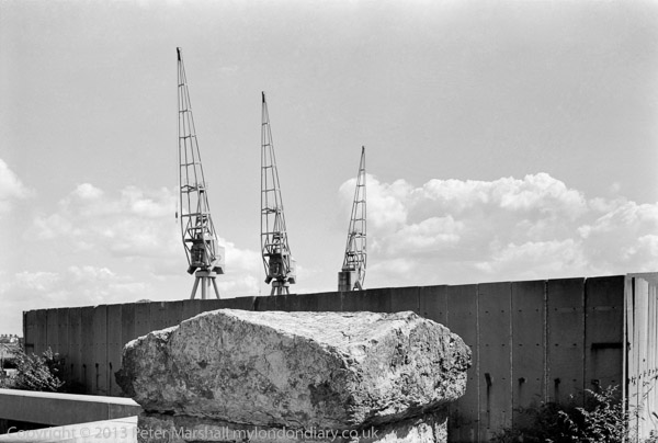
On the fence by the side of The Shore there are I think now some plaques marking what was the entrance to the Rosherville pier, and possibly the rather impressive stone pillars were also a part of the quayside from that era.
Two views of the same works, I think on Crete Hall Road
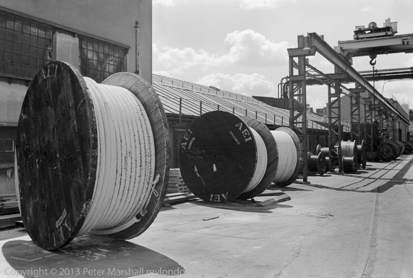
But on this first visit in 1985 I stuck fairly closely to The Shore (as the road along by the Thames here is called) and its industrial buildings, and perhaps surprisingly failed to the most interesting of these, Henley’s Cable Works on the corner with Crete Hall Road. I think there may have been rather a lot of lorries parked obstructing the view, but I did record some rather large drums of cable and the façade of their research laboratory.
It’s possible too, that I might have taken some on colour transparency, though the only image I can find from this area is also of the research lab. The next thing on the riverbank was Northfleet power station, and I went up a footpath that then took me back to Crete Hall Road. So much has changed in the area that that it is hard to recognise – the power station closed in 1991 and is just empty mud on Google Earth – as is the adjoining site where Henley’s lab and other works stood.
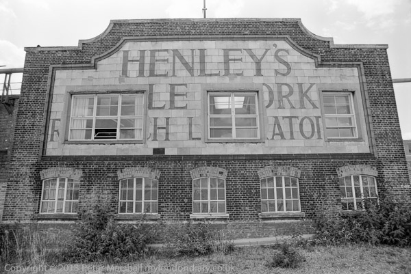
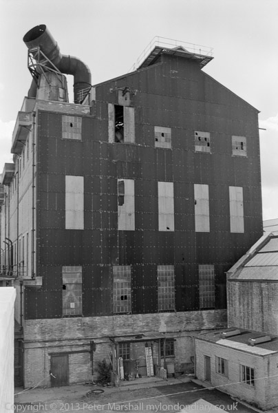
Once it had said ‘Henley’s Cable Works Research Laboratory’ but then they added windows
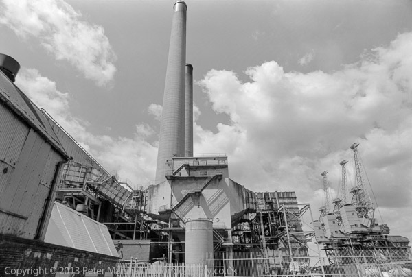
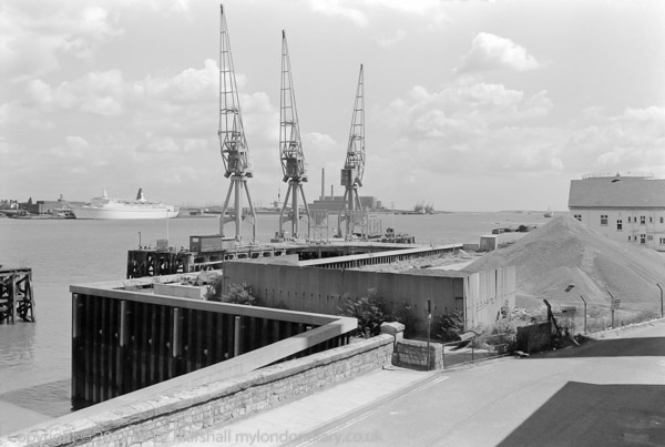
Cranes at the right were for unloading the coal for the power station
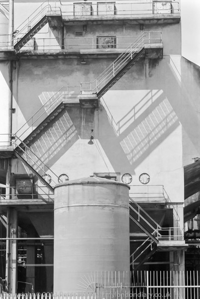
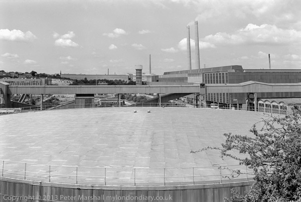
I think almost directly across Crete Hall Road there was then a rough track that took me up to the London Road, on the top of a chalk cliff overlooking the area. The large storage tank across which I took a picture was then one of three on the former quarry floor just west of Rosherville Way and I think the picture was probably taken from London Road. The tower you can see in the centre of the picture was still there last time I visited the area (and on Google Earth) on the right-angle bend in Crete Hall Road shortly before it joins Granby Road. I don’t think there is anything else in the picture that remained on my last visit to the area except for Northfleet on the cliff top at the left.
I walked along London Road and to Northfleet station to catch the train home. A few days later I returned to continue on my walk to Northfleet and Swanscombe – which I’ll cover in later posts.
______________________________________________________
My London Diary : Buildings of London : River Lea/Lee Valley : London’s Industrial Heritage
All photographs on this and my other sites, unless otherwise stated, are taken by and copyright of Peter Marshall, and are available for reproduction or can be bought as prints.
To order prints or reproduce images
________________________________________________________
One thought on “North Kent 1985: Rosherville”