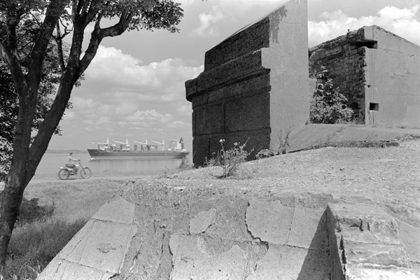
At Shornmead Fort, near Gravesend. 1985
Past Gravesend the Thames widens out and is still even now something of a shipping highway, with Tilbury Docks, opposite Gravesend on the Essex bank remaining a busy port for London – though there is now a new London Gateway Port a few miles further downstream. In June 1985 I walked from Gravesend along by the river east to Cliffe, a small village on some low chalk cliffs overlooking the river. And back.
I was perhaps prompted by reading one of my favourite books by Fay Godwin, ‘The Saxon Shore Way‘, published in 1983, three years after the long distance path was established, though it would annoy Fay greatly to hear me say that it was the text by Alan Sillitoe that attracted me as much as the photographs. It was one of her persistent (and in some ways justified) gripes that although she had conceived the book and been its prime mover, like all of her other collaborations with writers, it was always listed under the name of the writer, with her treated as simply the illustrator of their text.
As I told her, it wasn’t simply that she was a photographer, though words here in the UK always take precedence over text. To get her books published, the publishers required a well-known name to put on the cover, and despite her record in publishing, her’s was not a name that would sell books. Few books by individual photographers sell well – and things were even worse thirty years ago. Sillitoe was a name that would drive sales far more effectively. If she had wanted to get a greater share of the credit she should have got John Smith (and no, not the John Smith) to provide the text – and get the publisher to market it as a book by Fay Godwin. But as she had set it up, what she complained about was inevitable (and she knew the industry well enough to know it.)
It isn’t her best-known book, and her pictures of this first section of the walk from Gravesend to Rye are perhaps a little disappointing, though there are some fine examples of her work later in the book. I’ve never completed the full 163 miles of the walk myself, though I have photographed at both ends and a few other places along its length.
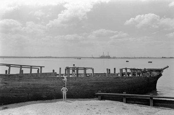
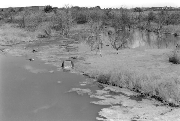
The Hans Egede at Cliffe, 1985
It wasn’t my first visit to Cliffe, I’d been there a couple of times before with photographer friends, and photographed the beached hulk of a wooden ship which had become a playground for photographers and small boys. (Wikpedia informs me it was not some ancient wreck, but the Hans Egede, built in Denmark in 1922, a three-master with an auxiliary engine which was damaged by fire in 1952 and then, with fittings removed, used as floating storage for coal and/or grain moored in the Medway. In 1955 while she was being towed up the Thames to London she started to sink and was eventually beached here.
I’ve posted the top picture on this page here before, and it was taken a little before I got to Cliffe, at Shornmead Fort, one of a number of forts along the river. There was a small fort here from 1796, but it was rebuilt a couple of times in the next century and what is left dates from around 1870. The guns were removed before the end of the century, but it was re-armed in both World Wars. Later in the 1960s it was part demolished and apparently used for target practice. There was still a live firing range next door in 1985 but they didn’t see to be aiming in my direction as I sat in the sun to eat my sandwiches, waiting for a ship to come past and watching young bikers on unlicensed bikes speeding along the riverside path.
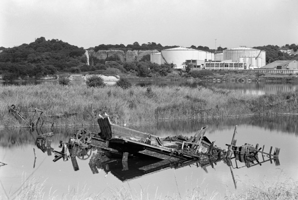
Cliffe has some low chalk cliffs from which it gets its name, and was probably a Saxon town, but it was the coming of the cement industry in the 1860s that transformed the area. As well as the confusingly named Nine Elms cement works a canal and tramway were constructed across the marshes to the Thames. The emptiness of the area also make it a good site for an explosive works, which proved rather too explosive; only working for the first 20 years of the 20th century, 16 workers were killed in explosions. The marshes weren’t too healthy before then, with malaria still common in the area before much of the marshland was drained around the end of the 19th century. The original cement works closed in the 1920s, but cement production continued with the Alpha Cement works until the 1970s. They dug out much of the marshes leaving many unfilled pits that are now nature sanctuaries.
The industry remaining on the riverside is now sand and gravel, dredged from the Thames.
Cliffe came back into the news in 2002, with plans to site a new London airport there, but these were abandoned largely on cost grounds at the end of 2003.
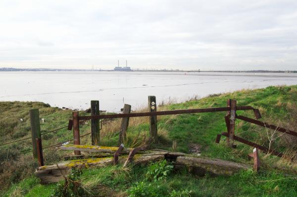
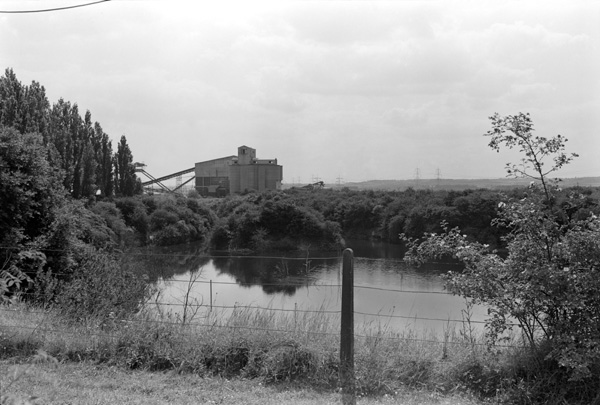
River Thames and Saxon Shore Way near Cliffe, 2002
I went back to the area shortly after the airport plans were announce and have a vivid memory of having cycled there not long after that, but though I’ve spent several hours searching I can’t find any pictures. Perhaps it was just in my dreams, as it certainly doesn’t seem to be in my filing system!
______________________________________________________
My London Diary : Buildings of London : River Lea/Lee Valley : London’s Industrial Heritage
All photographs on this and my other sites, unless otherwise stated, are taken by and copyright of Peter Marshall, and are available for reproduction or can be bought as prints.
To order prints or reproduce images
________________________________________________________