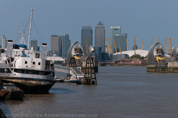
“The St Lawrence is water, the Mississippi is muddy water, but the Thames”, said John Burns in 1929, by then a Labour MP “is liquid history” and he was right at least about the Thames, although 70 years earlier he might well have replaced those last two words with “largely sewage.” There were reminders both of Burns and the work of the great Victorian engineers whose work so changed the river as well as more modern developments in the walk or ride I took downriver from the Thames Barrier with two of my family on the May Bank Holiday.

They were walking, but I’m still recovering from a painful bout of plantar fasciitis, an inflammation of the tissues which make up the arch of my left foot (apparently it usually takes around 9 months to go away completely) and can’t really cope with the kind of long and fast walking they like, so I’d taken my folding bike – of course a Brompton – and was either pushing or riding this.
If paths – like those by the Thames – are good it’s very useful. They are A to B people while I like to wander, and the bike allows me to detour or to stop and take photographs, and then easily catch up with them. Too often on walks in the past I’ve found mself having to run several odd quarter miles to catch up with them.
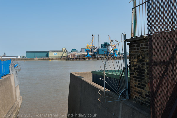
But this walk almost started with a disaster. From Charlton station we started a tedious walk along the busy main road as there is no path through the industrial area by the river before arriving at a roundabout where the Thames path extension heads off through a recent housing estate. Leading more directly to the river – where it is a dead end unless you have a boat waiting at the steps is Warspite Road, renamed presumably after the various navy vessels of that name from Trinity Street in the 1930s. Although so far as I’m aware none of the nine ships named HMS Warspite was built in Woolwich, perhaps some were refitted there. The Woolwich Naval Dockyard ran from its east side, and on its west was and is an industrial area, though now partly occupied by warehouse stores, artists studios and other facilities.

So I sped off down Warspite Rd to the steps leading to the river at its bottom while they continued along the Thames Path (actually the Thames Path extension here.) I’d photographed from these steps on previous visits, and to get a better view had walked out along the wall above them. It’s a fairly wide wall and seems safe enough, but there is a drop on one side to the road and on the other to some concrete steps leading down to the river. On this occasion I discovered I’d completely lost my head for heights. As I raised my camera to shoot several overlapping images for a panorama I couldn’t hold the camera still, and started shaking more and more. Then I felt myself about to faint, and only just managed the yard or two back to the safety of the rail I had ducked under earlier, falling towards it and clutching it as I subsided to my knees. Once I was holding the rail, my panic attack immediately cleared, but it had been a nasty moment, in a place with no one else around and nobody passing.
So I didn’t get that picture, and was more than a little shaken, but the rest of the walk went well, though I had to give up before the end to go elsewhere. Perhaps the highlight was again “largely sewage” with the fine Romanesque buildings of Bazalgette’s Southern Outfall, which at every high tide discharged all of South London’s sewage into the river to flow out to sea untreated until the 1950s. Next to it the huge tanks of the more modern sewage treatment plant, still in use, which now purifies it and discharges clean water – except when it rains and overwhemlms the treatment plant.

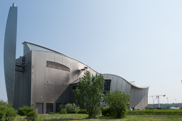
A few yards further on is an elegant metal swan-like structure of the 1998 sludge incinerator, and a short distance further a more recent but less elegant second version which has appeared since I last came this way.

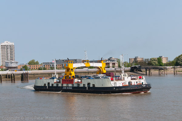
And back to John Burns, his name was given to one of the three vessels that now provide the Woolwich Free Ferry, joining London’s North Circular Road to the South Circular that never really became a joined up road. We didn’t really want to go to North Woolwich but we took the ferry across, walked around for a few minutes and then came back on the John Burns.
More pictures at More Thames Path.