18th August 2017
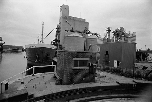
When the first Hudson Ward mill was built on this site, it was on the bank of the canal – the Aire and Calder Navigation – that made Goole a port for Yorkshire, linking it to Knottingley, Leeds, Sheffield and South Yorkshire. In 1910 the canal west of Barge Dock was widened to form South Dock.
Barges could bring cereals on the extensive canal system to Hudson Ward’s mill in Goole Docks from a wide area around, and grain from the USA and Canada could be brought by ocean-going large vessels for transhipment from Hull Docks by smaller vessel. Barges could also be used to distribute the mills products, flour, sharps, bran, flaked maize and a complete range of compounded foods for pigs, cattle and poultry.
The vessel berthed at the mill is the Daunt Rock, 892 tons and 64 m, long with beam 10.8 m, built in 1976 at Hancocks Shipbuilding Co. Ltd at Pembroke Dock and registered in Cork (where Daunt Rock is a hazard to navigation close to the harbour mouth.) In 1988 she was renamed Cornet and in 2001 Zila. In 2011 she was reported to be still sailing under the Panamanian flag, but her current status is listed as “Decommissioned or Lost”.
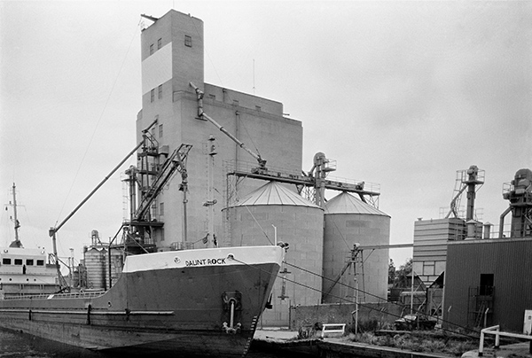
36l33: Daunt Rock berthed at silo, South Dock from Bridge St, Goole, 1983 – Goole
19th August 2017
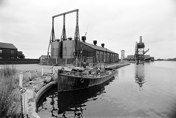
The view from the bridge along South Dock with the Hudson Ward mill at right, and the moored Gaunt Rock in the centre. At the left in the distance is one of Goole’s trademark buildings, No. 5 hoist for the ‘Tom Puddings’, compartment boats developed by William Bartholomew in 1863, bringing coal to Goole to be loaded into ships. Each compartment could hold about 40 tons of coal, and they were towed in trains normally or 21, sometimes up to 38. Trains often had be be split to go through the locks.
There used to be five hoists at Goole and they could load up to around 300 tons of coal an hour. They were last used in 1986 when No 5 was Grade II* listed.
36l34: South Dock, Goole, 1983 – Goole
20th August 2017
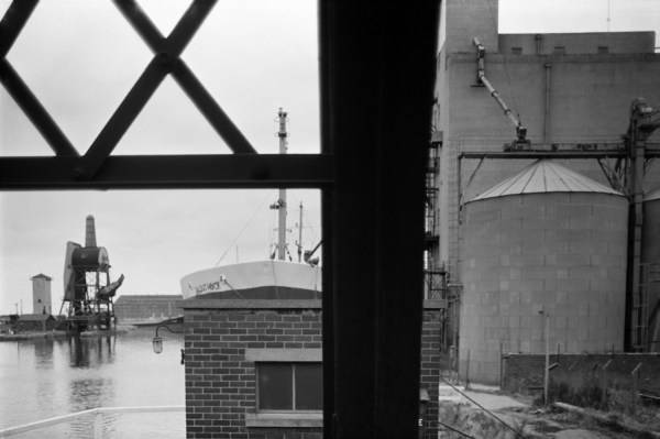
A view along the south side of South Dock from close to the Bridge. The boat moored a few yards down is I think an old steam tug and a board on it (partly obscured by a rope) says Acaster’s Water Transport Goole, a company still listed as supplying two tugs on the Humber web site and based in Swinefleet in Old Goole.
Beyond that is the entrance to No. 2 dry dock and then No. 5 Hoist. The ship moored just past this is I think partly in South Dock Basin which is I think the inlet where the ‘Tom Pudding’ compartments were stored. The rather odd tower to the left of the hoist is still standing, and there are still large sheds beyond – Sheds 44 and 45 of the Caldaire Terminal opened in 1999, which I think are modern replacements for that in my picture.
36l43: South Dock, Goole, 1983 – Goole
21st August 2017
A tighter view of the Acaster’s Water Transport tug in South Dock and the shed behind. There is a name on the lifebeltm but I can’t make it out. The first two letters at the top could be SV (for steam vessel?) but this is followed by an unreadable letter, possibly A, then T,O and some more I can’t read. Only a part of the lower letting is visible, with the first four letters clearly ROCH, perhaps the start of Rochester or Rochdale…
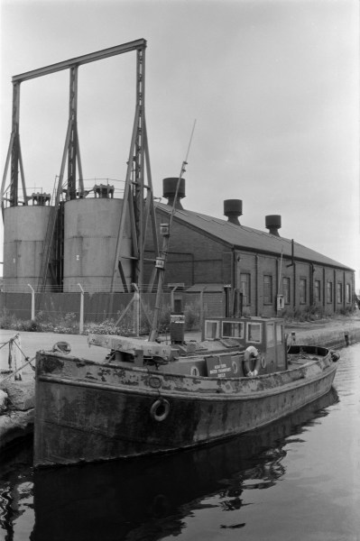
36l45: South Dock, Goole, 1983 – Goole
22nd August 2017
The entrance to Associated British Ports Goole with a barrier on a ramp, and on the building in the centre the message ‘No Public Allowed’. The dock visible in the distance is I think Ouse Dock, but I’m not exactly sure in which direction this picture was taken.
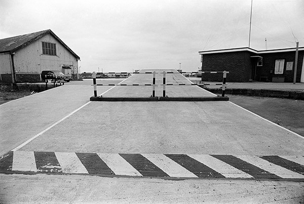
36l52: Associated British Ports entrance, Aire St, 1983
23rd August 2017
Another picture from Bridge St showing South Dock, Daunt Rock and the Hudson Ward mill. I’ve never been too good at holding a camera level, and would probably have straightened this up in printing, but I’ve left it, as correcting would lose the hoist at the left edge of the image.
36l55: South Dock from Bridge St, 1983 – Goole
24th August 2017
The sign points to Shed 37 which is on the north side of Ouse Dock, and Lowther Bridge joins this dock to the rest of Goole Docks. This was one of the early entrances from the Ouse through Packet lock (replaced by the larger Victoria Lock in 1881) for the numerous steam packets.
There was a larger ship entrance (Ship Lock into Harbour Dock – both now filled in) and then into Ship Dock, and then into Ship Dock, as well as a Barge Lock leading into Barge Dock. Ship Dock and Barge Dock were opened out where there had previously only been a narrow channel and Ocean Lock constructed from Barge Dock to the river to take larger ships in 1938, replacing both Ship Lock and Barge Lock.
There is a public right of way across the Lowther Bridge but I think in 1983 any signs to it had been fairly well hidden by ABP which had recently taken over the docks when they were privatised.
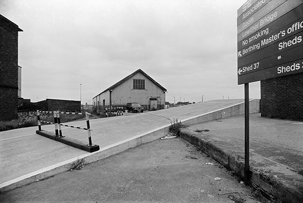
36l66: Associated British Ports entrance, Aire St, 1983
You can see the new pictures added each day at Hull Photos, and I post them with the short comments above on Facebook.
Comments and corrections to captions are welcome here or on Facebook.
______________________________________________________
There are no adverts on this site and it receives no sponsorship, and I like to keep it that way. But it does take a considerable amount of my time and thought, and if you enjoy reading it, a small donation – perhaps the cost of a beer – would be appreciated.
My London Diary : Buildings of London : River Lea/Lee Valley : London’s Industrial Heritage
All photographs on this and my other sites, unless otherwise stated, are taken by and copyright of Peter Marshall, and are available for reproduction or can be bought as prints.