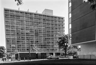
I’m not sure which of the nine eleven-story slab blocks on the estate is shown in my picture; the estate was and remains a rather confusing area. Possibly this is Leicester House on Loughborough Road, or more likely Harpur House on Angell Road where I think I walked to next, but the lower buildings in front of the block appear to have gone.
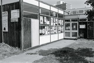
The sign ‘NO HATS’ is not a reference to any headgear but to Housing Action Trusts, an important part of Margaret Thatcher’s marginalisation of local authorities. Having ochestrated the run-down of council estates by earlier restrictions on council spending and the right to buy schemes, the Housing Act 1988 aimed to transfer these estates to non-departmental public bodies which were to redevelop or renovate them so they could be transferred into private ownership.
Opposition to HATs was intense, with the Labour Part, local authorities and estate residents all fighting their imposition, and the first six areas intended to becom HATs managed to avoid implementation, though later six were formed, but none in south London.
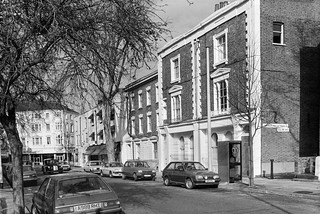
I think this rather temporary-looking building as on Angell Road close to Harpur House, but no sign of it remains. I photographed it largely for the posters showing opposition to Housing Action Trusts in Broxton.
As well as a Luncheon Club for pensioners it also has a sign for the Loughborough Sports & Social Club.
Fence, St John the Evangelist, Angell Park Gardens, Angell Town, Lambeth, 1989 89-5d-32
Further along Angell Road – named like the area after the Angell family who had owned large parts of the Lambeth and developed this area in the 1850s. In 1852 Benedict John Angell gave a site here for the building of St John the Evangelist Church which was consecrated in 1853. Unfortunately trees along the edge of the site along Angell Road and Angell Park Gardens had too many leaves in May to clearly see the church.
These paintings on the fence around the church are still visible but rather faded. I took a few pictures of them both in black and white and in colour before walking on past the church and across Wiltshire Road into Villa Road and back onto Brixton Road, where I photographed the rather austere Our Lady of the Rosary Catholic Church (not yet digitised.)
Abeng Youth Community Centre, Gresham Rd, Brixton, Lambeth, 1989 89-5d-22
I walked on down Brixton Road to the Police Station where I turned back east along Gresham Road, stopping to photograph what looked to me to be a former chapel. In 1877 this was the Angell Town Institution and later became Brixtons first telephone exchange.
In the 1970s the Rev Tony Ottey founded the Abeng Centre here to provide supplementary education and youth services to the local children. In 2003 it was relaunched with new management as the Karibu Centre, its Swahili name Karibu meaning welcome, with similar aims. It is also hired for weddings, funerals, birthdays and business meetings.
Soon I was walking through the Loughborough Estate again, going along Millbrook Road and through Wyck Gardens, a public open space which is thought to be the remnant of a larger wood knwon as Wickwood in the Manor of Lambeth Wick which had been cleared by the end of the 17th century.
The land had belonged to the Archbishops of Canterbury and was bought by the London County Council from the Church Commissioners for a new public open space, opened in 1959 and since extended and improved. You can see more pictures from the park on Brixton Buzz.
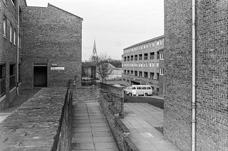
I think the large block here is Barrington Court, the first of three I walked past on my way through the park towards Loughborough Junction.
I left the park and walked along Ridgeway Rd, beside the railway line from Brixton which curves around to a junction just north of Loughborough Junction Station. The next station on this line is at Elephant & Castle.
Some extensive work seems to be in progress on what I am reliably informed (thanks to comments on Flickr) is a Ford Escort, while inside the garage a Renault 4 and a Rover P5 await their turn.
Arch 500 was empty for some years but later became home to the very Brixton Buzwakk Records Recording Studio a few years ago. The arches on both sides are still garages.
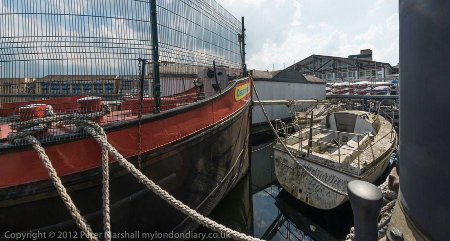
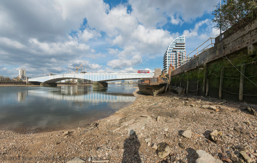
Cycling Around the Isle of Dogs: Tuesday June 24th 2014 was a nice Summer day in London. Not too hot, with a maximum in the low twenties, and with a blue sky tempered by some nice clouds and just a few light showers to cool me down. For me it was an ideal day for a bike ride and also for making some panoramic images.
It was a while since I’d been to the Isle of Dogs, and there had been quite a few changes around there in recent years, so after an early lunch I put my folding bike on the train and made my way to Limehouse.
It wasn’t really a bike ride, more just using the bike to carry me and my camera around the area, stopping on my way to make well over two hundred panoramic images in the roughly two and a half hours it took me to get to Island Gardens, opposite Greenwich for the train home. Later I worked on these images, selecting around 90 to put on-line – a higher than usual proportion. But I do rather more thinking about panoramic images and they require rather more care, particularly to get the camera absolutely level to keep the horizon straight.
I posted them in two groups, Limehouse pans and Millwall – Isle of Dogs pans. All the images were converted using the PT Gui software implementation of the Vedutismo perspective (also called Panini) made popular by Canaletto and other Italian cityscape painters in the 18th century which allows a more realistic representation of extreme angles of view – something like 147 degrees horizontally in these images. These would be impossibly stretched towards the edges in a normal rectilinear view, which only works up to around 90 degrees.
You can see any of these images larger on the links given to My London Diary at the end of this post, or by right-clicking on any of them and selecting to view them. Rather than write more about the ride here, I’ll quote from one of the posts there:
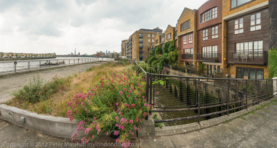
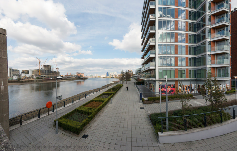
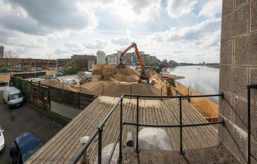
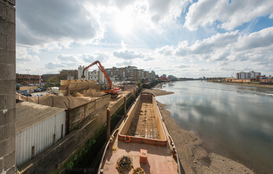
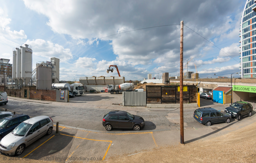
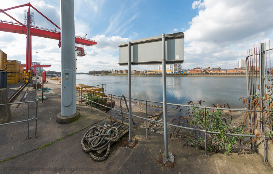
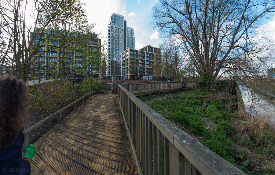
When I first walked these streets there was virtually no access to the riverside, with wharf after wharf between Westferry Rd and the river until you came to the park (Sir John McDougall Gardens.) A footbridge led from the Barkantine estate – built to replace a heavily bombed area of densely-packed small houses. South of this you again walked along the busy street until there were a few empty wharves around the south of the Isle of Dogs.
Now you can walk mainly along the riverside, with only one working area blocking the path. But there are several other places where you have to divert, including one wall dividing social housing from its wealthy neighbours. There was also a temporary diversion in one area, though it wasn’t clear why.
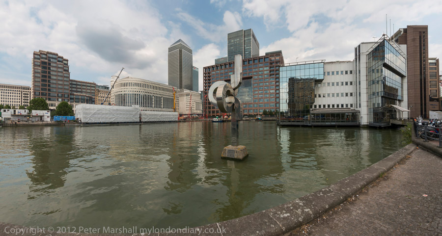
Further on are fine views across the river to Greenwich, along with further diversions from the riverside, where several earlier developments did not include riverside walks.
The Thames is too wide here for a panorama to work well without some foreground interest, or cropped to a very narrow strip. At the end of the ride, I did make a few pictures from Island Gardens across the river with a rather longer lens. These are in a separate post, also linked below.
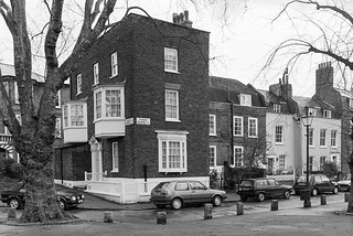
No 326, with two doors above each other with steps to the upper door with a balustrade. Many of the houses along here date from the first development along the road and are good examples of early-mid 19th century houses and most have some intresting features but are perhaps not distinctive enough to deserve listing.
The house now looks much the same as when I photographed it. I suspect this unusual arrangement with steps up to the front door was how this house was built. While many houses from the period have basement flats, this appears to have been built with its ground floor rather higher, perhaps becuase of the risk of flooding from the River Effra. But if so, why was a similar approach not used for neighbouring houses?
J & P Motors, Thornton St, Stockwell, Lambeth, 1989 89-5d-63
I walked a little back up Brixton Road to Thornton Street, though too much has changed for me to positively identify the exact location of J & P Motors on this fairly short L-shaped street. I think it was probably on the north side of the bottom of the L behind what is now the worker’s co-operative, Brixton Cycles.
There was a splendid utilitarian simplicity of this building which appealed to me, and which I enhanced with its symmetrical gates and No parking signs.
Back on Brixton Road, Evereds Bathrooms had its showroom in two shops at 308-10 Brixton Rd. The buildings here are still standing but no longer in use as a shop. For some years since 2011 the Victorian shopfront built as a house agents in 1879 has been in use as an art gallery, SHARP Gallery (Social, Hope and Recovery Project) which has shown the work of over 120 artists, many of whom use mental health services and is supported by the South London and Maudsley NHS Trust. Both the early nineteent century house and these shops are Grade II listed, along with 312.
Both buildings at 304 and 306 Brixton Road have survived, but in 2013 planning permission was granted for changes to the Eagle Printing Works, and the fine semi-circular panel including the building date of 1864 and its wrought-iron decoration was removed – a piece of vandalism that should never have been approved.
Apparently the printing works a few years later became a sub district Post, Money Order and Telegraph Office, and it was from here that Sherlock Holmes sent his first telegram.
I turned off the Brixton Road where I had spent some time wandering back and forth and struck off to the east along Loughborough Road. The first picture I took was of the Loughborough Hotel, described in more detail on a previous walk, a well known music venue, closed in 2008 and has been converted into flats, with a café gallery on the ground floor.
From Fiveways I continued along Lilford Road, again stopping to re-take the impressive porch on its corner with Minett Road, also featured in a previous post. I chose a very similar viewpoint but the lighting was quite different as it had been overcast for the earlier image.
I can’t remember why I made the detour, though possibly it was just the sheer pleasure of seeing an area with so many fine buildings again. Or it could have been to find a pleasant place to sit and eat my lunch, as I walked as far as Myatts Fields before returning to Loughborough Rd.
On Loughborough Road I was in a very different London, the Loughborough Estate, redeveloped after much of the area was devastated by wartime bombing. The first stages of the rebuild were in five-storey red brick blocks typical of 1930s LCC estates of that era, solid and with decent sized rooms but uninspiring visually. There height was kept to five floors as they had no lifts.
From 1954-7 more of the estate was developed with a mix of high and low-rise modern buildings designed by the LCC Architects Department which included nine eleven-storey slab blocks which became a model for later LCC estates. They even gained approval from John Betjeman who Layers of London quotes as writing “When one compares their open-ness, lightness, grass and trees, and carefully related changes of scale from tall blocks to small blocks, with the prison-like courts of artisans’ dwellings of earlier ages, one realises some things are better than they were… Maybe it has no place for someone like me, but it gives one hope for modern architecture.”
Not everyone shared Betjeman’s enthusiasm, and by the time I made these pictures the area had gained a reputation for crime, one of a number of estates in London about which some people expressed shock that I was walking around taking pictures. More about my walk in a later post.
A Submarine, Flats, Pub, Dog, Ducks & Milkmaid is the final post on my walk on Friday afternoon, May 5th 1989. The previous post was Around Camberwell New Road – 1989
I crossed over Camberwell New Road to the southern side, turned own Vassall Road and then left into Langton Road. I’ve not digitised the one picture I took of a house here, nor the single image I made in Lothian Road, but I continued further south along here, lured by the sight of an unusual object in the centre of Akerman Road.
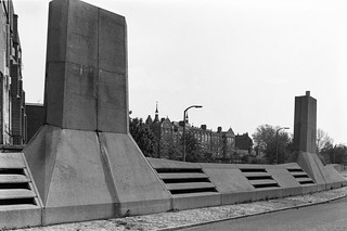
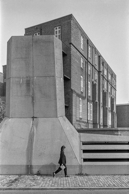
Two vertical concrete towers rose up from a more organic looking low concrete body. Later I was to learn that this was known as the Camberwell Submarine.
I had no idea what this structure was, though clearly it was providing ventilation for some below ground installation. Was it Lambeth’s nuclear bunker, perhaps an underground city? Was there some secret tunnel underneath – though the nearest Underground line was well over a mile away. Later I looked it up to find others had made similar speculations to mine, but of course the real purpose is rather more prosaic.
This is the visible structure of the below ground Myatt’s Fields North Boiler House designed by Michael Luffingham in the mid-seventies for Lambeth Council, and described at the time as Hollamby’s submarine after his boss, borough architect Ted Hollamby. An attempt was made to get it listed ten years ago but failed.
I could only walk around the outside of the submarine and although it had doors at each end, both were locked. In 2007, Mike Urban of Urban75 was photographing it and was invited inside by a maintenance worker and his post reveals some of the hidden secrets of the interior.
Flats, Akerman Rd, Lambeth, 1989 89-5b-26
These are some of the flats on the Myatt’s Fields North which were heated by the submarine. The estate later got a very poor reputation and much was demolished and replaced in controversial redevelopment in 2014, mentioned in a previous post.
I turned down Evandale Road and walked down to the Loughborough Hotel on the corner with Loughborough Road. The earliest record of a pub here – on the corner with what was then Cromwell Rd – was in 1864, and it was built on the site of Loughborough House which was demolished in 1854. This had been the Manor House of Lambeth Wick, home to the 1st Baron Loughborough, Henry Hastings. He had been given his title in 1643 for fighting for the Royalists in the English Civil War and returned to live here after a period of exile in 1661.
In 1900 the hotel was replaced by this splendid new building, designed as an entertainment palace with a large ballroom on the first floor. The name ‘Hotel’ simply meant it was a posher establishment than an inn, and it never had rooms where people could stay.
The nature of entertainment at the hotel changed from the late 1960s as did the local population. The Island Disco, a South Pacific Island themed disco opened in 1967 and various other night clubs followed including the legendary Latin and African music club, the Mambo Inn. There were drag nights too from !969.
All this finished in 2005, when the upstairs room s were turned into flats. The ground floor pub finally closed in 2007 and the former bar is now a café and possibly at times an art gallery.
I turned east along Loughborough Road and made my way to Fiveways, the junction with Akerman Road, Lilford Road and Fiveways Road. This shows the house on the corner with Akerman Raod, which has since been considerably refurbished. This was once the end of a long terrace from the Loughborough Hotel with ground floor shops, but those at this end and some others have been converted to residential.
I continued along Lilford Road, where at number 15 I photographed this small menagerie. I’m pleased to see that the ducks are still there on the short pillars at the front door, though now looking a little worn, but the milkmaid and dog have gone.
Auto Stores, Camberwell, Southwark, 1989 89-5c-63
By now it was getting a little late and I was getting hungry and I made my way quickly along Knatchbull Road towards Camberwell Green to catch a bus back to Waterloo for my train home. I only took this one last picture, though I’m not sure exactly where it was taken around Camberwell Green, though my contact sheet says Camberwell Road.
This is the third and final post on the walk which began with Naked Ladies, 3 Doors & A New Walk. But two days later I was back again on a new walk in South London which I’ll write about shortly
From Longfield Hall I wandered up Knatchbull Road to Cormont Road, which runs halfway around Myatt’s Fields Park on its southwest and northwest sides. I took half a dozen pictures which I haven’t digitised before coming to this on the corner of Brief Street which I think was built as flats. Almost all the buildings in the area are fine examples of late Victorian housing, largely in the Queen Anne style but there is perhaps a slightly overpowering amount of red brick directly onto the streets.
Another finely designed large block of flats a few yards down Brief Street, Burton House, its hedges a few years ago more tidily trimmed but now again reverting to wild. On the opposite side of the street is a short terrace of two storey houses with brief front gardens and Brief Street is appropriately short – a little under a hundred yards in length.
According to Lambeth’s 2018 Character Appraisal for the Minet Conservation Area, “Kennington Boys’ High School (latterly known as Charles Edward Brooke School), Cormont Road opened in 1897.” This was a LCC board school and the Grade II listing states that this building dates from 1912, architect T J Bailey. It is listed on Historic England’s Heritage At Risk Register.
Confusingly – and I hope I have got this right – the school renamed itself Saint Gabriel’s College when it became co-educational as a Specialist Arts and Music College in 2012, and then moved out to Langton Road a few years later.
Again from the Lambeth appraisal, “The former St. Gabriel’s College on Cormont Road opened in 1899 as a training college for Anglican schoolmistresses, the vision of Charles Edward Brooke, a senior curate of nearby St. John the Divine church; the attached chapel was added in 1903.” The style is described as “vaguely Art Nouveau“. In 1989 it was Myatts House, run by the ATC Group of Training Companies and offering courses in Accountancy, Finance, Management and I think Computers, though the final word on the sign is hard to read. Grade II listed.
The building was requisitioned in the First World War, becoming part of the 1st London General Hospital, and was where Vera Brittain was first stationed. Later it became a LCC rest Home. It is now residential, converted to expensive flats as St Gabriel’s Manor.
This is Calais Gate, also Grade II listed and said in the listing to date from the early 20th Century, though the Myatt’s Park history site dates that these large mansion blocks as c. 1895.
Perched on top of the fine stepped gable is a terracotta cat, one of a number of cats on buildings on the Minet estate, though most are rather less prominent. The whole estate was developed by the Minet family who were of French Huguenot origin, and their name is an affectionate or childish French term for a cat, (minette if the cat happens to be female.)
Houses, Calais St, Myatts Fields, Camberwell, Lambeth, 1989 89-4j-22
Substantial houses in Calais St facing the park on the north-east side. I wondered when I took this on the significance of the gateway at left with the cross above, but am no wiser now. Hard to make out from this picture but those are cats heads above the doorway.
Fine railings and decorative elements on these houses at 22 and 24 Flodden Road make them stand out and the absence of cats perhaps suggests these large semidetached Queen Anne style houses were not a part of the Minet development. Instead there are leaves and floral motifs and human heads.
Flodden was the site of a battle in 1513 in Northumberland, close to the border with Scotland when the English Army soundly defeated the army of King James IV of Scotland. England were engaged in a war with France and the Scottish invasion was in support of the ‘Auld Alliance’ they had made with France in 1295.
It was time for me to leave the area, and I walked up Flodden Road to Camberwell New Road to get a bus, coming out almost immediately opposite Calvary Temple of the United Pentecostal Church a few yards to the north of the road in Councillor St.
The church incorporates a memorial stone “laid by William Appleton Esq (Sutton), June 2nd !890″ with the text “Hitherto Hath the Lord Helped Us” (1 Samuel 7:12), naming George Baines Architect and H L Holloway Builder. The church, then Clarendon Chapel, opened as a Baptist church in March 1891, replacing an earlier ‘tin tabernacle’ which had burnt down in 1889. Clarendon Street became Councillor Street some time before 1912 and the church was renamed Camberwell New Road Church, continuing in use for Baptist worship until the 1950s.
It narrowly escaped demolition in 1959 when it was saved by Caribbean immigrants who were looking for a building for their Pentecostal worship and they held their first service there in March 1959. They kept and restored the churches original late Victorian fittings and it remains in use.
Then and now it makes a dramatic composition with the tower block behind, Laird House on Redcar St, one of five 22-storey 210ft blocks on the 1966 LCC Wyndham & Comber Estates.
New Road Bargains, Camberwell New Road, Lambeth, 1989 89-4j-12
There are few if any shops in Myatt’s Fields but several parades within walking distance including on Camberwell New Road where at 243 was New Road Bargains with a small chair fixed above its door and a wonderfully packed window of assorted items. For some years this has been Camberwell Daily, now with a shop front that offers GROCERIES | FRUIT & VEG | OFF LICENCE | NEWS & MAGS.
I might have photographed other shops in the row, but my bus came and I got on it to begin my journey home.
As a photographer I’ve long been interested in the difference between how we experience the world around us and how the camera records it. Some of those differences are obvious but others less so, and some we are seldom aware of.
The camera records an image produced by its lens which follows strict optical rules which I learnt about long ago in my physics lessons, though real lenses deviate slightly from those ideal and perfect specimens in those science texts.
The camera holds a film or sensor to record that image – and again does so following strict physical (and chemical for film) processes which may fail to record significant features and distort others to produce an essentially flat two-dimensional image. It may not even record colours but if it does they always to some extent arbitrary, as too are the tones.
Those of us who grew up on film are perhaps more aware of this than the digital generations. We had to be aware of the differences in recording of, for example Ilford’s Pan F and Kodak’s Tri-X, and how these were affected by processing and printing, and of the rather unreal but different colour renditions of Kodachrome, Kodacolor, Ektachrome, Agfa, Ferraniacolor and the other colour film films, each with its own qualities. Though perhaps if we ever used Orwo film quality was not the right word for its purplish nature.
Of course there are differences in the way digital cameras record colour, but these are rather smaller, and we can make use of software to make them match more closely or exaggerate the difference. Lightroom and Photoshop can make my Fuji files look very similar in terms of colour rendition to those from Nikon.
But our experience of a scene is very different, combining inputs from all of our senses, and it would be impossible to over-emphasise the subjective aspects. But even just visually it is still very different. While the lens cuts out all but a small rectangle in front of us, our eyes send information to the brain from a much wider field, much of it except from a small central section lacking in sharpness. Most of us have binocular vision, gathering this data from two eyes a short but significant distance apart, enabling us to see in depth. And our view is always dynamic, our eyes moving around, and as we swing our head around or up and down we have the sensation of moving through a static universe. Doing the same with a camera has a very different effect.
A standard lens – around 40 to 50mm on a full frame digital or 35mm film camera gives a similar idea of depth in its flat images to that we normally experience. With longer lens the effect of depth is reduced and by the time we get to really long lenses the images become flat patterns rather than appearing to represent a three dimensional scene. But what interested me more was what happened when the camera tried to represent a much wider angle of view than the standard, when the rectilinear rendering of normal lenses becomes impossible.
On Monday 14th of March I went for a walk with a painter friend who had brought her sketch book to introduce her to an area I thought she might find interesting. And I wanted to further explore some of the different ways of rendering very wide angles of view with digital cameras. I’d brought two Nikons with me, one fitted with a conventional wide-angle zoom which I used mainly at 16mm, close to the limit for such lenses (and I do have a wider lens which demonstrates this) and the other with a 16mm full-frame fisheye which fills the frame with an image which is 180 degrees across the diagonal.
While my friend stopped to make sketches I had time to make a series of images from similar locations. I kept warmer as I was moving around, but she fairly soon got cold, which was a good excuse to visit the pub which appears in some of these pictures, after which I took her back to the station where we had met and went back to take some more pictures on my own.
Back home I uploaded the images. Those from the conventional wide-angle zoom I’ve use as they were taken, with just the normal adjustments in Lightroom. But the fish-eye images I worked on with my panorama stitching software, PtGui, not to join images but to take the raw image data and process it it various different ways to produce cylindrical projections. If the camera was upright when the picture was taken, this will produce straight vertical lines for all upright elements. There are many different approaches to this which produce visually different results, some of which are common in mapping, such as Mercator.
Those I’ve found most useful are the equirectangular, Vedutismo and Transverse Vedutismo projections used in these examples.
This is the second and final part of my walk on Friday 7th April 1989 which had started at Gospel Oak station and I had walked up to Highgate. You can read the first part at Highgate April 1989.
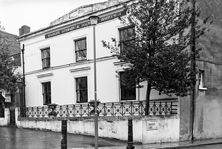
Highgate Literary, Scientific Institution, South Grove, Highgate, Camden, 1989 89-4a-11
I took another picture of the Highgate Literary & Scientific Institution, but didn’t explore much more at the top of the hill.
Pond Square, Highgate, Camden, 1989 89-4a-22
Though I did take a few more pictures, but have only digitised this one. I was eager to go down the hill again, this time taking Swain’s Lane, by the side of the Literary & Scientific Institution.
Swain’s Lane is rather steeper than West Hill and apparently had got its name from being used by pig herders and was first recorded in writing as Swayneslane in 1492. It provided access to farms on either side and only the top few yards were developed for housing before 1887. Fortunately I was walking down hill and hadn’t brought my bike as riding up this lane would have been something of a challenge.
Even now much of Swain’s Lane is undeveloped as it runs between one of London’s great cemeteries, Highgate Cemetery and one of its fine parks, Waterlow Park, both behind brick walls with just a narrow pavement. Below Waterlow Park on the east side is the newer part of Highgate Cemetery, which includes Karl Marx’s Tomb.
The Grade II listed building is the picture is the Lodge at the Swain’s Lane entrance to Waterlow Park, built in the mid-19th century in a fine example of Victorian Gothic, though the chimneys are more Tudor. The post at right is for the park gate and I took just a brief stroll inside before continuing my walk. On warmer days I’ve explored the park rather more and sometimes found a bench to eat my sandwiches as well as taking a few pictures.
In 1992 I visited and took some pictures in both the West and East parts of Highgate cemetery, some of which are on-line in Flickr, but on this walk I didn’t have time to stop and just went on down the hill.
Immediately south of the West cemetery is the Holly Lodge Estate, with mansion blocks on Makepeace Avenue and Oakeshott Avenue. The website tells that in 1809 Harriot Mellon, a young actress acquired a large villa later known as The Holly Lodge here, and after she married banker Thomas Coutts in 1815 both house and grounds were enlarged and landscaped. She died in 1837, leaving the property and her fortune to one of the most remarkable women of the Victorian age, her husband’s ganddaughter, Angela Burdett-Coutts.
When she died in 1906 her husband tried to sell the entire property with no success, but then managed to sell off some of the outlying parts – including Holly Terrace on West Hill and South Grove House, both mentioned in the previous post on this walk but it was not until 1923 that the main part was sold off and development of the Holly Lodge Estate began.
This area was acquired by the “Lady Workers’ Homes Limited to build blocks of rooms and flats for single women moving to London in order to work as secretaries and clerks in the city on the Eastern side of the estate.“
These blocks built in the 1920s had fallen into a poor state of repair by the 1960s and were acquired on a 150-year lease in 1964 by the Metropolitan Borough of St Pancras – and so are now owned by the London Borough of Camden. The council for some years continued with the policy of only housing women on the estate but this has now lapsed.
The flats were designed without separate kitchens and with shared bathrooms and toilets as bed-sits for single women – and the estate was built with a long-demolished community block with restaurant, reading and meeting rooms and a small theatre, and behind it three tennis courts. Some of the bed-sits have been converted into self-contained flats but others still share facilities.
Raydon St, Dartmouth Park Hill, Highgate, Camden, 1989 89-4b-42
I returned to Waterlow Park, making my way through it to Dartmouth Park Hill and on to take thsi picture of some very different housing on the Camden’s Whittington Estate. But by now I was in a hurry and the light was fading a little and I took very few photographs (none online) as I made my way through the streets of Dartmouth Park to Highgate Road and Grove Terrace and on to Gospel Oak station for my journey home.
Bird in Bush Park, Bird in Bush Rd, Naylor Rd, Peckham, Southwark, 1989 89-3b-45
This park was formed by wholesale housing clearances by Southwark Council in the 1970s. The triangular area between Bird in Bush Road, Naylor Road and Commercial Way which had around 35 houses built from around 1870 until the end of the century with back gardens was flattened, leaving only a couple of buildings on the northern corners of the area.
The houses in this picture are on the other side of Commercial Way and I was standing on or close to Naylor Road. I spent quite a long time taking dozen pictures of these semi-embedded tyres which made a BMX track, all fairly similar to this.
Flats, Meeting House Lane, Queen’s Rd, Peckham, Southwark, 1989 89-3b-11
I walked west from the park and down the route of the former Surrey Canal back to Peckham High Street, turning along this to the east to the junction with Meeting House Lane.
Southwark Council decided to demolish Wood Dene (part of the Acorn Estate) in 2000, later selling it off on the cheap for £7million to Notting Hill Housing Trust who redeveloped it as Peckham Place. It was demolished in 2007. When built Wood Dene was home to 323 families as council tenants. The replacement was only completed in 2019, has no real social housing with just 54 homes at so-called ‘affordable’ rent of up to 80% market rent.
As I was preparing to take this picture a woman walked across and I waited until she was in a suitable position to include in the picture. I think her presence emphasises the massive scale of the 1960’s block.
St John Chrysostom, Church, Meeting House Lane, Queen’s Rd, Peckham, Southwark, 1989 89-3b-14
Some way up Meeting House Lane on the corner of Springhall Street was the Anglican Church and Parish Centre of St John, Peckham, built in 1965 to replace the bombed St Jude and St Chrysostom, whose two parishes were amalgamated. The architect David Bush worked on a “truly theological and quite unique brief, following on from a weekend building conference at Sevenoaks” resulting in a building suitable for varied religious and secular use.
The building now lookks a little different, with the large brick side on Springhall Street now entirely covered by a colourful mural painted in 2017.
The Edwardian Baroque building here seems to go under several addresses in Asylum Rd, and although it now clearly calls itself 12b is Grade II listed as 12a Asylum Rd, a former annexe to offices of the almshouses, built 1913-1914, architect F.E Harford. Other sources refer to it as 10 Asylum Rd.
The Licensed Victuallers’ Benevolent Institution Asylum was founded in 1827 on a large site on what became Asylum Road, a short distance from the Old Kent Road (which its Grade II listing gives as its address.)
The asylum was simply housing for retired publicans and was not a ‘lunatic asylum’ though many of its elderly residents might have been a little fuddled from years of alcohol fumes and consumption. The earliest buildings date from 1827 and the architect was Henry Rose, but there were later additions in similar style in the 1840s, 1850s and finally in 1866. It became the largest almshouses in London with over 200 residents in 176 homes.
Most if not all of the buildings are Grade II listed. In 1959 the Licensed Victuallers moved to new almshouses in Denham, Bucks and in 1960 Camberwell Borough Council bought the property for council housing, apparently naming it Caroline Gardens after a former resident.
Leo Street School, Asylum Rd, Peckham, Southwark, 1989 89-3c-63
This 1900 building on Asylum Rd is at the back of the Leo Street School and opened in 1900, a year after the main school, architect T J Bailey. In my picture the board states it is part of ILEA’s Southwark College. It was converted to residential use in the 1990s.
Two protests in London on Saturday 15th January 2011.
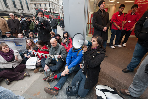
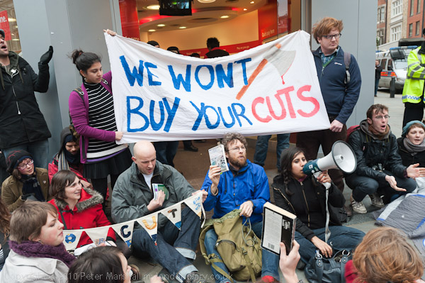
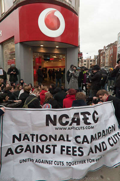
UK Uncut Protest VAT Rise at Vodaphone – Oxford St, 15 Jan 2011
A couple of days ago in 2023 the Commons Public Accounts Committee reported that £42bn is outstanding in tax debt, with HMRC failing to collect around 5% of tax owing each year. Committee chair Meg Hiller commented “The eye-watering £42bn now owed to HMRC in unpaid taxes would have filled a lot of this year’s infamous public spending black hole.” The report states that for every £1 the HMRC spends on compliance it recovers £18 in unpaid tax, and the MPs say it simply isn’t trying hard enough.
In addition, they point to the pathetic effort our tax authorities are making to recover the £4.5 billion lost by fraud over Covid support schemes, only even “trying to recover less than a quarter of estimated losses in schemes such as furlough.“
Back in 2011, anti-cuts activists UK Uncut were campaigning to force the government to clamp down on tax avoidance rather than cut public services and increase the tax burden on the poor. This protest took place following a rise in VAT from 17.5% to 20% and a couple a weeks before the UK deadline for tax returns by the self-employed of January 31st.
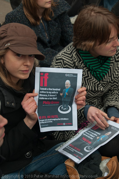
They said then that rich individuals and companies such as Vodafone, Philip Green, HSBC, Grolsch, HMV, Boots, Barclays, KPMG and others employ armies of lawyers and accountants to exploit legal loopholes and dodge around £25 billions in tax while the rest of us on PAYE or ordinary people sending in self-assessment tax forms pay the full amount.
Little has changed since then – except the amounts involved will have increased, but nothing has been done to move to a fairer approach to taxation which would eliminate the legal dodges and loopholes and insist that tax is paid on money earned in the UK rather than being squirrelled away in overseas tax havens. It should be a general principle that any scheme to deliberately avoid tax is illegal.
Many believe the main impetus for the Brexit campaign was the intention announced by Europe to clamp down on tax avoidance, which would have cost the wealthy backers of Vote Leave millions by cutting down their dodgy dealings.
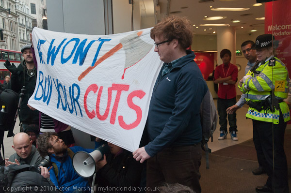
UK Uncut held a rally on the pavement on Oxford Street outside Vodaphone, one of the companies that manage to pay little or no UK tax. Large numbers of shoppers walked by, some stopping briefly to listen and applauding the protest.
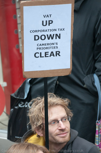
Speakers pointed out the regressive nature of VAT, applying to all purchases of goods (except those exempt from VAT) by everyone regardless of their incomes. Income tax should be fairer, as it is related to income and the ability to pay – and it would be fairer if the loopholes allowing tax avoidance were closed.
One speaker made the point that multinational companies not only use tricky accounting to avoid UK tax but also by shifting profits to tax havens they deny desperately needed funds to the poorer countries of the world.
Others spoke about the effects of the government cuts on education, with rising university fees and the removal of the maintenance allowance that had enabled many poorer students to remain in sixth-forms. At one point people held up books as a reminder of the cuts in library services being forced on local authorities by the government.
A member of the PCS spoke of his concern that the government was actually cutting down on the staff who combat tax evasion as well as relaxing the rules on tax avoidance rather than trying to collect more from the rich.
Prime Minister David Cameron had called for a ‘Big Society’ with charities and community organisations playing a larger role – presumably to replace the public services which were disappearing under his austerity programme. But many of these organisations were also under pressure as hard-pressed local authorities were having to slash funding grants.
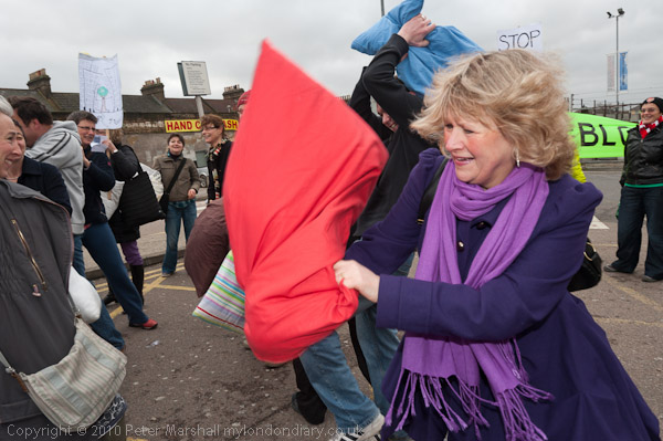
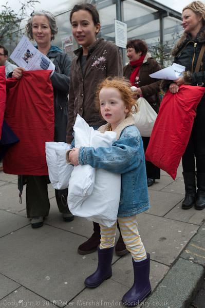
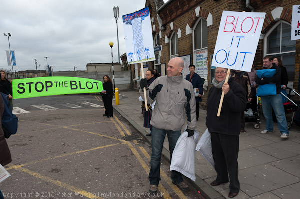
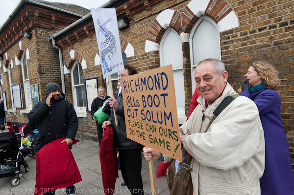
Pillow Fight Against Solum at Walthamstow, 15 Jan 2011
Ealier I had photographed Walthamstow residents staging a pillow fight in protest against plans for inappropriate high rise development on Walthamstow Central Station car park which were tocome to the council planning committee meeting the following Thursday.
Solum Regeneration had plans to build a 14 storey hotel and 8 storey blocks of flats there, towering over the surrounding area of largely late-Victorian low rise development.
The scheme had been condemned the previous year by CABE, the Commission for Architecture and the Built Environment set up in 1999 to provide impartial advice to the government “on architecture, urban design and public space“, and the developers had made minor changes which made it even less acceptable to the local objectors.
Solum Regeneration was set up by Network Rail and Kier Property to redevelop land around railway stations, including Walthamstow Central. One of their other plans was for a huge redevelopment at Twickenham station, now completed after some years of considerable inconvenience to station users. Richmond Council had initially turned down this scheme.
Despite the pillow fight and the other activities of local campaigners, the Walthamstow scheme also got the go-ahead, with building work beginning in 2012. Other high rise schemes have also been approved in the surrounding area, the character of which has changed considerably.
I began another walk from Camberwell on Sunday 12th February 1989, starting from a bus stop on Camberwell Road I made my way east towards Sedgemoor Place.
The Aged Pilgrims’ Friend Society was established in 1807 by a group of Christians concerned about “the aged and infirm Christian poor”. William Wilberforce, best known as an anti-slavery campaigner, was its Vice-President in the early years. At first it provided life pensions to Protestants over 60 whose income was less than 5s (25p) a year and by 1825 had supported over 800 pensioners with pensions of five or ten guineas a year.
The Aged Pilgrims’ Friend Society were given a site in Camberwell by William Peacock Esq and raised the money to build their first almshouses there, opening in 1837 to house 42 pensioners. The Tudor-style building is Grade II listed. It was sold by the Aged Pilgrims’ Friendly Society who by then had added an ‘ly’ to there name in 1991 and is now flats.
The Aged Pilgrims’ Friend Society were given a site in Camberwell by William Peacock Esq whose donation is recorded above the doorway and raised the money to build their first almshouses there, opening in 1837 to house 42 pensioners. The Tudor-style building is Grade II listed. It was sold by the Aged Pilgrims’ Friendly Society in 1991 and is now flats.
St Giles’ Hospital, Havil Street, Camberwell, Southwark, 1989 89-2c-26
The picture shows the demolition of former workhouse and the start of the conversion to flats of the Grade II listed circular ward tower fronting onto Havil Street. This was built in 1889-90 for the Camberwell Workhouse Infirmary, later St Giles’s Hospital, architect W S Cross. Each fllor contained 24 beds radiating around a central shaft, in which heating and ventilation services were located. I had photographed this building on a walk a few weeks earlier and had gone back to see if work was progressing and I could get a better view.
Plans for the Sceaux Gardens estate in the mature grounds of the former Camberwell House Lunatic Asylum were approved in 1957 and included two 15 storey tower blocks, Lakanal House and Marie Curie House. The estate was named after Sceaux near Paris which Camberwell had twinned with in 1954. I’ve visited Sceaux a few times and it has a rather better palace and park where festivals are held.
The Lakanal fire in 2009 killed 6 and injured at least 20 more; the recommendations from the enquiry were not implemented but would have prevented the later even more disastrous fire at Grenfell Tower. I think this block is probably Lakanal, but can find no details about the statue – and it certainly isn’t Lakanal.
Joseph Lakanal (1762 – 1845) was a French politician, and an original member of the Institut de France and one of the leading administrators of the French Revolution and responsible for educational reforms. He spent some time in the USA and helped to found and became President of what later became Tulane University before returning to France.
Camberwell Church St, Camberwell, Southwark, 1989 89-2d-63
I walked back west along Peckham Road to Camberwell Church St, pausing to take a couple of pictures not online and then this view of houses and a shop on the south side of the street, possibly at 70-72.
Houses, Camberwell Grove, Camberwell, Southwark, 1989 89-2d-65
I was on my way to Camberwell Grove to make photographs in the northern part of the street which I had not visited on my earlier walks. Just a few yards down the street I turned around and took this view looking up towards Camberwell Church St. At left is the path to Chamberlain Cottages mentioned in an earlier walk.
Houses, Camberwell Grove, Camberwell, Southwark, 1989 89-2d-66
A little further down I found this terrace with two porches on houses in the centre. Like most of the buildings along this part of the street this is Grade II listed, described as ‘Early C19 with some later C19 alterations’.
Flats, McNeil Rd, Camberwell Grove, Camberwell, Southwark, 1989 89-2d-52
The flats at left are 125-151 Camberwell Grove and you can see the spire of St Giles Camberwell in the distance. This is the Lettsom Estate, named after John Coakley Lettsom (1744-1815) who lived in Grove House, just beyond the southern end of Camberwell Groce, long demolished. He was Quaker physician and herbalist, who was friends with Benjamin Franklin, Dr. Johnson, Boswell and other leading figures of the day. This land had been a part of Lettsom’s estate.
When the flats were built in the early 1970s their scale was designed to match the nineteenth century housing along this section of Camberwell Grove – although they have four floors rather than the three in most of this. Their brickwork is also of a similar colour but they lack any of the interesting features of the older buildings and are relatively bland.
I made my way through the estate and on to Vestry Gardens where my next post on this walk will begin.